
City South Salt Lake, Salt Lake County
One ring south of downtown Salt Lake
South Salt Lake, the city that built its own center
South Salt Lake sits one ring south of downtown, about three miles from Temple Square and half an hour from four ski resorts. It never inherited a Main Street, so it built its own center on purpose: a warehouse arts district with roughly ninety murals, four S-Line streetcar platforms, and a ten acre park with three creeks, all on 6.94 square miles between two freeways. This is the plain guide to what is actually here, and where the county's bigger subjects sit next door.
 By Scott Buehler, Moving Utah
Updated October 2026
By Scott Buehler, Moving Utah
Updated October 2026
The short answer
South Salt Lake is a small, transit-heavy city one ring south of downtown Salt Lake, about three miles from Temple Square and half an hour from four ski resorts. It never inherited a Main Street, so it built its own center on purpose: a warehouse arts district with roughly ninety murals, four S-Line streetcar platforms, and a ten acre park with three creeks, all packed onto 6.94 square miles between two freeways. This hub is the map to six deeper pages on the city, and it hands the canyons, the lake and downtown to the wider Salt Lake County pages the whole valley shares.
South Salt Lake at a glance
1938
the year it incorporated, over a sewer bill
~90
murals up so far, toward a goal of a hundred
4 stops
S-Line platforms inside the city
6.94
square miles, between two freeways
Buying or selling in South Salt Lake?
The city itself
A warehouse city that built its own center
South Salt Lake did not grow out of a pioneer plat, and it never inherited a Main Street. The blocks here were called Central Park until the residents voted to incorporate on September 29, 1938, at a meeting the town's own history records was called to order by Robert R. Fitts. Two years earlier they had turned down annexation by Salt Lake City, largely over what a sewer would cost, and then found they needed one anyway. Incorporating turned out to be the cheaper answer, and the first city limits were drawn around workplaces, 500 East to 300 West and 2100 South to the middle of Mill Creek, rather than around a village green.
Everything you see today follows from that. The building stock is warehouses, shopfronts, small factories and the homes that went up beside them, on 6.94 square miles pinned between I-15 and I-80 and crossed by three light rail lines and the S-Line streetcar. There is no old town square to walk to, so the city built its own center of gravity on purpose: the Creative Industries Zone on the warehouse streets west of State Street, roughly ninety murals painted on working walls since 2018, a 650 seat music hall across from a streetcar platform, and Fitts Park with three creeks running through it. Two everyday anchors carry the ordinary civic life a Main Street would carry elsewhere, the Columbus Center at 2531 South 400 East, which pairs a community center with the county senior center, and the Central Park Community Center at 2797 South 200 East in a converted school. The county's Granite Branch library sits a few blocks south at 3331 South 500 East, on the old Granite High School site.
One quirk to know before you follow a map here: much of the northern half of the city runs on named avenues rather than the numbered grid, so directions read nothing like the rest of the valley. For the practical side of a move, what homes cost, the areas buyers weigh against each other and the school boundaries, the South Salt Lake city guide carries it, and what an inner ring address is actually like walks through the tradeoffs street by street.
It reads as one small rectangle on a map and works as four different places on the ground. That shape is the whole story of South Salt Lake.
Who runs what
A small city full of other people's institutions
For its size, South Salt Lake holds an unusual number of other people's institutions: a county library, a county trail, a transit authority right of way and a nonprofit nature center all sit inside the boundary, and none of them is answered by the city switchboard. Knowing who owns what saves a wasted call.
| The place | Who runs it | What that means for you |
|---|---|---|
| Fitts Park and the other city parks | City of South Salt Lake | Pavilion reservations run April 1 to October 31, booked through the city's parks office |
| Mural Fest and the murals on the warehouse walls | South Salt Lake Arts, the city arts council | Free and outdoors year round; the festival is a single Saturday, usually in early May |
| The S-Line streetcar and its corridor | UTA | Fares and timetables are UTA's, on the same fare as TRAX; as of 2026 the extension work is at the far Sugar House end |
| Granite Branch library, 3331 South 500 East | Salt Lake County Library | A county library branch on a city street, with a county card and county hours |
| The Nature Center at Pia Okwai, 3310 South 1000 West | Tracy Aviary | Free to enter on a short week, generally Thursday through Sunday, so the day you go matters more than the hour |
| Golf the Round, 600 West 3000 South | A private operator | A par 3 public course and driving range, a green fee rather than a park visit |
Hours and reservation windows shift, so confirm anything you plan to travel for before you go.
One address mix-up catches almost everyone who reads about this area online. Salt Lake City's Granary District and this city's Creative Industries Zone are two different places about a mile and a half apart, and a lot of what is written about the area blurs them. The Granary sits north of 2100 South inside Salt Lake City, around 800 South and 300 West. The Creative Industries Zone is South Salt Lake's own, running south from 2100 South to Mill Creek along West Temple between State Street and the railroad. If a listing puts a brewery on 800 South, it is in the other city.
The rhythm
One big day in May, and eleven quiet months
The civic calendar has a single peak, and it is a Saturday in spring. South Salt Lake Arts has run Mural Fest since 2018 on a goal of about ten new murals a year toward a hundred, and roughly ninety are up so far, so the festival turns the district into an open air gallery for a day, and the rest of the year those same walls are simply there, free, at any hour, on streets otherwise doing light industrial work. It is usually an early May Saturday, free and all ages, but the date moves, so take the current one from South Salt Lake Arts. Mural Fest and the creative zone covers the district, the festival and how to walk it without a ticket.
Around that, the year runs by season rather than by date. Park pavilion reservations open April 1 and close at the end of October, which is the clearest line the city draws around its outdoor season. The community garden plots at Fitts Park go by application in spring. The Nature Center at Pia Okwai on the river keeps a short week all year, generally Thursday through Sunday, and is free every day it opens. And the streetcar and the greenway beside it work in February exactly as they work in July, which in a valley city is worth more than it sounds. The Fitts Park and S-Line streetcar pages take those two in detail.
What has no season at all is the walking. Three paved corridors cross the city: the Mill Creek Trail through the middle, Parley's Trail beside the streetcar, and a stretch of the Jordan River Parkway down the western edge. They do not yet join into one loop, and saying so plainly is more useful than a map that implies they do. The top 8 things to do sorts what is genuinely worth a trip from what is simply good to have at the end of your street.
The best hour in South Salt Lake is an ordinary Tuesday, and its one big day fits inside a single Saturday in May.
The wider valley
The county's famous places are close, and none of them are this city's
Sitting three miles from downtown and half an hour from four ski resorts is the single strongest practical argument for this address, and it is also why a guide to this city has to stay honest: close is not the same as owns. Four county pages carry the big shared subjects properly, so here is where each one lives.

Three miles north
Downtown Salt Lake
Temple Square, the arenas, the big stores and the airport train, one ride north on TRAX.
Read the guide
The canyons
The Cottonwood canyons
The county's biggest subject: what sits up both roads, and what the watershed rules forbid.
Read the guide
November to March
The valley in winter
What the cold season on the valley floor actually asks of a household, and what it closes.
Read the guide
Days out
Weekends in the valley
Days out across the county, priced honestly, for the Saturdays this city will not fill on its own.
Read the guideRead the reviews of this area with the geography in one hand. A lot of what is written about these blocks online is really about somewhere else: the Granary District, Sugar House, or the State Street corridor north of 2100 South, all of which are in Salt Lake City. Two are within a mile and one is a single streetcar stop away, so the confusion is understandable, and it still lands businesses, prices and street conditions on the wrong side of a city line. Check the address against the boundary before you draw any conclusion from it.
If you only have one day
One good day in South Salt Lake, mostly without a car
Early
Start on the river before the traffic
A free Tracy Aviary nature center that opened in 2020, about seventy five acres of river-bottom natural area at 1100 West, and the quietest edge of a loud city.
The river page
Late morning
Cross to the creek in the middle
Ten acres, three creeks, the oldest trees the city claims, a veterans memorial and a garden let by application.
The park page
Afternoon
Walk the warehouse blocks
Roughly ninety murals on working walls since 2018, with the taprooms and distilleries on the same few streets.
The murals
Evening
Take the streetcar, not the car
Trains every fifteen minutes on weekdays and Saturdays, four stops inside the city, and a 650 seat hall across from the first one.
The streetcarThe South Salt Lake companion
Six pages on the city itself
Everything The Local has written about South Salt Lake: the ranked list of what is genuinely inside the boundary, the creative district and the roughly ninety murals across it, the ten acre park with three creeks, the streetcar that puts four platforms inside a city under seven square miles, the western river edge almost nobody uses, and what an inner ring address asks of a household in practice. Each is its own page, and this hub is the map to all seven.

Things to do
The top 8, ranked
ReadThe murals
Mural Fest and the creative zone
ReadThe park
Fitts Park and Mill Creek
ReadThe streetcar
The S-Line, from this end
ReadThe river
The Jordan River edge
Read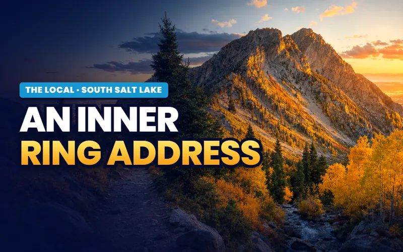
Moving here
An inner ring address
ReadWeighing a move, not a visit?
For today's listings, what homes actually cost, the areas buyers compare and the school boundaries, the South Salt Lake city guide carries it next.
Quick answers
South Salt Lake, answered
Immediately south of Salt Lake City, on the valley floor at about 4,255 feet. The city runs from 2100 South down to 3900 South, and from the Jordan River on the west across to 500 East and 700 East on the east, covering 6.94 square miles. Salt Lake City wraps it on the north, north east and east, Millcreek sits east, south and south east, and West Valley City is across the river to the west. Interstate 15 and Interstate 80 meet in its north west corner.
No, and this is the most common mix up in anything written about the area. The Granary District is inside Salt Lake City, roughly between 600 South, the interstate and West Temple, about a mile and a half north of here. South Salt Lake's own designated district is the Creative Industries Zone, which runs from 2100 South south to Mill Creek along West Temple, between State Street and the railroad. Two districts, two cities, two sets of streets.
Three things, in rough order of how often people travel for them. The murals, of which about ninety have gone up since South Salt Lake Arts started Mural Fest in 2018, all free to see on any day. The Creative Industries Zone that holds them, with a cluster of breweries and distilleries on and around West Temple. And its transit, because Central Pointe is where all three TRAX lines meet the S-Line streetcar, a junction no other Utah city this size has.
A single Saturday in spring, usually in early May. South Salt Lake Arts has run Mural Fest since 2018, adding about ten murals a year toward a founding goal of a hundred, so roughly ninety are up now. The festival day is free and all ages, with a mainstage, food trucks, a beer garden and guided walks through the district. The date moves each year, so take the current one from South Salt Lake Arts rather than from a listing site.
It starts here. Four of the S-Line's stops are inside the city: Central Pointe, South Salt Lake City, 300 East and 500 East. The rest sit east in Salt Lake City's Sugar House neighborhood. The line opened in December 2013, runs two miles in about ten minutes, and comes every 15 minutes on weekdays and Saturdays and every 30 minutes on Sundays, on the same fare as TRAX. As of 2026 UTA is extending the eastern end past Fairmont to a new Sugar House stop, which does not touch the four platforms here.
Most of the list. All the murals are outdoors and cost nothing at any hour, the Nature Center at Pia Okwai on the river is free to enter, every city park is free including the ten acres at Fitts Park, the Granite Branch is a county library, and all three paved trail corridors are open. The charges in this city attach to pavilion reservations, concert tickets at the Commonwealth Room, green fees at Golf the Round and whatever you buy in a taproom.
6.94 square miles, with 26,777 residents at the 2020 census. For its size it holds a lot of open space: the city counts a little over 200 acres of parks, trails and river corridor, and most of that is the Jordan River natural area on the western edge, at about 1100 West, plus Golf the Round, a par 3 course at 600 West 3000 South. The rest is mostly small neighborhood parks.
Because incorporating was cheaper than being annexed. The city's own history records that residents rejected a Salt Lake City annexation attempt in 1936 over what sewerage would cost, then found they needed a sewer system anyway, and voted to become a town instead. That happened on September 29, 1938, at a meeting called to order by Robert R. Fitts, who became the first town president. The original limits ran 500 East to 300 West and 2100 South to the middle of Mill Creek.
Yes, comfortably, and you can do most of it without a car. The murals, the taprooms, the park on the creek and the streetcar all sit within about two miles of each other and connect by rail or on foot. The one thing a single day cannot cover is the western river edge, because the nature center there keeps limited hours, generally Thursday through Sunday, and the crossing from the eastern half of the city is the longest trip inside the boundary.
Thinking about a move to South Salt Lake? The corridor your street sits on changes everything
This city reads as one small rectangle on a map and behaves as four different places on the ground: the warehouse and taproom blocks in the north, the residential streets around the creek in the middle, the State Street spine, and the river side out west. Rail, freight and freeway noise land very unevenly across them. Tell me what you are weighing and I will put you with a Salt Lake County partner agent who works this part of the valley, and stay on the file for the homework and the financing side.
Or call Scott: (435) 357-4345or send Scott a message
Keep going
Continue your South Salt Lake research
Eight more doors into South Salt Lake, chosen for what this page covers.
Questions about South Salt Lake?
Call Scott, send a message, or find out what your South Salt Lake home is worth. No pressure, no obligation.
Referral Disclosure: For moves outside Southern Utah, I can connect you with trusted local agents. If you choose to work with one, their brokerage pays my brokerage (Real Broker, LLC) a referral fee from their commission. This costs you nothing extra, and you are never obligated to use my referral.