
The first metro region
The capital county
Salt Lake County, from The Local
A valley of about 1.2 million people between two mountain ranges, with four ski resorts up two canyons, a shrinking inland sea at its west door, and eighteen cities sharing all of it. The Local arrives here county first: the subjects every city shares get their own pages, and the city companions follow.
Start here
One valley on the map, and the county owns the good parts
Salt Lake County is a bowl: the Wasatch along the east, the Oquirrhs along the west, the Great Salt Lake at the northwest corner, and a metro of about 1.2 million people filling the floor between them. Eighteen cities share that floor, and the honest thing about them is how much of what makes the valley famous belongs to none of them in particular. Big Cottonwood Canyon is not one city's property. Neither is the lake, the inversion, the bench trail or the river running up the middle.
That is why this region reads differently from the rest of The Local. In the town regions, a place owns its geography: Moab owns Arches, Springdale owns its mile of Zion Canyon. In a metro, the amenities are county property, so The Local arrives here county first. The nine subjects below, the canyons and their winter road rules, downtown, the two long trails, the west range, the family venues, the winter and the lake, each get a page that serves all eighteen cities at once. The city companions that follow route to them instead of re-writing them eighteen times.
The eighteen cities themselves are not interchangeable, and the differences, bench versus floor, east canyon mornings versus west sunset evenings, old grid versus new master plan, are exactly what their companions carry. Each city's full practical guide is already live and linked below.
Salt Lake County at a glance
18
cities with full guides here
9
county subjects live on The Local
4
ski resorts up two canyons
~1.2M
people share the valley
Live now
Nine subjects the whole county shares
The canyons, the road rules that govern them in winter, downtown, the two long trails, the other mountain range, the days out, the season and the lake. Each one belongs to all eighteen cities at once, so each one gets a county page rather than eighteen retellings. Read them in any order; each one stands on its own and links back to the cities it touches.

The canyons
The Cottonwood canyons
Alta, Snowbird, Brighton and Solitude on two dead end roads, the watershed rules, and the summer season locals rate above the snow.
Read the page
The road rules
Canyon winter access
The Class 3 traction law and the 5/32 inch tread rule, the free tire sticker, Alta's parking reservations and the closure mornings.
Read the page
Downtown
Downtown Salt Lake
Temple Square deep in a multiyear restoration, City Creek's retractable roof, and the Delta Center rebuilding around its two teams.
Read the page
The west line
The Jordan River Parkway
About 45 paved miles beside a river that flows north, with eight of the county's cities stacked along the way.
Read the page
The west range
The Oquirrh side
The valley's other mountains: the largest human dug excavation on earth, Olympic ice in Kearns, and a company town Main Street.
Read the page
Days out
Family weekends in the valley
Eight outings ranked by activity and price, from free farm grounds and a grand old park to the aquarium and the foothill museum.
Read the page
The season
The valley in winter
The inversion explained without drama: the bowl, the lid, the forecast colors, and what the season actually asks of a resident.
Read the page
The lake
The Great Salt Lake
A south arm sitting well below the level managers call healthy, a marina running shallow, the lakebed dust, and ten million migrating birds.
Read the page
The bench
The Bonneville Shoreline Trail
An eighteen thousand year old beach as a city balcony: where the trail is continuous, where it breaks, and why the gaps exist.
Read the pageLive now
Salt Lake City, the capital at the north end
The capital sits at the north end of the valley on a grid surveyed in July 1847, in blocks of ten acres with streets 132 feet wide, and every numbered address in the county still counts its distance from one corner of Temple Square. Seven creeks come out of the range behind it and most of their lower miles run in pipes. The founding block is mid restoration with a public open house in 2027, and an international airport sits four miles from downtown. Ten further pages round out the Salt Lake City companion.
The city page
Salt Lake City, block by block
About 199,700 people on 110 square miles, a grid drawn in 1847 before anybody had seen the ground, and seven creeks mostly in pipes.
Read the page
The top 12
Things to do, ranked
A capitol standing on 265 bearings, half an acre of visionary stonework behind a residential street, and six of the twelve costing nothing.
Read the top 12
The founding block
Temple Square
Forty years to build, closed since 2019, and ninety eight base isolators set twenty feet beneath it during the restoration.
Read the guide
After dark
Nightlife and the liquor rules
What the state sells, what the supermarket sells, why everybody shows identification now, and the pour limit written into the code.
Read the guideLive now
Holladay, the bench under the peak
Eight and a half square miles of tree covered east bench between I-215 and Wasatch Boulevard, with Mount Olympus filling the eastern sky at 9,026 feet and three walk-in drainages ending at the back of ordinary streets. It is the oldest continuously inhabited settlement in Utah, it has no downtown beyond a four block village crossroads, its hundred year old city hall is under restoration, and the old mall site is being redeveloped a mile west. Three further pages round out the Holladay companion.

The city page
Holladay, from the bench
A wall of rock for an east window, a village where a downtown would be, and five projects with dates on them.
Read the page
The top 6
Things to do, ranked
A September arts night on a village plaza, a 9,026 foot summit off a boulevard curb, a dog legal canyon and a creekside park.
Read the top 6
The peak
Mount Olympus
3.32 miles and 4,158 feet of gain into designated wilderness, with two honest places to stop before the scramble.
Read the guide
For movers
An east bench address
Bench snow, private lanes with no curb, mature trees over the roof, and the six questions to have in writing before an offer.
Read the guideLive now
Cottonwood Heights, the city at the two gates
About 33,617 people on the southeast bench of the Salt Lake Valley, between Big Cottonwood Creek and Little Cottonwood Creek, with a ridge between the two running through the middle of town. Two state highways up the canyons begin at the city line, which turns an ordinary bench suburb into a piece of ski infrastructure for four months of the year. The city voted itself into existence in 2005, took over its own policing in 2008, and argues hard about what belongs at a canyon gate. Three further pages round out the Cottonwood Heights companion.

The city page
Cottonwood Heights, at the two gates
Nine square miles of bench, two state highways starting inside it, and a civic set that includes a taxing district most residents mistake for the city.
Read the page
The top 6
Things to do, ranked
Six, because six is what this city actually owns once the canyons go back to the county and Bells Canyon goes back to Sandy.
See the six
The home canyon
Big Cottonwood from the doorstep
Night skiing as a weeknight habit, free midweek parking, and the powder morning queue arriving at the end of your own street.
Read the guide
The city's canyon
Ferguson Canyon
Fourteen hundred feet to an overlook, three creek crossings, granite crags, and the one canyon on this bench where a leashed dog is legal.
Read the guideLive now
Millcreek, and the canyon at the end of 3800 South
Millcreek incorporated in 2016 and inherited neighborhoods, corridors and no center at all. It also inherited a canyon. Millcreek Canyon leaves the valley at the east end of 3800 South, charges a fee on the way out, and runs on a calendar rule that decides what a dog and a bicycle may do on any given day. It is the only drainage on this stretch of the range where a dog may legally run. The companion opens with the canyon road end to end, the complete dog system, and the ranked list of the city. Three further pages round out the Millcreek companion.

The companion
Millcreek, the whole picture
The canyon, the dog rules, the new square, the summit and the address, in one place.
Open the companion
Dogs
The odd and even day system
Off leash on odd days, leashed on even ones, and banned on odd days above the winter gate.
Read the guide
The canyon
Millcreek Canyon, end to end
A tollbooth that charges on exit, a gate that shuts on 1 November, and a 29 million dollar rebuild.
Read the guide
The new downtown
Millcreek Common
The largest outdoor skating surface in Utah, in a city that had no square until it built one.
Read the guideLive now
Sandy, from the freeway to the canyon gate
State Route 209 leaves the gate of the Bingham Canyon Mine, crosses the whole width of the valley and ends at the mouth of Little Cottonwood Canyon. The middle six miles of it are Sandy, and the city changes character the whole way uphill: a 1986 shopping mall with two professional ice sheets built into one end of it, a downtown going up on a light rail parking lot, 630 acres of unpaved gulch running crosswise under the streets, and a bench that finishes at a wilderness boundary. The companion opens with the canyon mouth from the city side, the gulch, and the ranked list of the city. Three further pages round out the Sandy companion.
The companion
Sandy, the whole picture
The canyon mouth, the gulch, the mall, the venue and the train, in one place.
Open the companion
The canyon mouth
Little Cottonwood from Sandy
The queue forms below the gate, the bus starts across town, and the creek ends up in the tap.
Read the guide
The gulch
Dimple Dell Regional Park
630 acres of ravine ignoring the grid, unpaved by public decision rather than by neglect.
Read the guide
The downtown
South Town and the Cairns
A mall bought whole in 2024, and a downtown district built on a light rail parking lot.
Read the guideLive now
Draper, and the gap the whole state moves through
The Traverse Mountains close the bottom of the Salt Lake Valley to a single gap, and Draper sits astride it. On the eastern side the city owns most of Corner Canyon, 1,021 protected acres, and runs the trail network on it under its own ordinances, dog ban included. On the western side the state is turning 600 acres of former prison ground into a district that broke ground vertically on 29 June 2026. The companion opens with The Point, the aquarium that doubled in size in February 2026, and the ranked list of the city. Three further pages round out the Draper companion.

The companion
Draper, the whole picture
The canyon, the aquarium, the cycle park, The Point and the commute, in one place.
Open the companion
The Point
Six hundred acres at the county line
A former state prison site now being built out, with its first towers going vertical in June 2026.
Read the guide
The aquarium
The Living Planet Aquarium
A 120,000 square foot wing opened in February 2026, and a recycled U2 tour stage stands in the plaza.
Read the guide
The canyon
Corner Canyon and its rules
1,021 protected acres the city mostly owns, six one way descents, and no dogs above the watershed line.
Read the guideLive now
Murray, and what a city builds when it borders no mountain
Nothing in Murray is at the end of a canyon road. There is no lake, no ski gate and no trailhead into the range, because this city sits in the geometric middle of the Salt Lake Valley and every edge of it belongs to somebody else. So it built things instead: 63.4 acres of park along a mountain creek on ground that used to hold the county fair, five miles of river trail measured in tenths of a mile, a 1938 theater restored and reopened in September 2025, and a hospital campus on the ground where two smokestacks stood for eighty years. The companion opens with the ranked eight, the park end to end, and the smelter ground. Three further pages round out the Murray companion.
The companion
Murray, the whole picture
The park, the smelter ground, the city center, the river and the address, in one place.
Open the companion
The top 8
Things to do, ranked
Eight rather than a round six, because eight is the honest count of what is genuinely inside this city line.
See the eight
The smelter ground
Where the smokestacks stood
Two chimneys of 455 and 295 feet, a bond that failed in 1998, and a memorial garden in the footprint of the tall one.
Read the guide
The park
Murray Park, end to end
Sixty three acres on Little Cottonwood Creek, two swimming operations, an arboretum and a ticketed summer season.
Read the guideLive now
South Jordan, and the lake it had to dig itself
Nothing at the western end of this city existed twenty five years ago. The 67 acre lake was excavated on old mine ground, sealed with a liner because the gravel beneath would have drained it, and filled from a canal five miles away. The community around it went up from 2004, and the ballpark, the light rail station and the cinema and bowling center beside them all opened inside four months of each other in 2025. Meanwhile the river that named the city runs quietly along the far eastern boundary with three stocked ponds beside it. The companion opens with the ranked nine, the community, and the lake. Three further pages round out the South Jordan companion.

The companion
South Jordan, the whole picture
Daybreak, the lake, The District, the river reach and the practicalities, in one place.
Open the companion
The top 9
Things to do, ranked
Nine rather than a round six, and four of them did not exist three years ago.
See the nine
The community
Daybreak, village by village
Three groups of villages built in three decades, three light rail platforms and two commercial cores.
Read the guide
The lake
Oquirrh Lake, made and filled
Sixty seven acres excavated and sealed, filled from a canal, with a public ring and water that is not.
Read the guideLive now
Herriman, where the last street runs into the mountain
Herriman sits in the corner of the valley where the floor stops and the Oquirrhs start, and almost everything here is a consequence of that edge. An irrigation reservoir of about seven acres that ended up carrying the only municipal sand beach in the county, with a 15 dollar weekend parking lot and a permit zone on the streets around it. A road out of the top of Main Street that climbs 6.6 paved miles to a dirt spur and a rim near nine thousand feet, gated seven months a year and washed out by a storm in July 2026. Thirteen miles of county trail opened in 2023 on ground shut for a century. The companion opens with the ranked eight, the reservoir and the canyon road. Three further pages round out the Herriman companion.

The companion
Herriman, the whole picture
The reservoir, the canyon road, the corridor, the park and the growth, in one place.
Open the companion
The reservoir
Blackridge Reservoir
A seven acre irrigation pond with the county's only sand beach, a charged weekend and a permit street.
Read the guide
The canyon
Butterfield Canyon
A gate on 1 November, 6.6 paved miles of climb, and a washout that shut it in July 2026.
Read the guide
The corridor
The Mountain View Corridor
Seven miles of surface road named for a freeway that has not been built along most of it.
Read the guideLive now
Riverton, and the river it turned its back on
The Jordan River is this city's eastern boundary and the reason it stopped being called Gardnersville in 1879. It is also the edge Riverton has spent fifty years growing away from, west across the bench and out to the Mountain View Corridor, until the newest streets sit about four miles from the water they are named after. What the city built instead is a 31 acre park with a working rodeo arena inside the fence, a domed hall rebuilt in 2015 from a church demolished in 1940, and thirteen days of Town Days spread across three separate sites. The companion opens with the ranked seven, the flagship park and the festival in order. Three further pages round out the Riverton companion.

The companion
Riverton, the whole picture
The park, the festival, the river edge, the west side and the address, in one place.
Open the companion
The top 7
Things to do, ranked
Seven, because seven is what survives an honest count of things inside this boundary that justify a trip.
See the seven
Town Days
Riverton Town Days, in order
Thirteen days, three sites, and a rodeo that sells out in advance with nothing at all sold at the gate.
Read the guide
The park
Riverton City Park and the Dome
Thirty one acres holding a rodeo arena, a skate park, eight pickleball courts and a hall rebuilt from an 1899 design.
Read the guideLive now
Bluffdale, where the county runs out and the river comes in
This is the last city in Salt Lake County going south, and part of it is not in Salt Lake County at all. The Jordan River enters the valley through one gap in the Traverse Mountains at the bottom of the city, a National Guard training site holds the southern flank, four miles of new freeway opened through the western edge at seven in the evening on 19 December 2025, four months ahead of schedule, and the main east to west street closed in late 2025 for the replacement of an old rail underpass. The companion opens with the ranked six, the new road and the planned north end. Three further pages round out the Bluffdale companion.

The companion
Bluffdale, the whole picture
The new road, the river gap, the arena, the planned north end and the address, together.
Open the companion
The top 6
Things to do, ranked
Six, because six is what survives a count of things inside this boundary that justify a trip.
See the six
The new road
The Mountain View Corridor opens
Four miles of freeway that arrived four months early, with five pedestrian bridges and a twelve foot trail.
Read the guide
The river
Where the Jordan River comes in
Utah Lake has one outlet, and it squeezes into this valley through a single gap at the bottom of the city.
Read the guideLive now
Midvale, and what fits in 5.8 square miles
One of the smallest incorporated footprints on this valley floor, and one of the best served: about 5.8 square miles of land carrying three light rail platforms on two lines, an interstate through the middle and the Jordan River along the western boundary. On the older side sits a brick commercial street laid out for a smelter town in 1909, now published as an arts district with more than fifty murals on it, and a city park holding a free nine hole disc golf course, an amphitheater and a museum on its corner. The western third is ground that had to be cleaned before anything could stand on it, on two separate federal records with two separate sets of dates. The companion opens with the ranked seven, the mural street and the park. Three further pages round out the Midvale companion.
The companion
Midvale, the whole picture
Main Street, the park, the reclaimed ground, the river edge and the address, in one place.
Open the companion
The top 7
Things to do, ranked
Seven, because seven is what survives an honest count inside a boundary of about 5.8 square miles.
See the seven
Main Street
Midvale Main, the arts district
A 1909 brick street the freeway emptied, now carrying fifty murals, an art house and a repaint every June.
Read the guide
The district
Bingham Junction, on cleaned ground
Five smelters ran here between 1871 and 1958, and a new district stands on the cleaned ground now.
Read the guideLive now
South Salt Lake, and the center it built on purpose
This city became a town in 1938 because annexation looked more expensive than a sewer of its own, and it never inherited a Main Street to go with the decision. What it has assembled since sits on 6.94 square miles between two freeways: a designated Creative Industries Zone on the warehouse blocks west of State Street, ninety murals painted across it since 2018, four of the S-Line's seven platforms, ten and a half acres of park with three creeks in it, and a river edge on the far western boundary carrying most of the city's open space. The companion opens with the ranked eight, the murals and the park. Three further pages round out the South Salt Lake companion.
The companion
South Salt Lake, the whole picture
The murals, the creek park, the streetcar, the river edge and the address, in one place.
Open the companion
The top 8
Things to do, ranked
Eight, because eight is what survives an honest count of things inside 6.94 square miles that justify a journey.
See the eight
The murals
Mural Fest and the creative zone
Ninety walls painted since 2018, in a district the city designated for itself and nobody should confuse with the Granary.
Read the guide
The streetcar
The S-Line, from this end
Four of the seven platforms, fifteen minute weekday headways, and a linear park running beside the track.
Read the guideLive now
West Valley City, and the rooms the rest of the valley drives to
Four farming communities voted to become one city on 1 July 1980 by a margin of about 72 ballots, and the result is Utah's second most populous place with no historic downtown to show for it. What sits inside the boundary instead is an arena the city owns that staged Olympic ice hockey in 2002 and is booked for figure skating in 2034, an amphitheater holding 25,000 across seats and lawn, a civic arts campus with four free galleries and an eight ton basalt head from Veracruz on the grass outside, the largest skate park in the state, and an eastern boundary where a rail platform named for a trail stands a few hundred yards from a municipal boat dock. The companion opens with the ranked eight, the arena and the amphitheater. Three further pages round out the West Valley City companion.
The companion
West Valley City, the whole picture
The arena, the amphitheater, the free galleries, the river crossing and the address, together.
Open the companion
The top 8
Things to do, ranked
Eight, because eight is what survives an honest count of things inside 36 square miles that justify a journey.
See the eight
The arena
The Maverik Center
A city owned building that took an Olympic tournament in 2002 and is expected back on the roster in 2034.
Read the guide
The amphitheater
The amphitheater, renamed
Twenty five thousand on a field at the valley's southwest corner, and the name it stopped using in 2024.
Read the guideLive now
Kearns, and the four hundred meters that changed it
An army laid these streets out on wheat ground in 1942 and left in 1946, a developer bought the roads and the pipes for 287,270 dollars, and for half a century afterwards this was a postwar grid on the west side of the valley and little else. Then the 2002 Winter Games put Utah's only 400 meter speed skating track on Cougar Lane, next to 53 acres of park and three year round indoor pools, and gave the place a second thing to be. The companion opens with the ranked seven, the Oval and the park campus. Three further pages round out the Kearns companion.
The companion
Kearns, the whole picture
The ice, the water, the 2034 date, the vanished base and the address, in one place.
Open the companion
The top 7
Things to do, ranked
Seven, because seven is what survives an honest count of things inside 4.63 square miles that justify a journey.
See the seven
The Oval
The Utah Olympic Oval
Seven dollars puts the public on the only 400 meter track in the state, in the half of the year when it is the one in use.
Read the guide
The base
Camp Kearns, and what survived
An army built 926 buildings on this ground in five and a half months, then sold the lot. The roads are what stayed.
Read the guideLive now
Magna, and the street the copper paid for
A mining company began building at the foot of the Oquirrhs in 1906 and a town assembled itself around the payroll, then stayed county ground for close to a hundred years, became a metro township in January 2017 and only finished becoming a city on 1 May 2024. What survived that long gap is a commercial street built between 1904 and 1929 with 38 contributing buildings on 15.33 acres, a 1916 theater still running seasons under a volunteer company, and the county's only doorstep on the water at the end of one residential road. The companion opens with the ranked seven, the mine and the street. Three further pages round out the Magna companion.

The companion
Magna, the whole picture
The mine, Main Street, the state park, Copper Park and the address, in one place.
Open the companion
The top 7
Things to do, ranked
Seven, because seven things around this town will genuinely repay a drive, and five of them answer to somebody other than the city.
See the seven
The mine
The Bingham Canyon Mine
The pit measured properly, the night in April 2013 a mountainside came off its wall, and how the overlook ticket works.
Read the guide
The state park
Great Salt Lake State Park
A gate fee per vehicle, two named beaches, a shallow launch ramp and a free ranger talk at quarter past two.
Read the guideLive now
Taylorsville, and the institutions it never had to build
Farmers were working this ground in 1848 and the city itself was only created on 1 July 1996, which means the roads, the parks, the library, the pool and the leisure center were all standing before there was a council to build them. What that leaves is 10.85 square miles in the geographic middle of the valley where the 400 seat theater belongs to the county, the ninety acre park with a swimming pool and a library on it belongs to the county, the 5,000 seat arena belongs to a community college, ten acres of riverbank belong to the State of Utah and one trailhead parking lot belongs to an electricity utility. The companion opens with the ranked seven, the river system and the county park. Three further pages round out the Taylorsville companion.
The companion
Taylorsville, the whole picture
The theater, the river system, the county park, the festival and the corridor, together.
Open the companion
The top 7
Things to do, ranked
Seven, because seven is what survives an honest count of things inside 10.85 square miles worth a journey.
See the seven
The river
The Jordan River trail system
Four landlords on one bank, a creek arriving from 11,500 feet, and no municipal mileage anywhere.
Read the guide
The park
Valley Regional Park
Ninety odd county acres carrying a pool, a library, a leisure center and eighteen disc golf baskets.
Read the guideLive now
West Jordan, and the mill that has been working since 1853
A Scottish millwright put a flour mill on the west bank of the Jordan River in 1853, built out of logs hauled down from a canyon in the Oquirrhs, and the larger mill that replaced it in 1877 is still standing, still listed, and still serving dinner. Everything else in Utah's third most populous city was built afterwards, most of it a very long time afterwards: settlement came around 1849 and incorporation not until 1941. What the boundary holds now is 32.33 square miles running from that river bank to the foothills of a mountain range, with five light rail platforms strung along an 1872 railway alignment between them, a free demonstration garden the whole valley is meant to learn from, and sixty nine acres the city's own code calls its crown jewel. The companion opens with the ranked seven, the village and the river. Three further pages round out the West Jordan companion.

The companion
West Jordan, the whole picture
The mill village, the river reach, the crown jewel park, the west side rebuild and the address, together.
Open the companion
The top 7
Things to do, ranked
Seven, because seven is what survives an honest count of things inside 32.33 square miles that justify a drive.
See the seven
The village
Gardner Village and its season
A National Register mill from 1877, and a village of buildings that were bought through the newspapers and carried here.
Read the guide
The river
The Jordan River, from the mill
One of the few points on the whole corridor where the trailhead, a rail platform and an 1877 mill share a junction.
Read the guideCity guides
Eighteen cities, on the practical side
Every city in the county carries a full practical guide: prices, neighborhoods, schools, utilities and the listings themselves. As each city's companion goes live on The Local, its band appears on this page above this list.

The capital
Salt Lake City
The state's capital and the county's anchor: downtown, the university bench, the airport and the north end of the valley grid.
The city guide
The dog canyon's city
Millcreek
The east bench city at the mouth of Millcreek Canyon, the one Wasatch canyon that welcomes dogs on its own odd and even system.
The city guide
The leafy east bench
Holladay
One of the valley's oldest settled corners, under Mount Olympus with the two Cottonwood canyon mouths minutes away.
The city guide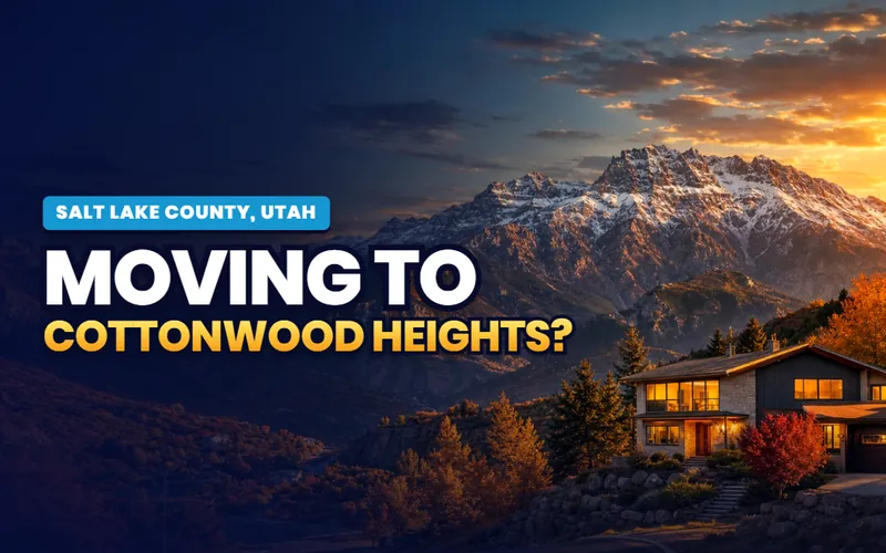
Between the canyons
Cottonwood Heights
The city on the bench between Big and Little Cottonwood, closest address in the county to four ski resorts.
The city guide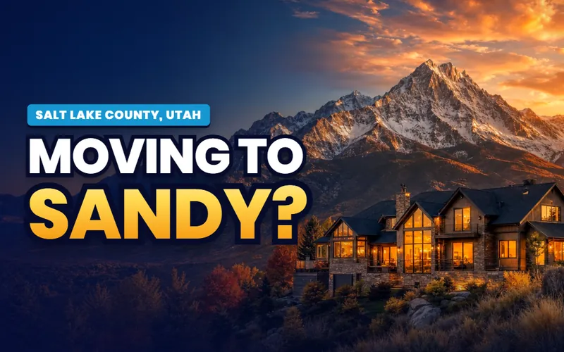
The southeast anchor
Sandy
The county's southeast hub: Little Cottonwood out the back door, Dimple Dell's gulch through the middle, and the Shops at South Town.
The city guide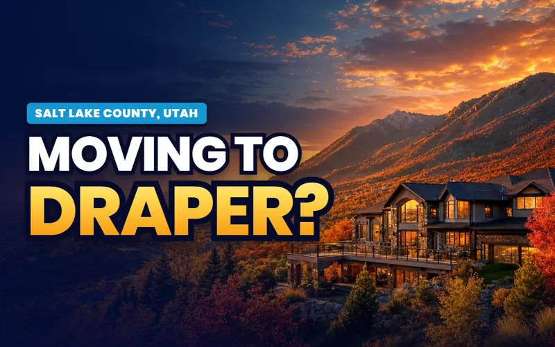
The point of the mountain
Draper
Corner Canyon's trail network, the aquarium, and The Point redevelopment rising on the old prison site at the county line.
The city guide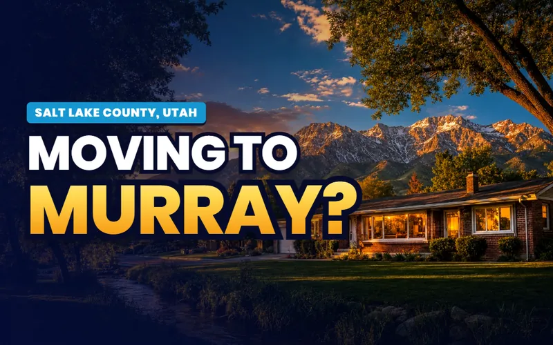
The center of the valley
Murray
The valley's geographic middle with its own power company, a grand central park and the Jordan River running through.
The city guide
The middle crossroads
Midvale
A historic Main Street and the Bingham Junction redevelopment, where the valley's two TRAX lines part ways.
The city guide
The mid valley west side
Taylorsville
A residential mid valley city on the Jordan River's west bank, threaded by the Redwood Road spine.
The city guide
Gardner Village's city
West Jordan
One of the county's largest cities, with an 1850s mill village on the riverbank and growth running toward the Oquirrh bench.
The city guide
Daybreak's city
South Jordan
The southwest valley's planned growth anchor, home to the Daybreak development and its lake, villages and TRAX line.
The city guide
The southwest bench
Herriman
One of the fastest growing cities in the country, tucked against the Oquirrh foothills with Blackridge Reservoir at its center.
The city guide
The southwest crossroads
Riverton
A south valley city between the Jordan River and the Mountain View Corridor, built around its own big city park.
The city guide
The last city south
Bluffdale
The county's southern edge, where the Jordan River enters the valley and the Mountain View Corridor's newest miles open.
The city guide
The inner ring
South Salt Lake
The compact city directly south of downtown, with the S-Line streetcar and a growing arts district in its industrial bones.
The city guide
The second largest city
West Valley City
Utah's second largest city: the Maverik Center, the Utah First Credit Union Amphitheatre and the most international calendar in the county.
The city guide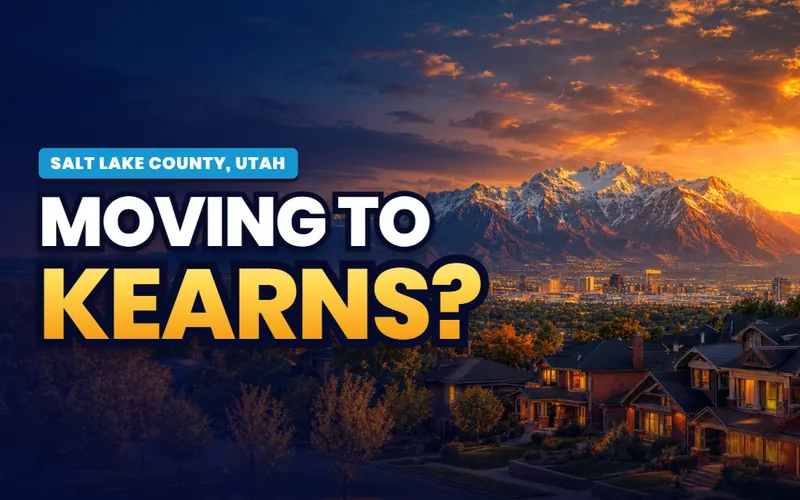
Olympic ice
Kearns
The west side city built around the Utah Olympic Oval, with 2034 expected to put its ice back on the world's calendar.
The city guide
The lake's doorstep
Magna
The copper company town with a century old brick Main Street and the county's only harbor on the Great Salt Lake.
The city guideQuick answers
Salt Lake County, answered
The city guides at /cities/ answer whether to live somewhere: prices, neighborhoods, schools, commutes and the listings. The Local's pages answer what you actually do here and how the place works in practice: the canyon road rules on a storm morning, the lake's condition, where the bench trail really runs. For Salt Lake County the practical guides for all eighteen cities are already live, and The Local's editorial layer is arriving on top, county subjects first.
Because in a metro the amenities belong to the county, not to whichever city happens to touch them. Big Cottonwood Canyon is not Cottonwood Heights' property, the Great Salt Lake is nobody's city park, and the Bonneville Shoreline Trail crosses six cities without belonging to any of them. Each shared subject gets one county page here, written once and linked from every city's companion, instead of eighteen overlapping retellings.
Eighteen: Salt Lake City, Millcreek, Holladay, Cottonwood Heights, Sandy, Draper, Murray, Midvale, Taylorsville, West Jordan, South Jordan, Herriman, Riverton, Bluffdale, South Salt Lake, West Valley City, Kearns and Magna. Every one has a full practical city guide live now, and each gets its own companion on The Local as the build waves land, starting with Salt Lake City itself.
Scott Buehler is based in Southern Utah, so for on-the-ground work in Salt Lake County he connects buyers and sellers with a trusted local partner agent and stays on the file for the research and the financing side. If you work with a referred agent, that agent's brokerage pays a referral fee to Real Broker, LLC out of the agent's compensation rather than as an added cost to you, and using a referred agent is never required.

The biggest county in the state. The same honest help
My base is Southern Utah, so for the on-the-ground work in the Salt Lake Valley I connect buyers and sellers with a trusted local partner agent and stay on the file for the homework and the financing side. Tell me which end of the valley you are weighing and I will get you the honest version.
Referral disclosure. Outside Southern Utah, I connect home sellers and buyers with partner agents I trust in their area. If you choose to work with an agent I refer, that agent's brokerage pays my brokerage (Real Broker, LLC) a referral fee. The fee comes out of the agent's compensation; it is not an added cost to you. You are always free to choose any agent you wish, and using a referred agent is never required.