
City Riverton, Salt Lake County
The southwest valley city that grew away from its own river
Riverton, and the river it turned its back on
The Jordan River is this city's eastern boundary and the reason it stopped being called Gardnersville in 1879. It is also the edge Riverton has spent fifty years growing away from, west across the bench and out to the Mountain View Corridor. What sits in between is a 31 acre park with a rodeo arena inside it, two weeks of Town Days spread across three separate sites, and a west side still getting its parks built. Here is the researched version of all of it.
 By Scott Buehler, Moving Utah
Updated October 2026
By Scott Buehler, Moving Utah
Updated October 2026
The short answer
Riverton is a southwest Salt Lake Valley city of about 45,000 that took its name from the Jordan River on its eastern edge, then spent fifty years growing the other way, west across the bench to the Mountain View Corridor. What sits in the middle is a 31 acre park with a rodeo arena inside it, two weeks of Town Days every summer, and a west side that filled in from farmland to the southwest valley's retail center in about a generation. Bangerter Highway splits the city north to south, so almost everything here gets talked about as east or west of Bangerter. This hub is the map to seven deeper pages, and it hands the canyons, the lake and the county's long river trail to the shared Salt Lake County pages.
The shape of it
A historic middle, a quiet river edge, and a west side still filling in
The Jordan River is Riverton's eastern boundary and the reason the settlement stopped being called Gardnersville in 1879. It is also the part of the city the fewest residents see in a given month, because for fifty years Riverton has grown the other way: west, across the bench the canals watered, past Bangerter Highway and out to the Mountain View Corridor. The newest streets sit about four miles from the water the city is named for.
That one fact organizes everything else. The civic middle is where a 31 acre park holds a rodeo arena, a skate park, a splash pad, pickleball courts and a domed hall rebuilt in 2015. The recreational east edge is a river bank with two city trailheads and a county golf course laid along the water since 1994. And the growing west side is where the parks are newest, one of them handed over by Salt Lake County as recently as 2017. Housing tracks the same story: older ranch and split level homes on larger lots toward the east and the original town core, and newer construction on tighter lots as you move west toward the corridor.
A couple of the best known outdoor spots inside the city line are not Riverton's to run, and that catches people out. Western Springs Park, the 20 acre park on the west side, was a county park until Riverton took it over in 2017, which is why older listings still file it under the county. Riverbend Golf Course on the river bottoms stays a Salt Lake County course, with county tee times and county pricing. And the Danny R. Crump fishing pond beside Old Farm Park is open every day, from about mid April to mid October.
So this is not a city with one center. It is a historic middle, a quiet water edge it has kept its back to, and a newer western half still getting its parks built. The river edge, the flagship park and the west side each have their own page, and the ranked list sorts what is worth a trip from what is simply handy if you live here.
One rule holds at every park in this city, and visitors break it constantly. Bounce houses are not allowed at any Riverton park. Not at the large pavilion, not at the small one, not on the open grass, not with a reservation. A city that hires out a big pavilion is the obvious venue for a large children's party, which is exactly why the rule exists and exactly why it disappoints somebody most summer weekends. Check the current park rules with Riverton Parks and Recreation before you hire anything in.
For fifty years this city has built away from the river it is named after, and that single choice explains almost everything else about it.
The rhythm
A year built around two weeks in the summer and not much else
Riverton concentrates its civic year harder than almost any city in this valley. There is no season of programmed evenings, no ticketed summer run at an amphitheater, no winter theater schedule. There is Town Days, and Town Days is enormous: a three night rodeo in the last week of June, then a gap, then a carnival, a concert, a parade, a film and a full day of the Fourth of July. The Town Days page takes the whole thing in order, including the three separate sites it happens on.
Around that, the calendar runs on seasons rather than dates. Splash pads run Memorial Day to Labor Day and there are three of them: one in the middle of the city, one on the west side, and one at Old Farm Park, which was closed in 2026. The fishing pond opens every day from the middle of April to the middle of October. Youth sport fills Centennial Park and the 30 acre sports complex through most of the warm months. And the sledding hill at Western Springs works exactly once a year, for however long the valley floor holds snow.
What runs in every month is the walking. Riverton keeps a set of trails that reads oddly generous for a suburb of this size: the Jordan River Trail on the east edge, the Midas Creek Trail built in sections, the Rose Creek Trail heading southwest out of Monarch Meadows Park, the Western Springs Trail, the Mountain View Trail, and paths that ring three separate parks. The ranked list sorts what is genuinely worth a trip from what is simply useful if you live here.
This city puts almost its whole civic year into two weeks and then goes quiet, and that is a real choice rather than a shortage.
The wider valley
The famous things sit at the far end of a long drive from this corner
This is the southwest corner of the county, which is the furthest point on the valley floor from most of what people come to Utah for. Everything spectacular is reachable and none of it is close, and none of it is Riverton's. Four county pages carry those subjects properly, so here is where each one lives.
The long line
The Jordan River Parkway
The valley's long green line read in segments, plus what paddling it actually involves.
Read the guide
The canyons
The Cottonwood canyons
Four resorts on two roads that both end in snow, and the watershed rules that come with them.
Read the guide
The west range
The Oquirrh side
The mine, the west bench and the range that closes the valley on the side Riverton grew toward.
Read the guide
Days out
Weekends in the valley
Outings across the county ordered by price, for the Saturdays that are not going to be spent in a park.
Read the guideDistance is the thing to be honest about from this corner of the valley. Riverton is among the furthest points in this county from the Cottonwood canyon gates, the lake shore and the bench trailheads, and the runs to all three cross most of the width or the length of the valley. That is a real cost and it is worth pricing rather than glossing. It is also why this companion is about a park, a festival, a river edge and a west side: those are the things a household here uses on an ordinary week, and everything else is a proper journey planned in advance.
The Riverton companion
Seven pages, and three of them are about ground the city built itself
Everything The Local has written about Riverton: the ranked list of what is genuinely here, the 31 acre flagship park and the hall at its gate, the two weeks of Town Days in order and across all three of its sites, the eastern river edge the city grew away from, the 20 acre west side park that used to be the county's, and what a southwest valley address actually asks of a household.
Things to do
The top 7, ranked
Read
The park
Riverton City Park and the dome
Read
Town Days
Riverton Town Days, in order
Read
The river
The Jordan River through Riverton
Read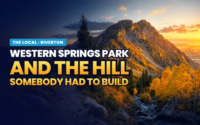
The west side
Western Springs Park
Read
Moving here
A southwest valley address
ReadWeighing a move, not a visit?
For a move rather than a day out, the Riverton city guide has the price bands, the east side and west side neighborhoods, the school boundaries and the homes on the market right now.
Scott Buehler
Moving Utah About Scott
Quick answers
Riverton, answered
In the southwest corner of the Salt Lake Valley, with the Jordan River forming its eastern boundary and the Mountain View Corridor running down its western edge. South Jordan sits to the north, Bluffdale to the south, Herriman to the west and Draper across the river to the east. Bangerter Highway runs through the middle of the city north to south, which is why so much of Riverton gets described as either east or west of Bangerter.
Its Town Days celebration and the three night rodeo at its center, which draws thousands to the rodeo arena in the last week of June. Beyond that, for a 31 acre flagship park with a domed hall at its gate that appears on the city seal, for having no train station of its own, and for a west side that filled in from farmland to the southwest valley's retail center in about a generation.
Riverton keeps 33 parks holding more than 540 acres of green and open space between them. The flagship is Riverton City Park at 31 acres, Western Springs Park on the west side is about 20, Centennial Park is 18.9 and the CR Hamilton Sports Complex is a 30 acre multipurpose site. Past the big five, most of the system is small neighborhood parks of two to five acres, many of them built from 2000 onward as the city grew west.
It spreads across nearly two weeks rather than one weekend. The three night rodeo runs in the last week of June, then the carnival, parade and a full Fourth of July program follow in early July. Exact dates move every year, so take the current calendar from the city before you plan around it.
In advance, and only in advance. Riverton sells rodeo tickets through the city, opens sales in early June, and states plainly that there are no ticket sales at the gate. Tickets ran 15 dollars in 2026 with children three and under free. The city also warns that its tickets are inexpensive and that it has never charged more than 100 dollars for one, because resale listings show up every year at many times the real price. Buy through the city and nowhere else.
Yes, along the whole eastern boundary of the city, and Riverton has two trailheads onto it: Dr. O. Roi Hardy Park at 12400 River Vista Drive and the Riverbend Trailhead at 12765 South 1125 West. The wider trail is a county system rather than a Riverton one, and the region page covers it end to end. What belongs to this city is a quiet, low, well treed edge that most of its own residents rarely visit.
Flood plain, and everything that follows from it. The Jordan River forms the boundary, the ground beside it was never buildable, and what fills that corridor instead is an eighteen hole public golf course opened in 1994, a paved regional trail, and two parks giving onto the water. It is the softest, greenest and quietest edge of the city, and it is also the edge the fewest residents ever use, because the city has been building the other way for fifty years.
No. There is no rail platform inside the city. The nearest light rail is the TRAX Red Line terminus at Daybreak Parkway in neighboring South Jordan, and the nearest commuter rail is across the river on the east side of the valley. That is the biggest practical difference between Riverton and the cities on the freeway spine, and it is the first thing to work out if a transit commute is part of the plan rather than an afterthought.
For a visitor, yes, because everything here sits within about fifteen minutes of everything else and there is no drive up a canyon to budget for. A morning on the river edge, a walk through the 31 acre park, an afternoon on the west side and an evening at the retail district fills a day comfortably. What one day cannot do is Town Days, because the rodeo, the parade and the Fourth of July program are fixed dates spread across two separate weeks.
Thinking about Riverton? Start with which side of Bangerter you mean
This city reads as one place on a map and behaves as two on the ground: an established eastern half within reach of the river and the older parks, and a western half that has been under construction for twenty years, where the newest housing, the newest parks and most of the traffic are. Tell me what you are weighing and I will put you with a Salt Lake County partner agent who works the southwest valley, and stay on the file for the homework and the financing side.
Or call Scott: (435) 357-4345or send Scott a message
Keep going
Continue your Riverton research
Eight more doors into Riverton, chosen for what this page covers.
Questions about Riverton?
Call Scott, send a message, or find out what your Riverton home is worth. No pressure, no obligation.
Referral Disclosure: For moves outside Southern Utah, I can connect you with trusted local agents. If you choose to work with one, their brokerage pays my brokerage (Real Broker, LLC) a referral fee from their commission. This costs you nothing extra, and you are never obligated to use my referral.