
Salt Lake County, Northern Utah
Moving to Cottonwood Heights, Utah
Cottonwood Heights sits on the southeast side of the Salt Lake Valley, between the mouths of Big and Little Cottonwood canyons. The middle of town sits at about 4,800 feet, and the streets climb past 5,000 feet along Wasatch Boulevard. Downtown Salt Lake City is about 20 minutes north and Snowbird about 22 minutes up the canyon. Want to see what is for sale right now? The Browse Cottonwood Heights homes button below shows every listing.
Drive times from Cottonwood Heights. Look up any Utah drive
Start here
What brings you to Cottonwood Heights?

Pick one, and I will point you to the right page. It takes three taps at most, and there is nothing to sign up for.
Chapter 1 of 4
The place and the weather
What Cottonwood Heights is, how high it climbs, and what the sky does all year.
City at a glance
What are the quick facts on Cottonwood Heights?
The place
The weather
The money
Around town
Sources: U.S. Census Bureau, NOAA, USGS, the Utah State Tax Commission, the Salt Lake County Clerk, and Cottonwood Heights City records. Prices move, so ask me for current numbers.
Overview
What is Cottonwood Heights like?
Short answerA city of about 32,300 on the southeast side of the Salt Lake Valley, between the mouths of Big and Little Cottonwood canyons. It became a city in 2005.
Cottonwood Heights sits on the southeast side of the Salt Lake Valley, between the mouths of Big and Little Cottonwood canyons. About 32,300 people live here, by the 2025 Census estimate. The city covers about 9.4 square miles, and all of it is in Salt Lake County. Holladay and Murray are to the north, Midvale is to the west, and Sandy is to the south. National forest is to the east. The count was 33,617 in 2020, so the city has grown a little smaller each year since.
The ground climbs from west to east. The middle of town, near City Hall at 2277 East Bengal Boulevard, sits at about 4,800 feet. The west edge by I-215 is near 4,400. Along Wasatch Boulevard the ground passes 5,000, and homes reach about 5,500. The city line runs up the slope above Ferguson Canyon to about 6,400 feet. So the city spans about 2,000 feet of height.
Big and Little Cottonwood creeks come out of the Wasatch Mountains here. The two canyon mouths sit at the east edge of town. Four ski resorts are up those two canyons, and the ski topic tells that story. Stores and offices sit along Fort Union Boulevard and in the Old Mill office area. The rest of the city is streets of houses that climb toward the mountains. With a canyon mouth at each end of its east edge, it is a city between the canyons.
The city is still deciding how to grow. It is rewriting its general plan in 2026. An open house was held on July 22, and the City Council and planning commission met on it on September 15. The plan has not been adopted. The new construction topic covers what is being built now.
Butlerville and the vote
Settlers came to this ground in 1849. Fort Union was built in 1853. The area was known as Butlerville, after the Butler family, who were early lumbermen. Sources differ on whether that was a formal name or a nickname. The fort has its own story in Fort Union on The Local. The Old Mill, a paper mill built in 1883, is still standing, and the things to do topic tells its story.
How it became a city in 2005
For most of its history the area was not a city. It was part of Salt Lake County. Residents voted on becoming a city on May 4, 2004. The county clerk counted 7,148 ballots. There were 5,600 votes for it and 1,021 against, which is about 85% yes. The same ballot picked the council-manager form of government. In that form, an elected council hires a professional manager to run the city day to day.
The city began on January 14, 2005. The case residents made was simple. They wanted zoning, police and tax decisions made close to home. They did not want to be run from the county, or to have neighboring cities annex the area a piece at a time. The vote shows how many agreed.
- 1849Settlers come to this ground.
- 1853Fort Union is built.
- 1883The Old Mill paper mill is built.
- 2004Voters pick cityhood on May 4, about 85% yes.
- 2005Cottonwood Heights becomes a city on January 14.
Highlights
- About 32,300 people, by the 2025 Census estimate. The count was 33,617 in 2020.
- Middle of town at about 4,800 feet. The city spans about 2,000 feet of height, from I-215 to the slope above Ferguson Canyon.
- The two canyon mouths sit at the east edge, with four ski resorts up the roads.
- The vote was 5,600 yes to 1,021 no on May 4, 2004. The city began on January 14, 2005.
- About 9.4 square miles, all in Salt Lake County.
- The city is rewriting its general plan in 2026. It has not been adopted.
Want the street level view? Cottonwood Heights on The Local has guides to the city. Weighing the whole state? Start with my relocating to Utah guide. I did the homework on Cottonwood Heights. In Cottonwood Heights, a partner agent I trust does the work on the ground.
Sources: the U.S. Census, USGS elevations, the Salt Lake County Clerk’s results for May 4, 2004, and Cottonwood Heights City meeting records for 2026.
Still choosing a town?Utah City FinderSort 138 Utah towns by budget, snow, summer heat, and the drive to work.Find a townClimate and weather
What is the weather like in Cottonwood Heights?
Short answerHot, dry summers, cold winters with a lot of snow, and mild spring and fall. July highs are near 91°F and January lows near 23°F.
Cottonwood Heights has four true seasons. Summers are hot and dry. Winters are cold, with a lot of snow. Spring and fall are mild. NOAA, the national weather agency, runs a station called Cottonwood Weir inside the city. It sits at the mouth of Big Cottonwood Canyon, about 5,000 feet up and about 2 miles east of City Hall. These numbers are NOAA’s 1991 to 2020 normals for that station.
Spring
Highs 54 to 71°F
Cool and changeable, with snow still likely in March and April. The last freeze usually comes around April 29.
Summer
Highs 82 to 91°F
Hot, dry days, with nights from the upper 50s to the upper 60s. About 48 days a year reach 90 or more.
Fall
Highs 49 to 79°F
Clear and mild, with color in the canyons. The first freeze usually comes around October 22.
Winter
Highs 38 to 44°F
Real winter, with December the snowiest month and nights near 23.
Month by month
These are the normal highs and lows for each month. Summer nights cool off. A normal July night drops to about 68°F.
- JanuaryHigh 38°F, low 23°F
- FebruaryHigh 44°F, low 27°F
- MarchHigh 54°F, low 34°F
- AprilHigh 61°F, low 40°F
- MayHigh 71°F, low 48°F
- JuneHigh 82°F, low 57°F
- JulyHigh 91°F, low 68°F
- AugustHigh 89°F, low 66°F
- SeptemberHigh 79°F, low 56°F
- OctoberHigh 64°F, low 43°F
- NovemberHigh 49°F, low 32°F
- DecemberHigh 38°F, low 23°F
Source: NOAA climate normals, 1991 to 2020, Cottonwood Weir station. Months are rounded to the nearest degree.
Rain and melted snow add up to about 24 inches a year. That is about 9 inches more than the Salt Lake City airport gets. April afternoons often reach the 60s, even while storms still come. The two creeks run high with snowmelt in spring.
Frost dates matter if you garden. The last spring freeze is usually around April 29, and the first fall freeze around October 22. That leaves about 174 frost-free days. About 21 days a year never rise above freezing.
Highlights
- A normal January day: high 38°F, low 23°F.
- A normal July day: high 91°F, low 68°F.
- About 24 inches of rain and melted snow a year.
- Last spring freeze about April 29. First fall freeze about October 22.
- About 174 frost-free days.
Good to know. The station sits at the canyon mouth, about as high as Wasatch Boulevard. The west edge by I-215 is about 500 feet lower, and it gets less snow. Ask which part of town a home is in.
For the day to day side, see Cottonwood Heights on The Local.
Snow
How much snow does Cottonwood Heights get?
Short answerAbout 82 inches in a normal year at the city’s own station, mostly December through March. The lower west side gets less.
Cottonwood Heights gets about 82 inches of snow in a normal year at its own weather station. NOAA still marks its snow numbers as provisional, so treat them as close, not exact. That is far more than the flat low ground of the Salt Lake Valley. The Salt Lake City airport station gets about 52 inches. So this city’s station gets about 30 inches more.
Source: NOAA climate normals, 1991 to 2020, the weather station in each town (Cottonwood Heights uses the station at the mouth of Big Cottonwood Canyon, inside the city; Sandy uses the Salt Lake City airport station).
December is the snowiest month, with about 23.3 inches. February brings about 18.4 and January about 17. November adds about 8.2, March about 7.6, and April about 5.6. October gets about 1.5, and May only a trace. No snow falls from June through September. December through February together bring about 58.7 inches.
About 19 days a year bring an inch or more of new snow.
Height changes the snow. The station at the canyon mouth gets about 82 inches. The lower west side by I-215, about 500 feet lower, gets less. A storm can rain on Fort Union Boulevard while it snows on Wasatch Boulevard. NOAA has no station on any one street, so no one can give you a total for yours.
Highlights
- About 82 inches a year at the city’s own station. NOAA marks it provisional.
- About 52 inches at the Salt Lake City airport, so about 30 inches less.
- December is the snowiest month, with about 23 inches.
- No snow falls from June through September.
- About 19 days a year bring an inch or more of new snow.
Good to know. The canyon mouth number is not your snow number. A home on the hillside can get more snow, a longer shoveling season and steeper roads in ice. A home by I-215 gets less. Ask what the street is like after a storm. The traffic topic covers the canyon roads.
For the bigger picture on snow and water in Utah, read my guide on Utah water and snowpack.
Snow is not your thing?Try the warm winter city finderSee the Utah towns where snow is rare or light, from St. George to Moab.Show warm winter townsSummer temperatures
How hot does Cottonwood Heights get in summer?
Short answerJuly highs average about 91°F, with about 48 days a year at 90°F or hotter.
Summers are hot and dry. A normal July afternoon reaches about 91°F at the city’s weather station. Nights fall to about 68°F. June is milder, with highs near 82°F. August is close to July, near 89°F.
Source: NOAA climate normals, 1991 to 2020, the weather station in each town (Cottonwood Heights uses the station at the mouth of Big Cottonwood Canyon, inside the city; Sandy uses the Salt Lake City airport station).
Hot days are common but not constant. A normal year has about 48 days at 90°F or hotter. A day at 100°F is rare, about one a year. Sandy, next door, uses the airport station, which runs hotter, at 94°F in July. The two stations sit at different heights, so compare them with care.
The hot stretch
July and August highs sit in the high 80s and low 90s. June runs about ten degrees cooler.
Warm nights
Summer lows run from the upper 50s in June to the upper 60s in July.
Fall color
Fall highs fall from 79°F in September to 49°F in November, with color up the canyons.
Highlights
- A July high of about 91°F.
- About 48 days a year reach 90°F or hotter.
- About 1 day a year reaches 100°F.
- July nights fall to about 68°F.
Summer is also a season for poor air. The air quality topic below has the numbers.
Wind
Is Cottonwood Heights windy?
Short answerSome storms bring strong east winds near the canyon mouths, but there is no official gust figure to quote.
Cottonwood Heights sits at the foot of the Wasatch Mountains, at the mouths of two canyons. Some storms bring strong east winds near the canyon mouths. The National Weather Service used those words in its warning for the March 2024 storm: strong winds along the Wasatch Front, especially the canyon mouths.
In that March 2024 storm, a Salt Lake meteorologist told KSL that the strongest winds would come from Bountiful northward, well north of here.
No NOAA, National Weather Service or UDOT gust figure exists for Cottonwood Heights. So this topic has no wind speed. I would not guess one. What I would do is learn how a home sits on its lot. The homes closest to the canyon mouths and on open hillside lots are the ones to ask about.
Where it blows
The weather service named the canyon mouths, on the east edge of town, as a place the strong winds hit.
On a tour
Look at the roof, the fences and the big trees near the house.
Ask the neighbors
Visit on a breezy evening. Ask what the last big wind did to the street.
Highlights
- Some storms bring strong east winds near the canyon mouths.
- In March 2024 the strongest winds were forecast from Bountiful northward.
- There is no official gust figure here, so none is given.
- Ask about the roof, fences and trees on any home on open ground.
Straight talk. Wind is easy to miss in a daytime showing. Visit a home on a breezy evening and ask the neighbors what the last big wind did.
Air quality and inversions
Does Cottonwood Heights get inversions?
Short answerYes, in winter. Summer ozone brings poor air days too, and EPA still lists the county as Serious for ozone.
Yes, the Salt Lake Valley gets inversions. An inversion is when cold air gets trapped in a valley under a lid of warmer air. On calm winter days, haze builds in that trapped air. Summer ozone brings poor air days too.
Winter haze
The air quality index starts at 0. A reading of 50 or less is good. Above 50 is moderate, and above 100 is unhealthy for sensitive groups. This table counts December through February days over 50 in Salt Lake County.
| Winter | Days above 50 | Worst day | Days above 100 |
|---|---|---|---|
| 2024 to 2025 | 46 of 90 | 126 | 5 |
| 2025 to 2026 | 42 of 90 | 101 | 1 |
Source: EPA AirData, daily air quality index for Salt Lake County. The worst days were December 5, 2024 and January 1, 2026, both from fine particles. The county figure uses the worst monitor of the day, so it is not a Cottonwood Heights reading.
Summer ozone
Ozone is a gas that forms on hot, sunny days. In 2025, Salt Lake County had 121 good days and 228 moderate days. It had 15 days that were unhealthy for sensitive groups and 1 that was unhealthy for everyone. Fourteen of those 16 poor days were ozone days, between May 12 and September 3.
What the EPA says
Salt Lake County is in the Northern Wasatch Front area for the 2015 ozone standard. EPA lists the area as Serious, so it does not meet that standard. For fine particles, called PM2.5, EPA ruled that the Salt Lake City area met the federal standard in 2025.
Highlights
- Winter days over 50 were 46 in 2024 to 2025 and 42 in 2025 to 2026, out of 90.
- Days over 100 fell from 5 to 1 between those two winters.
- In 2025, 14 of the 16 poor air days were summer ozone days.
- Salt Lake County is in the ozone area EPA lists as Serious.
- For fine particles, the Salt Lake City area met the federal standard in 2025.
- The higher streets can sit near or above the top of the haze on some days.
Here is what I would do. Check the air each day on the state’s air quality site, the way you check the weather. If air matters to you, visit during a gray winter stretch and a hot summer afternoon before you buy. No number backs the idea that one part of town has better air, so test it yourself.
Car emissions tests are part of the same story. The first 90 days topic covers the test.
Sources: EPA Green Book, the EPA news release on PM2.5, and EPA AirData for 2024 to 2026.
End of chapter 1 of 4
NextFeatured homesFeatured listings
Featured homes across Utah
Homes featured on MovingUtah right now, fed live from the MLS.
View all featured homes across Utah
Listing data is deemed reliable but not guaranteed and is subject to change. Where a listing is one in which Scott Buehler holds an ownership interest, that interest is disclosed on the listing.
Chapter 2 of 4
Homes and money
What it costs, what you can buy, how the ground changes, and what to check.
Cost of living
Is Cottonwood Heights affordable?
Short answerHousing is the big cost, and the Census typical value runs above Salt Lake City's and Sandy's. Taxes and monthly fees are set by public rules.
Housing is the big cost in Cottonwood Heights. The glance box at the top of this page shows the latest typical home value, from the U.S. Census. In words, the Census typical value here runs above Salt Lake City's and Sandy's.
The smaller costs are easier to pin down. Sales tax is a full point below Salt Lake City's. Utah taxes a primary home on only part of its value. Sewer and garbage are flat monthly fees that you can look up. The next topic walks through the taxes, and the utilities topic lists who bills what.
Four resorts sit within about half an hour. If you spend your free days in the canyons, that is ski days without lodging bills. It is a plain budget fact, and it is not a price break on the house.
So price the address, not the city. A home by I-215 and a home above Wasatch Boulevard are both in Cottonwood Heights. The lot, the view, and the street all differ, so compare a home with recent sales close by.
Housing
The main cost. The glance box shows the latest typical home value.
Property tax
About 0.55% of a home's value a year, the Salt Lake County average. A primary home is taxed on 55% of its value.
Sales tax
7.45% in Cottonwood Heights, against 8.45% in Salt Lake City.
Garbage
$26 a month for one garbage can and one recycling can, from a waste district.
Sewer
$24 a month for most of the city, from a separate improvement district.
Canyon days
Four resorts are about 22 to 31 minutes away, so a ski day does not need a hotel.
Do you want a side-by-side with a nearby city? Cottonwood Heights sits next to Sandy, Holladay, Murray, and Midvale. Ask me and I will run the numbers for the addresses you are weighing.
Highlights
- Housing is the big cost. The glance box shows the latest typical home value.
- The Census typical value here runs above Salt Lake City's and Sandy's.
- Sales tax is 7.45%, a full point below Salt Lake City.
- Sewer is $24 and garbage is $26 a month, set by separate districts.
- Four resorts are 22 to 31 minutes away.
Sources: U.S. Census Bureau (ACS 2020 to 2024), the Utah State Tax Commission, Cottonwood Improvement District, and Wasatch Front Waste and Recycling District. Costs change, so ask me for current numbers.
For general information only. This is not tax or financial advice. Tax rates and home prices change. Consult a qualified professional for guidance specific to your situation.
Taxes
What taxes will I pay in Cottonwood Heights?
Short answerSales tax is 7.45%. A primary home is taxed on 55% of its value. The city raised its property tax for 2026, and so did the school district.
Three taxes matter most when you move here: sales tax, state income tax, and property tax. Here is each one in plain terms. All of Cottonwood Heights is in Salt Lake County.
| Tax | Rate | What to know |
|---|---|---|
| Sales tax | 7.45% | The full rate in the city, set by the Utah State Tax Commission for fall 2026. Salt Lake City's rate is 8.45%. |
| Groceries | 3.00% | Food from the grocery store is taxed at a lower rate. |
| Restaurant meals | 8.45% | Prepared food carries a higher rate. |
| Hotel rooms | 14.52% | The rate on a hotel stay. |
| State income tax | 4.45% | One flat rate for everyone, for tax years starting in 2026. |
| Property tax | About 0.55% | The average yearly tax as a share of a home's market value in Salt Lake County, for 2025. |
Your property tax bill is made of several pieces. Each group that taxes you sets its own rate, and that rate is called a levy. Here the pieces include the schools, the county, the city, and special districts. The county lists eleven tax areas in Cottonwood Heights, so the total rate changes by address. Look up the real address on the county treasurer's site before you budget.
The city raised its property tax for 2026
The state requires a public hearing, called Truth in Taxation, before a tax group collects more than it did the year before. Cottonwood Heights held one for 2026. The City Council approved the increase on August 11, 2026. The city's own levy for 2025 was 0.001509. Your tax notice will show what the new rate means for one home.
The school district raised its rate too
Canyons School District held its own hearing on August 4, 2026, and its board voted 7 to 0 to raise its rate. The schools topic has the district and its schools.
Pieces that depend on the address
Some tax areas also pay a levy to the Cottonwood Heights Parks and Recreation Service Area. That is the district that runs the rec center. Property taxes are about half of its budget. Three tax areas pay a levy to Jordan Valley Water. Sewer comes from either Cottonwood Improvement District or Mt. Olympus Improvement District, depending on the area. Ask for the tax area when you look at a house.
The city runs its own police department and pays Unified Fire from its own budget. Because of that, no tax area in the city carries a county fire or county police levy.
The primary home exemption
Utah gives a tax break to the home you live in. A primary home is taxed on 55% of its market value. Other property is taxed on all of it. Look at your tax notice for the primary home line to see that the break is applied.
Highlights
- Sales tax is 7.45%, and groceries stay at 3.00%.
- 4.45% flat state income tax for 2026.
- A primary home is taxed on 55% of its value.
- Property tax averages about 0.55% in Salt Lake County, and the county lists eleven tax areas in the city.
- The city raised its property tax for 2026, and so did Canyons School District.
- The city pays for its own police and fire, so there is no county police or fire levy.
Sources: the Utah State Tax Commission, the Salt Lake County tax rate tables for 2025, and Cottonwood Heights City notices. Also the Canyons School District hearing of August 4, 2026. Questions about your own bill go to the county assessor.
For general information only. This is not tax or financial advice. Tax rates and home prices change. Consult a qualified professional for guidance specific to your situation.
Real estate overview
What do homes cost in Cottonwood Heights?
Short answerPrices move. The glance box at the top of this page shows the latest typical home value. The median home was built in 1978.
The glance box at the top of this page shows the latest typical home value for Cottonwood Heights, from the U.S. Census. That number is what owners think their homes are worth, averaged over five years. It is not a sale price. So price any home against recent sales of homes like it nearby.
The Census counts 13,046 homes in the city. About 71% are single-family houses on their own lots. About 7% are townhomes or other attached homes, and about 4% are in buildings of two to four units. About 18% are in buildings of five or more units. Homes are large, with a median of 7.4 rooms.
About 72% of occupied homes are owner-occupied, against 66% for the county. The median home was built in 1978. About 69% of all homes went up between 1950 and 1989, and the 1970s are the biggest decade. Fewer than 2% have been built since 2020. The city has no open land left, so most of what you see for sale is a resale home.
| Decade built | Share of homes |
|---|---|
| Before 1950 | About 1% |
| 1950s | About 8% |
| 1960s | About 15% |
| 1970s | About 32% |
| 1980s | About 13% |
| 1990s | About 15% |
| 2000s | About 9% |
| 2010s | About 5% |
| Since 2020 | Under 2% |
Know the kind of home before you trust the average
An average mixes very different homes. A condo near Fort Union Boulevard and a house above Wasatch Boulevard do not move together. Judge every home by its lot, its street, and its age.
Townhomes and condos
Attached homes are about 7% of the city, and buildings of five or more units are about 18%. Fort Union Boulevard has the most apartments.
Houses on the older streets
Most homes date from 1950 to 1989. Check the furnace, the wiring, the plumbing, and what has been updated.
Houses on the hillside
Wider views along and above Wasatch Boulevard, with the most snow and the quickest trail access.
Rebuilds
New homes arrive one lot at a time. On a rebuilt lot, ask for the permit history and how the new house sits on an older street.
Elevation, views and snow
The ground shapes this city. The land climbs from the west edge by I-215, at about 4,400 feet, to over 5,000 feet along Wasatch Boulevard. Homes sit as high as about 5,500 feet. The table shows the ground height by street, west to east. These are heights, not prices.
| Where | About how high |
|---|---|
| West of 1300 East | 4,460 feet |
| 1300 East to 2000 East | 4,550 feet |
| 2000 East to 2700 East | 4,720 feet |
| 2700 East to 3500 East | 4,940 feet |
| Along Wasatch Boulevard | 5,170 feet |
| Above Wasatch Boulevard | 5,390 feet |
Views, snow, and trail access rise with the ground. A storm that rains on Fort Union Boulevard can be snowing on Wasatch Boulevard, about 500 feet higher. The snow topic has the numbers from the weather station at the canyon mouth. A hillside driveway is a different winter from a street near I-215, so budget for the shoveling.
Ask me how fast homes like the one you want are selling right now. A partner agent I trust in Salt Lake County can walk through recent sales with you. Prices shift through the year, so a number from last season can mislead. Be ready to act on a well-priced home, but never let anyone rush you.
Highlights
- The glance box shows the latest typical home value, from the Census.
- About 71% of homes are single-family houses, and about 72% are owner-occupied.
- The median home was built in 1978, and about 69% went up from 1950 to 1989.
- The city has no open land, so most homes for sale are resales.
- The ground climbs from about 4,400 feet to over 5,000 feet, and views and snow rise with it.
Shop by price
Shop by kind of home
Sources: U.S. Census ACS 2020 to 2024 and U.S. Geological Survey elevation data. Prices shift through the year, so ask me for the latest Cottonwood Heights numbers.
Neighborhoods and communities
Where in Cottonwood Heights should I look for a home?
Short answerThink in areas from low to high: the west side, Fort Union Boulevard, Butler, the Old Mill corner, the canyon mouth, the hillside, and the Little Cottonwood corner.
Cottonwood Heights has no master-planned villages to sort by name. It is easiest to read by the ground and the main roads. The areas below run from low to high, west to east. The ground, the view, and the snow change block by block, so the partner agent walks the street with you.
- West sideBy I-215 and Union ParkAbout 4,400 to 4,550 feetThe flattest blocks in the city. I-215 has ramps at 6200 South and at Fort Union and Union Park. Whole Foods sits on Highland Drive on this side.
- Fort Union BoulevardThe 7000 South lineWest edge to Wasatch BoulevardShops and offices run along it all the way east. The Target, Trader Joe's, and Home Depot corner sits at 1300 East and Park Centre Drive.
- Butler, the middleAround City HallAbout 4,700 to 4,850 feetCity Hall, Brighton High, Butler Middle, Butler Park, and the rec center sit here. They are on Bengal Boulevard and 2700 East. This is the ground of old Butlerville, and the overview tells the story.
- The Old Mill cornerNortheastAbout 4,700 feetBig Cottonwood Creek and Big Cottonwood Canyon Road run through here. It holds the 1883 mill, office parks, and Old Mill Park. The things to do topic tells the mill's story.
- The canyon mouthFort Union and WasatchAbout 4,900 to 5,000 feetThe mouth of Big Cottonwood Canyon. Canyon Centre, with a hotel and restaurants, sits here, and so does the old gravel pit. The new construction topic covers both.
- The hillsideAlong and above Wasatch BoulevardAbout 4,950 to 5,500 feetThe streets between the two canyon mouths. Prospector Drive leads to Ferguson Park. Timberline Drive leads to the Ferguson Canyon trailhead.
- Little Cottonwood cornerSouth endWhere the city meets SandyThe parcel UDOT bought for a possible gondola base sits here. The traffic topic tells the story. The Little Cottonwood park and ride is just over the line in Sandy.
Which kind of area fits what you want
If you want flat ground and shops close by, look at the west side and Fort Union Boulevard. If you want the middle of town, look around Butler. If you want views and quick trail access, look along and above Wasatch Boulevard. Each trade has a cost. The high streets give you the view and the snow together, and the low streets give you shops and less shoveling.
A home's school depends on its address, so confirm it with the district. The schools topic lists the schools. I do not rate schools, so use the district, GreatSchools, and Niche to compare them.
Highlights
- The city is easiest to read by the ground and the roads.
- Heights run from about 4,400 feet by I-215 to about 5,500 feet on the hillside.
- Fort Union Boulevard carries the shops and offices.
- The canyon mouth and the Little Cottonwood corner are where land-use news happens.
- The mailing address and the city can differ, so check the city for any address.
Want the story on a certain block? Tell me what you are after. I will get it through the partner agent on the ground. My Cottonwood Heights guides on The Local cover Ferguson Canyon, Big Cottonwood, and more.
Area names follow the roads and the ground. Elevations come from the U.S. Geological Survey. A home's school depends on its exact address, so check with the district.
New construction
Are there new homes in Cottonwood Heights?
Short answerA few, in small pieces. There is no open land, so new homes come as small lots, second homes on a lot, and two big sites at the Big Cottonwood mouth.
Here is the straight answer. Cottonwood Heights has no open land for a large new subdivision. New homes come in small pieces. In 2026 the records show a few small lots and a rewrite of the rules for second homes on a lot. They also show two big sites at the Big Cottonwood mouth.
Homes the city approved in 2026
- HousesIvory Homes2327 East Bengal BoulevardTen single-family lots on a former church site, on a new street that ends in a cul-de-sac. Lots run from about 8,700 to 17,100 square feet. The planning commission approved the plan on July 1, 2026.
- HousesSouth Brady2193 East 6525 SouthThree single-family lots. The planning commission approved the plan on September 2, 2026.
- Second homesDetached ADUsAcross the cityA detached accessory dwelling unit, or ADU, is a small second home on the same lot. One was heard in June 2026. The city is also rewriting its ADU and multi-family rules in 2026. Ask what is in force when you buy.
Two big sites at the Big Cottonwood mouth
- Canyon CentreCanyon Centre ParkwayAt the canyon mouthToday it holds a hotel and several restaurants. The office building planned there was never built. A 36-unit condo building went to the planning commission in February 2026. No approval was found, so check what is actually for sale before you count on it.
- The old gravel pitAbout 6695 South Wasatch BoulevardAt the canyon mouthA mixed-use plan for the pit was approved in 2021. In 2025 a developer asked to set a condo tower of 75 to 110 units, 12 to 14 stories tall, on the site. In August 2026 the City Council discussed the development agreement. UDOT also plans a canyon parking hub at the pit, and the traffic topic tells that story.
The planning commission also recommended retail zoning for 7030 South Park Centre Drive in September 2026. The parcel the state bought at the Little Cottonwood mouth is a land-use marker too, and the same topic covers it. A project in a record is not a home for sale. Plans change, so ask me for the latest status.
Builders often cover the buyer agent fee, and your agent puts that in writing before you sign. Buying new works differently from buying a resale home, so read how it works before you tour.
Before you commit to a rebuild or a new home
- For sale or rental? Ask whether a project sells homes at all or only rents them.
- Permit history. On a rebuilt lot, ask for the permits and the remodel record.
- What is planned nearby? Ask what is approved on the parcels around the address.
- Snow and access. Ask how the street handles snow and how you reach it in winter.
- The fault map. On the hillside, ask whether the lot sits near a mapped fault. The home checks topic covers it.
Highlights
- There is no open land for a large subdivision.
- Ivory Homes won approval for ten lots on Bengal Boulevard in July 2026.
- A 36-unit condo building at Canyon Centre went to the planning commission, and no approval was found.
- The old gravel pit has an approved mixed-use plan and a development agreement under discussion.
- The city is rewriting its ADU rules in 2026.
- Check what is actually for sale before you plan around a project.
Sources: the Cottonwood Heights Planning Commission and City Council records for 2025 and 2026. A project in a record is not a home for sale. Plans change, so ask me for the latest status.
Before you buy
What should I check before I buy a home here?
Short answerCheck the fault and study zone, the slide maps, the flood map, the wildfire map, radon, and the snow and traffic on the street.
Every town has its own list of things to check. These are the questions I would ask about any home in Cottonwood Heights. Most come from the mountain edge and from the fault along Wasatch Boulevard. A map or a test can answer each one for a single address, so check them one home at a time.
Check the map
The fault
The Wasatch fault has mapped traces inside the city, roughly along and just east of Wasatch Boulevard. They run from the Little Cottonwood mouth north to about 6400 South. About one-eighth of the city's land, east of roughly 3000 East, sits in a state fault study zone. A lot inside one needs a fault study before building.
Ask for the report
Slides and debris flows
The state maps old debris flows near the Little Cottonwood side of Wasatch Boulevard. It also maps landslides at the Big Cottonwood mouth, one of them from gravel pit digging, and small slides on the hillside. On those lots, ask for a geotechnical report, which is a study of the soil and slope.
Check the map
Flood
FEMA maps flood zones along Big Cottonwood Creek and Little Cottonwood Creek. The map panels date from September 25, 2009. Look up the exact address.
Ask your insurer
Wildfire
The state map shows one high-risk wildfire area in the city, on the hillside east of Wasatch Boulevard south of Ferguson Canyon. Ask your insurer what a mapped area means for a policy.
Test the home
Radon
Radon is a gas from the ground that you cannot see or smell. In state test data, 28.5% of short-term tests in ZIP 84121 were at or above the fix-it level. The county figure was 33.2%. Ask for a radon test in your inspection.
Ask the city
Lot splits
Some 2026 homes sit on former church sites or on split lots. Ask how the lot was created and what the street looked like before.
The state's online layers show no flood or rockfall areas for the city. The county's liquefaction map marks the west edge by I-215 moderate and most of the city very low. Not mapped online is not the same as no risk, so ask your inspector about soils and slopes. The city's own map has fault, landslide, and liquefaction layers you can view.
Some checks are about the road, not the lot. Wasatch Boulevard and 6200 South carry canyon traffic on winter weekends. A street can also have deep snow, so ask how it is plowed. If the home is near the canyon mouths, ask what is planned at the gravel pit, Canyon Centre, the gondola parcel, and the Old Mill. The traffic topic has the canyon rules and UDOT's plan.
Also worth a look
- Insurance: the state notes that a normal homeowner policy usually does not cover damage from ground hazards.
- The law: Utah state law does not require realtors to verify or disclose geologic hazards, so the check is yours to make.
- The fault: about one-eighth of the city, east of roughly 3000 East, sits in a state fault study zone.
- The map: the online state layers show no other hazard here. Not mapped online is not the same as no hazard.
- CC&Rs: some subdivisions have recorded rules. Read them before your deadline.
Ask me about any of these on a home you like, and I will tell you what the record shows. Your agent on the ground can set up the radon test and the inspection.
More on inspections
This is general information, not legal, engineering, or insurance advice. Sources: the Utah Geological Survey, the U.S. Geological Survey, FEMA, and the Utah Department of Environmental Quality. Also the state forestry division and Cottonwood Heights City. Have a licensed inspector look at any home before you buy.
Financing your move
How do I pay for a home here?
Short answerGet pre-approved before you shop. Homes vary a lot in age and type, and USDA loans do not apply.
Sort the financing before the search in Cottonwood Heights. Few homes here are cookie-cutter houses built in one batch. Homes run from 1950s ramblers to new rebuilds. On the high streets, an appraiser has fewer close sales to compare. An appraiser is the person who sets a home's value for the lender.
The best first step is to get pre-approved. That means a lender checks your finances and tells you how much you can borrow. It shows what you can spend, and it makes your offer stronger. The type of home matters too. A condo or a townhome finances differently from a house, and the condo project has its own rules.
One loan type does not apply here. USDA loans are for rural homes, and the USDA map shows every Cottonwood Heights point tested as ineligible. Conventional, FHA, and VA loans are the ones to look at. Utah Housing Corporation runs statewide programs for buyers. Ask about current programs, because the rules change.
Highlights
- Get pre-approved first. It shows what you can spend and makes your offer stronger.
- On the high streets an appraiser has fewer close sales to compare, so ask early.
- A condo or townhome finances differently from a house.
- The USDA map shows every Cottonwood Heights point tested as outside the loan area.
- The loan guides on this site explain each loan type in plain English.
How my dual role works. I am licensed in both real estate and lending. On any one purchase I take one role. Every role is disclosed, and you are always free to choose your own agent and your own lender. In Cottonwood Heights, a partner agent I trust does the work on the ground. The full explanation is on How I Work. This section is general information, not financial, legal, or tax advice.
End of chapter 2 of 4
NextSelling in Cottonwood HeightsSelling in Cottonwood Heights
Want to sell your home in Cottonwood Heights?
List it with a partner agent I trust in Salt Lake County. Your home gets featured on MovingUtah. Buyers read these pages while they plan a move to Cottonwood Heights. I make the connection and stay involved. Commissions are always negotiable.
Start with what your home is worth. There is no cost, and you do not have to list.
Call or text (435) 357-4345. I reply within one business day.
Selling outside Southern Utah. In Iron, Washington, Kane, Garfield, and Beaver counties I am your listing agent. Elsewhere in Utah, I connect you with a partner agent I trust in that area. If you choose to work with an agent I refer, that agent's brokerage pays my brokerage (Real Broker, LLC) a referral fee out of their compensation, never an added cost to you. You are always free to choose any agent you wish, and using a referred agent is never required.
Chapter 3 of 4
Daily life
Work, hospitals, schools, the canyon roads, utilities, and the shops.
Employment centers
Where do people work in Cottonwood Heights?
Short answerInstructure lists an office in the Old Mill area, and Breeze Airways has its headquarters at the Cottonwood Corporate Center. The average trip to work is about 22 minutes.
Cottonwood Heights sits on the southeast side of the Salt Lake Valley. Downtown Salt Lake City is about 20 minutes north, and I-215 runs along the west side of town. The average trip to work is about 22 minutes (Census, 2020 to 2024).
About 62 workers in 100 drive alone, and 8 in 100 carpool. About 25 in 100 work from home, or about 1 in 4. The county figure is 20. About 1 in 100 rides transit to work, and the county figure is 2. These numbers count residents, wherever the job is.
Offices inside the city
Three business areas show up in the city’s own records: the Cottonwood Corporate Center, Canyon Centre, and the Old Mill office area. Stores and offices also line Fort Union Boulevard.
Instructure, the company behind the Canvas learning software, lists its North America office at 6330 South 3000 East, in the Old Mill area. A 2025 state announcement named the Cottonwood Corporate Center as the headquarters of Breeze Airways.
Many offices and stores in the city use a Salt Lake City or Midvale mailing address. The mailing city does not tell you which city the building is in.
The four ski resorts up the two canyons hire for the winter. Their offices are up the canyons, so count them as seasonal work. The Forest Service’s Salt Lake Ranger District office is also in the city.
Highlights
- The average trip to work is about 22 minutes.
- About 25 workers in 100 work from home, and about 1 in 100 rides transit.
- Salt Lake City is about 20 minutes north of City Hall.
- Instructure and Breeze Airways list offices in the city.
- Salt Lake County had about 806,300 jobs in March 2026, and the average weekly wage was $1,666 (BLS).
Do you work from home? My guide for remote workers in Utah covers what to check before you move.
City finderFind a town by your drive to workPick a workplace and a drive time, and see the towns that fit.Search by commuteSources: Census ACS 2020 to 2024, the company websites, the state announcement of February 2025, and the city’s tax records. Jobs data: BLS (first quarter 2026).
Healthcare
Is there a hospital in Cottonwood Heights?
Short answerNo, but three sit within about 13 minutes. Alta View Hospital in Sandy is about 10 minutes away, and the nearest Level I center is in Murray, about 13 minutes.
No hospital sits inside Cottonwood Heights. Three sit within about 13 minutes, so the gap is small in practice. Intermountain Health Alta View Hospital is at 9660 South 1300 East in Sandy, about 10 minutes from City Hall. The state licenses it for 59 beds, and it is a Level IV trauma center.
Trauma levels run from I, the most complete, to V. St. Mark’s Hospital is about 6 miles north, about 12 minutes away, and it is Level II. Intermountain Medical Center in Murray is about 8 miles away, about 13 minutes. It is the nearest Level I center.
Nearest
Alta View Hospital
It is in Sandy, about 10 minutes from City Hall. The state licenses it for 59 beds. It is a Level IV trauma center.
North
St. Mark’s Hospital
It is about 12 minutes north. The state licenses it for 325 beds. It is a Level II trauma center.
The most serious injuries
Level I centers
Intermountain Medical Center in Murray is about 13 minutes away, with 510 beds. University of Utah Hospital is about 21 minutes away, with 1,090 beds. Both are Level I.
Highlights
- No hospital sits inside the city.
- Alta View Hospital in Sandy is about 10 minutes away and is a Level IV center.
- St. Mark’s is about 12 minutes away and is Level II.
- The nearest Level I center is Intermountain Medical Center, about 13 minutes away.
- University of Utah Hospital is about 21 minutes away.
On military orders? My military PCS guide covers VA loans and timing the move.
Sources: the Utah state hospital license list, the Utah Bureau of Emergency Medical Services trauma list (May 2025), and the hospital websites. Drive times are map estimates from City Hall.
Schools and education
What schools serve Cottonwood Heights?
Short answerCanyons School District serves the city. Brighton High, Butler Middle, and four elementary schools sit inside it. I do not rate schools.
Canyons School District serves Cottonwood Heights. In Canyons, elementary school is kindergarten to grade 5, middle school is grades 6 to 8, and high school is grades 9 to 12. Six Canyons schools sit inside the city.
| School | Grades | Students, fall 2025 | Address |
|---|---|---|---|
| Brighton High | 9-12 | 2,465 | 2220 E Bengal Blvd |
| Butler Middle | 6-8 | 967 | 7530 S 2700 E |
| Butler Elementary (dual immersion) | K-5 | 604 | 2700 E 7000 S |
| Canyon View Elementary | K-5 | 479 | 3050 E 7800 S |
| Oakdale Elementary | K-5 | 316 | 1900 E Creek Road |
| Ridgecrest Elementary (dual immersion) | K-5 | 496 | 1800 E 7200 S |
Student counts come from the Utah State Board of Education. Dual immersion means part of the school day is taught in a second language.
Brighton High is the high school in the city. Butler Middle is the only middle school in the city. The district draws the lines, so confirm the school for an address with the district.
Bella Vista Elementary closed as an elementary school from the 2026-27 school year. On December 2, 2025, the Board of Education voted to merge it into Ridgecrest. The building stays a district property. The district is also studying new boundaries, including for Oakdale, so boundaries may change.
The Canyons School District
Canyons began teaching on August 26, 2009. The district says it was the first school district created in Utah in nearly 100 years. It serves Cottonwood Heights, Draper, Midvale, Sandy, and the town of Alta. Canyons had 31,499 students on October 1, 2025.
In 2026 the Canyons board raised its property tax rate. The taxes topic has the vote and what it means for a tax notice.
No charter school with a building sits inside the city. Utah Connections Academy, an online charter school, lists an office on Union Park Center.
I do not rate schools, and I would be wary of anyone who says which one is best. Check the boundaries and programs yourself, with what matters to you in mind. The links below go to the district and to independent sites.
What to know
- Canyons School District serves the city.
- Six Canyons schools sit inside the city: 1 high school, 1 middle school, and 4 elementary schools.
- Brighton High has 2,465 students, and Butler Middle has 967.
- Bella Vista closed as an elementary school from 2026-27, and its students go to Ridgecrest.
- The district is studying new boundaries, so confirm the school for an address.
Ratings and boundaries come from independent third parties and the district, not from me.
Higher education
Is Cottonwood Heights a college town?
Short answerNo. The city has no campus. The closest is Salt Lake Community College in Sandy, and the University of Utah is about 14 miles north.
Cottonwood Heights has no college campus. The closest campus is the Salt Lake Community College Miller Campus at 9750 South 300 West in Sandy. The University of Utah is about 14 miles north. Westminster University is in Sugar House.
The University of Utah announced that its Sandy Center will close. The university says the closing is part of a budget change the state requires.
| School | Where |
|---|---|
| Salt Lake Community College, Miller Campus | In Sandy, south of the city |
| University of Utah | Salt Lake City, about 14 miles north |
| Westminster University | Sugar House, in Salt Lake City |
| Utah Valley University and Brigham Young University | Orem and Provo, south on I-15 |
Rush hour changes every drive. Check the route at your class hours before you plan around a schedule.
Highlights
- No college campus sits inside the city.
- The SLCC Miller Campus is in Sandy.
- The University of Utah is about 14 miles north, and its hospital is about 21 minutes away.
- The University of Utah Sandy Center will close.
Traffic and commute
How bad is traffic in Cottonwood Heights?
Short answerThe average trip to work is about 22 minutes. The two canyon roads back up on powder mornings, and UDOT aims to start a new canyon bus plan in fall 2028.
I-215 runs along the west side of the city, with ramps at 6200 South and at Fort Union Boulevard and Union Park. Fort Union Boulevard crosses town from east to west.
Wasatch Boulevard runs along the east side, between the mouths of the two canyons. Highland Drive, 1300 East, and 2700 East carry trips north and south.
The two canyon roads
Big Cottonwood Canyon Road, State Route 190, and Little Cottonwood Canyon Road, State Route 210, both start at the east edge of the city. UDOT says both are dead-end roads in winter.
On powder mornings, cars back up along Wasatch Boulevard and State Route 210. Drivers call the long line of brake lights the red snake. Avalanche crews can close Little Cottonwood Canyon for hours.
The traction law is on when the beacons outside a canyon flash. Every vehicle needs at least 5/32 inch of tread. Most cars also need snow-rated tires on all wheels, or chains. UDOT can now start the rule up to 24 hours before a storm.
The gondola question
UDOT’s plan for Little Cottonwood Canyon came out of years of study. On July 12, 2023, UDOT picked Gondola Alternative B, with bus service first. The plan comes in three phases.
Phase 1 is more buses, new bus stops at the resorts, winter tolls, and no roadside parking near the resorts. It also adds a parking hub for about 1,750 cars at the gravel pit near the mouth of Big Cottonwood Canyon. UDOT calls Phase 1 fully funded and aims to have it running in fall 2028. The toll amounts are not set. In July 2026 UDOT said the hub land had not been completely sorted out with the owner.
Until then, UTA buses run every 30 minutes, and nothing changes for winter 2026-27. Phase 2 would widen Wasatch Boulevard outside the canyon mouths and build snow sheds. Phase 3 is the gondola. It is not fully funded, and lawsuits are pending.
In May 2026 the Utah Transportation Commission voted to buy an 8-acre parcel for a possible gondola base. It sits at the Little Cottonwood mouth, in Cottonwood Heights. UDOT closed the purchase in early June for nearly $8 million.
I take no side here. Are you looking near Wasatch Boulevard or the Little Cottonwood corner? Read UDOT’s current page before you write an offer. Then ask your agent how to price the uncertainty. The gravel pit is also in the new construction topic, and the ski topic has the drive times.
From City Hall
- Cottonwood Heights Recreation Center~4 min
- Ferguson Park~6 min
- Big Cottonwood Canyon~7 min
- Fashion Place Mall~9 min
- Alta View Hospital~10 min
- Little Cottonwood Canyon~10 min
Highlights
- The average trip to work is about 22 minutes.
- I-215 runs along the west side, and Wasatch Boulevard along the east side.
- Both canyon roads are dead ends in winter, and avalanche crews can close Little Cottonwood Canyon for hours.
- UDOT aims to have Phase 1 of its canyon plan running in fall 2028.
- UTA buses run every 30 minutes until then, and nothing changes for winter 2026-27.
- The gondola is not fully funded, and lawsuits are pending.
For winter road tips, read the canyon winter access guide and the guide to living at the mouth. UDOT’s own pages are the Little Cottonwood plan and live road status.
Road details come from UDOT, KUER, KUTV and The Salt Lake Tribune (June 2026), and map estimates. Plan details change often. Drive times are for normal traffic.
Public transportation
Does Cottonwood Heights have public transportation?
Short answerThere is no TRAX stop in the city. Midvale Fort Union Station is about 10 minutes away, and ski buses 972 and 994 run in winter.
Cottonwood Heights has no TRAX stop. TRAX is the light rail. The nearest station is Midvale Fort Union, about 10 minutes from City Hall by car. The Blue Line runs north to downtown Salt Lake City. Trains come every 15 minutes on weekdays and Saturdays, and every 30 on Sundays.
The nearest station
TRAX
Midvale Fort Union Station is about 10 minutes away by car, on the Blue Line. It is also where ski bus 972 starts.
Big Cottonwood
Ski bus 972
Route 972 runs from Midvale Fort Union Station to Solitude and Brighton, up Big Cottonwood Canyon.
Little Cottonwood
Ski bus 994
Route 994 runs from Historic Sandy Station to Snowbird and Alta, up Little Cottonwood Canyon.
The ski bus fare is $5 one way, or $2 for reduced fares. It is included with resort season passes, IKON passes, and Super Passes bought through Visit Salt Lake. Service usually begins in late November or early December and runs through late March or April. Buses come every 30 minutes. The 2026-27 schedule is not posted.
Park and ride lots sit at the mouth of Big Cottonwood Canyon and at 6200 South on Wasatch Boulevard. The second one is at the north edge of the city. Another is at the Little Cottonwood mouth, just over the line. Check UTA’s winter map for which buses stop where.
Highlights
- No TRAX station sits inside the city.
- Midvale Fort Union Station is about 10 minutes away by car.
- Trains come every 15 minutes on weekdays and Saturdays, and every 30 on Sundays.
- Ski bus 972 serves Solitude and Brighton, and 994 serves Snowbird and Alta.
- The ski bus costs $5 one way.
UDOT aims to run its own canyon buses from fall 2028. The gondola question tells that plan. For more on the winter buses, read my guide to the ski bus.
Details come from the UTA Blue Line schedule (April 2026) and the UTA ski service pages. Routes and times change, so check rideuta.com before you ride.
Airports
Does Cottonwood Heights have an airport?
Short answerNo. Salt Lake City International is about 30 minutes away.
Cottonwood Heights has no airport. Salt Lake City International (SLC) is the main airport. It is about 23 miles from City Hall, about 30 minutes by car.
- Salt Lake City (SLC)~23 mi · ~30 min
This is the drive to the airport, not to the terminal door. The trip changes most with rush hour and winter weather, so leave extra time.
Highlights
- No airport sits inside the city.
- Salt Lake City International is about 23 miles and 30 minutes away.
- Leave extra time at rush hour and in a storm.
Drive times are map estimates from City Hall in normal traffic.
Getting around
How far is Cottonwood Heights from everything?
Short answerSalt Lake City is about 20 minutes, Snowbird about 22, the airport about 30, and Park City about 37.
Cottonwood Heights sits on the southeast side of the Salt Lake Valley, between the mouths of Big and Little Cottonwood canyons. I-215 and I-15 take you north to Salt Lake City and south toward Lehi and Provo. The neighboring cities are close by.
- Holladay
- ~5 mi · ~10 min
- Midvale
- ~6 mi · ~11 min
- Murray
- ~6 mi · ~11 min
- Sandy
- ~7 mi · ~13 min
- Draper
- ~8 mi · ~15 min
- Salt Lake City
- ~15 mi · ~20 min
- Lehi
- ~20 mi · ~26 min
- Park City
- ~31 mi · ~37 min
Here are more drives people ask about, all from City Hall.
| Place | Miles | Time |
|---|---|---|
| Brighton High School | 0.7 | About 3 minutes |
| Whole Foods | 1.2 | About 4 minutes |
| Canyon Centre | 2.7 | About 6 minutes |
| Old Mill | 2.9 | About 7 minutes |
| 6200 South park and ride | 3.2 | About 8 minutes |
| Midvale Fort Union TRAX station | 4.9 | About 10 minutes |
| Holladay Village | 5.0 | About 11 minutes |
| St. Mark’s Hospital | 6.1 | About 12 minutes |
| Intermountain Medical Center, Murray | 7.6 | About 13 minutes |
| Mill B trailhead, Big Cottonwood Canyon | 7.3 | About 15 minutes |
| University of Utah Hospital | 13.7 | About 21 minutes |
| Snowbird | 11.7 | About 22 minutes |
| Alta | 12.9 | About 23 minutes |
| Solitude | 15.1 | About 27 minutes |
| Brighton | 17.4 | About 31 minutes |
| Timpanogos Cave National Monument | 28.8 | About 38 minutes |
These are map estimates in normal conditions, not official figures. Add time for snow and rush hour, and check your own route. Resort times are for a dry road.
Going somewhere else? Look up any Utah drive between 138 towns.
Utilities and getting set up
Who do I call to set up utilities?
Short answerSalt Lake City Public Utilities sells the water. A sewer district bills sewer, and the Wasatch Front Waste and Recycling District picks up the trash. Power and gas come from separate companies.
Three outfits bill most homes here, and none of them is the city. Salt Lake City Public Utilities sells the water, a sewer district bills for sewer, and a waste district picks up the trash. City Hall is at 2277 East Bengal Boulevard, and the main phone is 801-944-7000.
| Service | Who provides it | How to start |
|---|---|---|
| Water | Salt Lake City Public Utilities, for almost all of the city | Customer service, 801-483-6900 |
| Sewer | Cottonwood Improvement District for most of the city | 801-943-7671 |
| Garbage and recycling | Wasatch Front Waste and Recycling District | 385-468-6325 |
| Electricity | Rocky Mountain Power | Set up with the company |
| Natural gas | Enbridge Gas Utah | Set up with the company |
Confirm each provider for the exact address. The city runs its own police department. Unified Fire Authority covers fire, from Station 110 at 1790 Fort Union Boulevard and Station 116 at 8303 Wasatch Boulevard. The city pays for both services from its own budget, so no county police or fire levy shows on a tax area here. Whitmore Library and the recreation center are both in the city.
Water
Salt Lake City Public Utilities serves almost all of the city. A few edges get water from Jordan Valley Water, so confirm the provider for your address. Salt Lake City says customers in Cottonwood Heights pay county rates. Those rates are 35% more than water rates for customers inside Salt Lake City. New rates took effect July 1, 2026.
The water comes from protected canyon streams, including Big Cottonwood Creek and Little Cottonwood Creek. It also comes from wells, springs, and reservoir water. Since May 2025, under state law, Salt Lake City no longer adds fluoride.
Billed by the district
Sewer
Cottonwood Improvement District serves most of the city at $24 a month. Its office is at 8620 South Highland Drive in Sandy, 801-943-7671. The owner owns and maintains the whole pipe from the house to the main line. Mt. Olympus Improvement District serves the north edge, 801-262-2904. Ask the district for its rate.
Billed by the district
Garbage and recycling
Wasatch Front Waste and Recycling District charges $26 a month. That covers weekly pickup of one garbage can and one recycling can, plus leaf and Christmas tree pickup. Green waste and glass pickup are by subscription. An unpaid bill can be added to your property taxes.
Set up on your own
Power and gas
The state map shows Rocky Mountain Power at every spot checked across the city. Enbridge Gas Utah supplies natural gas. Enbridge was once called Dominion Energy Utah.
Each of these amounts is billed by its own outfit. Do not add them into one total, because water depends on how much you use.
Highlights
- Salt Lake City Public Utilities serves almost all of the city, at county rates 35% above its in-city rates.
- Cottonwood Improvement District bills sewer at $24 a month for most of the city.
- Wasatch Front Waste and Recycling bills garbage at $26 a month.
- Power is Rocky Mountain Power, and gas is Enbridge.
- The city runs its own police department, and Unified Fire Authority covers fire.
For general information only. This is not tax or financial advice. Tax rates and home prices change. Consult a qualified professional for guidance specific to your situation.
Internet and cell
What internet can I get in Cottonwood Heights?
Short answerXfinity cable shows everywhere, and fiber shows across much of the city. The highest hillside streets show the fewest choices. Check the exact address.
Cottonwood Heights has cable and several fiber companies, but the list changes by area. The state broadband map shows who reports service. I list who reports service, not speeds or prices.
| Part of the city | Wired providers reported |
|---|---|
| Everywhere | Xfinity cable |
| Most of the city | Quantum Fiber, plus CenturyLink fiber and SenaWave across much of the city |
| West and middle, around Fort Union | UTOPIA Fiber and Beehive Broadband |
| Parts of the west and south | Google Fiber |
| Highest hillside streets near Wasatch Boulevard and the canyon mouths | SenaWave only, or no fiber |
Source: the Utah Broadband Center provider data (edited October 1, 2026), 39 spots across the city. Fixed wireless and satellite also show everywhere.
That is what each company reports, not a promise for a given house. Service can change from one street to the next. For cell service, look at each carrier’s own coverage map for the address.
Highlights
- Xfinity cable shows at every spot checked.
- Quantum Fiber shows at most spots, and CenturyLink fiber and SenaWave across much of the city.
- UTOPIA Fiber and Beehive Broadband show on the west and middle of the city.
- The highest hillside streets show SenaWave only, or no fiber.
- Look up any address on the state broadband map.
Straight talk. Work from home? Check the internet at the exact address before you make an offer. It takes five minutes.
After you move
What do I need to do after I move to Cottonwood Heights?
Short answerStart the utilities, get a Utah driver license, register your car within 60 days, and get an emissions test.
Moving day is only the start. Here is the short list for your first 90 days in Cottonwood Heights, in a sensible order.
- Turn on the utilitiesCall Salt Lake City Public Utilities for water, and find the sewer district for your address. Set up garbage with the waste district, then Rocky Mountain Power and Enbridge Gas Utah. Do this a week before you move in.
- Get your Utah driver licenseThe South Valley office is at 14555 South Minuteman Drive in Draper. You need to take a written test, and maybe a driving test.
- Register your carUtah gives you 60 days after you make a permanent home here. The South Valley DMV office is at the same address. Pass the emissions test first.
- Get an emissions testSalt Lake County requires one. See the box below.
- Register to voteDo it online at vote.utah.gov, or through the county clerk.
- Find your schoolConfirm the school for your address with the district, then register.
- Check the primary home tax breakIt can cut the tax on the home you live in. The taxes topic has the rule.
- Test for radonRadon is a gas that seeps up from the ground. The home checks topic has the numbers by ZIP code.
The emissions test
Salt Lake County is one of five Utah counties that require an emissions test. Davis, Utah, Weber, and Cache are the others. A car less than six years old is tested every two years. An older car is tested every year. A passing test counts for 60 days, and you test no more than two months before your registration is due.
The test covers most cars and light trucks. The county has proposed changes to its emissions rule, and they are not final, so check the county page before you test. The county offices are in Salt Lake City.
Quick facts
- 60 days to register a car after you make a permanent home.
- Salt Lake County requires an emissions test, every two years for newer cars.
- The driver license and DMV offices are both at 14555 South Minuteman Drive in Draper.
- The City Hall phone is 801-944-7000.
Rules and office hours change. Check each office before you go.
Groceries and shopping
Where do people shop in Cottonwood Heights?
Short answerFive full grocery stores sit inside the city: Whole Foods, Trader Joe’s, Target, Dan’s, and Smith’s. The city has no mall.
Cottonwood Heights has five full grocery stores inside the city line. The big stores sit at Fort Union Boulevard and 1300 East, around Park Centre Drive.
Five grocery stores
Groceries
Whole Foods is at 6930 South Highland Drive. Trader Joe’s is at 6989 South 1300 East. Target is at 7025 South Park Centre Drive, with full grocery and a CVS pharmacy. Dan’s is at 2029 Fort Union Boulevard. Smith’s is at Brighton Point, 3470 East Bengal Boulevard.
Park Centre Drive
Home and big stores
The Home Depot and TJ Maxx sit near 1300 East and Park Centre Drive, next to Target and Trader Joe’s.
On Fort Union
Outdoor gear
Skimo Co sells ski mountaineering gear at 2477 Fort Union Boulevard. The Gear Room sells new and used outdoor gear at 3422 Fort Union Boulevard.
Next door
The malls
The city has no mall. Fashion Place in Murray is about 9 minutes away. Its directory lists Nordstrom, Macy’s, Dillard’s, and Apple. The Shops at South Town is in Sandy.
What the city does not have
There is no Harmons, Sprouts, Costco, or Walmart inside the city. The Smith’s at 980 East Fort Union Boulevard and the Walmart on Union Park Avenue are just over the line in Midvale. Costco is in Sandy.
Watch the mailing address. A store with a Salt Lake City 84121 or Midvale 84047 address can sit inside Cottonwood Heights. The ZIP code does not tell you the city.
For named places to eat, see the restaurants topic. For the next towns over, see Sandy and Midvale.
Highlights
- Whole Foods, Trader Joe’s, Target, Dan’s, and Smith’s are all inside the city.
- The big stores cluster at Fort Union Boulevard and 1300 East.
- Skimo Co and The Gear Room sell outdoor gear on Fort Union Boulevard.
- There is no mall in the city. Fashion Place in Murray is about 9 minutes away.
- There is no Harmons, Sprouts, Costco, or Walmart inside the city.
Store lists change. These were checked against store pages and directories in October 2026. Smith’s, The Home Depot, and TJ Maxx details come from directories.
End of chapter 3 of 4
NextBrowse Cottonwood Heights homesHomes for sale
Browse all Cottonwood Heights homes for sale
Live MLS listings with the same data agents use. No account needed to look.
Chapter 4 of 4
Weekends
Two canyons that start at the east edge of the city, four ski resorts up the roads, a granite mill on the creek, and a big rec center.
Outdoor recreation
What is there to do outside?
Short answerTwo canyons open at the east edge of the city. It also has its own trailhead park, a big rec center and a string of parks.
Cottonwood Heights ends where two canyons begin. Big Cottonwood and Little Cottonwood both open at the east edge of the city. Big Cottonwood is about 7 minutes from City Hall, and Little Cottonwood is about 10. Trails, creeks and snow are close to any front door.
From City Hall
- Cottonwood Heights Recreation Center~4 min
- Ferguson Park~6 min
- Big Cottonwood Canyon~7 min
- Fashion Place Mall~9 min
- Alta View Hospital~10 min
- Little Cottonwood Canyon~10 min
Big Cottonwood Canyon
Big Cottonwood Canyon Road, also called State Route 190, climbs from the east edge of the city. The Forest Service puts the Cardiff Fork and Mill D trailheads about 8.8 miles up. Cardiff Fork leads to Donut Falls by a boardwalk across Cardiff Meadows. Mill D North leads to Dog Lake and Desolation Lake. The Mill B trailhead, the start for Lake Blanche, is about 15 minutes from City Hall. Near the top, Silver Lake needs a recreation pass in summer.
Little Cottonwood Canyon
Little Cottonwood Road, State Route 210, climbs toward Snowbird and Alta. The White Pine trailhead sits about 5.3 miles up. From there trails reach White Pine Lake, the Red Pine lakes and the Lone Peak Wilderness. Hikers also know Cecret Lake in Albion Basin and the Temple Quarry area.
Rules and fees in both canyons
Both canyons are watersheds, which means their streams feed a drinking water supply. The Forest Service says no pets are allowed, even in a vehicle. It also bans swimming and wading. Some canyon trailheads now charge a Forest Service day use fee. At Cardiff Fork, Mill D and White Pine it is $10 per vehicle for three days, and some passes are accepted. The Forest Service is adding fee sites in phases, so check its site before you go. Its Salt Lake Ranger District office is in the city, at 6914 South 3000 East.
Ferguson Canyon and Ferguson Park
Ferguson Canyon is the city's own canyon, and it sits outside the two watershed canyons. Hiking guides list it as open to leashed dogs. The hike is a steep out-and-back. The trailhead is at the top of Timberline Drive, with about 18 stalls and permit parking on the streets around it.
A good place to start is Ferguson Park, 7722 South Prospector Drive, about 6 minutes from City Hall. It has an off-leash dog area, a walking loop, a dog wash, two small pavilions, and trailhead restrooms and water.
The recreation center
The Cottonwood Heights Recreation Center is at 7500 South 2700 East, about 4 minutes from City Hall. It has four indoor pools, three outdoor pools, a dive tank and two water slides. It also has an Olympic-size ice arena, a gym, a walking track, racquetball courts, six outdoor pickleball courts and child care. The district says it covers about 160,000 square feet and is one of the largest recreation facilities in the Salt Lake Valley.
The Cottonwood Heights Parks and Recreation Service Area runs it. That tax district was created in 1967, and the first phase of the center was built in 1971, long before the city existed. Three elected trustees lead the district, and property taxes cover about half its budget. The taxes topic tells which homes pay its levy.
City parks
Three groups run the parks: the recreation district, the city and Salt Lake County. The list below names who runs each one.
- Rec districtButler Park7500 S 2700 E, beside the rec centerA pavilion for 100, a playground and restrooms. Butler Middle School is next door.
- CountyCrestwood Park1673 E Siesta DrAt 58 acres, it is the largest park in the city. The city calls it a regional park.
- CountyOld Mill Park6708 S Big Cottonwood RdAlso called Spencer's Pond. It has a footbridge on the Big Cottonwood Trail and history plaques beside the old mill.
- Rec districtMountview Park1651 E Fort Union BlvdA pavilion for 110, two playgrounds, two tennis courts and basketball. It links to the East Jordan Canal Trail. The splash pad is closed for the 2026 season because of drought.
- More parksGolden Hills, Mill Hollow, Bywater, AntczakAround the cityGolden Hills Park, at 8303 S Wasatch Blvd, has tennis courts and views. Mill Hollow sits on steep ground left by gravel pit digging. Bywater has three ball diamonds. Antczak Park was built in 1977.
- Rec districtSummer Hill Park7650 S Primaverii CtA small park the rec district lists with a pavilion, a playground and a walking path.
- Rec districtGuthrie Skate Park2495 E Bengal BlvdBowls and rails for beginner to intermediate skaters.
The city also lists a Canyon Centre Park at 7371 South Canyon Centre Parkway, but construction has not started.
Highlights
- Big Cottonwood is about 7 minutes from City Hall, and Little Cottonwood is about 10.
- Both canyons are watersheds: no pets, even in a vehicle, and no swimming.
- Some canyon trailheads charge a Forest Service day use fee.
- Ferguson Park has an off-leash dog area and the way to Ferguson Canyon.
- The rec center has seven pools and an Olympic-size ice arena.
- The Salt Lake Ranger District office is inside the city.
Sources: the Forest Service, the Cottonwood Heights Parks and Recreation Service Area, the city's parks page and Salt Lake County. Drive times are map estimates from City Hall at 2277 East Bengal Boulevard. Fees, rules and park closures change, so check before you go.
National parks access
How close are the national parks?
Short answerNo national park is near. Timpanogos Cave National Monument is about 38 minutes away, and the big parks are a long day or more.
No national park is near Cottonwood Heights. The closest federal site is Timpanogos Cave National Monument, up American Fork Canyon in Utah County. It is about 38 minutes from City Hall. The big red rock parks lie to the south and east. Plan each one as a long day or an overnight trip.
~38 min
Timpanogos Cave
A national monument in American Fork Canyon. Check the park's site for tour dates.
~3 hr 46 min
Capitol Reef
The visitor center is in the red rock country of south central Utah.
~3 hr 55 min
Arches
The visitor center is near Moab, in the east.
Zion is in the far southwest corner of the state. Use the drive tool to time the trip to the entrance you plan to use. The two Cottonwood canyons, in the topic above, are the nearest mountain days.
Highlights
- No national park is near Cottonwood Heights.
- Timpanogos Cave is a national monument, about 38 minutes away.
- Capitol Reef is about 3 hours 46 minutes, and Arches about 3 hours 55 minutes.
- For Zion, time the drive to your entrance with the drive tool.
Drive times are map estimates from City Hall, in normal traffic. Check each park's own site for hours, fees and closures.
Ski access
How close is skiing?
Short answerSnowbird is about 22 minutes from City Hall and Alta about 23. Solitude is about 27 minutes and Brighton about 31.
Four ski resorts sit up the two canyons beside the city. Snowbird is about 22 minutes from City Hall and Alta about 23. Solitude is about 27 minutes and Brighton about 31. Cottonwood Heights is closer to all four than Sandy is.
| Ski area | From City Hall | What to know |
|---|---|---|
| Snowbird | About 22 minutes | In Little Cottonwood Canyon, on State Route 210. An aerial tram climbs to Hidden Peak. About 2,500 acres. |
| Alta | About 23 minutes | At the top of the same canyon, past Snowbird. Skiers only, with about 2,600 acres. |
| Solitude | About 27 minutes | In Big Cottonwood Canyon, on State Route 190. About 1,200 acres. |
| Brighton | About 31 minutes | At the top of Big Cottonwood Canyon. About 1,050 acres, with night skiing on 30 trails. |
| Park City | About 37 minutes | Main Street, on the other side of the mountains. The nearby topic has more. |
Between the canyons
The mouths of both canyons touch the east edge of the city, so the road to each resort starts here. The resorts usually open in late November, and each posts its own dates. Against a true ski town, you give up the walk to the slope. In return you get a real economy, a metro area about 20 minutes away and an airport about 30 minutes away. You also get four mountains to pick from on a given morning.
In summer the same two roads carry hikers. Snowbird's Oktoberfest runs on weekends from August into October. In 2026 a free UDOT shuttle for it ran from a park and ride in Sandy.
A few things come with the view. Powder mornings back up traffic on the canyon roads. A long line of brake lights that drivers call the red snake builds along Wasatch Boulevard, and the gondola question tells the state's plan. Both roads are dead ends in winter, and the traffic topic covers closures and the traction law. The dog stays home, because the canyons are watersheds. A UTA ski bus runs from Midvale Fort Union Station to Solitude and Brighton, and the transit topic has the fare.
Highlights
- Snowbird is about 22 minutes from City Hall, and Alta about 23.
- Solitude is about 27 minutes, and Brighton about 31.
- Both canyon mouths touch the east edge of the city.
- Alta is for skiers only. Snowbird has an aerial tram.
- Both roads dead-end in winter, and avalanche closures can shut Little Cottonwood for hours.
- Resorts usually open in late November. Each posts its own dates.
Drive times are map estimates from City Hall. Resort acreage comes from each resort, and it is a rounded figure. Check road conditions before you go.
Golf
Is there golf in Cottonwood Heights?
Short answerNo course sits inside the city. Old Mill Golf Course is a county course just north, in Holladay.
No golf course sits inside Cottonwood Heights. The nearest public course is Old Mill Golf Course, which Salt Lake County runs just north in Holladay, at 6080 South Wasatch Boulevard. Despite its name, it is not beside the old mill in Cottonwood Heights.
The county runs a men's 9 hole league on Tuesdays, starting in April. A women's 18 hole league runs from May through September. The course has a public practice range. Two other county courses are Mick Riley in Murray and South Mountain in Draper. Willow Creek Country Club is a private club in Sandy.
Holladay
Old Mill Golf Course
A Salt Lake County course with leagues and a public practice range.
Murray
Mick Riley Golf Course
A Salt Lake County course.
Draper
South Mountain Golf Course
A Salt Lake County course.
Highlights
- No golf course sits inside the city.
- Old Mill Golf Course is a county course just north, in Holladay.
- Mick Riley and South Mountain are other county courses.
- Willow Creek is a private club in Sandy.
Course details come from Salt Lake County. League schedules change each year, so check with the course. Call before you plan a round.
Restaurants
What are the restaurants like in Cottonwood Heights?
Short answerSix places are named here, each a different kind of food. They sit in a few clusters, and Canyon Centre is one.
Restaurants sit in a few clusters. Canyon Centre, at the Big Cottonwood mouth, holds a hotel and several restaurants. It is about 6 minutes from City Hall. On Fort Union Boulevard, a row of places sits between 2300 and 2500 East. Another group stands near Fort Union and 1300 East, by Park Centre Drive. Bengal Boulevard has a few near Brighton Point, and Cottonwood Parkway has one in the Old Mill office area.
Six places with a record you can check
- Seafood and steaksMarket Street Grill Cottonwood2985 E Cottonwood PkwyIt stays open after the downtown Market Street Grill closed on June 30, 2026.
- American and distilleryEight Settlers Distillery and Restaurant7321 S Canyon Centre PkwyIt makes its own spirits and opened at the canyon mouth in late 2020.
- Pub food and brunchPorcupine Pub & Grille3698 Fort Union BlvdIt opened at the mouth of Big Cottonwood Canyon in 1998 and serves brunch on weekends.
- AsianSAOLA7307 Canyon Centre Pkwy, Suite 1A dining room in Canyon Centre. Its site says it celebrates the food of Asia.
- ItalianCarmine's Kitchen2477 Fort Union BlvdIt serves dinner every night.
- ThaiAroon Thai Kitchen6945 S 1300 EThis is the second store, and the first is in Murray. It started in 2021.
Two more are worth a look. Pho Thin is a Vietnamese place in Canyon Centre, and Sumac Cafe is a Persian place on Bengal Boulevard. The Hog Wallow Pub, a bar for ages 21 and older, is in the entertainment topic. For groceries and stores, see the shopping topic.
Highlights
- Canyon Centre holds a hotel and several restaurants, about 6 minutes from City Hall.
- Market Street Grill Cottonwood stays open after the downtown restaurant closed.
- Porcupine Pub & Grille has been at the canyon mouth since 1998.
- Eight Settlers makes its own spirits.
- Hours change, so call first.
Each place is listed as open on its own site or in 2026 records. Hours change, and small places come and go. This is not a ranking, and no one paid to be listed.
Entertainment
What else is there to do in Cottonwood Heights?
Short answerThe Old Mill, a pub on the canyon road, public ice skating, and a fall drive up Big Cottonwood.
Start with the Old Mill, a stone paper mill on Big Cottonwood Creek. The rest of the list is a pub, a public ice rink and a fall drive up the canyon.
The Old Mill
The Old Mill stands at 6851 South Big Cottonwood Canyon Road, about 7 minutes from City Hall. The Deseret News Company built it in 1883 as a paper mill, using granite from nearby quarries. A fire gutted it in 1893. In 1927 it came back as the Old Mill Club, an open-air dance hall. It joined the National Register of Historic Places in 1971.
The city condemned the building in 2005 because of earthquake concerns, and no one may go inside. It is private and fenced. A request to tear it down is pending. City rules make the request wait at least a year before the planning commission can act, and the City Council would review it after that. The city's cost study named three paths: brace it, restore it, or rebuild with the old stone. You can see it from the road, or from Old Mill Park next door.
More to do
- PubThe Hog Wallow Pub3200 E Big Cottonwood Canyon RdOpen since 1947 in an old Civilian Conservation Corps bunkhouse, near the Old Mill. It serves smoked meats and burgers, has live music most nights, and is for ages 21 and older.
- Ice skatingCottonwood Heights Recreation Center7500 S 2700 EPublic skating on an Olympic-size sheet. Members skate free. Youth pay $6 and adults pay $7, with skates included. The rec center posts a new calendar each month.
- Scenic driveBig Cottonwood Canyon RoadUp the canyon from the cityThe road makes a fall color drive. It is a dead end in winter, so check road status first.
Snowbird's Oktoberfest is told in the ski topic. Butlerville Days and the other city events are in the festivals topic.
Highlights
- The Old Mill was built in 1883 and is fenced off today.
- A request to tear down the Old Mill is pending, and city rules make it wait at least a year.
- The Hog Wallow Pub has served the canyon road since 1947. It is for ages 21 and older.
- Public skating runs at the rec center, and members skate free.
Sources: the city's 2026 records, Preservation Utah and each place's own site. Fees and schedules change, so check before you go.
Arts and culture
What is the arts scene like?
Short answerIt is small. The city has an Arts Council, and bigger stages are in Sandy and downtown Salt Lake City.
The arts scene here is small. The city has an Arts Council, which holds events and exhibits. It runs an Artist of the Month and has put art wraps on utility boxes around town. Salt Lake County Zoo, Arts and Parks money and the Utah Division of Arts and Museums help pay for part of its work.
The Arts Council is not holding a community musical in 2026. Bigger stages are down the valley. Sandy has an outdoor amphitheater and Hale Centre Theatre, and downtown Salt Lake City has the larger venues. The Sandy page tells more.
Highlights
- The city's Arts Council runs an Artist of the Month and art wraps on utility boxes.
- There is no community musical in 2026.
- Bigger stages are in Sandy and downtown Salt Lake City.
Details come from the city's arts pages. Programs change each year, so check the city site.
Festivals and events
What festivals does Cottonwood Heights have?
Short answerButlerville Days in mid July is the big one. The year also has an Easter egg hunt, a Thanksgiving 5K and Light the Heights.
The city and the rec center host events most months, and many are free. Butlerville Days in July is the big one. Dates move each year, so the months below are the usual ones.
Butlerville Days
Butlerville Days takes place at Butler Park in mid July. In 2026 it ran July 16 to 18. The name comes from the early Butlerville settlement. It no longer falls on Pioneer Day. There is a carnival, food trucks, a classic car show, a movie in the park, a chalk art contest, a vendor market and live music. The Saturday parade starts at 5 p.m.
The city's 2026 schedule ended that night with a drone show at 10 p.m., followed by fireworks. The city sets each year's lineup, so check its calendar.
The year in Cottonwood Heights
- JanuarySki season at all four resorts, and public skating at the rec center.
- FebruarySweetheart Skate at the rec center, with a 2-for-1 price. Ski season continues.
- MarchSki season continues. Snow is still likely in town.
- AprilThe Easter Egg Hunt at Butler Park, usually in early April. Old Mill Golf Course starts its men's league in Holladay.
- MayPark pavilions open for rent, and the women's golf league starts in Holladay. Ski season usually ends in April or May.
- JuneThe outdoor pools open for summer, and canyon trailheads open as snow melts.
- JulyThe Mayors Cup pickleball tournament. Butlerville Days at Butler Park, with a parade, a carnival, a car show, a drone show and fireworks.
- AugustSnowbird's Oktoberfest begins on weekends.
- SeptemberOktoberfest weekends continue up Little Cottonwood. Fall color starts on the Big Cottonwood drive.
- OctoberOktoberfest ends. Monster Mash at the rec center, free and for ages 12 and under, and a Halloween event at City Hall.
- NovemberThe Thanksgiving Day 5K at the rec center. Resorts usually open late in the month, and the ski bus starts in late November or early December.
- DecemberLight the Heights at City Hall, with a tree lighting, Santa, a holiday market and the Brighton High band. It is free. Skate with Santa at the rec center.
Highlights
- Butlerville Days is in mid July at Butler Park, with a parade, a carnival and a drone show followed by fireworks.
- It no longer falls on Pioneer Day.
- The Easter Egg Hunt is at Butler Park, usually in early April.
- Light the Heights is at City Hall around the start of December, and it is free.
- The Thanksgiving Day 5K and Monster Mash are at the rec center.
These are the usual months, taken from the city's 2026 calendar and the rec center's own site. Dates move each year, so check the calendar before you plan a trip.
Nearby cities and day trips
What is near Cottonwood Heights?
Short answerHolladay, Midvale and Murray are about 10 to 11 minutes away. Salt Lake City is about 20 minutes north.
Cottonwood Heights sits on the southeast side of the Salt Lake Valley. Holladay and Murray lie to the north, Midvale to the west and Sandy to the south. National forest runs along the east. Times below are from City Hall. The county offices are in Salt Lake City.
| Town | Drive from City Hall | What to know |
|---|---|---|
| Holladay | About 10 minutes | North, next door. Holladay Village and Old Mill Golf Course are there. |
| Midvale | About 11 minutes | West, across I-215. The Midvale Fort Union TRAX station is there. |
| Murray | About 11 minutes | Northwest. Intermountain Medical Center and Fashion Place are there. |
| Millcreek | About 12 minutes | Farther north up the valley. |
| Sandy | About 13 minutes | South, next door. Alta View Hospital and the Little Cottonwood side are there. |
| Draper | About 15 minutes | South of Sandy. South Mountain Golf Course is there. |
| Salt Lake City | About 20 minutes | North on I-215 and I-15. |
| Lehi | About 26 minutes | South, over the Point of the Mountain. The time is to the Adobe campus. |
| Park City | About 37 minutes | East of the mountains, by I-80. |
| Provo | About 43 minutes | South in Utah County, down I-15. |
Day trips
The four resorts are 22 to 31 minutes up the two canyons. Timpanogos Cave National Monument is about 38 minutes away. Park City is about 37 minutes by I-80. When the seasonal road over Guardsman Pass is open, you can also reach it from the top of Big Cottonwood Canyon. The outdoor recreation, national parks and ski topics cover each trip.
Highlights
- Holladay, Midvale, Murray and Millcreek are each 10 to 12 minutes away.
- Sandy is about 13 minutes south, and Draper about 15.
- Salt Lake City is about 20 minutes north.
- Park City is about 37 minutes, and Timpanogos Cave about 38.
- School districts and utilities can change at a city line, so check any address you like.
Weighing the wider valley before you commit? Start with the Relocating to Utah guide.
Drive times are map estimates from City Hall at 2277 East Bengal Boulevard, in normal traffic. Town to town times come from this site's drive table. They are close, not exact.
End of chapter 4 of 4
NextWhat locals knowWhat locals know
The stuff only a local tells you
No brochure says this part. Here is the honest version of buying in Cottonwood Heights, the way the homework reads it.
The canyon traffic sets the winter calendar
On powder mornings a long line of brake lights, which drivers call the red snake, backs up SR-210 and along Wasatch Boulevard. Avalanche closures can shut Little Cottonwood for hours. People leave early, plan around storms, or take the ski bus. UDOT has a plan, and it will not change winter 2026-27. Drive Wasatch Boulevard on a busy winter Saturday before you buy near it. The gondola question has the plan.
The dog stays home, even in the car
Both canyons are protected drinking water. The Forest Service says no pets are allowed, even in vehicles, and no swimming or wading. Ferguson Park has an off-leash area, and hiking guides list Ferguson Canyon as open to leashed dogs. The outdoors topic has the rules.
Canyon-mouth snow is its own thing
NOAA’s station at the mouth of Big Cottonwood Canyon, near 5,000 feet, logs about 82 inches a year. The lower west side by I-215 gets less. No station reports for one street, so ask what a given street is like after a storm. The snow topic has the numbers.
The high ground buys views, snow and trail access
The ground rises from about 4,400 feet by I-215 to over 5,000 along Wasatch Boulevard. Views, snow and trail access rise with it. Each block is a little different, so walk the street before you decide. The elevation, views and snow section lays out the bands.
The land at the canyon mouths is where the news is
In 2026 the gravel pit plan was on the council’s agenda in August, and the Old Mill demolition request waits at the planning commission. A condo building at Canyon Centre went to the commission in February, and UDOT owns a parcel for a possible gondola base. If you buy near any of them, follow the agendas. The areas topic names each spot.
The ZIP code does not tell you the city
A “Salt Lake City 84121” or “Midvale 84047” mailing address can be inside Cottonwood Heights. Many stores and offices in the city use those mailing addresses. Check the city by the map, not by the ZIP. The shopping topic shows which stores are inside the line.
Three outfits bill one address
Salt Lake City Public Utilities sells the water to almost all of the city. A sewer district bills for sewer, and a waste district bills for trash. Each one bills on its own. Ask which ones serve your address on day one. The utilities topic lists them.
FAQ
More questions people ask about Cottonwood Heights
It sits on the southeast side of the Salt Lake Valley, between the mouths of Big and Little Cottonwood canyons. Holladay and Murray are to the north, Midvale is to the west, Sandy is to the south, and national forest is to the east. Downtown Salt Lake City is about 15 miles and about 20 minutes away. The airport is about 23 miles and about 30 minutes. The overview has the map in words.
Because of where it sits. The two canyon mouths, Big Cottonwood to the north and Little Cottonwood to the south, are both at the east edge of town. The city lies in the flat and rising ground between them. The overview tells how the land lies.
From City Hall, Snowbird is about 22 minutes and Alta about 23. Solitude is about 27 and Brighton about 31. Storm mornings and avalanche closures can add a lot of time. The ski topic has the four resorts, and the transit topic covers the ski buses.
The glance box at the top of the page shows the Census typical home value. It is a five-year estimate of what owners say their homes are worth, so treat it as a baseline, not a sale price. The Census typical value here runs above Salt Lake City’s and Sandy’s. The housing market topic has the age and type of homes, and the partner agent I trust can pull recent sales for a street.
On January 14, 2005. Voters chose it on May 4, 2004, with 5,600 votes for and 1,021 against, which is about 85% yes. Settlers first came to this ground in 1849, so the city is new but the place is old. The incorporation story has the details.
Canyons School District runs the public schools. Brighton High and Butler Middle are in the city. So are four elementary schools for 2026-27: Butler, Canyon View, Oakdale and Ridgecrest. Bella Vista closed as an elementary school from 2026-27, and the board voted to merge it into Ridgecrest. I do not rate schools. Check GreatSchools and Niche for ratings, and ask the district to confirm the school for an address. The schools topic has the counts.
UDOT’s 2023 decision picked a gondola, with buses first. The bus phase is fully funded, and UDOT aims to have it running in fall 2028. In May 2026 the Utah Transportation Commission voted to buy an 8-acre parcel for a possible gondola base. It sits at the Little Cottonwood mouth, in Cottonwood Heights. UDOT closed the purchase in early June for nearly $8 million. The gondola itself is not fully funded, and lawsuits are pending. Nothing changes for winter 2026-27. The gondola question has the full plan.
No. Both Big and Little Cottonwood canyons are protected drinking water, and the Forest Service says no pets are allowed, even in vehicles. Swimming and wading are not allowed either. Ferguson Park has an off-leash dog area, and hiking guides list Ferguson Canyon as open to leashed dogs. The outdoors topic has the rules and the trailhead fees.
No. The city has no open land for one. New homes come a few at a time. In July 2026 the planning commission approved 10 single-family lots at 2327 East Bengal Boulevard, from Ivory Homes. A second project of three lots on East 6525 South won planning commission approval in September 2026. Rebuilds on older lots add more. The new construction topic has the list.
Yes. The City Council approved a property tax increase on August 11, 2026, after a required tax hearing. Canyons School District raised its rate in 2026 too. The county lists eleven tax areas inside the city, so the rate varies by address. Sales tax is 7.45%, a full point below Salt Lake City’s 8.45%. The taxes topic has the rest.
No. There is no golf course inside the city. Old Mill Golf Course is a Salt Lake County course just north, in Holladay, on Wasatch Boulevard. It has a practice range and league play. The golf topic lists it with the other county courses.
Yes. The festival is held at Butler Park in mid July, and in 2026 it ran from July 16 to 18. The city’s schedule had the parade on Saturday at 5 p.m., then a drone show at 10 p.m., followed by fireworks. It no longer falls on Pioneer Day. The events topic has the whole year.
No. There is no TRAX line in the city. The nearest station is Midvale Fort Union, about 10 minutes away, on the Blue Line. UTA also runs ski buses from Midvale Fort Union to Solitude and Brighton, and from Historic Sandy Station to Snowbird and Alta. The transit topic has the routes.
For more answers about living in Utah, see the Utah FAQ.
Tools for your move
Plan your move in five simple steps
Each step is a tool on this site. There is no cost, and there is nothing to sign up for.
- 1
Ask the big question
Take the Should I Move to Utah quiz. It gives an honest answer, even when it is no.
Take the quiz - 2
Pick your town
The Utah City Finder sorts 138 towns by budget, snow, summer heat, and the drive to work.
Open the city finder - 3
Know your budget
The affordability calculator shows the price range your income and debts support. Estimates only.
Run the numbers - 4
Build your plan
The relocation plan builds a week by week timeline and checklist from your move day.
Build my plan - 5
Tour the homes
See every Cottonwood Heights home for sale, fed live from the MLS. No account needed to look.
Browse Cottonwood Heights homes
Cottonwood Heights on The Local
Six guides to life here
A ranked list, Big Cottonwood, the old fort behind the boulevard, the ski bus, Ferguson Canyon, and life at the canyon mouths.
 The top 6 things to doA canyon walk from the park, a July festival, the rec center pools and ice, and the 1883 Old Mill.Read the guide
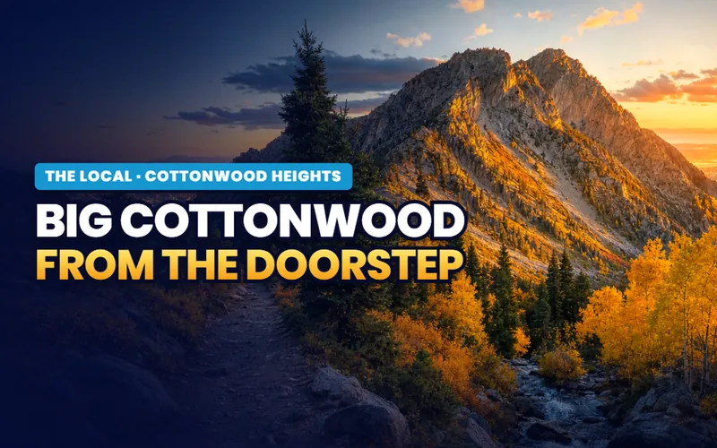 Big Cottonwood from the doorstepThe canyon road minutes from home, night skiing at Brighton, and four resorts a short drive up.Read the guide
 Fort UnionThe 1853 fort behind the name of the city's main street, and the farm district that grew around it.Read the guide
 The ski busThe winter buses up both canyons, the fare, and which park and ride to aim for.Read the guide
 Ferguson CanyonThe city's own canyon trail, the small lot at the top of a street, and the park at the bottom.Read the guide
 Living at the mouthWho bills one address, winter tires for the canyon roads, and the parking rules to learn.Read the guide
Talk to Scott
Ready for your next step in Cottonwood Heights?
My base is Southern Utah. So for a Cottonwood Heights move, I connect you with a partner agent I trust for the work on the ground. I stay on your file for the homework and the loan side. You get a partner agent who knows the area, plus me in your corner.
How it works in Cottonwood Heights
- A local agent on the ground.I connect you with a partner agent I trust near Cottonwood Heights for the showings, the offer, and the closing.
- A second set of eyes.I stay on your file and do the homework on any home you are weighing, from the commute to the school boundaries.
- Real estate and lending, one person.I am licensed in both real estate and lending. On any one purchase I take one role. If I am your lender, I can tell you early if a home could be hard to get a loan on.
- A reply within one business day.Call or text, and I get back to you within one business day.
Or call me: (435) 357-4345I reply within one business day.

Referral disclosure. Outside Southern Utah, I connect home sellers and buyers with partner agents I trust in their area. If you choose to work with an agent I refer, that agent's brokerage pays my brokerage (Real Broker, LLC) a referral fee. The fee comes out of the agent's compensation; it is not an added cost to you. You are always free to choose any agent you wish, and using a referred agent is never required.