
City West Jordan, Salt Lake County
Utah's third largest city, on the valley floor southwest of Salt Lake
West Jordan, between a river and a mountain
West Jordan is a big working city of about 117,000 people, and the short version for a visitor is that most of what you come for sits at the river end. Gardner Village, an 1877 flour mill turned into a lane of shops and restaurants, anchors it, with the Jordan River trail, a free demonstration garden and a 69 acre park close by. Jordan Landing handles the shopping over on the west side, and the Oquirrh foothills rise beyond the city line, the Bingham Canyon mine cut into them. Here is the honest map to all of it.
 By Scott Buehler, Moving Utah
Updated October 2026
By Scott Buehler, Moving Utah
Updated October 2026
The short answer
West Jordan is a big, mostly residential city on the southwest side of the Salt Lake Valley, and the honest read is that it rewards a targeted visit rather than a wander. The draws cluster at the river end near 7800 South: Gardner Village, a lane of shops and restaurants wrapped around an 1877 flour mill, plus the Jordan River trail, a free demonstration garden and the 69 acre park the city calls its crown jewel. The rest is homes, laid out in visible bands of era from the pioneer river end out to the newest streets under the Oquirrhs, with Jordan Landing handling the shopping in between. This hub is the map to seven deeper West Jordan pages, and it hands the mountains, the canyons and the wider valley to the Salt Lake County pages every valley town shares.
Start here
A city that begins on a river bank and stops at the foot of a mountain range
West Jordan is drawn between two hard edges and almost nothing about the place makes sense until you see that. The city limits start on the western bank of the Jordan River and finish in the eastern foothills of the Oquirrh Mountains, so the boundary is not a circle around a town center. It is a broad band laid across the valley floor with water at one end and rising ground at the other, 32.33 square miles of it, all land and no water area at all on the census sheet. Third most populous city in Utah, 116,961 people at the 2020 count, and still the one most of the valley drives through without stopping.
The pioneer settlement went in around 1850 beside the river, and the mill that came with it is still standing: Archibald Gardner built the area's first flour mill in 1853 out of logs hauled down from Bingham Canyon, and the larger mill that replaced it in 1877 is now on the National Register and has a restaurant in it. Incorporation did not follow until 10 January 1941. So the historic end of this city is the river end, and everything west of about 2700 West is postwar, then late century, then the last decade, in visible bands as you drive out toward the mountains.
What that produces is a companion with an unusual job. This is not a place with one famous thing and a lot of filler. It is a place with a working nineteenth century mill site at one edge, a free demonstration garden the whole state is meant to learn from in the middle, a park the city's own code calls its crown jewel, a disc golf course that opened at the mountain foot in August 2025, and six light rail platforms strung between them that all opened on the same day. The honest job here is to say which of those justify a drive and what each one actually asks of your calendar.
West Jordan at a glance
1853
the year the first mill went up, of logs from a canyon
32.33
square miles, river bank to mountain foot
5
Red Line platforms, all opened on one day in 2011
69
acres the city's code calls its crown jewel park
What is actually here
A lot of the best places here are run by somebody other than the city
A surprising share of what is worth visiting inside the boundary belongs to someone else. A water district, the county library service, a county golf course and a family business all hold ground here, and knowing who runs what saves a wasted call and, in one case, a wasted drive.
The parks are the city's own. Veterans Memorial Park, Ron Wood Park and every other city park run on the same calendar: the outdoor booking season is April 1 to the second Saturday in October, and the year's reservations open on January 2. Gardner Village, at 1100 West 7800 South, is a family business now in its second generation, and the practical thing to know is that it trades Monday through Saturday and closes on Sundays, so a Sunday drive out here is the most common wasted trip in the city.
Three more anchors answer to somebody else. Conservation Garden Park, the free demonstration garden at 8275 South 1300 West, belongs to the Jordan Valley Water Conservancy District, and its hours change four times a year, dropping Saturdays entirely through winter. The Viridian at 8030 South 1825 West is a 70,000 square foot building that serves as the Salt Lake County library system's headquarters as well as a branch, so it keeps county hours. And Mountain View Golf Course at 2400 West 8660 South is a Salt Lake County course sitting inside the city line, so tee times, rates and cards are the county's, not the city's.
Gardner Village is closed on Sundays. It is the single most common wasted drive in West Jordan. The lane and its shops keep to Monday through Saturday year round, and only stretch their evening hours during the autumn WitchFest season. Check the current hours before you plan a Sunday around it.
The rhythm
Two fixed seasons and ten months of ordinary use
The visitor year here has two peaks and they do not overlap. The first is the Western Stampede in early July, usually July 2 to 4: a sanctioned rodeo across all three nights in the arena at Veterans Memorial Park, a carnival and vendor fair beside it, a drone show, a parade down Redwood Road on the morning of July 4, and fireworks to close it. It takes over the crown jewel park for about three days and closes a state highway for one morning. The park page covers the ground it happens on and how the rest of the year works there.
The second peak is six weeks long and it is the reason a lot of the valley knows this city at all. WitchFest at Gardner Village runs from mid September through Halloween, the lane stays open into the evening through October instead of closing at six, and the whole thing is free to walk into, with a ticketed dinner theater sitting inside it. It is also the one stretch of the year when parking here can cost money, and only on a few days of the week. The village page takes the season, the charges and the hours properly.
Everything else runs on a calendar rather than a date. Park pavilions book from April 1 to the second Saturday in October, with the year opening on January 2. The demonstration garden changes its hours four times a year and closes Saturdays from November. The river trail and the disc golf course work all year and cost nothing. The ranked list sorts what justifies a drive from what is simply good to have at the end of your street.
Two weekends in this city are booked years in advance by everybody else. The other fifty are quiet, cheap and almost entirely uncrowded.
The wider valley
The county's famous things are close from here, and none of them are this city's
The mountains on the western skyline and the canyons on the eastern one are both visible from most streets in this boundary, and neither belongs to West Jordan. Proximity is not ownership. Four county pages carry the big shared subjects properly, so here is where each one lives.

The west skyline
The Oquirrh side
The range on this city's western horizon, what sits in it, and which towns hold the ground below it.
Read the guide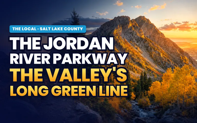
The long route
The Jordan River Parkway
The corridor as one system, read end to end, with what connects and what does not.
Read the guide
The east skyline
The Cottonwood canyons
The county's biggest single subject: what sits up both roads, and what the watershed forbids.
Read the guide
Days out
Weekends in the valley
Days out across the county, priced honestly, for the Saturdays this city will not fill on its own.
Read the guideThe mountain on the west window is a county subject, not a city one. A great deal of writing about this address leans on the Oquirrhs and on the mine cut into them, and none of that ground is inside this boundary. The city stops at the foothills. What West Jordan genuinely owns of that story is a road name, a railway alignment now carrying light rail, and the fact that the logs for an 1853 flour mill came down out of that canyon by horse team. The rest belongs to the county page and to the town at the foot of the mine.
If you only have one day
One version of a good day in West Jordan

Early
Start on the river, by train if you like
A trailhead beside an 1877 flour mill, served by a light rail platform that opened in 2011 on an 1872 railway alignment.
The river page
Late morning
Cross the road to the mill
A lane of shops and restaurants wrapped around a National Register flour mill, with cabins and a rail depot moved here to join them.
The village
Afternoon
Walk the garden that teaches the valley
More than 8 acres of demonstration planting run by a water district, free to enter, with the hours changing four times a year.
The ranked list
Evening
Finish at the crown jewel
Sixty nine acres holding a rodeo arena, a museum, a recreation center and a playground rebuilt from a volunteer original.
The park pageThe West Jordan companion
Seven pages, and the oldest thing on them is still serving dinner
Everything The Local has written about West Jordan: the ranked list of what genuinely justifies a drive inside 32.33 square miles, the 1877 flour mill and the village that grew around it since 1979, the reach of the Jordan River this city spent a decade stitching back together, the 69 acres the city calls its crown jewel, the west side park that holds an all-wheels park, and what an address between a river and a mountain range asks of a household.


Scott Buehler
Moving Utah About Scott
Quick answers
West Jordan, answered
At the southwest end of the Salt Lake Valley, on the valley floor at about 4,373 feet. The city limits begin on the western bank of the Jordan River and end in the eastern foothills of the Oquirrh Mountains, covering 32.33 square miles with no water area at all on the census sheet. Taylorsville and West Valley City sit north, Midvale and Sandy across the river to the east, South Jordan south, and Copperton and the unincorporated county ground west.
Two things carry almost all of the traffic. Gardner Village at 1100 West 7800 South is a National Register flour mill from 1877 with a village of shops and restaurants built around it since 1979, and its autumn WitchFest season is the single biggest visitor draw in the city. Jordan Landing is the other, a large retail and cinema district beside Bangerter Highway that serves the whole southwest quadrant of the valley. Beyond those, the free demonstration garden run by the water district is the most distinctive thing inside the boundary.
Yes. The village is trading, open Monday through Saturday and closed on Sundays, with the shops keeping to roughly 10am to 6pm outside the fall season. It stays in the founding family that reopened it: Nancy Long bought the derelict mill property in 1979, and her children run it now. WitchFest runs from mid September through Halloween each year, ticketed dinner theater included, so the autumn season is intact. Check the current daily hours before you go.
Six, and every one of them opened on the same day, 7 August 2011, when the Red Line's Mid Jordan leg was completed. They are Historic Gardner at 1127 West 7800 South, West Jordan City Center at 8021 South Redwood Road, Jordan Valley on Haun Drive by the hospital, 2700 West Sugar Factory Road at 8351 South 2700 West, 4800 West Old Bingham Highway at 4773 West Old Bingham Highway, and 5600 West Old Bingham Highway at 5651 West Old Bingham Highway. Park and ride provision ranges from about 130 spaces to 420.
A good share of the list. The demonstration garden at 8275 South 1300 West charges nothing for general admission, the Jordan River Parkway trail and its trailheads are free, the disc golf course that opened at Sycamore Ridge in August 2025 is a city park, every city park including the sixty nine acres at Veterans Memorial Park is free, and walking into Gardner Village costs nothing at any time of year. The charges here attach to pavilion bookings, rodeo tickets, dinner theater seats, green fees and October parking on three days of the week.
Usually July 2 to 4, at Veterans Memorial Park. A sanctioned rodeo runs on all three nights in the arena, with a carnival and vendor fair alongside it, a free morning slack session, a drone show, the Grand Parade down Redwood Road on the morning of July 4, and fireworks that night. It is one of two weekends that fill this city, and the other is the fall WitchFest season at Gardner Village.
32.33 square miles, with 116,961 residents at the 2020 census, which makes it the third most populous city in Utah. The unusual figure on the census sheet is the water area, which is zero, in a city whose entire eastern boundary is a river: the line runs along the western bank rather than down the middle of the channel. The city's parks department publishes more than 475 acres of open space and 350 acres of park properties on top of that.
Because it is following a railway that was surveyed to reach a canyon. The narrow gauge was built in 1872 between Sandy and Bingham Canyon, was sold to the Denver and Rio Grande Western in 1881 as its Bingham Branch, and ended up as a Union Pacific industrial lead. UTA bought access to the corridor in May 2002 and the roadbed and track in March 2007, and the 10.6 mile Mid Jordan leg opened on it in August 2011. The road names along the route give the same history away.
Yes, and the honest reason is that the good things here are close together at the river end of the city. The mill village, the light rail platform beside it, the river trailhead and the crown jewel park all sit within about a mile and a half of 7800 South. What one day cannot do is the two fixed seasons, because the rodeo is a single July weekend and the autumn village season is six specific weeks, and it cannot do the disc golf course at the far western edge in the same afternoon as the river.
Thinking about West Jordan? Start with how far west the street sits
This city reads as one rectangle on a map and lives as several eras on the ground, laid in bands from the river out to the foothills: the pioneer river end, the postwar middle, the late century subdivisions and the newest streets under the mountains. Drive times, rail access, park access and the age of everything around you change with each band. Tell me what you are weighing and I will put you with a Salt Lake County partner agent who works this side of the valley, and stay on the file for the homework and the financing side.
Or call Scott: (435) 357-4345or send Scott a message
Keep going
Continue your West Jordan research
Eight more doors into West Jordan, chosen for what this page covers.
Questions about West Jordan?
Call Scott, send a message, or find out what your West Jordan home is worth. No pressure, no obligation.
Referral Disclosure: For moves outside Southern Utah, I can connect you with trusted local agents. If you choose to work with one, their brokerage pays my brokerage (Real Broker, LLC) a referral fee from their commission. This costs you nothing extra, and you are never obligated to use my referral.