
Sandy Salt Lake County
The southeast valley city that ends at a canyon gate and a wilderness boundary
Sandy, from the freeway to the canyon gate
Six miles wide and uphill the whole way. Sandy starts at a freeway interchange, a soccer stadium and a shopping mall being remade into a downtown, crosses a light rail line, cuts across a 630 acre unpaved gulch, and finishes on a bench at the mouth of Little Cottonwood Canyon. This hub is the map to the city, with six deeper pages and the wider county written once.
 By Scott Buehler, Moving Utah
Updated October 2026
By Scott Buehler, Moving Utah
Updated October 2026
The short answer
Sandy is the southeast corner of the Salt Lake Valley, and it runs uphill. It starts at Interstate 15 and State Street on the west, where America First Field and Hale Centre Theatre sit within a mile of each other, crosses the TRAX Blue Line and the Shops at South Town, cuts across Dimple Dell, a 630 acre unpaved gulch that runs the wrong way across the grid, and ends on a bench at the mouth of Little Cottonwood Canyon. It is the closest valley city to that canyon, about ten minutes from the gate. This hub is the map to six deeper pages on the city, and it hands the resorts, the traction law and the winter canyon survey to the Salt Lake County region pages every valley town shares.
The shape of it
A freeway at one end, a canyon gate at the other, and the city climbs the whole way between
Sandy reads west to east and low to high, and the useful way to hold it is not by neighborhood name but by the bands the city crosses on its way uphill. State Route 209 runs the whole width of it, arriving on 9000 South, shifting to 9400 South, crossing the freeway, the light rail and State Street, then climbing the bench to stop at the canyon gate. The west end is the freeway, the Shops at South Town and America First Field. The middle is the TRAX corridor, a civic center district being built up with housing, and the gulch. The east end is a bench that rises to the canyon mouth, a wilderness boundary and the drinking water for a large part of the valley.
Bench or floor is the distinction that ends up mattering most. The east side of Sandy sits several hundred feet above the freeway, takes more snow, holds it longer and catches canyon wind the west side never sees. That is the trade for being ten minutes from a canyon gate, and it shows up in a driveway, a roof and a plowing bill rather than in a listing photo. It is worth walking a bench street in February before deciding the view settles it.
This hub stays at the level of the map and hands the detail to the pages below. The canyon mouth as it works from a Sandy address belongs to Little Cottonwood from Sandy. The mall and the downtown going up around it belong to South Town and the Cairns. The gulch and the fight that kept it unpaved belong to Dimple Dell. And the practical side of a move, the prices, the schools and the neighborhoods for buyers, lives on the Sandy city guide.
One half of the year happens above the city, and the other half happens below it.
The wider county
The canyons and the valley in winter are written once, for the whole county
The mouth of Little Cottonwood is Sandy's doorstep, so this companion carries the approach, the queue and the water from the Sandy side and stops at the gate. Everything above it, the resorts, the traction law and how the road behaves in a storm, sits at the county level, written once for every valley town rather than retold on each city page. These pages carry it.

Up the two roads
The Cottonwood canyons
Alta, Snowbird, Brighton and Solitude, two roads, two watersheds, and what is up them in summer.
Read
The road rules
Canyon winter access
The traction law, the tread depth, the parking systems and the mornings the road simply stops.
Read
The season below
The valley in winter
Snow, inversion and how the valley floor lives through the months the canyon fills.
Read
The bench
The Bonneville Shoreline Trail
The county's bench route, written once for all the cities it runs behind rather than each in turn.
Read
Days out
Family weekends in the valley
Outings across the county ranked by activity and by price, from free ground to Olympic ice.
ReadAll of these sit under the Salt Lake County region hub, which is the front door to every town in the valley.
The Sandy companion
Six pages on the city itself, and none of them retells a canyon guide
Everything The Local has written about Sandy itself: the ranked list of what is actually here, the mouth of Little Cottonwood from a Sandy address, the mall and the downtown being built out of it, the 630 acre gulch and the fight that kept it unpaved, the open air venue on the bench, and what four light rail stations really do for a household.
Things to do
Top 8 things to do
Ranked picks from the canyon mouth to the amphitheater, each with a cost and a drive time.
Read
The canyon mouth
Little Cottonwood from Sandy
The gate from a Sandy address: the approach, the queue and the water below the mouth.
Read
The downtown
South Town and the Cairns
A mall and a downtown being rebuilt at once on the State Street corridor.
Read
The gulch
Dimple Dell Regional Park
The 630 acre ravine that ignores the grid, and the fight that kept it unpaved.
Read
The venue
Sandy Amphitheater
The open air venue on the bench, and the half of the season that costs nothing.
Read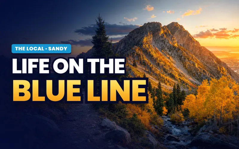
The train
Life on the Blue Line
The four Blue Line stations, and which one is actually any use to you.
ReadWeighing a move, not a visit?
For asking prices, the buyer's-eye neighborhood breakdown, school boundaries and live listings, turn to the Sandy city guide.
Scott Buehler
Moving Utah About Scott
Quick answers
Sandy, answered
On the southeast side of the Salt Lake Valley, entirely inside Salt Lake County, roughly thirteen miles south of downtown Salt Lake City. It runs west to east from Interstate 15 up onto the Wasatch bench, ending at the mouth of Little Cottonwood Canyon and the Lone Peak Wilderness boundary. State Route 209 crosses the whole city on 9000 South and then 9400 South, and it ends at the canyon road.
Four things, and they sit in different parts of the city. It is the closest valley address to the mouth of Little Cottonwood Canyon. It holds Dimple Dell Regional Park, 630 acres of unpaved gulch running east to west through the middle of town. It has America First Field and Hale Centre Theatre within a mile of each other on the west side. And the Shops at South Town, its mall on State Street, is being rebuilt into a downtown district.
The canyon mouth is about four miles from the middle of the city and roughly ten minutes from most Sandy addresses off peak, which is as close as any valley city gets. State Route 209 runs east through Sandy on 9400 South and ends at State Route 210, the canyon road, at Wasatch Boulevard. On a powder morning that ten minutes is not the number that matters, because the queue forms below the gate rather than above it.
Not in Bells Canyon, which is the most walked trail in the city. It is protected watershed feeding the Little Cottonwood Water Treatment Plant, and dogs are prohibited there for the same reason they are prohibited in both Cottonwood canyons. Dimple Dell Regional Park is county open space rather than watershed and does allow dogs under Salt Lake County park rules, which is the practical answer for a household in this city with a dog.
A natural open space rather than a developed park, and that distinction is deliberate. Salt Lake County proposed paving about three miles of the North Rim Trail in 2017 and dropped the plan after a public campaign, redirecting the roughly four million dollars of parks bond money into other improvements in the park instead. The result is 630 acres with miles of unpaved trail, no lighting and no pavement through the bottom.
Four of them, all on the TRAX Blue Line: Historic Sandy at 9000 South 165 East, Sandy Expo at 9375 South 150 East, Sandy Civic Center at 115 East Sego Lily Drive and Crescent View at 361 East 11400 South. They are not interchangeable. Two have large free parking lots, one sits in a civic center district being built up with housing, and Sandy Expo was built with no parking lot at all because it serves the stadium and the exposition center.
May and June, or September and October. The shoulder seasons give you the gulch when the creek is running and the foothill trails before or after the heat, the amphitheater season is open, and the canyon road is quiet on a weekday. Midwinter is the canyon's season and it is excellent if that is what you came for. Midsummer afternoons on the bench are hot and shadeless on almost every trail in the city.
A fair amount. Dimple Dell Regional Park and its three trailheads cost nothing, the Bell Canyon Preservation Trailhead and the Bells Canyon trails are free, the Sandy Museum charges no admission, the summer balloon festival is free including the evening glow, and Sandy City and the Sandy Arts Guild program free nights at the amphitheater through the season alongside the ticketed shows.
For a visitor, yes, if you work west to east or east to west rather than criss crossing. A morning at the canyon mouth or in Dimple Dell, an afternoon on the State Street corridor, and an evening at the amphitheater or a match at America First Field covers the city honestly. What one day cannot do is the summits, because the walks out of Bells Canyon are half day objectives on their own.
Weighing Sandy? Start with which band of the city you actually want
The freeway end, the rail corridor and the bench are three different propositions in one city, and they differ on snow, on traffic, on what is within walking distance and on what is being built next door. Tell me what you are weighing and I will put you with a Salt Lake County partner agent who works this side of the valley, and stay on the file for the homework and the financing side.
Or call Scott: (435) 357-4345or send Scott a message
Keep going
Continue your Sandy research
Eight more doors into Sandy, chosen for what this page covers.
Questions about Sandy?
Call Scott, send a message, or find out what your Sandy home is worth. No pressure, no obligation.
Referral Disclosure: For moves outside Southern Utah, I can connect you with trusted local agents. If you choose to work with one, their brokerage pays my brokerage (Real Broker, LLC) a referral fee from their commission. This costs you nothing extra, and you are never obligated to use my referral.