
City Alpine, Utah County
The town where the pavement stops and the wilderness starts
Alpine, at the end of the road
Ten thousand people at about five thousand feet, under a skyline that runs to 11,253 feet, reached by five miles of state highway that finish against a designated wilderness. Seven pages on the town itself, including its 255 acre open space, the three walks that start at the top of residential streets and the honest version of the Lone Peak approach that everybody files under the wrong city.
 By Scott Buehler, Moving Utah
Updated October 2026
By Scott Buehler, Moving Utah
Updated October 2026
Start here
A state highway five miles long that stops against a wilderness
State Route 74, the Alpine Highway, leaves US-89 in American Fork, crosses SR-92 in Highland on the way up, and ends in Alpine a couple hundred feet short of Canyon Crest Road. It does not carry on over anything. Behind the last streets the ground stands up into the Lone Peak Wilderness and the pavement simply has nowhere left to go, which is the single fact that explains most of what this town is like to visit and to live in. Local streets do connect west into Highland and Cedar Hills, so nobody here is sealed in, but the state highway ends at the mountain and there is no through traffic to speak of.
The numbers are small and the relief is not. There were 10,251 people here at the 2020 census, the town sits at just over five thousand feet, and the skyline directly above it runs to 11,253 feet at Lone Peak and 11,101 feet at Box Elder Peak. Settlers arrived in 1850 under the name Mountainville, and the town took the name Alpine when it was chartered in 1855, for the look of the peaks behind it. Much of the ground around the town center is zoned Country Residential at a 40,000 square foot minimum, close to a full acre a lot, with higher minimums on the steeper bench parcels, so this is a town of large lots, with older homes near the center and custom builds on the benches above them. How the commute, the household budget and the school assignments actually work here sits on the practical Alpine city guide, not here.
What that leaves a visitor is a short list of very specific things rather than a long list of ordinary ones. There is a 255 acre city open space with more than sixteen miles of volunteer built singletrack in it. There is a defensive stone tower on a two acre historical park that has no equal anywhere else in Utah. There are three serious walks into designated wilderness from two trailheads at the top of residential streets. And there is one week in August when the whole place runs at once. Everything else worth doing near here belongs to somebody else's page, and these pages say so each time.
Alpine at a glance
10,251
people at the 2020 census
5 miles
of state highway, and it ends here
255 acres
of city open space at Lambert Park
11,253 ft
Lone Peak, on the skyline above town
The four doors
Four ways onto the mountain, and only two of them are Alpine's
This is the most useful table on the companion, because almost every question a visitor asks here turns out to be a question about which door they want. The four are within about ten minutes of each other, they are run by three different bodies, and two of them cost money while two of them cost nothing. Sort this before you set an alarm.
| Lambert Park | Dry Creek | Schoolhouse Springs | American Fork Canyon | |
|---|---|---|---|---|
| What it opens | 255 acres of city open space and sixteen plus miles of singletrack | Horsetail Falls, and above it the long way onto Box Elder Peak | First and Second Hamongog, Lake Hardy and the ground under Lone Peak | Tibble Fork, Silver Lake, the cave and the byway over the top |
| Who runs it | Alpine City | Uinta-Wasatch-Cache National Forest, Pleasant Grove Ranger District | Forest and wilderness above; the approach crosses ground in dispute | The national forest, with a fee area and a seasonal gate |
| What it costs | Nothing, including the parking | Nothing, and there is no permit for the wilderness above it | Nothing, but the walk in is longer than the map suggests | A recreation fee applies, and American Fork's page carries the card |
| How hard | Easy to advanced intermediate, and you choose | Steady and steep for a bit over two miles each way | Serious. Second Hamongog alone is about 6.9 miles out and back | As easy as a parking lot or as hard as you like |
| Where to read it | The Lambert Park page | The Horsetail Falls page, and the Box Elder Peak page above it | The Hamongog route page, which leads on the access question | American Fork's canyon page, at region level |
Fire restrictions on the forest change through the season and are posted on the forest's alerts page rather than at the trailheads, so check them there before you plan anything involving a stove or a fire.
No fires are permitted anywhere in Lambert Park, and that includes the Bowery you just rented. This catches people every summer, because a reservable pavilion in a wooded park reads like somewhere you can cook. The rules are firm: no fires at the Bowery or anywhere else in Lambert Park, no shooting, and no alcohol in any Alpine City park. Weddings and wedding receptions are not permitted in city parks either, which is worth knowing before anybody books a date around the poppy bloom. Confirm the rules with Alpine City when you reserve, because these are council decisions that can change, and the park's fire posture in particular can tighten with the season.
The public estate
A great deal of open space and almost no programming attached to it
Alpine owns land generously and services it sparingly, and once you notice the pattern the whole city makes more sense. Lambert Park is 255 acres of largely undeveloped ground on the northeast edge, held by the city, threaded with volunteer built singletrack and carrying the rodeo grounds inside it. The Lambert Park page covers the trails, the rules, the Bowery and the poppy garden that draws half the valley here for about three weeks each spring.
Creekside Park at 100 South 600 East is the civic middle of the town: twenty four acres carrying a splash pad, pickleball and tennis courts, basketball, sand volleyball, a walking track, two reservable pavilions and a playground. It is where most of Alpine Days happens. Burgess Park takes the sport and the children's events during that week, Legacy Park takes the evening ones, and Healey Park on Healey Boulevard is four acres with a soccer field, a playground and restrooms.
Moyle Historical Park is the one that has no equivalent anywhere else. Two acres at 606 East 770 North hold the Moyle House and the Indian Tower, listed on the National Register in 1992, along with a museum, restored log structures and picnic ground. John Rowe Moyle dug in here around 1858 and built the river rock tower between 1860 and 1866 during the Black Hawk War years. It is the only tower known to have been built in Utah for the defense of a single household, and the same stonemason walked roughly twenty two miles each week to cut stone for the Salt Lake Temple.
What the city does not do is run recreation programs. Alpine offers none of its own, and Cedar Hills Recreation carries them for this side of the bench without charging Alpine residents a non-resident rate. That is a genuinely unusual arrangement between two cities, it is published rather than informal, and it is the kind of thing nobody discovers until they go looking for a youth league in September.
Alpine buys land and borrows programs. The result is a town with 255 acres of open space and a recreation department in the next city.
What belongs to the valley
The mountain in the window is not this town's to write about
Alpine looks out at subjects that nineteen towns share, and a page written from one doorstep about a mountain everybody can see is a worse page than one written about the mountain. The Local settles those at valley level. Four of the seven touch Alpine directly and the links here send you to them rather than paraphrasing them badly.
The mountain
Timpanogos and the Loop
SR-92, the winter gate, the ticketed cave, the two summit trails and the week the maples turn.
Read the guide
Days out
Family weekends in Utah Valley
The valley's outings priced and dated against each other, with the closure rumors sorted first.
Read the guide
The paved spine
The Murdock Canal Trail
Seventeen flat miles over a buried aqueduct through seven cities, none of which is this one.
Read the guide
The other canyon
Provo Canyon
US-189, the falls and the canyon drive, the resort under new ownership and the road through to Heber.
Read the guideThe canyon at Alpine's north edge belongs to American Fork, and that is deliberate. American Fork Canyon carries the fee card, the seasonal road closure, the campgrounds and the trailhead that now needs a reservation, and all of it is written once on American Fork's canyon page. Alpine sits at the mouth of it and gains a very short drive, which is a real advantage of an address here and not a license to rewrite the canyon. The whole set of valley subjects, including the lake, the Nebo Loop and the two campuses, is listed on the Utah Valley hub.
If you only have one day
One honest version of a day spent entirely inside this town
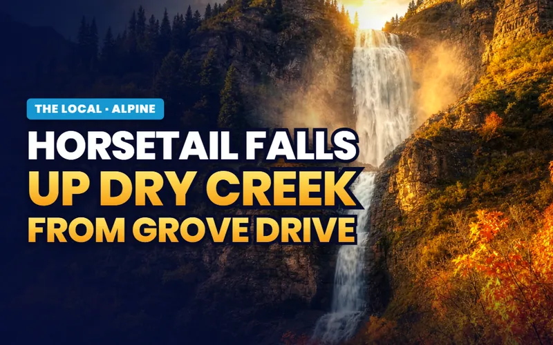
Early
Walk up Dry Creek before the sun clears the ridge
The lot at the top of Grove Drive holds about twenty cars and it is full by mid morning on a weekend.
The falls page
Late morning
Ride or walk the Lambert Park network
Sixteen plus miles of volunteer built singletrack, a downhill called Rodeo, and no motors anywhere in it.
The park page
Afternoon
Take the ranked list in order
Eight entries with the operator, the season and the honest cost named against each one.
The ranked list
Evening
Drive to where the pavement quits
Five miles of state highway end under a wilderness boundary, which is worth seeing before you judge the place.
The moving here pageThe rhythm
Three weeks of poppies and eight days in August
Two windows carry the Alpine calendar and both of them are short. The first is the poppy bloom in Lambert Park, and the window shifts each year with the weather: in 2026 the garden opened on the evening of May 21, and the previous cycle closed on June 11. The whole visit is a flat walk of about four tenths of a mile from the Lambert Park south trailhead, and the flowers grow among the ruins of the early twentieth century Lambert homestead. The park page carries the rules for the garden.
The second is Alpine Days, which ran from 8 to August 15 in 2026 under the theme Celebrating America's 250 Years of Freedom, with the pickleball tournament starting on August 3 ahead of it. The rodeo runs three nights at the Lambert Park grounds with gates at 6:15 and the first event at 7:30, the parade goes up Main Street at nine on the Saturday morning, and the fireworks go off at Creekside Park at ten that night. Ticket sales open to residents on July 1 and to everybody else on July 15, which tells you what demand is like.
Everything in between runs on snow and heat instead of on a calendar. The high routes hold snow into early summer and the Lone Peak Wilderness is a genuinely alpine environment above about nine thousand feet, so a walk that is trivial in September can be a serious undertaking in May. The low ground is the opposite: Lambert Park rides earliest in the year and Dry Creek is shaded enough to be pleasant when the valley floor is not. The ranked list puts a season against each entry.
Alpine has two dates that fill its streets. One is a flower that lasts three weeks and the other is a rodeo that sells out.
The Alpine companion
Seven pages, four of which are ground you walk on
Everything The Local has written about Alpine itself: the ranked list, the city's 255 acre open space and the flowers inside it, the Dry Creek walk to a cascade, the long approach toward Lone Peak with its live access question, the summit above the same trailhead, and the honest account of living where a state highway stops.


Scott Buehler
Moving Utah About Scott
Quick answers
Alpine, answered
For sitting at the top of Utah Valley where the state highway runs out against designated wilderness, and for the outdoor access that comes with that address. Locally it is known for Lambert Park, a 255 acre city open space carrying more than sixteen miles of volunteer built singletrack and an annual poppy bloom that draws the whole valley for about three weeks; for the Moyle House and Indian Tower, a river rock defensive tower listed on the National Register; for the Horsetail Falls walk up Dry Creek; and for Alpine Days in August.
Not literally, and the honest version is more interesting. The Alpine Highway climbs up out of American Fork and simply stops at the town, because the Lone Peak Wilderness rises directly behind the last streets and leaves a road nowhere to go. You can still drive out sideways through Highland and Cedar Hills, so nobody is sealed in, but there is no through traffic, no freeway interchange and no rail stop, and that is what people mean when they call Alpine the end of the road.
It is 255 acres, held by Alpine City, on the northeast edge of town between Grove Drive and Box Elder Drive. Most of it is undeveloped ground carrying more than sixteen miles of volunteer maintained singletrack through scrub oak, maple and sage, with the Alpine Rodeo Grounds inside the park at the north end and a rentable pavilion called the Bowery. Motorized vehicles have been banned there by the city council since 2018, with exceptions only for maintenance and emergency use and for the improved roads to the Bowery and the rodeo grounds.
Late May into early June, and the window is genuinely short. Alpine City publishes an alert for each cycle rather than a fixed date: the 2026 garden opened on the evening of May 21, and the previous year's garden closed on June 11. Parking is at the Lambert Park south trailhead and the walk in is about four tenths of a mile on flat ground. The posted rules for the garden ask visitors to stay on the paths, keep pets leashed inside it, and take nothing away, and City Hall issues a one use drive in pass for anybody with mobility needs.
The Alpine side approach begins at the Schoolhouse Springs area above the Alpine Cove neighborhood and climbs through First Hamongog to Second Hamongog before turning steeply toward Lake Hardy and the summit ridge. The much better known Jacob's Ladder is not in Alpine at all: it is the Draper side approach through Corner Canyon, which is why so many search results file the Lone Peak hike under Draper. The Alpine approach also carries a live access question over the last stretch of gravel road, which is covered in full on the Hamongog route page.
Moderately hard, and longer than several popular listings say. From the Dry Creek trailhead at the top of Grove Drive it runs roughly 4.4 to 4.6 miles out and back with somewhere between about 1,500 and 1,617 feet of climbing, depending on which mapping source you trust. The grade is steady and steep rather than technical, most of it is shaded, and it crosses into the Lone Peak Wilderness on the way, so bicycles have to stop at the boundary. Dogs are allowed, because this is the Utah County side rather than a Salt Lake watershed canyon.
Not for a day hike. The Lone Peak Wilderness covers 30,088 acres, was designated in 1978 under the Endangered American Wilderness Act and was the first wilderness area in Utah, and the Forest Service lists no day use permit for it. What the designation does change is behavior: no bicycles and no motorized or mechanized equipment past the boundary signs, and group size and campfire rules that can tighten with the season. Fire restrictions are posted on the Uinta-Wasatch-Cache National Forest alerts page rather than at the trailheads.
The second week of August. In 2026 the main celebration ran from 8 to August 15 under the theme Celebrating America's 250 Years of Freedom, with the pickleball tournament starting on August 3 ahead of it. The rodeo ran three nights at the Lambert Park rodeo grounds with gates at 6:15 and the first event at 7:30, the Grand Parade went up Main Street at nine on Saturday August 15, and the fireworks followed at Creekside Park at ten that night. Rodeo tickets open to Alpine residents on July 1 and to everybody else on July 15.
Yes, although the list is short and specific rather than long. Moyle Historical Park at 606 East 770 North carries a museum, restored log structures and the National Register listed Moyle House and Indian Tower on two acres. Creekside Park at 100 South 600 East runs to twenty four acres with a splash pad, pickleball and tennis courts, sand volleyball, a walking track and two reservable pavilions. Alpine Days fills eight days in August. Beyond that the town is residential, and the valley's larger attractions sit on the region pages rather than here.
Seven pages on the town, and a mountain that belongs to the valley
A visit here asks which trailhead to drive to. A move asks harder questions: how far up the slope you want to be, what a bench parcel needs in the way of geologic homework before anybody draws a plan, whether pressurized irrigation actually reaches the lot, and what a wildland interface address asks of an owner every summer. Tell me what you are weighing and I will put you with a Utah County partner agent who works this end of the valley, and stay on the file for the financing side.
Or call Scott: (435) 357-4345or send Scott a message
Keep going
Continue your Alpine research
Eight more doors into Alpine, chosen for what this page covers.
Questions about Alpine?
Call Scott, send a message, or find out what your Alpine home is worth. No pressure, no obligation.
Referral Disclosure: For moves outside Southern Utah, I can connect you with trusted local agents. If you choose to work with one, their brokerage pays my brokerage (Real Broker, LLC) a referral fee from their commission. This costs you nothing extra, and you are never obligated to use my referral.