
City Syracuse, Davis County
A fast-growing city on the Great Salt Lake edge, the mainland starting point for Antelope Island
Syracuse, Utah, the city on the edge of the Great Salt Lake
Syracuse is a fast-growing city on the west edge of Davis County, about ten miles south of Ogden and half an hour north of Salt Lake City, on flat ground that runs out to the shore of the Great Salt Lake. It is the mainland starting point for Antelope Island: the only road onto the island starts at the west end of town, and the park entrance station stands just past the city line, on the county road, with the seven mile causeway beyond it. This is the hub for everything The Local has written about Syracuse, from that road to the temple, the museum and the resort the lake killed in 1891.
 By Scott Buehler, Moving Utah
Updated October 2026
By Scott Buehler, Moving Utah
Updated October 2026
The short answer
Syracuse is a fast-growing city of a little over 32,000 people, counted in 2020, on the west edge of Davis County where the flat farm plain runs out to the Great Salt Lake. It is best understood as the mainland starting point for Antelope Island: the only road onto the island starts at the west end of town, and the state park entrance station stands just past the Syracuse city line, on the county road. Pay the fee and pull forward, and you are on a Davis County causeway, seven miles of open water and salt flat the city does not own. Two more facts round out the picture. Syracuse never set up a street grid of its own, so its house numbers are measured from Clearfield next door. And its western horizon is unincorporated county ground, the lake side and the farm side, which is why it stays open. What is left is a city with its own police and fire departments, a fourteen month old temple, a museum that grew from one building to five, and a June festival at the park its recreation tax built. This guide is the map to all of it.
Start here
The road west explains most of Syracuse
One thing explains most of what looks distinctive about Syracuse, and it is the road west. The only way onto Antelope Island runs out the west end of town, and the state park entrance station stands just past the Syracuse city line, on the county road. Pay the fee, pull forward, and you are on a Davis County causeway crossing seven miles of open water and salt flat the city does not own an inch of. Syracuse takes the traffic on the busy island mornings, and even the fire engine that answers a call out on the island. What happens past the booth belongs to the Antelope Island page.
The rest of the city is easiest to read by its edges. Of Syracuse's four sides, two touch other cities, West Point on the north and Clearfield due east at the main intersection, with Layton picking up the southeast corner. The other two sides, the whole south and the whole west, are unincorporated Davis County. Those are the lake side and the farm side, and they are the two that will not fill in with rooftops, which is why the western horizon stays open. One more orientation note trips up every newcomer: Syracuse never set up a street grid of its own, so its house numbers are measured from Clearfield's zero point next door. That is why City Hall reads 1900 South and the nature park reads 3176 South in a town whose own center is nowhere near a zero. It is a navigation quirk and nothing more.
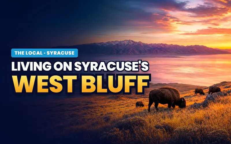
For all that open ground, Syracuse is not a quiet backwater. It grew from about 800 people at city incorporation in 1950 to more than 32,000 in the 2020 census, and the 2025 Census estimate is about 39,900. The newest landmark is the largest: the Syracuse Utah Temple, dedicated in June 2025, whose granite tower is visible from most of the west side. There is a full page on living on the bluff, where the flat plain steps down toward the lake, and for home prices, neighborhoods and the current market, the Syracuse city guide is the place to look. This hub stays on the shape of the place.
Getting around
A short set of state routes, and one road that exists to reach an island
Most local trips in Syracuse run on a short set of state routes. SR-108 makes an L through town: it runs north and south as 2000 West, then turns east along Antelope Drive toward I-15 in Layton. West of 2000 West, Antelope Drive becomes SR-127, a short western stub whose whole reason for existing is to reach the causeway, and it ends at 4500 West, which is SR-110. Past that line the road is a county causeway, not a state highway. The West Davis Highway, signed SR-177, opened in 2024 and runs down the west side of the county with two Syracuse interchanges, one at 2000 West and one at Antelope Drive. If you toured the city before 2024, your west side commute assumptions are out of date.
| From the middle of Syracuse | Distance | Off-peak drive |
|---|---|---|
| Antelope Island entrance station | About 3 miles | 5 to 10 minutes |
| Ogden | About 12 miles | About 20 minutes |
| Hill Air Force Base, nearest gate | About 5 to 6 miles | About 10 minutes |
| Clearfield FrontRunner station | About 4 miles | About 10 minutes |
| Salt Lake City airport | About 29 miles | 35 to 40 minutes |
| Downtown Salt Lake City | About 30 miles | 35 to 45 minutes |
Distances are measured from the middle of Syracuse and the drive times are off-peak estimates. Hill Air Force Base is close enough that flight operations are audible across this end of the county on flying days. Check current conditions before you rely on any of it.
History
A salt bag name, and a resort the lake killed in four seasons
The name came off a salt bag. William Galbraith, who made salt on the lakeshore, printed the word Syracuse on his bags after the salt town in New York, and it stuck to the settlement. David Cook plowed the first ground here in the spring of 1876 and Joseph Bodily built the first cabin the next year, on farmland the Hooper Canal made possible when it brought Weber River water in 1884.
The lake wrote the next chapter and then tore it up. In 1887 the Union Pacific built the Ogden and Syracuse Railway out to a brand new bathing resort on the one stretch of lakeshore around with natural trees, and daily bathing trains ran from Ogden and Salt Lake City for a few good summers. Then the Great Salt Lake began to recede. Brackish mud replaced the beach sand, flies covered the flats, the shoreline started to smell, and the resort was gone by the end of the 1891 season. It is the honest answer, delivered a hundred and thirty five years early, to anyone who hears the phrase lake adjacent and pictures a beach. The whole story is on the bathing resort page.
Syracuse stayed a farming town with a little salt mixed in for decades after that. It became a third class city in 1950 with about 800 people, ran quiet through the middle of the century, then grew hard from the 1990s on as the farms turned to subdivisions. Today it is one of the more densely built cities on this side of the county and still gaining, while the county road out to the island, opened in 1969, has become the busy front door the city arranges part of its year around.
In 1891 a receding lake turned the beach to mud and put flies on the sand. It is the same warning a buyer hears about lake adjacent today, delivered a hundred and thirty five years early.
The county
The Davis County subjects a Syracuse address actually reaches
Some places belong to the whole of Davis County, so The Local gives each its own page instead of repeating it town by town. From Syracuse, three of them are genuinely close, and it is worth being honest about how each one connects.

Out the west end
Antelope Island
The island, the bison and the causeway drive, reached from the road that starts at the western edge of Syracuse. The island is the county's, and the booth stands just past the city line.
Read the guide
Pond by pond
The lakeside parks
Davis County's walk-to water, gathered in one place. Jensen Nature Park on Syracuse's Bluff Road is one of them, with a fishing pond and a rare orienteering course.
Read the guide
In the fall
Family weekends in Davis County
The county's harvest season and family outings, including Black Island Farms and its corn maze on the flat ground at Syracuse's western edge.
Read the guideThe county's other big subjects have a weaker tie to a Syracuse address. There is no canyon or mountain trailhead in the city; the county birding is anchored on Farmington Bay at the south end, and the Legacy Parkway Trail runs through the southern cities. The Davis County hub indexes all of them so the choice stays yours.
If you only have a day
The causeway, the museum, the temple grounds and a corn maze
First, the drive
Take the causeway
The seven mile county road out to the Antelope Island gate, the jurisdiction it crosses, and what the drive is like from the Syracuse end.
The road page
Mid morning
See the five buildings
A regional museum that grew from one building in 2002 to five on the civic block, run with the Lions Club and open Tuesday through Saturday.
The museum page
Midday
Walk the temple grounds
The Syracuse Utah Temple, dedicated in 2025, in white granite, with art glass of the lake's own wetland plants. Grounds and building only.
The landmark page
Time it for fall
Get lost in the maze
Black Island Farms cuts an eight acre corn maze and a haunted one out on 4000 West, open through the harvest season each fall.
The farm pageThe year
A week in June, a maze in the fall, and a watering rule to plan around
June is the big civic week. The city fills eight days at Founders Park, the sixteen acre park its recreation tax built, with a parade from the 2000 West roundabout to the high school, an auto show, a model train display, a museum ribbon and fireworks on the final Saturday night. It is called the Founders Park week, and the page on it carries the shape of the week. The rest of the summer is quieter, until the island's big days pull traffic west through town.
The other season is the harvest and the traffic. In the fall Black Island Farms opens its corn maze on the flat ground west of the highway, and on the busiest island days, the fall bison roundup and a summer moonlight bike ride, a stream of cars comes west through town on Antelope Drive and heads back after dark. Locals learn to run their errands east on those mornings. And the most quietly useful civic fact in Syracuse is a watering rule: secondary irrigation water runs only through the warm months, roughly early May to the middle of September, on days the city assigns by which quadrant of town you live in.
Event dates, water seasons and park rules are set by the city year by year and they move. The June festival, the fall maze season and the secondary water dates all shift, so check the current details at syracuseut.gov before you plan around any of them.
The Syracuse companion
Eight pages on the city itself
Everything The Local has written about Syracuse: the ranked things to do, the road to the island, the June festival, the 1887 resort, the regional museum, the temple, the maze farm, and what living on the western bluff asks of a household.


Scott Buehler
Moving Utah About Scott
Quick answers
Syracuse, answered
That is a personal call, so here are the plain facts to weigh. Syracuse is a fast-growing city on the west edge of Davis County, about 32,000 people in the 2020 census and about 39,900 by the 2025 Census estimate, on roughly ten and a half square miles at the edge of the Great Salt Lake. It runs its own police and fire departments, keeps more than a dozen parks, and sits about ten miles south of Ogden and half an hour north of Salt Lake City. It is best known as the mainland starting point for Antelope Island, reached by a seven mile causeway that starts at the west end of town. For home prices and the current market, the Syracuse city guide is the place to look.
You drive west across town on Antelope Drive to 4500 West, and from there the seven mile causeway carries you out to the state park entrance station. That booth stands just past the Syracuse city line, on the county road, and the moment you pay and pull forward you are on the county causeway and headed for the island. From the middle of Syracuse the entrance station is only a few minutes away. What the fee buys, the bison, the trails and the beaches all belong to the Antelope Island page rather than to the city.
Sometimes, on a west wind in late summer. The lake sits low and the shoreline is often more than a third of a mile out past the last streets, so the flats, the brine flies and decaying algae can carry a smell into the west side of town on the wrong afternoon. Syracuse learned this the hard way in 1891, when a receding lake turned the beach at its old bathing resort to mud and closed it in four seasons. It is a city near the lake, not a beachfront one, and nobody should buy here expecting docks and swimming.
For being the mainland starting point for Antelope Island. The only road onto the island starts at the west edge of town, and the entrance station stands just past the city line, on the county road, where the causeway belongs to Davis County. Syracuse also holds the Syracuse Utah Temple, dedicated in June 2025, a regional museum that grew from a single building in 2002 to five, an eight day June festival at Founders Park, and Black Island Farms with its corn maze out on the flat ground west of the highway.
Yes. The West Davis Highway, signed SR-177, opened in 2024 and runs down the west side of Davis County, with two interchanges in Syracuse, one at 2000 West and one at Antelope Drive. If you toured Syracuse before 2024, your commute assumptions from the west side are out of date. Most local trips still use 2000 West, which is SR-108, and Antelope Drive.
Both. The Syracuse Fire Department is an all hazards department that responds in Syracuse City, in unincorporated Davis County, and on Antelope Island State Park, so the engine and ambulance that cross the causeway to the island are Syracuse's own. The Syracuse Police Department is on 2000 West and dates itself from 1950, the year the city was incorporated. That sets Syracuse apart from the towns just north, which share a separate fire district.
Roughly from early May to the middle of September, with the exact season set by the city each year. In 2026 it ran from 8 May to 18 September, shorter than usual because of reduced water delivery. The city publishes a watering schedule rather than a suggestion: fewer days a week early and late in the season, more in high summer, nothing between ten in the morning and six at night, nothing on Sunday, and a no water day assigned by which quadrant of the city you live in. Seasons move, so check the year you are in.
About 30 miles, which is roughly a 35 to 45 minute drive south when traffic is light. Ogden is closer, about ten miles and twenty minutes north, and by the statistics Syracuse sits in the Ogden orbit even though the city faces south toward Salt Lake. The nearest commuter rail is the Clearfield FrontRunner station, about four miles from the middle of town, and the Salt Lake City airport is about 35 to 40 minutes away.
Most of it points at the lake or the past. You can drive the causeway toward Antelope Island, walk the grounds of the Syracuse Utah Temple, or visit the regional museum's five buildings on the civic block. In the fall Black Island Farms opens its corn maze on 4000 West, and each June the city fills eight days at Founders Park with a parade, an auto show, model trains and fireworks on the final Saturday night. The ranked rundown is on the top 8 things to do.
Weighing an address in Syracuse, or anywhere in Davis County?
Syracuse asks a buyer a specific set of questions, and most are not the ones a listing answers. How close is the western edge, where the county line, the open shoreland and the lake breeze all begin. Does the home carry a secondary irrigation connection, and which watering quadrant it sits in. And what the causeway traffic and the June festival sound like from that street. Tell me what you are weighing, and I will connect you with a Davis County partner agent who works this corner of the county, and stay on the file for the financing side.
Or call Scott: (435) 357-4345or send Scott a message
Keep going
Continue your Syracuse research
Eight more doors into Syracuse, chosen for what this page covers.
Questions about Syracuse?
Call Scott, send a message, or find out what your Syracuse home is worth. No pressure, no obligation.
Referral Disclosure: For moves outside Southern Utah, I can connect you with trusted local agents. If you choose to work with one, their brokerage pays my brokerage (Real Broker, LLC) a referral fee from their commission. This costs you nothing extra, and you are never obligated to use my referral.