
Emery County, Eastern Utah
Moving to Huntington, Utah
Huntington is a small farm and power plant town where Huntington Canyon opens into Castle Valley. It is the largest town in Emery County, with a state park lake at the edge of town and the San Rafael Swell out east. Price is about 30 minutes north, and Provo is just under 2 hours away. Want to see what is for sale right now? The Browse Huntington homes button below shows every listing.
Drive times from Huntington. Look up any Utah drive
Start here
What brings you to Huntington?

Pick one, and I will point you to the right page. It takes three taps at most, and there is nothing to sign up for.
Chapter 1 of 4
The place and the weather
What Huntington is, how a canyon mouth town began, and what the weather does at 5,790 feet.
City at a glance
What are the quick facts on Huntington?
The place
The weather
The money
Around town
Sources: U.S. Census Bureau, NOAA, the Utah State Tax Commission, and Huntington City. Prices move, so ask me for current numbers.
Overview
What is Huntington like?
Short answerA small farm and power plant town of about 1,990 people where Huntington Canyon opens into Castle Valley. Price is about 30 minutes north, and Provo is just under 2 hours away.
Huntington is a small farm and power plant town in Emery County, in eastern Utah. The Census estimated 1,986 people in 2025, up from 1,914 at the 2020 count. That makes it the largest town in Emery County. The town had 2,129 people in 2010, fell through that decade, and has edged up every year since 2020. It covers 2.26 square miles, about 1.9 miles north to south and 1.8 miles east to west.
Huntington sits where Huntington Canyon opens into Castle Valley, on SR-10, which is Main Street. City Hall is at about 5,790 feet, and the ground across town runs from about 5,700 to 5,900 feet. It falls about 150 feet from the west edge to the creek on the east side. The Wasatch Plateau rises west of town, and SR-31 climbs Huntington Canyon onto it, on a byway that rises up to 10,000 feet. The San Rafael Swell lies out east. The city calls itself "the North entrance to the San Rafael Swell."
Castle Dale, where the Emery County offices are, is about 9 miles south, a drive of about 11 minutes. Price is about 22 miles and about 30 minutes north. Provo is about 97 miles, just under 2 hours. Salt Lake City is about 140 miles, or about 2.5 hours. A partner agent I trust does the work on the ground here. I do the homework and stay on your file.
How the town began
Stockmen grazed herds on Huntington Creek from 1875. The city's history sign says horses came first, then cattle and sheep in 1876. In June 1877, explorers from the Thistle Valley found men with horses at the canyon mouth. On October 15, 1877, families came back from Fairview and spent the winter in dugouts, which are homes dug into the ground, on Huntington Creek.
The townsite was surveyed in the fall of 1880 as 64 blocks of ten acres, each split into four lots. The men drew lots from a hat. The Huntington Canal Company formed in 1885 to bring water to the fields. The town was incorporated on October 3, 1891, and brick building began in the 1890s. Utah State Parks says the name honors three Huntington brothers, Oliver, William and Dimick, who explored the area in 1855.
The power plant years
The town had 123 people in 1880 and 1,285 in 1910. By 1960 it was down to 787. Then the Huntington and Hunter power plants were built in the 1970s. The city's 2017 plan says the population passed 3,000 in the mid-1970s, then settled to 2,316 at the 1980 count. That growth almost doubled the city's area. Both plants are still running in 2026. The economy topic has the jobs picture and the plant dates.
Two other moments shaped the town. In 1988 a mammoth skeleton, one of the most complete ever recovered, was found near the top of the canyon. The outdoors topic tells where. In August 2007, nine men died in the Crandall Canyon mine disaster, six miners and three rescue workers. The Heroes Among Us memorial, with nine bronze portraits, stands in Miners Memorial Park at the west edge of town. The things to do topic has the details.
The short version for a buyer
Huntington is a working town built on farming, ranching and energy. The glance box at the top of this page shows the Census typical home value. Only a handful of homes are for sale at a time. The weekly shop, the hospital and the college are in Price, about 30 minutes away. Much of the work here leans on two coal plants and the mines, so read the economy topic next to the real estate topic.
Highlights
- About 1,990 people, the largest town in Emery County, up slowly since the 2020 count.
- Where Huntington Canyon opens into Castle Valley, at about 5,790 feet.
- Castle Dale, where the county offices are, is about 11 minutes south. Price is about 30 minutes north.
- Families wintered in dugouts in 1877. The town was incorporated in 1891.
- The two big power plants were built in the 1970s and still run in 2026.
- The city calls itself the North entrance to the San Rafael Swell.
Sources: the Census, the Huntington City history sign, the Huntington City General Plan (updated January 2017), Utah State Parks, the U.S. Labor Department inspector general, and the city website.
Want the street level story? Huntington on The Local has six guides, from the state park lake to the Swell. Price has its own page at Price, and Helper, about 35 minutes away, has one at Helper. My relocating to Utah guide covers the wider move.
Still choosing a town?Utah City FinderSort 138 Utah towns by budget, snow, summer heat, and the drive to work.Find a townClimate and weather
What is the weather like in Huntington?
Short answerHigh desert: hot dry summers, cold winter nights, light snow, and about 8 inches of rain a year. About 128 days pass between freezes.
Huntington has a high desert climate with a mountain wall at its back. Summer days are hot and dry, and the nights cool off. Winter is cold, with light snow that comes and goes. Spring warms fast. Fall is clear and mild. A normal year brings only about 8 inches of rain and melted snow.
Huntington has no weather station with current normals. The numbers below come from the station at Castle Dale, about 9 miles south and about 160 feet lower. NOAA calls it CASTLE DALE. The 1991 to 2020 normals are the latest set. Treat them as a guide, not a reading from your yard.
Spring
Highs 58 to 75°F
Warming fast, with cold nights. The last freeze usually comes in mid to late May.
Summer
Highs 85 to 91°F
Hot, dry days and cool nights near 50. Late summer storms make September the wettest month.
Fall
Highs 53 to 81°F
Clear and mild days. The first freeze usually comes in late September.
Winter
Highs 40 to 47°F
Cold nights near 10, light snow that comes and goes, and cold air that settles in the valley on still nights.
Month by month
These are the normal highs and lows for each month. Look at how far the air cools at night. In July, the low runs about 37 degrees under the high.
- JanuaryHigh 40°F, low 10°F
- FebruaryHigh 47°F, low 16°F
- MarchHigh 58°F, low 25°F
- AprilHigh 66°F, low 31°F
- MayHigh 75°F, low 40°F
- JuneHigh 85°F, low 47°F
- JulyHigh 91°F, low 54°F
- AugustHigh 89°F, low 52°F
- SeptemberHigh 81°F, low 43°F
- OctoberHigh 68°F, low 32°F
- NovemberHigh 53°F, low 20°F
- DecemberHigh 41°F, low 11°F
Source: NOAA climate normals, 1991 to 2020, CASTLE DALE station (USC00421214).
Frost and the growing season
The last spring freeze usually comes about May 18. The first fall freeze usually comes about September 27. That leaves about 128 days between them, a short growing season. Frost can come a week earlier or later in any year. The USDA plant zone for Huntington's ZIP code is 6a.
Late summer storms make September the wettest month, at about 1 inch. October is next, then August. Rain is light the rest of the year. Those storms can wash out dirt roads and side washes, so the home checks topic has the drainage questions.
Highlights
- A normal January day: high 40°F, low 10°F.
- A normal July day: high 91°F, low 54°F.
- Last spring freeze usually about May 18. First fall freeze about September 27.
- About 128 days between freezes in a normal year.
- About 8 inches of rain and melted snow a year. September and October are the wettest months.
About 186 nights a year fall to freezing or below, and about 11 fall below zero. Those are normals, so any one year can differ.
Source: NOAA climate normals, 1991 to 2020, the CASTLE DALE station, and the USDA plant hardiness zone map.
Snow, summer heat, wind and air have their own topics. The snow topic, the summer topic, the wind topic and the air topic have the rest.
Snow
How much snow does Huntington get?
Short answerAbout 15 to 20 inches in a typical winter, a few inches at a time. The deep snow is up on the plateau.
A typical winter brings about 15 to 20 inches of snow in town. That is light for Utah. Most of it falls a few inches at a time. December and January are the snowiest months, at about 5 inches each. February brings about 3 inches, and March about 1. Almost none falls from April through October.
Winters swing a lot. At Castle Dale, the 1991 to 2020 normal is 16.6 inches a year, and NOAA marks it provisional. Some winters bring almost none, and the snowiest brought about 44 inches. The last 12 winters averaged about 19 inches. So a range of 15 to 20 inches is a fair guide, but plan for the swing.
Source: NOAA climate normals, 1991 to 2020, the weather station in each town (Huntington uses the Castle Dale station, about 9 miles south).
The Huntington bar uses the Castle Dale figure. No closer station has a sound record, so town itself may run a little different.
The deep snow is up high, not in town. A gauge at the Skyline Mine, at the top of Eccles Canyon on the plateau, averages about 225 inches a year. That is feet on the plateau while town gets inches. SR-31 is the road that climbs into it.
Highlights
- About 15 to 20 inches of snow in a typical winter.
- Castle Dale, about 9 miles south, has a normal of 16.6 inches.
- December and January are the snowiest months, at about 5 inches each.
- Winters swing from almost none to about 44 inches. The last 12 averaged about 19.
- The plateau above town gets about 225 inches a year.
The traffic topic covers winter on SR-31. For the bigger picture on snow and water in Utah, read my guide on Utah water and snowpack.
Sources: NOAA climate normals, 1991 to 2020, CASTLE DALE (USC00421214) and SCOFIELD-SKYLINE MINE (USC00427729), and NOAA daily records for Castle Dale.
Snow is not your thing?Try the warm winter city finderSee the Utah towns where snow is rare or light, from St. George to Moab.Show warm winter townsSummer temperatures
How hot does Huntington get in summer?
Short answerJuly highs average about 91°F, with nights near 54°F. About 44 days a year reach 90°F or hotter.
Summers are hot, dry and bright. A normal July afternoon reaches about 91°F. That is about 3 degrees cooler than Salt Lake City. The nights are the relief. A July night usually falls to about 54°F, so a house can cool off by morning.
Source: NOAA climate normals, 1991 to 2020, the weather station in each town (Huntington uses the Castle Dale station, about 9 miles south).
A normal year has about 44 days at 90°F or hotter. Days at 100°F are rare, only one or two a year. August runs a little cooler than July, with highs near 89°F. Late summer storms make September the wettest month.
Cool nights
A July night is near 54°F, and August is near 52°F.
Dry air
July brings about 0.6 inch of rain, and August about 0.9.
Up the canyon
SR-31 climbs onto the plateau, on a byway that rises up to 10,000 feet. The outdoors topic has the lakes and campgrounds up the canyon.
Highlights
- A July high of 91°F and a July low of 54°F.
- About 3 degrees cooler than Salt Lake City in July.
- About 44 days a year reach 90°F or hotter.
- A 100°F day comes once or twice a year.
- September is the wettest month, from late summer storms.
Ask how a home is cooled and insulated. The home checks topic has the list for older homes.
Source: NOAA climate normals, 1991 to 2020, the CASTLE DALE station.
Wind
Is Huntington windy?
Short answerNo wind reading for Castle Valley was found. The town sits at a canyon mouth, so visit on a breezy day.
No wind reading for Castle Valley was found, so this page gives no wind figure for Huntington. The town sits at a canyon mouth with the Wasatch Plateau to the west. That is a setting, not a measurement.
Here is what I would do. Visit on a breezy day and on a calm one. Look at roofing, fences and window seals, because wind works on all three. Ask the neighbors which season blows hardest on that street.
The setting
A canyon mouth, with the plateau to the west and open valley to the east.
On a tour
Look at roofing, fences and window seals.
Ask
Ask neighbors which season blows hardest on that street.
Highlights
- No wind reading for Castle Valley was found, so there is no figure here.
- The town sits at a canyon mouth, with the plateau to the west.
- On a tour, check roofing, fences and window seals.
Air quality and inversions
Does Huntington get inversions?
Short answerCold air can settle in Castle Valley on still winter nights. No air monitor reading was found, so check the state air site.
An inversion is when cold air gets trapped near the ground under a lid of warmer air. Haze builds up in the trapped air. A storm or a change in the weather usually clears it out.
Castle Valley has some of the setup in winter. Castle Dale's January low is about 10°F. That is about 6 degrees colder than the Price airport, which sits at about the same height. On still winter nights, cold air settles in the valley. Huntington is a little higher, at the canyon mouth, so it may drain a little better.
No air quality monitor reading was found for Castle Valley. So this page gives no count of inversion days or smoky days for Huntington. A weather station can tell you the temperature, but only an air monitor counts haze.
Smoke is the other risk. The Seeley Fire of 2012 burned about 47,600 acres of the Huntington Canyon high country. The Trail Mountain Fire of 2018 burned about 18,000 acres toward Joe's Valley. Near town since 2021, only small fires have burned. Smoke can drift in during summer fires. I have no smoke day count.
Highlights
- This page gives no count of inversion days for Huntington.
- On still winter nights, cold air settles in Castle Valley.
- The Seeley Fire of 2012 burned about 47,600 acres up the canyon.
- The state posts daily air readings online.
Check the air on the state's air quality site the way you check the weather. If air matters to you, visit on a calm winter morning before you buy. The first 90 days topic has the car rules, including that Emery County has no emissions test.
Sources: NOAA climate normals at CASTLE DALE and the Price airport station, and the National Interagency Fire Center fire perimeter record.
End of chapter 1 of 4
NextFeatured homesFeatured listings
Featured homes across Utah
Homes featured on MovingUtah right now, fed live from the MLS.
View all featured homes across Utah
Listing data is deemed reliable but not guaranteed and is subject to change. Where a listing is one in which Scott Buehler holds an ownership interest, that interest is disclosed on the listing.
Chapter 2 of 4
Homes and money
What it costs, what you can buy, where people live, and what to check.
Cost of living
Is Huntington affordable?
Short answerHousing is the big cost, and the glance box at the top shows the typical home value. Sales tax is 6.35%. The big shop and the hospital are in Price, about 30 minutes away.
Housing is the biggest cost in Huntington, and it is the main reason people look here. The glance box at the top of this page shows the Census typical home value. That number is what owners say their homes are worth, averaged over five years. It is not a sale price.
Only a handful of homes are for sale at a time. So few sell that one sale can move any average. Look at a full year, not one month, and price each home against recent sales of similar homes nearby. I do not publish a monthly market report for Huntington.
Everyday errands are in town. Hometown Market, at 221 North Main, is a grocery store with a pharmacy at the same address. It is open Monday to Saturday, 8 a.m. to 9 p.m., and closed Sunday. Family Dollar and three fuel stops with food cover the gaps. The weekly big shop, the hospital and the college are in Price, about 30 minutes away. The shopping topic lists the stores.
Water and sewer run through the Castle Valley Special Service District, which sets the rates. The district adopted yearly rate steps through 2030, so budget on the rate in force when you buy. The utilities topic tells where to sign up.
Housing
Old brick, houses from the 1970s, manufactured homes, and acreage. The age of a home and its past updates drive much of the price.
Taxes
Sales tax is 6.35%, and a primary home pays about 0.91% of its value a year in property tax.
The Price run
Price is about 22 miles and 30 minutes north. Plan errands into trips.
Next to Price, you trade the regional services for a quieter town, a state park at the edge and the canyon at your back door. Next to Castle Dale, where the Emery County offices are, Huntington is a little bigger and has the middle school. Ask me for a side by side of the towns you are weighing, and I will run the numbers with you.
Highlights
- Housing is the big cost, and the Census typical value sits in the glance box above.
- Sales tax is 6.35%, with a lower rate on groceries.
- A primary home pays about 0.91% of its value a year in property tax.
- Few homes sell each year, so judge each one against recent sales.
- The big shop, the hospital and the college are in Price, about 30 minutes away.
Sources: U.S. Census Bureau, American Community Survey 2020 to 2024; Utah State Tax Commission; Huntington City Resolution 4-2026; Hometown Market. Rates change, so ask City Hall for today's numbers.
For general information only. This is not tax or financial advice. Tax rates and home prices change. Consult a qualified professional for guidance specific to your situation.
Taxes
What taxes will I pay in Huntington?
Short answerSales tax is 6.35% in Huntington. Utah has one flat income tax rate. A primary home is taxed on 55% of its value, and the yearly bill runs about 0.91%.
Three taxes matter most when you move here: sales tax, state income tax, and property tax. Here is each one in plain terms. The sales tax rates are the ones in effect in October 2026.
| Tax | Rate | What to know |
|---|---|---|
| Sales tax in Huntington | 6.35% | Castle Dale, Ferron and Orangeville charge the same rate. |
| Groceries | 3% | Food you buy at the store is taxed at a lower rate. |
| Restaurant meals | 7.35% | Prepared food carries a higher rate. |
| Lodging | 12.92% | This is the tax on a hotel room. Guests pay it, and an owner who rents a room by the night collects it. |
| State income tax | 4.45% | One flat rate for everyone, for 2026. |
| Property tax | About 0.91% | The yearly bill on a primary home inside Huntington, as a share of its market value, at 2025 rates. |
The primary home exemption
Utah gives a tax break to the home you live in. A primary home is taxed on 55% of its market value. Second homes and nightly rentals do not qualify, so they are taxed on the full value.
Where the property tax goes
Huntington's tax area adds up to a 2025 levy of 0.016530. Take 55% of that and a primary home pays about 0.91% of its value a year. The largest share goes to the Emery County School District. The rest goes to Emery County, Huntington City, the Emery Water Conservancy District and the Castle Valley Special Service District. The city's own share is small.
Emery County's average bill on a primary home is about 0.88% of its value. That is the highest of Utah's 29 counties, against about 0.52% for the whole state. Much of the reason is that PacifiCorp's power plants and other centrally assessed property make up about 49% of the county's taxable value. That figure is the county average, not Huntington's. Your tax notice is the final word.
Car fees
Utah charges a fee at registration that depends on the age of the car. Emery County has no emissions test. The first 90 days topic has the registration steps.
Highlights
- 6.35% sales tax in Huntington, with groceries at 3%.
- 4.45% flat state income tax for 2026.
- A primary home is taxed on 55% of its value.
- Inside Huntington, a primary home pays about 0.91% a year at 2025 rates.
- Emery County's average of about 0.88% is the highest of Utah's 29 counties.
- There is no emissions test in Emery County.
Good to know. If you plan to rent a home by the night, add the lodging tax and the full-value property tax to your math. The city also passed a nightly rental rule in September 2026. The real estate topic has it.
Sources: Utah State Tax Commission (sales tax rates in effect October 1, 2026; the 2025 annual property tax report, Table 6; approved 2025 rates); Utah DMV. Questions about your own bill go to the Emery County Assessor.
For general information only. This is not tax or financial advice. Tax rates and home prices change. Consult a qualified professional for guidance specific to your situation.
Real estate overview
What do homes cost in Huntington?
Short answerThe glance box at the top shows the Census typical home value. Few homes are for sale at a time. The median home was built in 1977, and the 1970s are the biggest wave.
The glance box at the top of this page shows the Census typical home value. Huntington is a very small market, and only a handful of homes are for sale at one time. With so few sales, the numbers can swing in a single month. That is noise, not a trend. Recent sales of similar homes tell you far more than any town number. Ask me for current numbers.
Huntington has about 735 homes. About three of every four lived-in homes are owned by the people in them, and the rest are rented. About seven in ten homes are detached houses. Nearly one in five is a mobile or manufactured home, and about one in ten sits in a building with two to four units. These are Census estimates for 2020 to 2024, and in a town this small they carry a wide margin.
The median home was built in 1977. The 1970s are the biggest wave, about 38% of all homes. The 1990s come next, at about a quarter. About one home in ten dates from 1939 or earlier, and very few have gone up since 2000. That is the power plant boom in wood and brick.
Old brick on the original townsite
Homes on the 1880 blocks, with deep, wide lots. The inspection decides the real price.
Houses from the 1970s
Built in the years the power plants went up. Check the roof, the heating and the windows.
Manufactured homes
Ask about the title status, the foundation and the year built.
Acreage and pasture on the edges
Value rides on water shares, wells and fencing. A city permit is needed for livestock.
Zoning in plain words
Single-family lots in the city need at least 10,000 square feet and 85 feet along the street. A home must be at least 24 feet wide. Manufactured homes are permitted in the residential zone. Livestock and new subdivisions need a conditional use permit, which is a case by case approval. The 1880 blocks give the old core deep, wide lots. The median parcel in the city's map layer is about 0.43 acre.
An accessory dwelling unit, or ADU, is a small second home on a lot. Huntington allows one by conditional use permit, only on a lot of at least 0.45 acre. The owner must live on site, and a detached one needs its own water and sewer meters.
Nightly rentals
On September 16, 2026, the city council passed a short-term rental rule. It sets a citywide cap on licenses and a waiting list. Ask City Hall for the cap before you buy a home to rent by the night. Do not count on nightly rentals or quick price gains.
The plants, and the long view
The two coal plants in this valley employ hundreds of people and make up a large share of the county's taxable value. Both plants are running in 2026, and the owner's final 2025 plan set no retirement date. The economy topic has the dates the plan has moved through. Take the long view. Choose a home that still works for you if the local economy changes.
Highlights
- The Census typical value sits in the glance box above. Ask me for current numbers.
- About three of four lived-in homes are owned by the people in them.
- About seven in ten homes are detached houses. Nearly one in five is a mobile or manufactured home.
- The median home was built in 1977. The 1970s are the biggest wave.
- Single-family lots need 10,000 square feet. An ADU needs 0.45 acre.
You can browse every Huntington home for sale any time. No account is needed to look.
Sources: U.S. Census Bureau, American Community Survey 2020 to 2024 (housing counts are estimates with a margin); Huntington City Code, Title 9, through May 2026; the city parcel layer; city council agendas, September 2026; Utah News Dispatch. Ask the county recorder about any specific parcel.
Neighborhoods and communities
Where in Huntington should I look for a home?
Short answerHomes sit on the original townsite, the north side, the streets that filled in during the 1970s, and the edges. Lawrence, Cleveland and Elmo are outside the city.
Huntington is a grid of broad streets along SR-10. City Hall is at 20 South Main Street, and the drive times below start there. Here is each area, from the center outward. No named home subdivisions show up in the city maps or agendas.
- CenterThe original townsiteMain Street and the 1880 blocksThe town was laid out in 1880 on SR-10, with wide streets and deep lots. City Hall, the library at 70 South Main, Huntington Elementary and the school district office at 120 North Main all sit here. The homes are the oldest in town, so the inspection matters.
- NorthThe north side toward the canyon roadNorth of Main StreetCanyon View Middle, at 550 North 400 West, is inside the city line, about 4 minutes from City Hall. In September 2026 the council rezoned four lots on North 100 West and North 200 West from residential to commercial.
- MiddleThe streets that filled in during the 1970sBetween the old blocks and the edgesWhen the power plants went up, the city grew, and its area almost doubled between 1960 and 1980. About 38% of today's homes date from the 1970s. No street names are on record for this period, so ask which blocks a home sits on.
- EdgesPasture, horse property and the creekThe low east side and the west edgeGround falls about 150 feet from the west edge to the creek on the east side. About 226 parcels in the city are an acre or more. Value rides on water shares, wells and fencing as much as on the house. Livestock needs a conditional use permit.
- Outside the cityHuntington State Park, Lawrence, Cleveland and ElmoNorth, south and up SR-155Huntington State Park is just north, about 5 minutes. Lawrence is an unincorporated place to the south, about 7 minutes, and its water comes from North Emery Water Users. Cleveland, about 11 minutes, and Elmo, about 20, are their own towns up SR-155. County rules apply outside the city line.
Highlights
- The original townsite holds City Hall, the library and the elementary school.
- The north side has Canyon View Middle, inside the city line.
- The 1970s streets grew with the power plants. No street names are on record.
- The edges have pasture and horse property, where water shares matter.
- Lawrence, Cleveland and Elmo are outside the city, 7, 11 and 20 minutes away.
Because the market is small, what is for sale changes fast. Tell me what you are looking for, and I will pass it to the partner agent on the ground. You can also browse every Huntington home for sale.
Locations come from map points and the Census city line, measured from City Hall. Drive times are by car and are estimates.
New construction
Are there new homes in Huntington?
Short answerVery few. No builder or named subdivision is active in 2026, and new homes go up one at a time.
New building is thin in Huntington. No builder and no named home subdivision is active in 2026. The city's planning commission agendas from January through September carry one unnamed preliminary subdivision review in January and one private subdivision request in May. They also carry code updates on flag lots, ADUs, short-term rentals, water outside the city line, and annexation. New homes go up one at a time, as custom and owner builds.
How it works here
Building permits come from Emery County, at 75 East Main in Castle Dale. Zoning clearance and utility hookups happen at City Hall. The 2026 hookup fees are $2,000 for culinary water, $1,400 for sewer and $2,100 for secondary water, which is about $5,500 for all three. Those are the district's schedule, adopted by the city, so ask City Hall for today's numbers.
A lot outside the city line raises a new question. Can it hook to city water, or must it join the city? The city rewrote its rules on outside water hookups and annexation in 2026, and you will likely have to hand over water shares. Ask City Hall before you buy. For a septic system on the edges, ask the Southeast Utah Health Department in Castle Dale.
Good to know. Manufactured homes are permitted in the residential zone, and a manufactured home park is a conditional use. If you plan one, ask the city early.
Buying new works differently from buying resale. You pick a lot, follow a build schedule, and sign the builder's contract. Builders often cover the buyer agent fee, and your agent puts that in writing before you sign. I am licensed in both real estate and lending, and on any one purchase I take one role. If I am your lender, I can line up a construction loan early so nothing surprises you at the framing stage.
Water and sewer
Can the lot hook to city water and sewer? Outside the city, ask about wells and septic.
Irrigation shares
Green ground needs Huntington-Cleveland Irrigation Company shares. Ask what they delivered.
Soils and drainage
No state hazard map covers the town. Get a soils report before you build.
Minerals
Have the title company report who owns the minerals under the land.
Drainage
FEMA shows no flood hazard area here, but ask about drainage near the creek.
Permits
County for the building permit, City Hall for zoning and hookups.
Highlights
- No builder or named subdivision is active in 2026.
- New homes go up one at a time.
- Building permits come from Emery County. Zoning and hookups are at City Hall.
- 2026 hookups: $2,000 water, $1,400 sewer, $2,100 secondary water.
- Ask for a soils report before you build.
Sources: Huntington City planning commission and council agendas, January to September 2026; Huntington City Resolution 4-2026 and Code, Title 9; Emery County. Fees change, so ask City Hall for today's numbers.
Before you buy
What should I check before I buy a home here?
Short answerStart with drainage and the canyon mouth, then water shares and the age of the home. Test for radon and get a soils report before you build.
Every town has its own list of things to check. Huntington has nine, and none of them should scare you off. They are the questions I would ask about any home here. Several have a free map you can look up for one address.
Ask about drainage
Flood and drainage
FEMA lists Huntington as no special flood hazard area, and its flood layer shows no flood zones in town. Still ask about drainage and the creek on any lot near it. The county posts its own hazard maps.
Test the soil
The canyon mouth and soils
No state hazard mapping covers Huntington. No map is not the same as no hazard. At a canyon mouth, ask about debris flow and flash floods off the canyon and side washes. Get a soils report before you build, because Mancos Shale soils can swell and carry salts.
Know the canyon
Wildfire
The Seeley Fire of 2012 and the Trail Mountain Fire of 2018 burned the high country up the canyon. Near town since 2021, only small fires have burned.
Test the home
Radon
Radon is a gas from the ground that you cannot see or smell. In ZIP code 84528, 35.7% of 14 state tests ran at or above 4 pCi/L. That is a tiny sample from 2019, so test every house.
Ask about the parcel
Mine works
The underground works sit up the canyons and on the plateau, not under the town. Ask the county recorder about a specific parcel.
Hire a close inspector
Old and manufactured homes
About one home in ten dates from 1939 or earlier. Wiring, foundation, roof, plumbing, heating and venting are the inspection list. For a manufactured home, check the title status, the foundation and the year built.
Ask for the numbers
Water shares
Irrigation runs on Huntington-Cleveland Irrigation Company shares. Class A is primary water, and Class B is project water through the Emery Water Conservancy District. The acre-feet per share are set each season. In the 2022 drought it took 5 Class A shares for one acre-foot. 2026 was a very dry year in Castle Valley. Ask what the shares delivered in the last few years, in writing.
Order the title report
Minerals
This is coal and gas country. Have the title company report who owns the minerals under the land.
Check the services
The edges
Outside the city, wells and septic systems go through the Southeast Utah Health Department. County rules apply, not the city's.
Also worth a look
- Flood: FEMA shows no flood hazard area here. Still ask about drainage near the creek.
- Canyon mouth: ask about debris flow and flash floods, and get a soils report before you build.
- Radon: test every home. The Huntington ZIP sample was small.
- Water shares: ask what they delivered in recent seasons, in writing.
- Old homes: about one in ten dates from 1939 or earlier, so inspect the systems.
Ask me about any of these on a home you like, and I will tell you what the record shows.
This is general information, not legal, engineering, or insurance advice. Sources: FEMA flood hazard layer; Utah Geological Survey; Utah DEQ radon results (2019); National Interagency Fire Center; Emery Water Conservancy District; a PacifiCorp filing to the Utah Public Service Commission, 2022. Utah law does not require agents to verify or disclose geologic hazards, so have a licensed inspector look at any home before you buy.
Financing your move
How do I pay for a home here?
Short answerGet pre-approved before you shop. It shows what you can spend and makes your offer stronger.
The best thing you can do before you shop for a home is get pre-approved. That means a lender checks your finances and tells you how much you can borrow. It shows you what you can spend, and it makes your offer stronger when the right home comes up. In a small market like Huntington, being ready the day the right home appears matters.
Lenders look at a home's condition, not its charm. Some homes get a closer look: old brick, acreage on a well and septic, and land where irrigation shares carry value. So can a manufactured home or a parcel with a tangled mineral history. With few recent sales nearby, the appraisal matters even more. An appraisal is the lender's check on what the home is worth. If I am your lender, I can tell you early if a home could be hard to get a loan on. For a manufactured home, ask the lender about the foundation and the title before you offer.
Conventional, FHA, VA and USDA loans can all work in some cases. USDA has a map of eligible areas. On that map, Huntington and the rest of Castle Valley sit outside the ineligible area. USDA rural loans are open to buyers who qualify. Check any address on the map, because income limits and other rules decide the rest. The loan guides on this site explain each loan type in plain English.
Highlights
- Get pre-approved first. It shows what you can spend and makes your offer stronger.
- On USDA's map, Huntington and Castle Valley sit outside the ineligible area. Check each address.
- Old brick, acreage and manufactured homes bring their own loan questions.
- The appraisal matters more in a market with few sales.
How my dual role works. I am licensed in both real estate and lending. On any one purchase I take one role. Every role is disclosed, and you are always free to choose your own agent and your own lender. In Huntington, a partner agent I trust does the work on the ground. The full explanation is on How I Work. This section is general information, not financial, legal, or tax advice.
End of chapter 2 of 4
NextSelling in HuntingtonSelling in Huntington
Want to sell your home in Huntington?
List it with a partner agent I trust in Emery County. Your home gets featured on MovingUtah. Buyers read these pages while they plan a move to Huntington. I make the connection and stay involved. Commissions are always negotiable.
Start with what your home is worth. There is no cost, and you do not have to list.
Call or text (435) 357-4345. I reply within one business day.
Selling outside Southern Utah. In Iron, Washington, Kane, Garfield, and Beaver counties I am your listing agent. Elsewhere in Utah, I connect you with a partner agent I trust in that area. If you choose to work with an agent I refer, that agent's brokerage pays my brokerage (Real Broker, LLC) a referral fee out of their compensation, never an added cost to you. You are always free to choose any agent you wish, and using a referred agent is never required.
Chapter 3 of 4
Daily life
Work, doctors, schools, roads, utilities and the first things to do after you move.
Employment centers
Where do people work in Huntington?
Short answerEnergy is the biggest job base. Two coal plants run in 2026 with no retirement date set, and Emery County still mines coal.
Energy is the biggest job base in Huntington. The Huntington power plant sits up the canyon from town, and the Hunter plant is near Castle Dale. Both plants were built in the 1970s.
Their future has moved with each plan. The owner's 2023 plan said 2032. A 2024 update moved Huntington to 2036. The final 2025 plan set no retirement date, and both plants are running in 2026. More than 400 people work at the two plants, according to High Country News in January 2025.
The mine that fed the Huntington plant, Deer Creek, closed in 2015. Emery County still mines coal, and the story here is different from Carbon County's. Fossil Rock, the old Trail Mountain mine near Orangeville, reopened in 2024. Lila Canyon was sealed in January 2024 after an underground fire. The Emery Valley mine, south of Emery Town, stopped in December 2025. It was sold in February 2026 to a company that plans to reopen it.
The state also runs the Utah San Rafael Energy Lab in Orangeville. A test reactor site broke ground there in September 2025. Emery County had about 3,600 jobs in early 2026, counting jobs covered by unemployment insurance. Unemployment ran between about 4 and 5.5 percent over the past year.
Work in and near Huntington
This list names places that give work. It is not a ranking, because no public list ranks them.
| Employer | What it is | Where |
|---|---|---|
| Huntington and Hunter power plants | Two coal power plants owned by PacifiCorp | Up the canyon, and near Castle Dale |
| Coal mines | Fossil Rock is running. The Emery Valley mine is idle, and its new owner plans to reopen it | Orangeville area, and south of Emery Town |
| Emery County School District | The district office is in Huntington, with 10 schools in the county | Huntington and the valley |
| Emery County | The county offices, the landfill and the Huntington airport | Castle Dale |
| Castleview Hospital | The regional hospital, with an emergency room open around the clock | Price |
| Utah San Rafael Energy Lab | A state energy test site | Orangeville |
Some workers drive out of town each day. The traffic topic has the commute numbers from the Census.
Highlights
- Two coal plants run in 2026, with no retirement date set.
- More than 400 people work at the two plants, according to a 2025 report.
- Deer Creek, the mine that fed the Huntington plant, closed in 2015.
- Emery County still mines coal: Fossil Rock reopened in 2024.
- The county had about 3,600 jobs in early 2026.
Working from home? The internet topic covers fiber. Moving for a job? My job relocation guide covers the timeline.
Sources: PacifiCorp plan news from 2023 to 2025, High Country News (January 2025), the Utah Geological Survey coal tables, 2024 and 2026 mining news and the BLS. No wage figure is printed on purpose.
Healthcare
Is there a hospital in Huntington?
Short answerNot in Emery County. Castleview Hospital is in Price, about 23 miles and 30 minutes away, with an emergency room open around the clock.
Not in town, and not in Emery County. Castleview Hospital is at 300 North Hospital Drive in Price, about 23 miles and about 30 minutes from City Hall. It has 39 beds and an emergency room that is open around the clock.
The hospital is a Level IV trauma center. Trauma levels run from I, the most complete, to V. Its services include surgery, orthopedics, and labor and delivery.
Closer in
Emery Medical Center is at 90 West Main Street in Castle Dale, about 12 minutes away. It is a family practice clinic run by Castleview, and walk-ins are welcome on weekdays. The hours are Monday to Wednesday 7 a.m. to 7 p.m., Thursday 7 a.m. to 5 p.m. and Friday 7 a.m. to 4 p.m. Check before you go, because hours change. It is not an urgent care.
Castleview Urgent Care is in Price at 317 East 100 North. It is open weekdays from noon to 8 p.m., and weekends from 9 a.m. to 1 p.m. A pharmacy shares the grocery's address on Main Street in Huntington. The shopping topic has the stores.
When you need more
The nearest Level II trauma center is Utah Valley Hospital in Provo, about 1 hour 55 minutes away. Serious injuries and rare conditions often mean that drive. Huntington has its own fire department, which is part of the county fire district. The Huntington senior center, at 176 West 100 North, serves lunch on Mondays.
Highlights
- Castleview Hospital is in Price, about 23 miles and 30 minutes away.
- It has 39 beds and an emergency room open around the clock.
- Emery Medical Center in Castle Dale takes walk-ins on weekdays.
- Urgent care is in Price, with shorter weekend hours.
- The nearest Level II trauma center is in Provo, about 1 hour 55 minutes.
The catch. If someone in your home sees specialists often, plan for the drive to Price, Provo or Salt Lake City. Learn the way to the emergency room before you need it.
On military orders? My military PCS guide covers VA loans and timing the move.
Sources: Castleview Hospital and its clinic pages, the Utah Bureau of EMS trauma list, the Emery County senior services page and the county fire district, checked in October 2026. Drive times are map estimates from City Hall.
Schools and education
What schools serve Huntington?
Short answerThe Emery County School District. Huntington Elementary and Canyon View Middle are in town. Emery High is in Castle Dale, about 11 minutes away.
Huntington is in the Emery County School District. The district office is at 120 North Main Street in Huntington. The district has 10 schools and about 1,900 students, from the Utah State Board of Education count for fall 2025. Two of its schools are in town.
In Huntington
Huntington Elementary
Grades K to 5, with 200 students in fall 2025. The address is 70 East 100 North.
In Huntington
Canyon View Middle
Grades 6 to 8, with 211 students. It sits at 550 North 400 West, and it is the middle school for the north end of the valley.
In Castle Dale, about 11 minutes
Emery High
Grades 9 to 12, with 589 students. The address is 975 North Center Street.
The district confirms which school serves an address, so ask before you make an offer. The state's fall 2025 list shows no charter school in the county.
I do not rate schools, and I would be wary of anyone who says which one is best. Boundaries and programs can change. The links below go to the district and to independent sites, so you can look for yourself.
What to know
- The Emery County School District has 10 schools and about 1,900 students.
- Huntington Elementary (K to 5) had 200 students.
- Canyon View Middle (6 to 8) had 211 students.
- Emery High is in Castle Dale, about 11 minutes away, with 589 students.
- The district office is in Huntington.
Counts come from the Utah State Board of Education (fall 2025), kindergarten to grade 12 only. Addresses come from the school sites. Ratings and boundaries come from independent third parties and the district, not from me.
Higher education
Is Huntington a college town?
Short answerNo. USU Eastern is in Price, about 30 minutes north. USU also has a small site in Castle Dale.
Not in town, but one is close. Utah State University Eastern is in Price, about 30 minutes north. It offers bachelor's and associate degrees, plus technical training.
Utah State University also runs a small site in Castle Dale, called USU Castle Dale. It is inside Emery High School at 975 North Center Street, about 11 minutes south. It offers Utah State degrees in person and online.
For a large campus, go to the Wasatch Front, about 2 to 2.5 hours away. The drive times topic has the miles and minutes.
Highlights
- USU Eastern in Price offers bachelor's and associate degrees and technical training.
- It is about 30 minutes north of town.
- USU Castle Dale is inside Emery High School, about 11 minutes south.
- The Wasatch Front campuses are about 2 to 2.5 hours away.
Sources: USU Eastern's site and the Utah State University statewide campus page for Castle Dale, checked in October 2026. Drive times are map estimates from City Hall.
Traffic and commute
How bad is traffic in Huntington?
Short answerLight. About half of workers get to work in under 15 minutes. SR-31 up the canyon is the road that closes.
Traffic in Huntington is light. SR-10 is Main Street. It runs north to Price, and south through Castle Dale and Ferron to I-70. No count of cars is posted.
How long people drive to work
The Census counts about 880 workers who live in Huntington. About half of them get to work in under 15 minutes. That fits work in town and at the plants. About a third travel 15 to 34 minutes, which reaches Price, Castle Dale and the mines. About one in eight travels an hour or more. These are survey estimates with wide margins, so treat them as a guide. The jobs topic has where people work.
The roads
SR-31 climbs Huntington Canyon over the Wasatch Plateau to Fairview. With SR-264 and SR-96 it forms the Energy Loop, a National Scenic Byway. The Federal Highway Administration puts the loop at about 86 miles, or 1.5 hours to drive and a day to visit. SR-155 runs to Cleveland and Elmo. SR-29 climbs to Joe's Valley from north of Castle Dale.
SR-31 is a real mountain road. Snow, avalanche work and blowing snow can close it. Avalanches closed it in 2019 and 2023. In July 2026, a flash flood buried parts of SR-31 near Pole Canyon in mud and rocks. The road was shut between Huntington and Fairview while crews dug it out. Check UDOT Traffic before you go. No chain rule or fixed closing season is posted for the road.
Highlights
- SR-10 is Main Street, and runs from Price to I-70.
- About half of workers get to work in under 15 minutes.
- About one in eight travels an hour or more.
- SR-31 climbs the canyon and can close for snow, avalanches or flash floods.
- A July 2026 flash flood shut SR-31 between Huntington and Fairview.
Before you go. Check UDOT Traffic before any drive up the canyon, in every season. A summer storm can close the road as fast as a winter one.
Sources: the Census ACS (2020 to 2024), Utah Code route definitions, the Federal Highway Administration byway page, news reports from 2019 and 2026. Counts carry wide margins. The route times are in the drive times topic.
Public transportation
Does Huntington have public transportation?
Short answerNo bus. The nearest train stops are at Helper, about 35 minutes away, and Green River.
There is no city or county bus, and no ride service is listed. Emery County has no fixed-route bus. Plan on a car for daily errands.
The nearest passenger trains are Amtrak's California Zephyr. It stops once a day in each direction at Helper, about 29 miles and about 35 minutes away. It also stops at Green River, about 80 miles and about 1.5 hours away.
At Helper, the eastbound train leaves early in the morning. It was listed at 6:22 a.m. on the October 2026 timetable. The westbound train leaves in the evening, and it was listed at 7:53 p.m. Schedules change, so check the current timetable. The Helper station has no staff, so buy your ticket ahead. The Helper hub tells more about the town.
Highlights
- Emery County has no fixed-route bus.
- The California Zephyr stops at Helper, about 35 minutes away, once a day each way.
- It also stops at Green River, about 1.5 hours away.
- Helper times were 6:22 a.m. east and 7:53 p.m. west in October 2026.
Good to know. The train fits an occasional trip, not a daily one. Daily errands still need a car, since the weekly shop is in Price.
Sources: the Emery County department list, Amtrak's station page and timetable (October 2026) and the Utah Code route definitions. Drive times are map estimates from City Hall.
Airports
Does Huntington have an airport?
Short answerOnly a county airstrip with no airline. Airline flights leave from Provo, about 1 hour 55 minutes away, and Salt Lake City.
Not for airline flights. Huntington Municipal Airport is owned by Emery County, about 3 miles northeast of town and about 7 minutes from City Hall. It has a 4,048 foot paved runway and self-serve fuel. No airline flies there.
Carbon County Regional Airport, near Price, is for private planes only. Airlines fly from Provo and Salt Lake City. Provo Airport has Allegiant, American and Breeze. Salt Lake City International is the full-service airport.
- Provo (PVU)~98 mi · ~1 hr 55 min
- Salt Lake City (SLC)~148 mi · ~2 hr 40 min
Highlights
- Huntington Municipal is a county airstrip with no airline flights.
- Provo is about 1 hour 55 minutes away and has three airlines.
- Salt Lake City is about 2 hours 40 minutes away.
Sources: the Emery County airport page, FAA data effective October 2026, the Provo Airport airline list and map drive estimates from City Hall. Winter storms add time.
Getting around
How far is Huntington from everything?
Short answerPrice is about 22 miles and 30 minutes. Provo is just under 2 hours and Salt Lake City about 2.5 hours.
Huntington sits where Huntington Canyon opens into Castle Valley. SR-10 runs through town as Main Street. Price lies north, and the other valley towns lie south. Everything here is measured from City Hall, 20 South Main Street.
- Castle Dale
- ~9 mi · ~11 min
- Ferron
- ~20 mi · ~25 min
- Price
- ~22 mi · ~30 min
- Helper
- ~29 mi · ~35 min
- Provo
- ~97 mi · ~1 hr 50 min
- Salt Lake City
- ~140 mi · ~2 hr 30 min
From the center of town
- Huntington State Park~5 min
- Emery High (Castle Dale)~11 min
- Emery Medical Center~12 min
- Huntington Power Plant turn~17 min
- Castleview Hospital~30 min
- Joe's Valley Reservoir~40 min
Here are more drives people ask about. The road to Provo is the long one.
| Place | Time |
|---|---|
| Cleveland | About 11 minutes |
| Orangeville, about 10 miles | About 15 minutes |
| Elmo | About 20 minutes |
| Green River and I-70, about 80 miles | About 1.5 hours |
| Mount Pleasant, about 55 miles over SR-31 in summer | About 1 hour 25 minutes |
| Spanish Fork, about 89 miles | About 1 hour 40 minutes |
| Moab, about 132 miles | About 2 hours 25 minutes |
Highlights
- Price is about 22 miles and 30 minutes north on SR-10.
- Provo is about 97 miles, just under 2 hours.
- Salt Lake City is about 140 miles, about 2.5 hours, via Price and US-6.
- Green River and I-70 are about 80 miles, about 1.5 hours.
- Moab is about 132 miles, about 2 hours 25 minutes.
The outdoors topic covers what is at the end of the canyon and Swell drives, and the nearby topic covers the towns.
These are map estimates from City Hall in normal conditions, not official figures. Gravel roads are slow. Add time for snow, and check your own route.
Going somewhere else? Look up any Utah drive between 138 towns.
Utilities and getting set up
Who do I call to set up utilities?
Short answerCity Hall takes water, sewer and garbage accounts. The county water district sets the rates. Rocky Mountain Power and Enbridge Gas serve the town.
Huntington City Hall is the one counter for most of this. It is at 20 South Main Street, phone (435) 687-2436. The city site is huntingtonut.com. Here is who to call.
| Service | Who provides it | How to start |
|---|---|---|
| Water and sewer | The Castle Valley Special Service District owns the systems and sets the rates | Sign up, hook up and pay at City Hall |
| Garbage | City Hall runs pickup | Ask City Hall for the day |
| Power | Rocky Mountain Power | 888-221-7070 |
| Natural gas | Enbridge Gas Utah | 800-323-5517 |
| Landfill | Emery County Landfill, for county residents | 435-381-3515 |
| Septic and wells | Southeast Utah Health Department | Castle Dale office, 25 West Main |
| Internet | Fiber and wireless companies | See the internet topic |
Ask City Hall
Water and sewer
The Castle Valley Special Service District, a county water and sewer district, owns the water and sewer systems. It sets the rates. In 2026 the city dropped its own water and sewer rates, so the district's apply. The district adopted yearly rate steps through 2030. It is still replacing lines in town, and a new sewer pump system was installed in January 2026. A new utility account asks for a deposit.
Shares, not a bill
Irrigation water
Outdoor and pasture water runs on shares in the Huntington-Cleveland Irrigation Company. A share is property, and the water it delivers changes by season. The home checks topic covers what to ask for.
Pickup and drop-off
Garbage and the landfill
The city runs garbage pickup. The pickup day and rate are not posted, so ask City Hall. If you haul your own, the Emery County Landfill takes loads from county residents Tuesday to Saturday. Household garbage costs $10 a ton. Closed Sunday and Monday.
Who to call
Power and gas
Rocky Mountain Power and Enbridge Gas Utah serve the town. Ranch ground away from town may use propane instead.
A home on a well or septic system needs a different call. Ask the Southeast Utah Health Department about septic permits and water tests. Call 811 before you dig.
Highlights
- City Hall handles water, sewer and secondary water hookups and garbage.
- The Castle Valley Special Service District sets water and sewer rates.
- Rocky Mountain Power and Enbridge Gas serve the town.
- Irrigation runs on shares in the Huntington-Cleveland Irrigation Company.
- Call 811 before you dig.
Sources: Huntington City Resolution 4-2026, the district's rate notices, the city services page, state utility maps and the county landfill page, checked in October 2026. Rates change.
Internet and cell
What internet can I get in Huntington?
Short answerFiber is reported in town. No cable internet is reported. Check the exact address.
Good, on paper. Fiber to the home is reported in Huntington. E Fiber is the brand of Emery Telcom, which is based in Orangeville. It advertises speeds of up to 1,000 megabits each way. Fiber is a glass cable that carries internet very fast.
The state map shows what providers report at single points, not what a given house can order. Check the exact address before you count on it.
Fixed wireless, which is home internet by radio signal, is listed too. The companies include River Canyon Wireless, Verizon and T-Mobile. Satellite service from Starlink, HughesNet and Viasat is also listed. No cable internet is reported in Huntington.
Cell coverage drops in the canyons and out in the San Rafael Swell. Expect gaps there, and check each carrier's own map for the address you like.
Highlights
- Fiber is reported in Huntington, from Emery Telcom.
- No cable internet is reported.
- Fixed wireless and satellite fill the gaps.
- Expect cell gaps in the canyons and the Swell.
- For a home office, check the exact address first.
Source: the Utah Broadband Center provider layer, queried at points in October 2026, and Emery Telcom's site. Other streets may differ. No prices are listed on purpose.
After you move
What do I need to do after I move to Huntington?
Short answerSet up accounts at City Hall, register your car within 60 days, and get a Utah license in Price. Emery County has no emissions test.
Moving day is only the start. Here is the short list for your first 90 days in Huntington. Most of it starts at City Hall or in Castle Dale.
- Set up your accountsStop by City Hall, 20 South Main Street, phone (435) 687-2436. City Hall posts no office hours, so call first. Ask about water, sewer and secondary water hookups, garbage and the city dump site. A new utility account asks for a deposit.
- Call the power and gas companiesRocky Mountain Power is 888-221-7070. Enbridge Gas Utah is 800-323-5517.
- Register your carUtah gives you 60 days after you become a resident. The DMV is at 75 East Main Street in Castle Dale, phone 435-381-3545, open Monday to Friday from 8:30 a.m. to 5 p.m. A first Utah title needs a VIN check. Emery County has no emissions test.
- Get your Utah driver licenseThere is no license office in Emery County. The Price office is at 940 South Carbon Avenue, open Monday to Friday from 8 a.m. to 5 p.m., and closed from 12 to 1.
- License your dogThe city charges $30 a year for a dog that is not spayed or neutered. A spayed or neutered dog is free. Bring a rabies certificate. Dog and business licenses end December 31.
- Register to voteRegister online at vote.utah.gov, or in person with ID.
- Sign up for schoolAsk the Emery County School District, at 120 North Main Street, which school serves your address.
- Know the town rulesThe city council meets the third Wednesday of the month at 6:30 p.m. at City Hall. Planning and zoning usually meets the second Thursday. The city lists no police department of its own. The Emery County Sheriff's Office is in Castle Dale. Huntington has its own fire department.
- Test for radonTest every home. The home checks topic has the numbers.
Quick facts
- 60 days to register a car after you become a Utah resident.
- No emissions test in Emery County.
- The DMV is in Castle Dale. The license office is in Price.
- City Hall sets up water, sewer and garbage.
Rules and office hours change. Check each office before you go.
Groceries and shopping
Where do people shop in Huntington?
Short answerOne grocery with a pharmacy is in town. The weekly shop is in Price. Costco, Target and Lowe's are in Spanish Fork.
Huntington has one grocery store, and the weekly shop is in Price. Hometown Market is at 221 North Main Street. It is open Monday to Saturday from 8 a.m. to 9 p.m., and closed on Sunday. A pharmacy shares its address.
Family Dollar is at 151 North Main Street. The city counts three fuel stops with snacks and food, and the restaurants topic names them. Castle Valley Supply, on Canyon Road, sells moving and packing supplies and is a U-Haul dealer. No hardware or feed store is confirmed in town.
Down the valley, Stewart's Marketplace in Castle Dale is a full grocery with a deli and bakery. The weekly big shop is in Price, about 30 minutes north. Lin's Fresh Market, Walmart and Smith's each have a pharmacy. Price also has Ace Hardware and Tractor Supply.
Near home
In Huntington
One grocery with a pharmacy at its address, a dollar store, three fuel stops and a moving supply dealer.
About 30 minutes
In Price
Three supermarkets with pharmacies, hardware and farm supply. Most everyday errands are here.
About 1 hr 40 min
In Spanish Fork
Costco, Target and Lowe's are here.
About 1 hr 50 min
In Provo
Home Depot and the full set of Utah Valley stores are here.
What Huntington does not have
These stores are not in town. Here is the nearest one of each.
| Store | Nearest one |
|---|---|
| A second grocery or a bakery | Castle Dale, at Stewart's Marketplace |
| Supermarket chains | Price |
| Hardware and farm supply | Price |
| Costco, Target and Lowe's | Spanish Fork |
| Home Depot | Provo |
In summer, the Carbon and Emery Farmers Market meets on Saturdays in Price.
Highlights
- Hometown Market is the town grocery, open Monday to Saturday.
- Family Dollar is on North Main Street.
- Supermarkets and hardware are in Price, about 30 minutes away.
- Costco, Target and Lowe's are in Spanish Fork.
- Home Depot is in Provo.
Store lists and hours change. These come from the stores' own sites and the county's dining list, checked in October 2026. A business missing here is not necessarily closed.
End of chapter 3 of 4
NextBrowse Huntington homesHomes for sale
Browse all Huntington homes for sale
Live MLS listings with the same data agents use. No account needed to look.
Or start with every listing
All Huntington homes for saleChapter 4 of 4
Weekends
A warm lake at the edge of town, a canyon road to the high country, and the San Rafael Swell out east.
Outdoor recreation
What is there to do outside?
Short answerA warm lake is 5 minutes north. Trout water and a scenic byway are up the canyon, and the San Rafael Swell is out east.
Huntington's outdoors runs in three directions. There is warm water at the edge of town, cold water and high country up the canyon, and red rock desert out east. The lake is about 5 minutes from City Hall. The other two take a longer drive.
Huntington State Park
The city calls it Huntington Lake. It lies about 5 minutes north of town. The warm-water reservoir was finished in 1966 and sits at 5,840 feet. County tourism lists it at about 237 acres. The park has a beach and a boat launch, and people waterski and swim here. Paddleboard and kayak rentals run from Memorial Day to Labor Day. Anglers catch largemouth bass and bluegill. The state limit is 6 bass, and only 1 may be over 12 inches. A trail from the city's softball complex winds around to the lake.
The park is getting a new campground building. In October 2026 its page still said the showers and restroom building were closed. Check the park page before you plan a stay. The park closes on Thanksgiving and Christmas.
Huntington Canyon and the Energy Loop
SR-31 climbs Huntington Canyon into the Manti-La Sal National Forest. It is a National Scenic Byway, called the Energy Loop. Along the way are campgrounds, four-wheeling in summer, and snowmobiling and cross-country skiing in winter. The power plant turn is about 17 minutes up. The turn to Crandall Canyon is about 30 minutes up, and the county lists a miners memorial in that canyon.
About 40 minutes
The fly-only water
The Right Fork of Huntington Creek, below Electric Lake Dam, has a two trout limit. You may use artificial flies only. That is the state's rule for 2025 and 2026. It is about 40 minutes up the canyon.
About 40 minutes
Electric Lake
A reservoir built to supply the power plant. It has boating, swimming and fishing, and no services. The old coal town of Connellsville lies under the water.
About 50 minutes
Huntington Reservoir
At the top of the canyon, just over the line in Sanpete County. A mammoth skeleton came out of the ground here on August 8, 1988. It is one of the most complete ever found.
Along SR-31
Manti-La Sal National Forest
The high country west of town, reached by SR-31. It has campgrounds and trails, and the fall color comes in September.
The San Rafael Swell, from the north entrance
The city calls itself the north entrance to the San Rafael Swell. The Swell is a huge area of canyons and rock walls, about 80 miles long and 35 miles wide. The BLM, the federal land agency, manages close to 217,000 acres of it as a recreation area. There are no services out there. Bring water, a real spare tire and a downloaded map, since cell coverage drops.
Gravel road
The Wedge Overlook
The San Rafael River runs more than 1,200 feet below the rim. It is about 28 miles from town, and much of the road is gravel. The overlook is day-use only.
Rock art and a bridge
Buckhorn Wash
A panel of Barrier Canyon style rock art, over 130 feet long. The county says it may be over 2,000 years old. The 1938 San Rafael Bridge, built by the Civilian Conservation Corps, is nearby.
Mountain biking
Good Water Rim
About 15 miles of singletrack along the edge of Good Water Canyon, or about 21 miles as a loop. The city says the trail is 26 miles east of town. There are no services.
Joe's Valley
Joe's Valley Reservoir is about 23 miles and 40 minutes from town, west of Orangeville. It covers 1,170 acres at 7,000 feet. It holds trout, tiger muskie and splake. The canyons off SR-29 are known for bouldering. The festival that gathers there each fall calls it some of the best bouldering in America. It is held in early October.
Highlights
- Huntington State Park is about 5 minutes north, with bass and bluegill.
- The fly-only water is about 40 minutes up the canyon.
- SR-31 is the Energy Loop, a National Scenic Byway.
- The Wedge Overlook is about 28 miles out, much of it on gravel.
- Joe's Valley Reservoir is about 40 minutes away.
Good to know. Water levels, fees and access rules change from year to year. Confirm each one before you plan a trip, and before you plan a purchase around any of them.
Sources: Utah State Parks, the Utah Division of Wildlife Resources 2025 to 2026 fishing rules, the Federal Highway Administration, the BLM, Huntington City and Emery County tourism. Drive times are map estimates from City Hall.
National parks access
How close are the national parks?
Short answerArches is the nearest national park, about 2 hours 20 minutes away. Millsite, Goblin Valley and Jurassic National Monument make shorter trips.
Arches National Park is the nearest national park. The visitor center is about 128 miles and about 2 hours 20 minutes from City Hall. Moab is about 2 hours 25 minutes away. That makes Arches a long day or a weekend trip.
Closer in, a few places fill a day trip. Each can change with the water level or the road, so check before you go. Huntington State Park, at the edge of town, is in the outdoors topic.
About 36 minutes
Millsite State Park
In Ferron, at 6,100 feet, with year-round fishing and an 18 hole golf course next door. In October 2026 the boat ramp was closed for low water, with a note to launch at your own risk.
About 2 hours 10 minutes
Goblin Valley State Park
An International Dark Sky Park, about 112 miles away. The park posts heat and flash flood advisories.
About 22 miles east
Jurassic National Monument
The Cleveland-Lloyd Dinosaur Quarry. Read the notes below before you drive.
Jurassic National Monument
The BLM runs the monument. It is about 22 miles east of Huntington, and the last 11 miles are graded gravel. More than 12,000 bones from at least 74 animals have come out of one hillside. The BLM calls it one of the densest concentrations of Jurassic fossils ever found.
The building over the quarry was closed for construction in 2026. The visitor center and the trails stayed open, and the BLM listed Thursday to Sunday, 10 a.m. to 5 p.m. Call the BLM Price Field Office before you drive, because the closed part and the hours can change.
ToolUtah drive timesMiles and minutes between any two of 138 Utah towns. Use it to measure a trip from Huntington to any park.Look up a driveHighlights
- Arches is the nearest national park, about 2 hours 20 minutes away.
- Millsite State Park in Ferron is about 36 minutes away.
- Goblin Valley is about 2 hours 10 minutes away, and an International Dark Sky Park.
- Jurassic National Monument is about 22 miles east. Call the BLM first.
Sources: Utah State Parks, the BLM (checked October 15, 2026), Emery County tourism and the National Park Service. Drive times are map estimates from City Hall. Alerts and water levels change, so check each park's own site.
Ski access
How close is skiing?
Short answerNo ski area sits in Emery County. Sundance is the nearest open one, about 2 hours 10 minutes away.
There is no ski area in Emery County. The nearest open one is Sundance Mountain Resort, in Provo Canyon. It is about 111 miles and 2 hours 10 minutes from City Hall. Snow sets its opening date, so check the resort. Eagle Point will not open for the 2026-27 season.
A ski day from Huntington is a long one. Winter sports close to home are up Huntington Canyon, where people go snowmobiling and cross-country skiing. The plateau gets far more snow than the town does. The snow topic has the numbers.
Highlights
- No ski area sits in Emery County.
- Sundance is the nearest open one, about 2 hours 10 minutes away.
- Eagle Point will not open for the 2026-27 season.
- The canyon offers snowmobiling and cross-country skiing.
Good to know. Opening dates depend on snow. Check the resort before you plan a season around it.
Drive times are map estimates from City Hall with no traffic. Winter storms add time.
Golf
Is there golf in Huntington?
Short answerNot in town. Millsite Golf Course in Ferron has 18 holes and is about 33 minutes away.
Huntington has no golf course in town, but one sits down the valley. Millsite Golf Course is in Ferron, about 33 minutes from City Hall. It has 18 holes and opened in 1988. It lies next to Millsite State Park. The course is usually open from mid-March to late November.
About 33 minutes
Millsite Golf Course, Ferron
An 18 hole public course beside Millsite State Park and its reservoir.
About 35 minutes
Carbon Country Club, near Price
An 18 hole course that is open to the public.
Highlights
- Millsite has 18 holes, and opened in 1988.
- It is about 33 minutes away, in Ferron.
- Carbon Country Club near Price is about 35 minutes away.
Sources: Emery County tourism and the Millsite State Park page. Call the course for the current season, rates and tee times.
Restaurants
What are the restaurants like in Huntington?
Short answerA few places to eat: a grill, a grocery counter and fuel stops with food. The full range is in Price, about 30 minutes north.
Huntington has a few places to eat, and the full range of restaurants is in Price, about 30 minutes north. The places below sit along Main Street, except one. They run from a sit-down grill to fuel stops with food.
Six places, by kind of food
- GrillPonderosa Grill686 North 400 EastBurgers, pizza and sandwiches. You can eat inside, sit outside or order curbside pickup.
- Grocery counterHometown Market221 North MainThe town grocery, with ready-made hot meals to take home.
- SandwichesSubwaySouth MainA Subway on south Main Street.
- Fuel stopHarts Gas and Food135 South MainFrozen yogurt and shakes at a fuel stop.
- Fuel stopMaverik200 North MainBurritos, sandwiches, pizza and coffee.
- Fuel stopBK's Stop-N-Shop500 North MainA deli with pizza and hot sandwiches, and weekly lunch specials.
These are facts, not a ranking, and no one paid to be on this list. Small places change owners and hours, so check before you drive.
More to know
Where else to eat
- Ponderosa Grill has seats inside and out.
- Hometown Market closes at 9 p.m. and is closed on Sunday.
- Down the valley, Castle Dale has Fatty's Pizza and Grill.
- The Food Ranch in Orangeville has a deli.
Plan dinner with the hours in mind, because few places stay open late. For groceries and the big-store runs, see the groceries and shopping topic.
Sources: the Emery County tourism dining list, each business's own page where one was found, and the city's about page. Hours change, so check before you go.
Entertainment
What else is there to do in Huntington?
Short answerThe lake, a miners memorial, a library, city parks and a county museum in Castle Dale.
Huntington is small, but a few places are worth a stop. A lake, a library, a memorial, parks and a county museum are all within about 15 minutes. The festival season is in the events topic.
- LakeHuntington State Park5 minutes northThe warm-water lake. The outdoors topic has the details.
- MemorialHeroes Among UsMiners Memorial Park, west edge of townA curved wall of nine bronze portraits, unveiled September 14, 2008. In August 2007, nine men died at the Crandall Canyon mine: six miners and three rescue workers. The sculptor was Karen Jobe Templeton.
- LibraryHuntington Library70 South Main StreetOpen Monday 9:30 a.m. to 7:30 p.m., Tuesday to Thursday 10 a.m. to 6 p.m., and Friday 10 a.m. to 5 p.m. Closed on weekends. You can borrow laptops and Wi-Fi hotspots.
- City parksSplash pad and skate parkIn townThe city parks have pavilions with tables, a splash pad, a skate park and playgrounds. A trail from the softball complex runs to the lake.
- MuseumMuseum of the San Rafael70 North 100 East, Castle DaleAbout 11 minutes south. It shows dinosaur fossils, Native American artifacts, and pioneer and industry exhibits. Check its hours before you go.
- PoolsEmery County Aquatic Center240 East 800 North, Castle DaleAbout 12 minutes south. It has an indoor pool and an outdoor pool.
- Pioneer cabinsO'ville Pioneer VillageOrangevilleEight rescued pioneer cabins, about 15 minutes south.
The Prehistoric Museum is in Price, about 30 minutes north. For the dinosaur quarry east of town, see the parks topic.
Highlights
- The Heroes Among Us memorial honors the nine men lost at Crandall Canyon in 2007.
- The Huntington Library is closed on weekends, and lends laptops and hotspots.
- The city parks have a splash pad, a skate park and playgrounds.
- The Museum of the San Rafael is in Castle Dale, about 11 minutes away.
Sources: Huntington City, the Emery County library, tourism and department pages, and a 2008 Deseret News report on the memorial. Hours and seasons change, so check before you go.
Arts and culture
What is the arts scene like?
Short answerSmall. Huntington has no gallery row. Helper, about 35 minutes north, has the galleries.
The arts scene is small. Huntington has no gallery row. The library, the county museum and the Emery County Fair in Castle Dale are the main places for local culture.
For a gallery walk, go to Helper, about 35 minutes north. Helper's Main Street has galleries and a First Friday evening walk from April to October. The Helper hub has the details.
Highlights
- Huntington has no gallery row.
- The library, the county museum and the fair are the main local stops.
- Helper has the galleries, about 35 minutes away.
Sources: Huntington City, Emery County and the Helper hub. Check what is open before you plan a day around one stop.
Festivals and events
What festivals does Huntington have?
Short answerHeritage Days in late June is the big weekend. The county fair, Peach Days and Joe's Valley Fest fill the valley later in the year.
Huntington's big weekend is Heritage Days in late June. The rodeo runs on Friday and Saturday, and in 2026 those nights were June 26 and 27. A parade has usually been part of it. The valley around town keeps a full calendar, so the list below mixes Huntington events with ones in nearby towns.
The Emery County Fair is in Castle Dale. In 2026 the main days were July 29 to August 1, with the parade and rodeo on August 1. Joe's Valley Fest draws climbers from far away, and it ran October 1 to 4 in 2026.
- JanuaryMillsite On Ice, a fishing tournament, usually the second weekend. Snowmobiling and cross-country skiing up the canyon.
- FebruaryA quiet month in Castle Valley. Price and Helper hold their own events.
- MarchMillsite golf usually opens in mid-March.
- AprilGreen River holds spring events.
- MayBike the Swell, a mountain bike event (May 1 to 3 in 2026). State park rentals start at Memorial Day.
- JuneHuntington Heritage Days, with the rodeo on Friday and Saturday (June 26 and 27 in 2026). The Castle Country Classic (June 25 and 26 in 2026).
- JulyThe Emery County Fair begins at the end of the month in Castle Dale (July 29 in 2026).
- AugustThe fair parade and rodeo in Castle Dale (August 1 in 2026).
- SeptemberFerron Peach Days (September 10 to 12 in 2026) and Green River Melon Days (September 18 and 19). Fall color up the canyon.
- OctoberJoe's Valley Fest (October 1 to 4 in 2026).
- NovemberGreen River Outlaw Days, usually early in the month. Millsite golf usually closes late in the month.
- DecemberThe state parks close on Christmas. Ski season starts at Sundance when the snow allows.
Highlights
- Heritage Days is held in late June, with a rodeo on Friday and Saturday.
- The Emery County Fair is in Castle Dale, at the end of July.
- Joe's Valley Fest is held in early October.
- Ferron Peach Days and Green River Melon Days fill September.
These are the usual months, from the Emery County 2026 events calendar. Dates move each year, so check the county and each event's own site before you plan a trip. Huntington City has no events page.
Nearby cities and day trips
What is near Huntington?
Short answerCastle Dale is about 11 minutes south, Price about 30 minutes north, and the San Rafael Swell is out east.
Huntington sits at the upper end of Castle Valley. The valley towns run south along SR-10, Price lies north, and the Swell fills the horizon to the east. The county offices are in Castle Dale. These are the drives people make most.
| Place | From City Hall | What it is |
|---|---|---|
| Castle Dale | About 11 minutes | The Emery County offices, Emery High, the county museum and the Emery Medical Center clinic. |
| Orangeville | About 15 minutes | Emery Telcom, the state energy lab and the road to Joe's Valley. |
| Cleveland | About 11 minutes | Its own town, up SR-155. |
| Elmo | About 20 minutes | Its own town, further up SR-155. |
| Ferron | About 25 minutes | Millsite State Park and the golf course. |
| Price | About 30 minutes | The hospital, USU Eastern and the big stores. |
| Helper | About 35 minutes | The Amtrak stop and Main Street galleries. |
| Joe's Valley | About 40 minutes | A reservoir, and boulders in the canyons. |
| The Wedge Overlook | About 28 miles | A gravel road to the rim above the San Rafael River. |
| Green River | About 1.5 hours | The town on I-70. |
| Salt Lake City | About 2.5 hours | Reached via Price and US-6. |
The drive times topic has the full list. The outdoors topic covers the places that need a day.
Highlights
- Castle Dale is about 11 minutes south, and has the county offices.
- Price is about 30 minutes north, with the hospital and the big stores.
- Helper is about 35 minutes north, with the Amtrak stop.
- Joe's Valley is about 40 minutes away.
- Salt Lake City is about 2.5 hours away.
Still weighing the wider state before you commit to a town? The Relocating to Utah guide is a good place to start.
Drive times are map estimates from City Hall with no traffic.
End of chapter 4 of 4
NextWhat locals knowWhat locals know
The stuff only a local tells you
No brochure says this part. Here is the honest version of buying in Huntington, the way the homework reads it.
Watch the resource plan, not the rumor mill
The plant's future gets rewritten in utility filings. The 2023 plan said 2032, a 2024 update said 2036, and the final 2025 plan set no date. Both plants are running in 2026. If your purchase depends on the answer, read the latest plan before you write the offer. The economy topic has the jobs picture.
The 2007 mine disaster is living memory
In August 2007, nine men died at Crandall Canyon, six miners and three rescue workers. The Heroes Among Us memorial in Miners Memorial Park, at the west edge of town, honors them. Know what it means here before you bring it up. The things to do topic has the details.
Water shares are the real currency
Irrigated ground is worth the shares that come with it and the water each share delivers. 2026 was a very dry year in Castle Valley. Ask the seller for the last few years' numbers, in writing, before you pay for pasture. The home checks topic has more.
The fly-only stretch is the one to know
The Right Fork of Huntington Creek below Electric Lake Dam is about 40 minutes up the canyon. It is fly-only water with a two trout limit. Plan the drive, not a quick evening stop. The outdoors topic has more.
SR-31 is two different roads
In summer it is a scenic road over the plateau toward Fairview. In winter it is a mountain road over the plateau, where snow, blowing snow and avalanche work can close it. A July 2026 flash flood buried parts of it and shut it between Huntington and Fairview. Check UDOT Traffic before you go. The traffic topic has the road notes.
Fiber is reported, but check the address
Fiber from Emery Telcom is reported in Huntington. That comes from a state map of single points. Ask the provider about the exact address before you count on it for work. The internet topic has the other choices.
Castle Dale has the county offices, and Huntington is the largest town
Castle Dale is where the Emery County offices, the DMV and Emery High are, about 11 minutes south. Huntington is the largest town in the county. Plan your errands by town. The nearby topic has the list.
FAQ
More questions people ask about Huntington
Price, where the hospital and the big stores are, is about 22 miles and 30 minutes north on SR-10. Salt Lake City is about 140 miles, or about 2.5 hours, via Price and US-6. Provo is about 97 miles, just under 2 hours. Moab is about 132 miles, or about 2 hours 25 minutes. Castle Dale, where the Emery County offices are, is about 9 miles south. The getting around topic has the other drive times.
There is no retirement date set. The plant owner's 2023 plan said 2032. A 2024 update moved Huntington to 2036. The final 2025 plan set no retirement date, and both plants are running in 2026. A January 2025 report from High Country News says more than 400 people work at the two plants. If your purchase depends on the answer, read the latest plan before you write an offer. The economy topic has more.
It is tiny and easy to misread. Only a handful of homes are for sale at a time, so one sale can move the median. The glance box shows the Census typical value, which is a five-year average of what owners say their homes are worth. The median home was built in 1977, and nearly one in five is a mobile or manufactured home. Price each home on its own condition. The real estate topic has the details.
Not always. Irrigated land here usually runs on shares in the Huntington-Cleveland Irrigation Company. Class A is primary water, and Class B is project water through the Emery Water Conservancy District. The water a share delivers changes each season, and 2026 was a very dry year in Castle Valley. Ask how many shares convey and what they delivered in recent seasons, in writing. A lot outside town that wants city water will likely have to hand over water shares, so ask City Hall. The home checks topic has more.
Water and sewer run through the Castle Valley Special Service District, which owns the systems and sets the rates. You sign up, hook up and pay at Huntington City Hall, which also runs garbage pickup. Power is from Rocky Mountain Power, and natural gas is from Enbridge Gas. Ask City Hall for the garbage day. The utilities topic has the setup.
The city calls itself the North entrance to the San Rafael Swell. The state park lake sits at the edge of town, and SR-31 climbs Huntington Canyon as part of the Energy Loop scenic byway. Coal and power are the other identity. Jurassic National Monument is about 22 miles east, with one of the densest concentrations of Jurassic fossils ever found, in the BLM's words. The building over the quarry was closed for construction in 2026, while the visitor center and trails stayed open. Call the BLM Price Field Office before you drive. The things to do topic has more.
Yes, on both counts. Huntington State Park, about 5 minutes north, has a warm reservoir for swimming and waterskiing in summer. It holds largemouth bass and bluegill. About 40 minutes up Huntington Canyon, the Right Fork of Huntington Creek below Electric Lake Dam is fly-only water. The limit is two trout, and you may use only artificial flies. The outdoors topic has more.
Huntington is in the Emery County School District. Huntington Elementary (kindergarten to grade 5) had 200 students in fall 2025, and Canyon View Middle (grades 6 to 8) had 211. Both are in town. Students then go to Emery High School in Castle Dale, about 11 minutes away, which had 589. The district office is in Huntington. I do not rate schools. Check the Emery County School District for which school serves an address, and read GreatSchools and Niche yourself. The schools topic has more.
Light. A typical winter brings about 15 to 20 inches, a few inches at a time. Castle Dale, about 9 miles south, has a 1991 to 2020 normal of 16.6 inches. July highs average about 91°F, and January lows average about 10°F. The plateau above town gets far more, about 225 inches a year at the Skyline Mine gauge. The snow topic has the numbers.
Fiber is reported in Huntington. E Fiber, from Emery Telcom, advertises speeds up to 1,000 megabits both ways. Fixed wireless, cellular home internet and satellite are also listed, and no cable internet is reported. These come from single points on a state map, so check the exact address with the provider. Expect gaps in cell coverage in the canyons and the Swell. The internet topic has more.
There is no hospital in Emery County. Castleview Hospital, at 300 North Hospital Drive in Price, is about 23 miles and 30 minutes away. It has an emergency room open around the clock. Emery Medical Center in Castle Dale, about 12 minutes away, is a family practice clinic that welcomes walk-ins on weekdays. Check its hours before you go. The healthcare topic has more.
FEMA lists Huntington as no special flood hazard area, and its flood layer shows no flood zones in town. That does not rule out water. Huntington sits at a canyon mouth, so ask about drainage, side washes and the creek on any lot near them. The county posts its own hazard maps. The home checks topic has the other checks.
For more answers about living in Utah, see the Utah FAQ.
Tools for your move
Plan your move in five simple steps
Each step is a tool on this site. There is no cost, and there is nothing to sign up for.
- 1
Ask the big question
Take the Should I Move to Utah quiz. It gives an honest answer, even when it is no.
Take the quiz - 2
Pick your town
The Utah City Finder sorts 138 towns by budget, snow, summer heat, and the drive to work.
Open the city finder - 3
Know your budget
The affordability calculator shows the price range your income and debts support. Estimates only.
Run the numbers - 4
Build your plan
The relocation plan builds a week by week timeline and checklist from your move day.
Build my plan - 5
Tour the homes
See every Huntington home for sale, fed live from the MLS. No account needed to look.
Browse Huntington homes
Huntington on The Local
Six guides to life here
A ranked list, the canyon byway, the Swell, the rock art, the dinosaur quarry, and what an Emery County address takes.
 The top 7 things to doFrom the state park lake at the edge of town to the gravel roads of the Swell.Read the guide
 The Energy LoopSR-31 from Main Street up onto the plateau, past the power plant, the miners memorial and Electric Lake.Read the guide
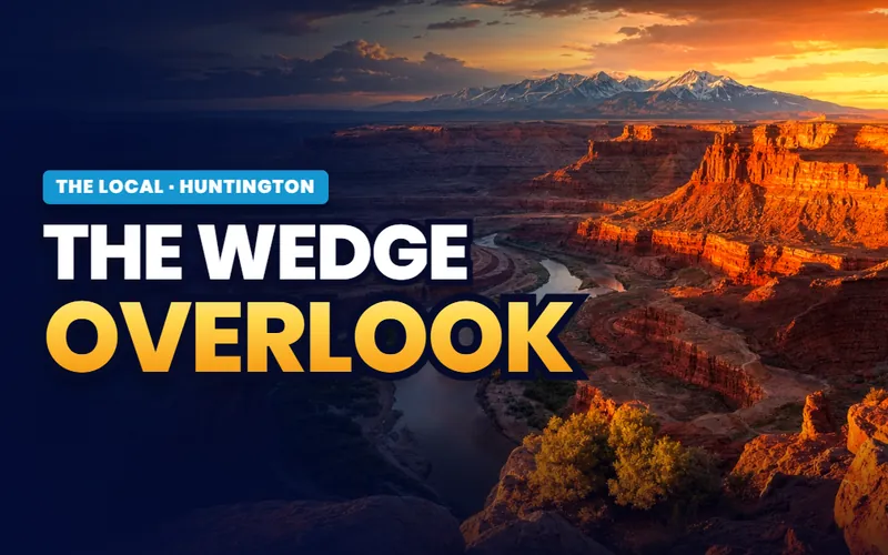 The Wedge OverlookThe rim more than 1,200 feet above the San Rafael River, at the end of a long gravel road.Read the guide
 Buckhorn WashBarrier Canyon style rock art in red ochre and the 1938 San Rafael Bridge.Read the guide
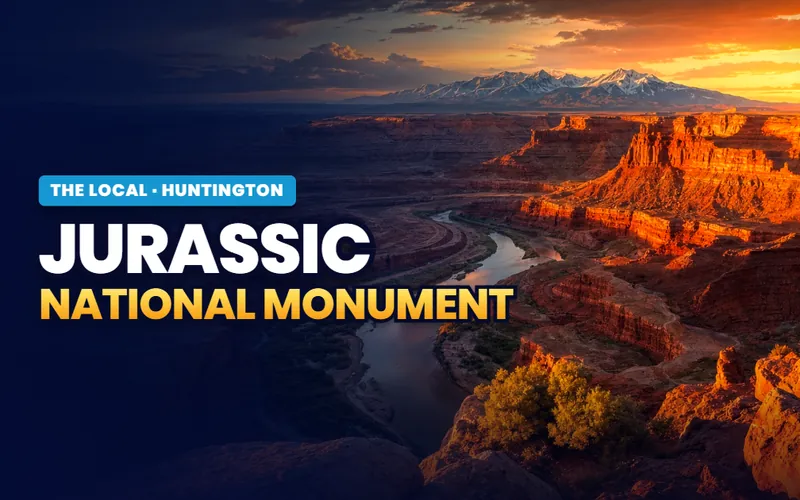 Jurassic National MonumentMore than 12,000 bones from one hillside. The quarry building was closed for construction in 2026; call the BLM first.Read the guide
 The Emery County addressIrrigation shares, mineral rights in coal country, and about 23 miles to the nearest emergency room.Read the guide
Talk to Scott
Ready for your next step in Huntington?
My base is Southern Utah. So for a Huntington move, I connect you with a partner agent I trust for the work on the ground. I stay on your file for the homework and the loan side. You get a partner agent who knows the area, plus me in your corner.
How it works in Huntington
- A local agent on the ground.I connect you with a partner agent I trust near Huntington for the showings, the offer, and the closing.
- A second set of eyes.I stay on your file and do the homework on any home you are weighing, from the commute to the school boundaries.
- Real estate and lending, one person.I am licensed in both real estate and lending. On any one purchase I take one role. If I am your lender, I can tell you early if a home could be hard to get a loan on.
- A reply within one business day.Call or text, and I get back to you within one business day.
Or call me: (435) 357-4345I reply within one business day.

Referral disclosure. Outside Southern Utah, I connect home sellers and buyers with partner agents I trust in their area. If you choose to work with an agent I refer, that agent's brokerage pays my brokerage (Real Broker, LLC) a referral fee. The fee comes out of the agent's compensation; it is not an added cost to you. You are always free to choose any agent you wish, and using a referred agent is never required.