
City American Fork, Utah County
Where the valley floor is at its narrowest
American Fork, from the fee gate to the sand beach
A canyon mouth at the top of town where the national forest starts charging, a city harbor at the bottom that reopened in June 2025 after a 3.9 million dollar rebuild, and about eleven square miles of pinched valley floor in between carrying a pioneer grid, a hospital, a rail platform and 27 parks. Seven pages on the city itself, plus seven region pages that carry the mountain, the lake and the trail.
 By Scott Buehler, Moving Utah
Updated October 2026
By Scott Buehler, Moving Utah
Updated October 2026
Start here
A city with a fee gate at one end and a boat ramp at the other
Read American Fork north to south and the whole place makes sense in about a minute. The top of the city is a canyon mouth where a national forest starts charging admission. The bottom of it is a shoreline where the city charges five dollars to park a car next to a sand beach. In between sit a pioneer street grid, a hospital, a regional retail edge along the interstate, a commuter rail platform and about eleven square miles of ordinary blocks doing ordinary things.
The middle of that section is the part people underestimate. This is where Utah Valley is at its narrowest useful width: the Wasatch comes down hard on the east, Utah Lake pushes in from the southwest, and the buildable ground between the two pinches into a band that every road, every rail line and every utility corridor in the north county has to share. Living here means most journeys are short and a few of them are unavoidably slow, which is a different bargain from the one the bench towns above the city are selling.
What the city owns inside that band is unusually good for a place of this size, and it is spread out rather than clustered. There is a 22 acre sports and recreation complex on 1000 North with six free pickleball courts on it. There is an indoor pool that runs all winter. There is a city owned golf course. There is a harbor at the end of 100 West that reopened in June 2025 after a 3.9 million dollar rebuild. And there is a July celebration that takes over eight days and about nine venues at once.
American Fork at a glance
33,337
people at the 2020 census
27
city parks across town
$10
the three day canyon pass, per vehicle
1850
settled; renamed American Fork in 1860
Buying or selling in American Fork?
The two doors
One city, two gates, and neither one is run by the same people
The canyon at the top of American Fork and the harbor at the bottom of it are the two reasons a stranger drives here, and they are opposites in almost every way that matters to a Saturday: different owners, different money, different seasons and different failure modes. Sort this table before you decide which end of town you are going to.
| The canyon door | The harbor door | |
|---|---|---|
| Who runs it | The Uinta-Wasatch-Cache National Forest, through the Pleasant Grove Ranger District | American Fork City, on 801-763-3023 |
| What it costs | Ten dollars for three consecutive days, twenty for seven, sixty for twelve months | Five dollars to park a car, ten dollars to launch a boat, nothing on foot or by bicycle |
| The annual option | Sixty dollars, and interagency passes are honored in place of it | Eighty dollars for a resident pass, one hundred for a non resident pass |
| When it works | Lower canyon and the road to Tibble Fork all year; the upper loop shuts behind a winter gate | The open water season, with posted operating hours of 8am to 6pm |
| What goes wrong | Full parking lots by mid morning on weekends, and a weekend ticket at one trailhead that catches people out | Wind on open water, and the state advisory position on the lake in high summer |
| The page for it | American Fork Canyon | The Beach and Boat Harbor |
Forest fees changed after December 2024 and the harbor fees were reset when the site reopened in June 2025, so both are newer than most of what a search will show you. Confirm the current figures before you build a plan around either.
The canyon fee figures on most guides to this city are the old ones. American Fork Canyon charges by the vehicle: ten dollars for three consecutive days, twenty dollars for seven and sixty dollars for twelve months. The six dollar day rate and the forty five dollar annual pass that still appear on older listicles and printed guides were superseded when fees rose after December 2024. There is still no fee for non-stop travel through the canyon, interagency passes are honored, and passes are sold at the information stations on SR-92, at self service stations in the canyon and on Recreation.gov.
What the city owns
A pool, a golf course, a harbor and a 22 acre complex on 1000 North
The biggest single piece of it is on the northeast side. Mary and Art Dye Park at 550 East 1000 North carries five ball diamonds with a scoring tower, soccer fields, six free dedicated pickleball courts, a disc golf course, a playground, restrooms, singletrack through the trees and access to the American Fork River Trailhead. The complex is about 22 acres and it is leased from the state of Utah rather than owned outright, which is the sort of detail that never makes a park listing. The park page carries the courts, the trails and the story behind the name.
The indoor answer is the American Fork Fitness Center at 454 North Center Street, which is the reason this city does not go quiet in January. It carries a 500,000 gallon competition pool and runs on a daily admission rather than a membership requirement, with public swim beginning in the early afternoon. The city also owns Fox Hollow Golf Club, eighteen holes at the north end of 200 East that started life as a three city venture and is now wholly American Fork's, and it lists 27 parks in total across the city.
Then there is the water at the other end. The American Fork Beach and Boat Harbor at the south end of 100 West reopened on June 30, 2025 after a 3.9 million dollar improvement project that built new parking, restrooms, a welcome building, an expanded sand beach with shade structures, a playground, a twelve foot trail and better fishing access. It is day use only and it is run by the city rather than by the state. The harbor page is the user manual for that one address.
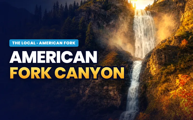
The odd one out is the canyon, because the city does not own it and cannot charge for it. American Fork Canyon is national forest, it begins where the streets stop at the northeast corner of town, and it operates on federal fees, federal seasons and, since recently, a federal weekend ticket at one trailhead. The canyon page is the logistics: the pass, the gate, the reservoir lots and the rough roads. The mountain above it belongs to the whole valley.
A city of this size with a competition pool, a golf course, a harbor and a 22 acre sports complex is not normal. American Fork has all four and a national forest at the end of the street.
What belongs to the valley
The mountain, the lake and the canal trail are shared property, not city property
Nineteen towns look at the same peak, launch onto the same water and ride the same seventeen mile corridor across the bench. Written from one doorstep at a time, each of those turns into nineteen thinner versions of a page that should exist once. The Local sends them to their own region pages, and these pages point you there instead of competing with them.

The mountain
Timpanogos and the Loop
The peak above this city, the ticketed cave inside its canyon wall, the two summit routes and the drive over the top.
Read the guide
The water
Utah Lake
What the lake is doing as a body of water, how its advisories are issued and read, and how the five access points differ.
Read the guide
The corridor
The Murdock Canal Trail
Seventeen paved miles laid over a buried aqueduct, crossing this city on its way between Lehi and Orem.
Read the guide
Days out
Family weekends in Utah Valley
Nine days out across nineteen towns, with a price, a season and a current status on every one of them.
Read the guideThree more valley subjects sit behind those four. One follows US-189 up the other canyon, past the falls and the canyon drive to a resort that changed hands years ago. One climbs a byway over the shoulder of Mount Nebo and settles the annual question of whether the gate is open yet. One treats the two universities strictly as venues: their halls, their capacities, their calendars and where a car may legally sit on a game day. All seven are listed on the Utah Valley hub.
If you only have one day
Top of the city to the bottom, in the order that keeps the car working least
First thing
Buy the pass and go up early
The reservoir lots at the top of SR-144 fill on summer weekend mornings, so an early start is worth more here than an early start anywhere else in the city.
The canyon page
Late morning
Come back down the list
Seven entries that survive an honest count, ranked in the order that avoids driving the length of town twice.
The ranked list
Afternoon
Six free courts on 1000 North
Dedicated pickleball courts with permanent nets, a disc golf round, and singletrack through the same 22 acres.
The park page
Evening
Finish at the end of 100 West
Five dollars parks the car beside a rebuilt sand beach with the Lake Mountains taking the last of the light across the water.
The harbor pageThe rhythm
Three calendars run this city, and only one of them is the city's
The federal calendar is the one that surprises people. The upper stretch of SR-92 shuts behind a winter gate from roughly the end of October until late spring, and it reopened on May 22 in 2026 when UDOT declared its seasonal roads open. On top of that the Timpooneke trailhead now runs a weekend timed entry ticket from mid July into October, midnight to noon on Saturdays, Sundays and two holidays, sold through Recreation.gov. Neither of those is signposted from a listing photograph. The canyon page lays both out with dates.
The city calendar has one immovable object in it, and it is the third and fourth weeks of July. Steel Days ran from Saturday July 18 to Saturday July 25 in 2026, billed as the 81st year, and it is not an evening out. It is eight days across roughly nine venues, opening with a car show at Rotary Park and a drone show with a hot air balloon glow at 9:45 in the evening, and closing with a run at seven in the morning, a parade at nine and fireworks at ten at night. The Steel Days page takes the week apart.
The third calendar belongs to the water and it is the shortest. The harbor works the open water season with posted hours of 8am to 6pm, the beach is the part that works without any equipment at all, and high summer is also when the state and the county post advisories on the lake. That question is a valley question rather than a harbor question; the lake page and the agencies that post the advisories carry the current answer.
What runs all year is the ordinary stuff, and in this city the ordinary stuff is unusually deep. The indoor pool on Center Street, the courts and the disc golf on 1000 North, the golf course at the north end of 200 East and the paved corridor across the bench do not care what month it is. The ranked list sorts the seasonal from the permanent so you can tell which is which before you drive.
Two gates decide the American Fork year: the one across SR-92 that closes for winter, and the one at the harbor that opens at eight in the morning.
The American Fork companion
Seven pages, and two of them are doorstep exceptions
Everything The Local has written about American Fork itself: the ranked seven, the canyon's own logistics, the eight day July week, the harbor that reopened in 2025, the 22 acre complex whose name was put right the same year, and the honest version of living on the narrow part of the valley floor.


Quick answers
American Fork, answered
For the canyon that carries its name and for the July week named after a steel mill. American Fork Canyon starts at the city's northeast corner and runs on a national forest recreation fee, and Steel Days takes over eight days in the second half of July with a drone show, a parade, a carnival and a run. Locally the city is also known for a rebuilt harbor and sand beach on Utah Lake at the south end of 100 West, a 22 acre sports complex on 1000 North with six free pickleball courts, an indoor competition pool on Center Street and a historic Main Street core that survived.
Ten dollars for three consecutive days, twenty dollars for seven consecutive days and sixty dollars for twelve months, per vehicle. Interagency America the Beautiful passes are honored in place of buying one. There is no fee for driving through without stopping, and the pass is only required when you stop at a developed recreation site. The six dollar and forty five dollar figures that still circulate on guides and listicles were superseded when fees rose after December 2024.
At one trailhead, on some days, in some months. The Timpooneke trailhead requires a timed entry ticket bought through Recreation.gov to park there between midnight and noon on Saturdays, Sundays and two holidays during a window that runs from mid July into October. Seventy six tickets are released thirty days ahead and another twenty four are released two days ahead, one vehicle per reservation, with the ticket holder required to be present. Every other trailhead in the canyon is first come, first served on the standard recreation pass.
Yes. The American Fork Beach and Boat Harbor at 1730 South 100 West reopened on June 30, 2025 after a 3.9 million dollar improvement project, and the city posts standard operating hours of 8am to 6pm. Parking a car costs five dollars, launching a boat costs ten, and walking or cycling in is free, with annual passes at eighty dollars for residents and one hundred for non residents. It is a day use site with no camping.
The second half of July. In 2026 the festival week ran from Saturday July 18 to Saturday July 25 and was billed as the 81st year. The two Saturdays carry most of the weight and they are completely different days: the opening Saturday has the car show at Rotary Park, the cruise on Main Street, the opening concert and a drone show with a hot air balloon glow at 9:45 in the evening, while the closing Saturday has the run at seven in the morning, the grand parade at nine, the Big Show at eight in the evening and fireworks at ten.
No, and keeping them apart saves a lot of confusion. American Fork Canyon is the canyon itself: SR-92 through the gorge, the fee corridor, the reservoirs on SR-144, the campgrounds and the trailheads. Mount Timpanogos is the peak above it, the summit routes climb out of the canyon toward it, and the Alpine Loop is the road that carries on over the top toward Provo Canyon. The Local writes the canyon's logistics on the American Fork page and the mountain, the cave and the loop drive once at valley level.
More than most cities this size manage. The six dedicated pickleball courts and the disc golf course at Mary and Art Dye Park are free, the singletrack and the American Fork River Trailhead at the same address cost nothing, walking or cycling into the boat harbor is free even though parking a car is not, the Murdock Canal Trail across the bench is free, and the historic Main Street core has a self guided walking route around it. Most of Steel Days is free at the gate as well, with the run and a few activities carrying an entry.
The indoor and the paved. The American Fork Fitness Center at 454 North Center Street runs a 500,000 gallon competition pool through the winter on daily admission, the Murdock Canal Trail across the bench carries no seasonal gate, and the lower canyon road as far as Tibble Fork stays open all year even when the upper loop is shut. What closes is the interesting half of the canyon, because the winter gate on SR-92 shuts the stretch between Pine Hollow and Aspen Grove from roughly late October until late spring.
A day covers the city and a second day covers the canyon properly. The city itself is a north to south line about five miles long, so a morning at the park, an afternoon at the pool or the golf course and an evening at the harbor needs almost no driving. The canyon is the part that deserves its own day, because the drive up, the reservoir at the top of SR-144 and the rough road beyond it will absorb one comfortably. Arrive during the third week of July and both plans change, because the July week owns the calendar.
Seven pages on the city, and seven more on the valley it sits in
A visit asks which end of town to start at. A move asks harder questions: how close to the canyon road you want to be when the fall color traffic starts, what a parcel on the south flats sits behind, how the rail corridor and the interstate frontage read at commute hours, and what the zoning allows on the block you are circling. Tell me what you are weighing and I will put you with a Utah County partner agent who works this end of the valley, and stay on the file for the financing side.
Or call Scott: (435) 357-4345or send Scott a message
Keep going
Continue your American Fork research
Eight more doors into American Fork, chosen for what this page covers.
Questions about American Fork?
Call Scott, send a message, or find out what your American Fork home is worth. No pressure, no obligation.
Referral Disclosure: For moves outside Southern Utah, I can connect you with trusted local agents. If you choose to work with one, their brokerage pays my brokerage (Real Broker, LLC) a referral fee from their commission. This costs you nothing extra, and you are never obligated to use my referral.