
Utah County, Northern Utah
Moving to American Fork, Utah
American Fork sits in the north end of Utah Valley, between Lehi and Pleasant Grove, with Mount Timpanogos to the east. City Hall sits at about 4,600 feet on a Main Street laid out in the 1850s. The city runs from the low flats by Utah Lake north to the Highland line, with its own hospital and a FrontRunner station. Provo is about 19 minutes south, and Salt Lake City is about 34 minutes north. Want to see what is for sale right now? The Browse American Fork homes button below shows every listing.
Drive times from American Fork. Look up any Utah drive
Start here
What brings you to American Fork?

Pick one, and I will point you to the right page. It takes three taps at most, and there is nothing to sign up for.
Chapter 1 of 4
The place and the weather
What American Fork is, how a creek, a lake city and a steel plant shaped a city of about 41,000, and what the sky does all year.
City at a glance
What are the quick facts on American Fork?
The place
The weather
The money
Around town
Sources: U.S. Census Bureau, NOAA, USGS, the Utah State Tax Commission, and American Fork City. Prices move, so ask me for current numbers.
Overview
What is American Fork like?
Short answerA city of about 41,000 at the foot of Mount Timpanogos, in the north end of Utah Valley. It was settled in 1850, named Lake City for a few years, and has held steady at about 41,000 since 2024.
American Fork sits in the north end of Utah Valley, at the foot of Mount Timpanogos. The mountain is about 11,750 feet high. Lehi is on the west. Highland and Cedar Hills are on the north, and Pleasant Grove is on the east. Utah Lake is on the south, and Alpine lies beyond Highland.
About 41,000 people live here, by the 2025 Census estimate. The count in 2020 was 33,337, so the city has grown by about 7,600 people since then. The 2025 estimate is a hair below the 2024 one, so the count was about flat from 2024 to 2025. The city’s own planners count building permits, and their estimate runs higher. The Census figure is the one used on this page.
The city covers about 11.4 square miles of land, or about 3,580 people per square mile. All of it is in Utah County. Everything inside the city line uses ZIP code 84003, and Highland shares that ZIP.
Lake City and the first settlers
Pioneers camped beside American Fork Creek in the summer of 1850. The trees along the creek and the green meadows toward the lake convinced them to stay. The city is named for the American Fork River. In those days the streams running into the lake were called forks.
In September 1852, settlers met and chose the name Lake City for their town. The Utah legislature incorporated the town on June 4, 1853. In 1860 the name changed back to American Fork. The reason given was to avoid a mix-up of mail with Salt Lake City.
The settlers also built a fort in 1853. A memorial in Robinson Park marks the line of its south wall, and the entertainment topic covers the park. A marker in the park credits American Fork with a first. In 1868 it was the first town in Utah Territory with free public schools paid for by taxes.
The steel years
In 1942 and 1943, Columbia Steel built a plant in Utah County, in what is now Vineyard. The plant later became Geneva Steel. The encyclopedia says it brought a building boom to American Fork, the biggest the town had seen. The population then reached about 4,500.
The July festival took the name Steel Days from that era. The Main Street and Steel Days story tells how.
Today
Today the big tech campuses in Lehi are about 11 minutes north, near Thanksgiving Point. Orem is about 14 minutes south, and Provo is about 19. The tech jobs story has the details.
The lay of the land
City Hall sits at about 4,600 feet. Homes run from about 4,500 feet on the flats by Utah Lake to about 4,860 feet at the Highland line. That is a rise of about 370 feet, and the ground climbs to the north, not the east. American Fork Hospital is on the east side, and it sits at about the same height as Main Street.
The mountains are not at the edge of town. The city line stops at about 1800 North. American Fork Canyon opens about 6 miles northeast of downtown, past Highland. Timpanogos Cave is about 15 minutes from City Hall. The outdoors topic covers the canyon and the cave.
The Boat Harbor on Utah Lake is at the south end of town. The neighborhoods topic walks through the city from the lake up to Highland.
The city line is not one solid shape. A few blocks inside it are still county land, so check which side of the line an address sits on. The what to check topic says how.
The General Plan
The city has rewritten its General Plan. It has seven parts and looks 10 to 20 years ahead. The Planning Commission recommended it in August 2026, and it went to the City Council for action. Check with the city to see where it stands. A citywide zoning map and code rewrite was pulled back, and a plan for the city center is still to come.
Read the plan before you count on a zoning change near an address. The city’s plan page keeps the record.
Growth since 2020
- 2020The Census counted 33,337 people.
- 2024The Census estimate was 41,119 people.
- 2025The Census estimate is 41,020 people, a hair below 2024.
Highlights
- About 41,000 people by the 2025 Census estimate, up about 7,600 since the 2020 count.
- About 11.4 square miles of land and about 3,580 people per square mile.
- Settled in 1850, called Lake City from 1852, incorporated in 1853, renamed in 1860.
- City Hall is at about 4,600 feet. Homes run from about 4,500 to 4,860 feet.
- The canyon opens about 6 miles northeast, past Highland. Timpanogos Cave is about 15 minutes away.
- Lehi’s tech campuses are about 11 minutes north. Provo is about 19 south.
Want the street level view? American Fork on The Local has six guides to the city. Weighing the whole state? Start with my relocating to Utah guide. I did the homework here, and a partner agent I trust does the work on the ground.
Sources: the U.S. Census Bureau (2020 count, 2025 estimate, land area), USGS elevations, the Utah History Encyclopedia, the American Fork City About and Historic Walking Tour pages, and the Planning Commission record of August 19, 2026.
Still choosing a town?Utah City FinderSort 138 Utah towns by budget, snow, summer heat, and the drive to work.Find a townClimate and weather
What is the weather like in American Fork?
Short answerFour seasons: hot, dry summers and cold, snowy winters. July highs are near 93°F and January lows near 24°F.
American Fork has four true seasons. Summers are hot and dry. Winters are cold and snowy. Spring is cool and changeable, and fall is warm early and crisp late. The weather numbers come from the Pleasant Grove station. It sits in the next town, about 3.4 miles east-southeast of City Hall and about 90 feet higher.
Spring
Highs 58 to 75°F
Cool and changeable, with snow still possible in March and April. May is the wettest month. The last freeze usually comes around April 17.
Summer
Highs 85 to 93°F
Hot, dry days and nights near 60. About 55 days a year reach 90 or more.
Fall
Highs 53 to 82°F
Warm early, crisp late. The first freeze usually comes around October 25.
Winter
Highs 41 to 47°F
Real winter, with January the snowiest month and nights near 24. Cold air can sit in the valley for days.
Month by month
These are the normal highs and lows for each month. The swing from day to night is big in every season. A normal July day runs from about 93°F down to about 64°F.
- JanuaryHigh 41°F, low 24°F
- FebruaryHigh 47°F, low 28°F
- MarchHigh 58°F, low 35°F
- AprilHigh 64°F, low 40°F
- MayHigh 75°F, low 48°F
- JuneHigh 85°F, low 56°F
- JulyHigh 93°F, low 64°F
- AugustHigh 91°F, low 62°F
- SeptemberHigh 82°F, low 53°F
- OctoberHigh 68°F, low 42°F
- NovemberHigh 53°F, low 32°F
- DecemberHigh 41°F, low 25°F
Source: NOAA climate normals, 1991 to 2020, Pleasant Grove station. Months are rounded to the nearest degree.
About 16 inches of rain and melted snow fall in a year. May is the wettest month, with about 2 inches. July is the driest, with about 0.6.
Frost dates matter if you garden. The last spring freeze is usually around April 17, and the first fall freeze around October 25. That leaves about 188 days between them. The city’s yard water runs from April 15 to October 15. The utilities topic has the water details.
Nights are cold in winter. About 123 nights a year drop to 32°F or below. About 14 days a year stay below freezing all day. Nights of 0°F or colder are rare, fewer than one a year.
Fall color in the mountains above town usually starts in late September. Winter snow is a day trip away at Sundance and the Cottonwood Canyons ski resorts. The skiing topic has the times.
Highlights
- A normal January day: high 41°F, low 24°F.
- A normal July day: high 93°F, low 64°F.
- About 16 inches of rain and melted snow a year. May is the wettest month and July the driest.
- Last spring freeze about April 17. First fall freeze about October 25. About 188 days between.
- The station is in Pleasant Grove, about 3.4 miles from City Hall.
Good to know. The flats by the lake sit 130 to 200 feet below the station. The north edge of the city sits 80 to 170 feet above it. The differences are small, but expect it to be a little warmer by the lake and a little snowier at the north edge. No station measures a single street, so ask a neighbor what winter is like where you are looking.
For the day to day side, see American Fork on The Local.
Snow
How much snow does American Fork get?
Short answerAbout 41 inches in a normal year at the weather station, mostly November through March. January is the snowiest month.
American Fork gets about 41 inches of snow in a normal year at the weather station. That is more than Lehi and a little less than Provo. Most of it falls from November through March.
Source: NOAA climate normals, 1991 to 2020, the weather station in each town (American Fork uses the Pleasant Grove station, about 3.4 miles east of City Hall and about 90 feet higher).
January is the snowiest month, with about 11.5 inches. December follows with about 10. February brings about 8, and March and November about 4 each. April adds about 3. October and May average less than an inch. No snow falls from June through September.
About 14 days a year bring an inch or more of new snow. About 14 days stay below freezing all day, so what falls can stick around. Winters here are real winters.
Highlights
- About 41 inches a year at the weather station.
- January is the snowiest month, then December and February.
- No snow falls from June through September.
- About 14 days a year bring an inch or more of new snow.
- More than Lehi, a little less than Provo.
Good to know. The higher streets toward Highland catch a little more snow than the flats by the lake. No station sits on those streets, so I cannot give a number. Ask what a street is like after a storm, and who plows it.
For the bigger picture on snow and water in Utah, read my guide on Utah water and snowpack.
Snow is not your thing?Try the warm winter city finderSee the Utah towns where snow is rare or light, from St. George to Moab.Show warm winter townsSummer temperatures
How hot does American Fork get in summer?
Short answerJuly highs average about 93°F, with about 55 days a year at 90°F or hotter. Nights cool to about 64°F.
Summers are hot and dry, but the nights cool off. A normal July afternoon reaches about 93°F. A normal July night drops to about 64°F.
Source: NOAA climate normals, 1991 to 2020, the weather station in each town (American Fork uses the Pleasant Grove station, about 3.4 miles east of City Hall and about 90 feet higher).
About 55 days a year reach 90°F or hotter. Days at 100°F or hotter are rare, about 3 a year. June is milder, with highs near 85°F. August is close to July, near 91°F.
Provo has its own station, and it runs about 2 degrees hotter in July, at 95°F.
The hot stretch
July and August highs sit near 91 to 93°F. June runs several degrees cooler.
Cool nights
A July night drops to about 64°F, so the house can cool off after dark.
Cooler up the canyon
American Fork Canyon climbs from about 5,100 feet at the mouth to about 8,000 at the Alpine Loop summit. The air cools as you climb.
Highlights
- A July high of about 93°F.
- About 55 days a year reach 90°F or hotter.
- About 3 days a year reach 100°F.
- July nights fall to about 64°F.
Summer can also bring poor air. The air quality topic below has the details.
Wind
Is American Fork windy?
Short answerNo wind figure exists for the city. Judge wind one home at a time, and visit at more than one time of day.
No weather station keeps wind records for American Fork. The canyon mouth is about 2.8 miles past the northeast corner of the city, and no station sits there either. No source gives a wind figure for the city, so this topic gives none. I would rather say so than guess.
Judge wind one home at a time. Shelter changes from street to street, and the cards below show what I would check.
Open ground
Homes on open lots have less shelter than streets with older, bigger trees.
On a tour
Check the roof, the fences and the trees. Ask how the home did in the last big wind.
Come back later
Visit once in the afternoon and once in the evening. Wind changes through the day.
Highlights
- There is no official wind figure for the city, so none is given here.
- Shelter changes from street to street.
- Ask about the roof, fences and trees on any home on open ground.
- Visit at more than one time of day.
Straight talk. Wind is easy to miss in a daytime showing. Visit a home on a breezy afternoon and ask the neighbors what they have seen.
Air quality and inversions
Does American Fork get inversions?
Short answerYes, in winter, as the rest of Utah Valley does. Summer ozone brings poor air days too, and EPA lists Utah County as Marginal for ozone.
Yes, American Fork sits in Utah Valley, and Utah Valley gets winter inversions. An inversion is when cold air sinks into a valley and gets trapped under a lid of warmer air. On calm winter days, haze builds in that trapped air until a storm clears it.
Summer brings a different problem. Ozone is a gas that forms on hot, sunny days, and it brings some poor air days in summer.
What the EPA says
Utah County is in the Southern Wasatch Front area for the 2015 ozone standard. EPA lists the area as Marginal, so it does not yet meet that standard. For fine particles, called PM2.5, EPA ruled in 2025 that the Provo area met the federal standard for the 2006 daily limit. That took effect on December 19, 2025.
Highlights
- Winter inversions trap haze in Utah Valley.
- Summer ozone still does not meet the federal standard. EPA lists Utah County as Marginal.
- The Provo area met the federal fine particle standard on December 19, 2025.
- The county posts the daily air quality index online.
Here is what I would do. Check the air each day on the county air quality page or the state’s air quality site, the way you check the weather. If air matters to you, visit during a gray winter stretch and a hot summer afternoon before you buy.
Car emissions tests are part of the same story. The first 90 days topic covers the test. Utah Lake has its own water quality warnings, and the outdoors topic covers them.
Sources: EPA Green Book (current as of September 30, 2026), the EPA news release on PM2.5 and the Utah County Air Quality Bureau.
End of chapter 1 of 4
NextFeatured homesFeatured listings
Featured homes across Utah
Homes featured on MovingUtah right now, fed live from the MLS.
View all featured homes across Utah
Listing data is deemed reliable but not guaranteed and is subject to change. Where a listing is one in which Scott Buehler holds an ownership interest, that interest is disclosed on the listing.
Chapter 2 of 4
Homes and money
What it costs, what you can buy, where the homes are, and what to check.
Cost of living
Is American Fork affordable?
Short answerHousing is the big cost. The glance box at the top of this page shows the latest typical home value. The city sends one bill for most utilities, and yard water turns metered on January 1, 2027.
Housing is the biggest cost in American Fork. The glance box at the top of this page shows the latest typical home value, from the U.S. Census. That number is the middle of what owners say their homes are worth. It is not a sale price, so judge any home against recent sales nearby.
The city sends one bill for most of the rest. One city account covers drinking water, yard water, sewer, storm drains, trash and recycling. Power comes from Rocky Mountain Power and gas from Enbridge Gas Utah. The utilities topic lists each charge and the steps to sign up.
Yard water is the part to watch. American Fork has a second water system for lawns, called pressurized irrigation, and it is billed all year. Today it is a flat monthly fee. From January 1, 2027, it is metered and priced in steps by lot size, and the city expects most bills to go up. The utilities topic has the rest.
The big cost
Housing. The glance box shows the latest typical home value.
Property tax
The Utah County average is about 0.49% of a primary home’s value a year. The city raised its own rate for 2027. The taxes topic explains.
Sales tax
The American Fork rate is 7.45%. That is a full point below Salt Lake City.
Yard water
A second water system for lawns, billed all year, with metered rates from January 1, 2027.
Weighing American Fork against a town nearby? Lehi is about 7 minutes away, and so is Pleasant Grove. Orem is about 14 minutes south, and Provo about 19. Ask me and I will run the numbers side by side for the towns you are weighing. You can also open Lehi, Pleasant Grove, Orem and Provo.
Highlights
- Housing is the big cost. The glance box shows the latest typical home value.
- Sales tax is 7.45%, a full point below Salt Lake City.
- One city account covers water, yard water, sewer, storm drains, trash and recycling.
- Yard water is billed all year, and it turns metered on January 1, 2027.
- The city raised its property tax rate for 2027.
Sources: U.S. Census Bureau (ACS 2020 to 2024), the Utah State Tax Commission, and American Fork City. Costs change, so ask me for current numbers.
For general information only. This is not tax or financial advice. Tax rates and home prices change. Consult a qualified professional for guidance specific to your situation.
Taxes
What taxes will I pay in American Fork?
Short answerSales tax is 7.45%. A primary home is taxed on 55% of its value, and the county average is about 0.49% a year. The city raised its own property tax 5.7% in August 2026.
Three taxes matter most when you move here: sales tax, state income tax and property tax. American Fork also raised its own property tax rate in 2026.
| Tax | Rate | What to know |
|---|---|---|
| Sales tax | 7.45% | The full American Fork rate, from the Utah State Tax Commission table of October 2026. Salt Lake City is 8.45%. |
| Groceries | 3.00% | Food from a grocery store is taxed at a lower rate. |
| Restaurant meals | 8.45% | Prepared food carries a higher rate. |
| State income tax | 4.45% | One flat rate for everyone, for tax years starting in 2026. |
| Property tax | About 0.49% | The Utah County average for a primary home, as a share of its market value, at 2025 rates. |
The city’s 2026 raise
On August 25, 2026, the City Council adopted its 2026-27 budget. It came with a 5.7% property tax increase. The required public hearing, called a Truth in Taxation hearing, was held on August 11. The city says the raise brings in "$435,000 additional dollars annually for the City." It puts the cost to the average household at $1.87 a month.
The budget adds nine firefighters and two police officers. The city also raised its rate in 2022. Before that, the last raise was in 2008.
Where the tax bill goes
Most of a property tax bill does not go to the city. The city says only about 17% of the property taxes you pay go to American Fork City. Most of what you pay funds education. On the city’s own table for an average home, about two-thirds goes to the school district. About 12% goes to Utah County, and about 5% to water districts.
The schools will change the bill again. The new Aspen Peaks School District takes over American Fork’s public schools on July 1, 2027, and it will set its own levy. A levy is the tax rate one group sets. No rate has been set yet, so no one can tell you what it will be. The school district change tells the story.
The primary home exemption
Utah gives a tax break to the home you live in. A primary home is taxed on 55% of its market value. The county assessor asks owners to declare a home as primary or secondary.
A new owner has to apply for the break. From January 1, 2027, that application is required statewide when a home changes hands. If you buy after that date, ask your agent about it at closing.
The emissions test
Utah County requires an emissions test to register most cars. The first 90 days topic walks through the test and the steps to register.
Highlights
- Sales tax is 7.45%. Groceries stay at 3.00%.
- 4.45% flat state income tax for 2026.
- The county average is about 0.49% of a primary home’s value.
- A primary home is taxed on 55% of its value.
- The city raised its property tax 5.7% in August 2026, for firefighters and police.
- Only about 17% of a property tax bill goes to the city.
- The new school district sets its own levy from July 1, 2027.
Sources: the Utah State Tax Commission (the 2025 county rate and the October 2026 sales tax table), the Utah Legislature, and American Fork City’s property tax and budget pages. Questions about your own bill go to the county assessor.
For general information only. This is not tax or financial advice. Tax rates and home prices change. Consult a qualified professional for guidance specific to your situation.
Real estate overview
What do homes cost in American Fork?
Short answerPrices move. The glance box at the top of this page shows the latest typical home value. The median home was built in 1998, and two in three homes are lived in by their owners.
The glance box at the top of this page shows the latest typical home value for American Fork, from the U.S. Census. That number is the middle of what owners say their homes are worth, from Census surveys over five years. It is not a sale price. Prices shift through the year, so judge any home against recent sales of homes like it.
The Census counts about 11,972 homes in the city. About 61% are detached houses. Another 12% are townhomes or other attached homes. About one home in six sits in a building of five or more units. The median home has 6.8 rooms.
Two in three homes are lived in by their owners, and one in three is rented. In Utah County as a whole, 68% are owner-occupied. The new construction topic shows what is being built.
How old the homes are
The median home was built in 1998. The 2010s were the biggest building decade, with about 23% of all homes. The 1970s came next at 16%, then the 1990s at 15%. About one home in three was built in 2010 or later, and 11% since 2020. Only about 18% were built before 1970. American Fork grew in two big waves, the 1970s and the 2010s on.
The age of a home follows the map. Pioneer homes and early 1900s houses sit on the Main Street grid. Look along 100 East, Main Street, 100 to 200 North and Pacific Drive. Homes from the 1940s to the 1970s ring downtown. Most building since 2010 sits south of 200 South toward I-15 and the lake, and on the far north edge. The areas topic walks the city block by block.
The historic core
The American Fork Historic District is on the National Register of Historic Places, listed in 1998. It runs roughly along 100 South from 300 West to 200 East. A National Register listing puts no design rules on owners. Ask the city whether it has its own local historic zoning on top of that.
Old homes are character homes, so have the wiring, the foundation and the roof inspected with care. The home checks topic lists what to ask about each part of town.
Ask me how fast homes like the one you want are selling right now. A number from last season can mislead.
Highlights
- The glance box shows the latest typical home value, from the Census.
- 61% of homes are detached houses, and 66% are lived in by their owners.
- The median home was built in 1998, and it has 6.8 rooms.
- About one home in three was built in 2010 or later.
- The Main Street grid has a National Register district, listed in 1998.
- A National Register listing adds no design rules for owners.
Shop by price
Shop by kind of home
Sources: U.S. Census ACS 2020 to 2024, the National Park Service National Register of Historic Places, and American Fork City’s historic homes list. Prices shift through the year, so ask me for the latest American Fork numbers.
Neighborhoods and communities
Where in American Fork should I look for a home?
Short answerThink in eight areas, from the old Main Street grid north toward Highland, east to the hospital, west to I-15, and south to Utah Lake. The ground rises to the north.
American Fork does not sell itself by branded neighborhood names, so the useful map is the ground and the roads. This list has eight areas. It starts downtown, goes north, east and west, then moves south to Utah Lake. The overview explains the lay of the land.
- CenterHistoric downtown and Main StreetAbout 4,600 feetThis is the grid laid out in the 1850s. It centers on Main Street and Robinson Park, at 100 East and Main. The 1903 City Hall on Church Street and the Harrington School are here, and so is Macey’s at 135 East Main. The American Fork Historic District runs along 100 South. The things to do topic tells about the park and the walking tour.
- MiddleThe middle blocksBetween downtown and about 1000 NorthStreets from the 1940s to the 1990s fill this part of town. It holds the largest share of ordinary resale houses. Homes here sit on the original grid’s extensions.
- NorthThe north side, rising toward Highland and Cedar HillsAbout 4,650 to 4,860 feetThe ground climbs here. Mary and Art Dye Park, at 1000 North 550 East, is on this side. So are American Fork High, Fox Hollow Golf Club, the cemetery and Star Roller Mills. The city’s highest homes sit at the Highland line, near 1800 North. Highland, Alpine and Cedar Hills are next door.
- EastThe east side by the hospitalAbout Main Street’s levelAmerican Fork Hospital is at 170 North 1100 East. It sits about as high as Main Street, not on a hillside. East State Street runs from here toward Pleasant Grove. The home checks topic mentions one mapped old landslide north of the hospital.
- WestThe west side by I-15 and The MeadowsFlat ground by the freewayWalmart, Target, The Home Depot and Kohl’s are here, and the developer of The Meadows lists a Cinemark. Costco sits just over the line in Lehi. Newer townhomes and apartments fill this side. Some new buildings are rentals, so ask whether a home is for sale or for rent.
- SouthwestThe 200 South station areaNear the FrontRunner stationThe FrontRunner station is at 782 West 200 South. The city zones the blocks along 200 South as its transit area. Woodside’s Meadowbrook townhomes, at 853 West 560 South, sit just south. Edgewater North and The Yard are going up on 200 South. The station area section has the story.
- SouthSouth of downtown, 300 to 800 SouthLower groundHarbor Village, with twin homes around 700 South between 100 and 240 West, is here. It is about 1.5 miles north of the Boat Harbor. Fenn Farms is at 350 South 700 West. The ground gets lower toward the lake, and the south side is mapped as high for liquefaction. The home checks topic explains.
- LakeThe flats by Utah LakeAbout 4,500 feetSouth of about 900 South, the ground is the lowest in the city. The lowest streets, around 1080 South and 1100 West, are in a FEMA flood zone. The American Fork Boat Harbor is at the south end of town. The home checks topic has the flood map.
The ground, the flood map and the zoning change block by block. So the partner agent walks the street with you, and I stay on the homework behind it.
Some plats have recorded rules called CC&Rs. If a home has them, ask for the recorded CC&Rs and read them before your deadline. Which school a home goes to depends on its exact address, and the boundaries may shift with the district change in July 2027. The schools topic has the details.
Want the story on a certain block? Tell me what you are after. My American Fork guides on The Local cover the canyon, the lake and the old Main Street.
Highlights
- Eight areas, from downtown north, east and west, then south to the lake.
- The north side climbs from about 4,650 to 4,860 feet at the Highland line.
- The hospital sits on the east side, about as high as Main Street.
- The 200 South station area is the city’s transit zone.
- The flats by the lake are the lowest ground, about 4,500 feet.
- Check the zone, the lot and the school by address.
Areas follow the ground and the roads, since the city names no neighborhood map. Elevations come from the U.S. Geological Survey and are rounded. Which school a home goes to depends on its exact address, so check with the school district.
New construction
Are there new homes in American Fork?
Short answerYes. The big apartment wave has passed, and the city now adds about 150 to 200 homes a year. Woodside sells townhomes at Meadowbrook near the station.
American Fork added a lot of homes in the last few years, and the pace has changed. A big wave of apartment buildings came first. Since 2024 the city has added mostly houses and townhomes, about 150 to 200 a year, as the record shows.
The Census counts the homes that cities permit. A permit is the city’s approval to start building. American Fork permitted about 3,430 homes from 2020 to 2025. The peak was 2021, with about 1,300, most of them in apartment buildings. The city reported no apartment-building permits in 2024 or 2025. It reported 150 single-unit homes in 2024 and 190 in 2025. Townhomes count as single units in that survey.
Homes you can buy
Woodside Homes sells two townhome communities, Regency at Meadowbrook and Legacy at Meadowbrook, at 853 West 560 South. Both were listed with homes for sale on the builder’s own site in October 2026. Some new buildings near The Meadows and the station are rentals, so ask whether a home is for sale or for rent.
A new-home site for "Utah Valley" covers the whole valley, not this city. Check that each address is inside American Fork.
What is in the city’s 2026 record
These are plans in the city’s records, not homes for sale. Bridges at Fox Hollow Plat B covers about 31 acres, and the council approved an agreement for it in August 2026. Edgewater North and The Yard are going up along 200 South. The city is also annexing some land in 2026, including a site of about 24 acres near 510 South 100 West for single-family homes.
A backyard cottage rule was proposed in September 2026. An accessory dwelling unit is a second, smaller home on the same lot. The draft allows one detached unit on a lot of 11,000 square feet or more that has a house. It would top out at 24 feet. Check the city’s current rule before you count on one.
The city has also rewritten its General Plan. The overview says where that stands.
The 200 South station area
The FrontRunner station is at 782 West 200 South, about 5 minutes from City Hall. The city zones the blocks along 200 South near it as a transit-oriented area, which means homes and shops placed close to the train. City staff described a plan for single-family homes near 500 West as a buffer, with townhomes on the rest.
In August 2026, FrontRunner 2X entered the federal Engineering phase, and the federal government is committing $1.28 billion. The plan adds a second track along about 8 miles of single track through American Fork, Lehi and Lindon. The project site promises 15-minute service at peak times. UDOT and UTA can now begin engineering, property purchases and utility moves. Service changes are years out.
The city’s 2026-27 budget lists $33 million for 200 South. The city has planned that project for years and is waiting on property owners. The station is already built, so a home here does not depend on a promise. The catch is a district still taking shape, with changing streets and a train line next door. Walk the street at commute hours before you write an offer.
Before you plan around a lot or a project, line up these checks.
- For sale or for rent. Ask whether a new attached home or an apartment is for sale or for rent.
- Phase and builder. Ask which phase a home is in and who builds it.
- The zone next door. Ask what the next parcel is zoned for, above all on 200 South and State Street.
- Which side of the line. A few blocks inside the city are still county land. Ask which side of the line the parcel is on.
- The lake and the soil. Ask whether a lot sits in the flood zone or on ground mapped high for liquefaction.
- The school. Ask for the school assignment, and how the July 2027 district change affects it.
Highlights
- American Fork permitted about 3,430 homes from 2020 to 2025.
- The big apartment wave has passed. The city now adds 150 to 200 homes a year.
- Regency and Legacy at Meadowbrook are Woodside townhomes at 853 West 560 South.
- FrontRunner 2X entered the Engineering phase in August 2026, with service changes years out.
- A "Utah Valley" new-home search is not this city. Check the address.
Builders often cover the buyer agent fee, and your agent puts that in writing before you sign. Buying new works differently from buying a resale home, so read how it works before you tour.
Sources: the Census Bureau’s building permits survey (2020 to 2025), American Fork City’s 2026 council and planning records, the FTA, the FrontRunner 2X project site, and Woodside Homes. A plan in the records is not a home for sale. Plans change, so ask me for the latest status.
Before you buy
What should I check before I buy a home here?
Short answerCheck the liquefaction and flood maps on the south side, look up the old landslide north of the hospital, test for radon, and confirm which side of the city line the home sits on.
Every town has its own list of things to check. These are the questions I would ask about any home in American Fork. A map or a test can answer each one for a single address, so check them one home at a time.
Liquefaction on the south side
Liquefaction is when wet, loose ground turns soft in a strong quake. The state layer the county has adopted maps the south side as high, with a study required. That covers roughly everything south of 300 to 400 South, including the station area, Meadowbrook, Harbor Village and the lake flats. It is moderate around 200 to 400 South, low near Main Street, and very low north of about 500 North.
Flood
Since June 23, 2026, FEMA maps the lowest streets by the lake, around 1080 South and 1100 West, in a high-risk coastal flood zone. About 66 homes are in it. The American Fork River also has a mapped floodway through town. A handful of homes sit inside it, and about 134 are in the shaded 500-year zone. Most of the city is outside the high-risk zones. Lenders require flood insurance in the high-risk zones, so ask for an elevation certificate.
Faults
No mapped fault crosses the city. The Wasatch fault, Provo section, runs through Highland and Cedar Hills, about a mile past the north line. The Utah Lake faults lie just off the south tip.
An old landslide
The state maps one old landslide on the east side, north of the hospital. It runs from about 400 to 700 North, between 830 East and North County Boulevard. Ask for a geotechnical report on a home there.
Radon
Radon is a gas from the ground that you cannot see or smell. The state’s June 2019 table is the newest posted. In ZIP 84003, 43.8% of short-term tests were at or above the fix-it level of 4, and the average was 5.3. Utah County was 34.5%. ZIP 84003 also covers Highland. Test every home anyway.
County land inside the city
About 30 small islands of county land sit inside the city line, and the city is annexing some in 2026. A few blocks inside the city are still county land. Check which side of the line an address sits on.
The state’s other online hazard layers map nothing in American Fork. That is not the same as no hazard. Utah law does not require agents to check or share ground hazards, so the check is yours.
School, zone and the next parcel
Ask for the school assignment by address. The whole city moves to the Aspen Peaks School District on July 1, 2027, and some boundaries are likely to change. The school district change has the details.
Read the zone next door, above all on 200 South and State Street. The city’s zoning map shows what can be built beside a lot. Ask whether a new attached home is for sale or for rent.
Also worth a look
- The law: Utah does not make agents check or share ground hazards, so the check is yours.
- The south side is mapped high for liquefaction, with a study required.
- Flood: FEMA mapped the lowest lake streets in a flood zone on June 23, 2026.
- Faults: none cross the city, and the Wasatch fault lies about a mile past the north line.
- Radon: ZIP 84003 ran above the county rate, so test every home.
- County land: check which side of the city line an address sits on.
Ask me about any of these on a home you like, and I will tell you what the record shows. Your agent on the ground can set up the radon test and the inspection.
More on inspections
This is general information, not legal, engineering, or insurance advice. Sources: the Utah Geological Survey, FEMA, the Utah Department of Environmental Quality, and the state’s liquefaction layer. Have a licensed inspector look at any home before you buy.
Financing your move
How do I pay for a home here?
Short answerGet pre-approved before you shop. The USDA loan map shows American Fork inside its ineligible area, so look at conventional, FHA and VA loans.
Sort out the financing before you start the search. The best first step is to get pre-approved. That means a lender checks your finances and tells you how much you can borrow. It shows what you can spend, and it makes your offer stronger.
Two buying situations come up often here. One is the move from out of state with a job offer in hand. The start date, the lending homework and the house hunt all have to land on the same calendar. So do the lending homework first. The other is the buyer trading up to a bigger home, who needs real numbers instead of one citywide figure. A side-by-side for your own budget is the honest way to compare.
On the loan side I stay on your file myself. If I am your lender, I can tell you early if a home could be hard to get a loan on. The loan guides on this site explain each loan type in plain English. Utah Housing Corporation runs statewide homebuyer programs, so ask me what is open now.
One loan type does not apply here. USDA loans are for rural homes, and the USDA map shows every American Fork point tested as inside the ineligible area. That map result covers only the city itself. Conventional, FHA and VA loans are the ones to look at.
Highlights
- Get pre-approved first. It shows what you can spend and makes your offer stronger.
- A move with a job offer needs the lending homework done before the house hunt.
- On the loan side, I stay on your file.
- The USDA map shows every American Fork point tested as outside the loan area.
- The loan guides on this site explain each loan type in plain English.
How my dual role works. I am licensed in both real estate and lending. On any one purchase I take one role. Every role is disclosed, and you are always free to choose your own agent and your own lender. In American Fork, a partner agent I trust does the work on the ground. The full explanation is on How I Work. This section is general information, not financial, legal, or tax advice.
End of chapter 2 of 4
NextSelling in American ForkSelling in American Fork
Want to sell your home in American Fork?
List it with a partner agent I trust in Utah County. Your home gets featured on MovingUtah. Buyers read these pages while they plan a move to American Fork. I make the connection and stay involved. Commissions are always negotiable.
Start with what your home is worth. There is no cost, and you do not have to list.
Call or text (435) 357-4345. I reply within one business day.
Selling outside Southern Utah. In Iron, Washington, Kane, Garfield, and Beaver counties I am your listing agent. Elsewhere in Utah, I connect you with a partner agent I trust in that area. If you choose to work with an agent I refer, that agent's brokerage pays my brokerage (Real Broker, LLC) a referral fee out of their compensation, never an added cost to you. You are always free to choose any agent you wish, and using a referred agent is never required.
Chapter 3 of 4
Daily life
Work, a hospital in town, a school district change, roads, a train station, two water systems, fiber internet, and where the groceries are.
Employment centers
Where do people work in American Fork?
Short answerAmerican Fork has a hospital, a state center and a software company among its larger employers. Lehi’s tech employers are about 11 minutes north. The average trip to work is 23.3 minutes.
American Fork has a few large employers of its own, and two big job areas sit within a short drive. Lehi is about 11 minutes north at Thanksgiving Point. Orem and Provo, with their two universities, are 14 to 21 minutes south.
Employers in town
Each year the city lists its principal employers and gives a range for the number of workers. For 2025, American Fork Hospital, the Utah State Developmental Center and Alpine Building each have 500 to 999 workers. The city gives ranges, so the table is not a ranking.
| Employer | Workers (city range, 2025) |
|---|---|
| American Fork Hospital | 500 to 999 |
| Utah State Developmental Center | 500 to 999 |
| Alpine Building | 500 to 999 |
| Alpine Board of Education | 250 to 499 |
| Domo | 250 to 499 |
| Doug Smith Autoplex | 250 to 499 |
| Live View Technologies | 250 to 499 |
| MedicareMD | 250 to 499 |
| Walmart | 250 to 499 |
Domo, a company that sells data software, has its headquarters at 802 East 1050 South. Altabank keeps its main office at 33 East Main Street. It is now a division of Glacier Bank. The healthcare topic tells more about the hospital, and the shopping topic covers The Meadows, a large shopping area on the west side.
The city also plans to rebuild its Public Works complex. The first phase is budgeted at $40 million, and design starts in fall 2026. The city has not set a date for the building work.
How people get to work
The average trip to work is 23.3 minutes (Census, 2020 to 2024). The county average is 22.6 minutes. About 37 workers in 100 reach work in under 15 minutes, and about 13 in 100 spend 45 minutes or more.
About 69 workers in 100 drive alone, and 10 in 100 carpool. Fewer than 1 in 100 ride transit. About 18 in 100 work from home. These numbers count people who live in American Fork, wherever the job is.
Tech jobs on both sides
Lehi, about 11 minutes north, is where much of Utah County’s tech work sits. Lehi’s own budget lists Texas Instruments and Adobe at 1,000 to 1,999 workers each. State job data also shows a large Ancestry office there. The Lehi hub has the full list.
South of American Fork, Orem and Provo have Utah Valley University and Brigham Young University, and Utah Valley Hospital is in Provo. A buyer with a job in either area can live in American Fork and drive either way. The traffic topic covers Pioneer Crossing, the road west toward Saratoga Springs.
Utah County had about 302,200 jobs in March 2026. Remote work depends on the address, because internet service changes from street to street. The internet topic shows how to check. My guide for remote workers in Utah covers what to ask before you move.
Highlights
- The city lists American Fork Hospital, the Utah State Developmental Center and Alpine Building at 500 to 999 workers each.
- Domo has its headquarters here, and Altabank keeps its main office on Main Street.
- The average trip to work is 23.3 minutes, a little over the county average of 22.6.
- About 18 in 100 workers work from home.
- Lehi’s tech employers are about 11 minutes north. Provo is about 19 minutes south.
- Utah County had about 302,200 jobs in March 2026.
Sources: the American Fork annual financial report for 2025 (principal employers, in ranges), the Domo and Altabank sites, Census ACS 2020 to 2024, the city’s budget pages, the Lehi budget, and BLS County Employment and Wages. The city lists employers by range, not by rank.
Healthcare
Is there a hospital in American Fork?
Short answerYes. American Fork Hospital is about 6 minutes from City Hall and open 24 hours. The state licenses it for 70 beds, and it is a Level III trauma center.
Yes. American Fork Hospital is at 170 North 1100 East, about 6 minutes from City Hall. Intermountain Health runs it. It is open 24 hours a day with an emergency room, and the state licenses it for 70 beds. The state trauma list rates it Level III.
Trauma centers are ranked from Level I, the most complete, to Level V. InstaCare, an urgent care clinic, is at the American Fork Specialty Clinic, 98 North 1100 East. Intermountain also runs an emergency room in Saratoga Springs as a department of American Fork Hospital.
Hospitals nearby
About 12 minutes
Primary Children’s Hospital in Lehi
It is a children’s hospital with 66 beds.
About 11 minutes
Timpanogos Regional Hospital
It is in Orem. It has 122 licensed beds and is a Level III trauma center on the state list.
About 19 minutes
Utah Valley Hospital in Provo
Intermountain runs it. It has 398 beds. The state list rates it Level II, the highest level in the county.
Lone Peak Hospital in Draper, with 61 beds, is the nearest hospital across the county line to the north.
Highlights
- American Fork Hospital is in town, about 6 minutes from City Hall, and open 24 hours.
- The state licenses it for 70 beds, and it is a Level III trauma center.
- InstaCare urgent care is at 98 North 1100 East.
- Timpanogos Regional in Orem is about 11 minutes away.
- Utah Valley Hospital in Provo, Level II, is about 19 minutes away.
On military orders? My military PCS guide covers VA loans and timing the move. Ask which clinics sit closest to your address when you set up care, and check hours before you go.
Sources: Intermountain Health, the Utah DHHS licensed facility list, the Utah trauma center list (May 2025), and a router drive table. Drive times are map estimates from City Hall.
Schools and education
What schools serve American Fork?
Short answerAlpine School District runs the schools through June 30, 2027, and Aspen Peaks School District takes over on July 1, 2027. The city has one high school, one junior high and five elementary schools. I do not rate schools.
Alpine School District runs every American Fork school through June 30, 2027. On July 1, 2027, the new Aspen Peaks School District takes over. The school buildings stay where they are. The board and the district office above them change.
Schools in the city
High school
American Fork High
Grades 10 to 12. It is at 510 North 600 East and had about 2,340 students in October 2025.
Junior high
American Fork Junior High
Grades 7 to 9. It is at 20 West 1120 North and had 1,880 students in October 2025. It is also a stop for UTA On Demand rides.
Elementary
Five elementary schools
Barratt (168 North 900 East), Forbes (281 North 200 East), Greenwood (50 East 200 South), Legacy (28 East 1340 North) and Shelley (602 North 200 West).
Charter school
Odyssey Charter School, for kindergarten to grade 6, is at 738 East Quality Drive. A charter school is a public school you apply to, not one set by your address. An online charter school, Athenian eAcademy, is also based in American Fork.
In Alpine, elementary school runs from kindergarten to grade 6, junior high is grades 7 to 9, and high school is grades 10 to 12. Alpine had 84,215 students on October 1, 2025.
Confirm the school for an address with the district. Do not guess from a listing, because a street on the edge of a school zone can go either way.
The 2027 district change
Voters approved Proposition 11 in November 2024, and it created Aspen Peaks. The district covers Alpine, American Fork, Cedar Hills, Highland and Lehi, plus the Utah County part of Draper. It will have about 36 schools and 35,000 students. Voters elected its board in November 2025, and its first superintendent is Dr. Joel K. Perkins.
Now
Through June 30, 2027
Alpine School District runs the schools. The 2026-27 school year is its last.
Next
From July 1, 2027
Aspen Peaks School District runs American Fork’s schools.
The district says some school boundaries are likely to change, because they overlap the new district lines. The new district also sets its own property tax rate. No rate has been set, so I will not guess at one. The taxes topic shows what the school share looks like today.
I do not rate schools, and I would be wary of anyone who says which one is best. Check boundaries and programs yourself, with what matters to you in mind. The links below go to the districts and to independent sites.
What to know
- Alpine School District runs every American Fork school through June 30, 2027.
- Aspen Peaks School District takes over on July 1, 2027, with about 36 schools and 35,000 students.
- The city has one high school, one junior high and five elementary schools.
- Odyssey is the charter school in town.
- Some school boundaries are likely to change.
- Confirm the school for an address with the district.
Sources: the Alpine School District page on the three new districts, the Aspen Peaks About page, and the Utah school map (October 2025). Ratings come from independent third parties, not from me.
Higher education
Is American Fork a college town?
Short answerAmerican Fork has no campus. Utah Valley University is about 14 minutes from City Hall, and BYU in Provo is about 21.
American Fork has no campus of its own, but two large universities are a short drive away. Utah Valley University (UVU) is in Orem, about 14 minutes from City Hall. Brigham Young University (BYU) is in Provo, about 21 minutes away.
Mountainland Technical College has a campus in Lehi, about 10 minutes away. It teaches career and technical programs. Check which programs that campus offers before you plan around it.
| School | Where | From City Hall |
|---|---|---|
| Utah Valley University | Orem | About 14 minutes, 9 miles |
| Brigham Young University | Provo | About 21 minutes, 14 miles |
| Mountainland Technical College | Lehi | About 10 minutes |
You can also go by train. FrontRunner runs from the American Fork station to Orem Central. From there, the UVX bus line, a rapid bus, runs on to UVU and BYU. The regular $2.50 fare applies on the bus. The transit topic has the train times.
Highlights
- UVU in Orem is about 14 minutes from City Hall, and BYU in Provo is about 21.
- Mountainland Technical College has a Lehi campus, about 10 minutes away.
- By train, ride FrontRunner to Orem Central, then the UVX bus.
Times are map estimates in normal traffic, not to the campus door. Rush hour and parking change them.
Traffic and commute
How bad is traffic in American Fork?
Short answerThe average trip to work is 23.3 minutes. I-15 runs along the west side, and Pioneer Crossing got a new lane each way in May 2026.
Most American Fork workers drive. The average trip to work is 23.3 minutes, and the main roads are easy to learn. I-15 runs along the west side of the city. State Street, which is US-89, runs east toward Pleasant Grove.
Two I-15 exits matter most: Main Street, where Pioneer Crossing begins, and 500 East. Main Street runs through downtown. 100 East and 500 East run north toward Highland.
From City Hall
- American Fork FrontRunner~5 min
- American Fork Hospital~6 min
- The Boat Harbor~10 min
- Thanksgiving Point~11 min
- Utah Valley University~14 min
- Timpanogos Cave~15 min
Pioneer Crossing
Pioneer Crossing is the road west from I-15 to Saratoga Springs. On May 4, 2026, UDOT opened a new lane each way on 4.5 miles of it, between Lehi and Saratoga Springs. UDOT expects the new lanes to save drivers more than six minutes a day.
Work continues through late 2026. UDOT says the road is set to start Flex Lanes by the end of the year. A Flex Lane can change direction with the traffic, so more lanes face the busy way at rush hour.
Traffic in town
Rush hour loads I-15 and the Main Street interchange. Test your own route: drive it at the hours you would drive it before you buy. The jobs topic has the commute numbers.
Construction plans change, so check UDOT for current road work before a big move.
Highlights
- I-15 runs along the west side. State Street is US-89 and runs east.
- The Main Street and 500 East exits are the two main ways onto the freeway.
- UDOT opened a new lane each way on Pioneer Crossing on May 4, 2026.
- Flex Lanes are set to start there by the end of 2026.
- The average trip to work is 23.3 minutes.
Sources: Census ACS 2020 to 2024, UDOT’s May 1, 2026 release on Pioneer Crossing, and a router drive table. Drive times are map estimates in normal traffic.
Public transportation
Does American Fork have public transportation?
Short answerYes, with limits. A FrontRunner station is about 5 minutes from City Hall, with no Sunday trains. UTA On Demand rides began in parts of the city in August 2026.
Yes, with limits. The American Fork FrontRunner station is at 782 West 200 South, about 5 minutes from City Hall. Even so, fewer than 1 in 100 American Fork workers ride transit. Most trips still need a car.
The commuter train
FrontRunner train
The first weekday train north leaves at 5:05 a.m., and Salt Lake Central is about 50 minutes away. Peak trains come every 30 minutes, and midday trains come hourly. There is no Sunday service. The fare is $2.50 for one station, plus $0.60 for each added station. Lehi is the next stop north, and Vineyard is the next stop south.
A ride by request
UTA On Demand
Since August 17, 2026, this ride service runs in parts of American Fork. A trip costs $2.50, or $1 at the reduced fare, for rides up to 6 miles. Stops include the FrontRunner station and American Fork Junior High. Book by app or call 385-217-8191.
Trains run north to Salt Lake City and Ogden and south to Provo. A free park and ride lot sits at the station, which opened in December 2012. For the Salt Lake City airport by train, ride to Salt Lake Central and transfer to TRAX, the light rail. UTA also lists Route 850 on State Street.
A project called FrontRunner 2X would add a second track through American Fork, Lehi and Lindon. The station area section has the details. Service changes from it are years away.
Highlights
- The FrontRunner station is about 5 minutes from City Hall.
- The first weekday train north leaves at 5:05 a.m.
- The train has no Sunday service.
- UTA On Demand began in parts of the city on August 17, 2026.
- Under 1 in 100 workers ride transit.
Check the schedule before you ride. Routes and times change.
Sources: the UTA FrontRunner (Route 750) fall 2026 schedule, the UTA On Demand page, and a router drive table. Check rideuta.com before you ride.
Airports
Does American Fork have an airport?
Short answerNot in the city. Provo Airport is about 20 minutes away, and Salt Lake City International is about 45.
American Fork has no airport of its own. Provo Airport (PVU) is the close one for commercial flights, about 15 miles and 20 minutes away. Its website lists Allegiant, American and Breeze. Check which cities each airline flies to from Provo before you plan around it.
Salt Lake City International (SLC) is the full-service airport. It is about 39 miles and 45 minutes from City Hall.
- Provo (PVU)~15 mi · ~20 min
- Salt Lake City (SLC)~39 mi · ~45 min
These are drive times to the airport, not to the terminal door. Rush hour and winter storms change the Salt Lake City run the most, so leave extra time. The train is another way to reach SLC. The transit topic tells how.
Highlights
- Provo Airport is about 15 miles and 20 minutes away.
- Salt Lake City International is about 39 miles and 45 minutes away.
- Provo lists Allegiant, American and Breeze.
- Leave extra time at rush hour and in a storm.
Sources: the Provo Airport website and a router drive table. Drive times are map estimates from City Hall in normal traffic.
Getting around
How far is American Fork from everything?
Short answerLehi and Pleasant Grove are about 7 minutes, Highland 8, Orem 14, Provo 19, Salt Lake City 34, and Park City 58.
American Fork sits in the north end of Utah Valley, between Lehi and Pleasant Grove. Utah Lake is to the south, and Highland and Cedar Hills are to the north. Each town below is a short drive.
- Lehi
- ~3 mi · ~7 min
- Pleasant Grove
- ~3 mi · ~7 min
- Highland
- ~4 mi · ~8 min
- Cedar Hills
- ~5 mi · ~10 min
- Orem
- ~9 mi · ~14 min
- Provo
- ~14 mi · ~19 min
- Salt Lake City
- ~32 mi · ~34 min
- Park City
- ~50 mi · ~58 min
Lindon and Alpine are each about 10 minutes away, Saratoga Springs is about 13, and Vineyard is about 14. Here are more drives people ask about, all from City Hall.
| Place | Time |
|---|---|
| Robinson Park | About 2 minutes |
| FrontRunner station and The Meadows | About 5 minutes each |
| American Fork High, American Fork Hospital and Fox Hollow Golf Club | About 6 minutes each |
| Mary and Art Dye Park | About 7 minutes |
| Boat Harbor on Utah Lake | About 10 minutes |
| Mountainland Technical College, Lehi | About 10 minutes |
| American Fork Canyon mouth (in Highland) | About 11 minutes |
| Thanksgiving Point and Timpanogos Regional Hospital | About 11 minutes each |
| Primary Children’s Hospital, Lehi | About 12 minutes |
| Utah Valley University | About 14 minutes |
| Timpanogos Cave visitor center | About 15 minutes |
| Utah Valley Hospital, Provo | About 19 minutes |
| Provo Airport | About 20 minutes |
| Brigham Young University | About 21 minutes |
| Sundance Mountain Resort | About 26 minutes |
| Salt Lake City International Airport | About 45 minutes |
These are map estimates in normal conditions, not official figures. Add time for snow and rush hour, and check your own route. Canyon roads can close in winter.
There is no bridge across Utah Lake, so trips to the west shore go through Lehi or Saratoga Springs. The national parks are long drives. The national parks topic has the times. More towns and day trips are in the nearby topic.
Want any other pair of towns? Look up any Utah drive between 138 towns.
Utilities and getting set up
Who do I call to set up utilities?
Short answerCall the city for water, sewer, trash and irrigation water. Power is Rocky Mountain Power, and gas is Enbridge Gas Utah. Irrigation water switches to meters on January 1, 2027.
The City of American Fork bills culinary water, sewer, garbage and recycling, storm drain and pressurized irrigation on one city account. Call 801-763-3000 or write [email protected]. You can apply online or on the printed form. Every application carries a $30 fee.
City Hall is at 51 East Main Street. It is open Monday to Thursday, 7 a.m. to 6 p.m., and Friday, 8 a.m. to noon and 1 to 4 p.m. Bills are due by the 20th of each month. A renter does not apply, because utilities stay in the owner’s name.
| Service | Who provides it | How to start |
|---|---|---|
| Culinary water, sewer, garbage, recycling, storm drain, irrigation water | The City of American Fork | The city’s application |
| Power | Rocky Mountain Power | Start service with the company |
| Natural gas | Enbridge Gas Utah | Start service with the company |
| Internet | Several companies | See the internet topic |
Two water systems
Most homes use two kinds of water. Culinary water is the treated water you drink and wash with. It comes from springs in American Fork Canyon and five deep wells. The city does not add fluoride. Pressurized irrigation, also called secondary water, is untreated water for lawns and gardens. It must never be used for drinking.
The city says pressurized irrigation is available to all residents. It runs from April 15 to October 15, but the city bills it all year to avoid big summer bills. Even house numbers water on Tuesday, Thursday and Sunday. Odd numbers water on Monday, Wednesday and Friday. The system rests from 11 p.m. to 1 a.m.
Today the irrigation bill is a flat $21.68 a month for lots up to 9,000 square feet. On January 1, 2027, it switches to meters and tiered rates set by lot size, with a minimum of $18.80 a month. The city is phasing the change in over five years and says it expects most bills to go up, though not necessarily all. State law requires meters on all secondary water connections by 2030.
Culinary water
These are the rates for a 3/4-inch meter from July 1, 2026. The city reads meters every three months, and the reading shows on the next month’s bill.
| Culinary water | Monthly charge |
|---|---|
| Base, first 3,000 gallons | $18.47 |
| 3,000 to 6,000 gallons | $4.02 for each 1,000 |
| 6,000 to 9,000 gallons | $4.84 for each 1,000 |
| Over 9,000 gallons | $5.67 for each 1,000 |
| Water Agency Assessment | $6.50 |
Sewer and storm drain
The city collects sewer, and the Timpanogos Sanitary Sewer District treats it. The city charges $13.89 a month plus $0.52 for each 1,000 gallons. The district’s part is $36.40 a month plus $1.62 for each 1,000 gallons. The use is set by the February meter read. One winter reading sets the sewer charge for the year.
Storm drain is $12.50 a month.
Trash and recycling
Republic Services picks up under a city contract. The first can is $12.50 a month, and each extra can is $8.20. A recycling can is $7.35 and is picked up every other week. Recycling takes cardboard, paper, metal cans and clean plastics numbered 1 to 7. It does not take glass. Each year you can pick up a free dump pass at City Hall. It covers three free loads at North Pointe Solid Waste District in Lindon.
Power, gas and emergencies
Rocky Mountain Power serves the city, and Enbridge Gas Utah supplies natural gas. Confirm both for your address. Police and fire are city departments. Public Works is at 275 East 200 North. I have not added these charges into a monthly total, because use, lot size and the February sewer read change the sum.
Highlights
- The City of American Fork bills water, sewer, garbage, storm drain and irrigation on one account.
- Pressurized irrigation is $21.68 a month today and switches to meters on January 1, 2027.
- The February meter read sets the sewer charge for the year.
- Every application carries a $30 fee, and bills are due by the 20th.
- Power is Rocky Mountain Power, and gas is Enbridge Gas Utah.
Sources: the City of American Fork utility, water, sewer, irrigation and garbage pages (October 2026). Fees change, so check with the city.
For general information only. This is not tax or financial advice. Tax rates and home prices change. Consult a qualified professional for guidance specific to your situation.
Internet and cell
What internet can I get in American Fork?
Short answerCable reaches almost every spot checked, and fiber reaches parts of the city from several companies. A citywide fiber build is under way. Check the exact address.
Cable reaches almost every spot checked in American Fork, and fiber reaches parts of the city from several companies. The state broadband map shows Xfinity cable at 48 of the 49 spots checked. It shows Quantum Fiber at 34, CentraCom fiber at 26, CenturyLink fiber at 22 and UTOPIA fiber at 16. Beehive and SenaWave fiber show at a few spots each. The map shows no Google Fiber in American Fork.
A citywide fiber build is under way. In February 2025, the city signed an agreement with Strata Networks and CentraCom to build it. CentraCom owns AFConnect. The network is mostly privately owned, and the city holds a small share. Neighborhoods connect as the work reaches them. You can pre-register for free at americanfork.fibertomycity.com. The city has not posted a finish date.
I list who reports service, not speeds or prices. That is what the companies report, not a promise for a given house. Check an address on the state broadband map. For cell service, look at each carrier’s own coverage map for the address.
Highlights
- Xfinity cable shows at 48 of 49 spots checked.
- Fiber shows in parts of the city from several companies, led by Quantum Fiber and CentraCom.
- UTOPIA fiber shows at about a third of the spots.
- A citywide fiber build with CentraCom and Strata Networks connects neighborhoods as it goes.
- The state map shows no Google Fiber in American Fork.
- Service can change from one street to the next.
Straight talk. Work from home? Check the internet at the exact address before you make an offer.
Sources: the Utah state broadband data (October 2026) and the City of American Fork fiber page. Plans and companies change, so check before you sign.
After you move
What do I need to do after I move to American Fork?
Short answerStart the utilities, get a Utah driver license, register your car within 60 days, and get an emissions test.
Moving day is only the start. Here is the short list for your first 90 days in American Fork, in a sensible order.
- Set up the city accountApply for water, sewer, trash and irrigation water through the city. Ask which watering days your address uses. Then set up Rocky Mountain Power and Enbridge Gas Utah, and pick an internet company. Do this a week before you move in.
- Get your Utah driver licenseThe Driver License office is in Orem, at 759 North 1370 West. The fee to transfer an out-of-state license is $52 for ages 21 and up, and $39 for 20 and under.
- Get an emissions testUtah County requires one for most cars. See the box below.
- Register your carUtah gives you 60 days after you make a permanent home here. The DMV office is at 150 East Center Street in Provo. Pass the emissions test first.
- Declare your homeTell the Utah County Assessor whether the home is your primary home or a second home. The county offices are in Provo, at 100 East Center Street.
- Test for radonRadon is a gas that can seep into a home from the ground. Test even a new home. The home checks topic has the local numbers.
- Sign up for city alertsAF Notify is the city’s alert system. Sign up so you hear about water and road notices.
- Register to voteDo it online at vote.utah.gov, or in person with ID.
- Sign up for schoolConfirm the school for your address with the district, then register. The district changes on July 1, 2027. See the district change.
- Call before you digCall 811 before any digging. It is free, and it marks buried lines.
The emissions test
Utah County is one of five Utah counties that require an emissions test. Salt Lake, Davis, Weber and Cache are the others. A new gas car is exempt for its first two years. A gas car six model years old or newer is tested every two years. An older gas car is tested every year. Even model years test in even years, and odd model years in odd years.
Diesel rules differ, so check the county page. Testing stations set their own prices, and they must post them. The Utah County Air Quality Bureau is at 3255 North Main Street in Spanish Fork, and the phone is 801-851-7600.
Quick facts
- 60 days to register a car after you make a permanent home.
- Utah County requires an emissions test for most cars, every two years for newer ones.
- The driver license office is in Orem, and the DMV office is in Provo.
- Call 811 before you dig.
Rules and office hours change. Check each office before you go.
Groceries and shopping
Where do people shop in American Fork?
Short answerMacey’s, Rancho Markets, Target and a Walmart Supercenter are inside the city. Costco and Lowe’s are just over the line in Lehi.
Four grocery stores sit inside American Fork: Macey’s, Rancho Markets, Target and a Walmart Supercenter. Costco is just over the city line in Lehi. All of these are within about 5 minutes of City Hall.
| Store | Address | Drive from City Hall |
|---|---|---|
| Macey’s | 135 E Main St, American Fork | About 2 minutes |
| Rancho Markets, a Mexican supermarket | 702 E State St, American Fork | About 4 minutes |
| Target, with groceries and a CVS pharmacy | 608 W Main St, American Fork | About 4 minutes |
| Walmart Supercenter at The Meadows | 949 W Grassland Dr, American Fork | About 5 minutes |
| Costco, Lehi | 198 N 1200 E | About 5 minutes |
| Smith’s, Pleasant Grove | 210 E 700 S | About 8 minutes |
| Harmons, Orem | 870 E 800 N | About 14 minutes |
| Trader Joe’s, Orem | 440 E Park Ave | About 16 minutes |
Times are map estimates in normal traffic. The store list was checked in October 2026. Hours change, so check before you go.
Stores in American Fork
Everyday groceries
Downtown Main Street
Macey’s sits on Main Street. It was a Fresh Market and reopened as a Macey’s in April 2022. Small local shops line the street too, such as Renewed Vintage Market at 53 East Main.
Large stores
The Meadows
This is the big shopping area on the west side, between I-15 and State Street. The developer says it covers 130 acres and about 850,000 square feet. It lists Kohl’s, Walmart, The Home Depot, Cinemark, Best Buy and Ross, and says more is planned.
Next door
Farmers market
American Fork has no farmers market on the state’s list. The nearest are in Highland and Lehi. The Lindon Sunset Market is usually held on Thursdays.
What is not here
American Fork has no Smith’s, Harmons, Trader Joe’s or Sprouts. The nearest Smith’s is in Pleasant Grove. Harmons and Trader Joe’s are in Orem. Costco and Lowe’s are in Lehi, just over the line from The Meadows. This table shows other larger shopping areas and the drive from City Hall.
| Place | Drive from City Hall |
|---|---|
| Lowe’s, Lehi | About 5 minutes |
| Outlets at Traverse Mountain, Lehi | About 12 minutes |
| University Place, Orem | About 16 minutes |
The restaurants topic has the places to eat and where food clusters.
Highlights
- Macey’s, Rancho Markets, Target and a Walmart Supercenter are inside the city.
- Costco and Lowe’s are just over the line in Lehi, about 5 minutes away.
- The Meadows is the large-store area, on the west side.
- There is no Smith’s in the city. The nearest is in Pleasant Grove, about 8 minutes away.
Sources: store pages, the Macey’s reopening notice, the Woodbury Corporation page for The Meadows, the state farmers market list, OpenStreetMap, and a router drive table (October 2026). Hours change, so check before you go.
End of chapter 3 of 4
NextBrowse American Fork homesHomes for sale
Browse all American Fork homes for sale
Live MLS listings with the same data agents use. No account needed to look.
Chapter 4 of 4
Weekends
A canyon, a cave and a lake within 15 minutes, a historic Main Street, and a July festival with a parade and fireworks.
Outdoor recreation
What is there to do outside?
Short answerAmerican Fork Canyon opens about 6 miles northeast, past Highland. Timpanogos Cave is about 15 minutes away, and the Boat Harbor on Utah Lake about 10.
American Fork has a canyon, a cave and a lake close by, but none of them sits inside the city. The canyon opens about 6 miles northeast of downtown, past Highland. The cave is about 15 minutes from City Hall. The Boat Harbor on Utah Lake is about 10 minutes away. Inside the city there are 27 parks, a city pool and a stretch of the Murdock Canal Trail.
The canyon and the cave
American Fork Canyon is national forest land. The road, SR-92, enters the canyon mouth in Highland, about 11 minutes from City Hall. The mouth sits near 5,100 feet. The Forest Service charges a fee: $10 for three days, $20 for seven days, or $60 for a year. Interagency passes are honored, and there are self-service pay stations in the canyon.
Timpanogos Cave National Monument is about 15 minutes from City Hall. It has an American Fork mailing address, but it sits higher up the canyon. The trail to the caves is a strenuous 1.5 miles. A ranger leads each tour, which lasts about 55 minutes inside the cave system. The tour visits three connected caves: Hansen, Middle and Timpanogos. The Park Service says to plan on 3 to 4 hours for the hike, the tour and the hike down.
Cave tours usually open in late May and run through early October. Tickets are sold on Recreation.gov up to 30 days ahead. The Park Service takes cards only, no cash. The 2026 visitor paper lists tickets at $12 for ages 12 and up and $7 for ages 2 to 11. The park has no entry fee, but you need a ticket to enter the caves.
The Alpine Loop is the scenic road over the mountain to Provo Canyon. It tops out near 8,000 feet. UDOT reopened it on May 22 in 2026, and it usually opens in late May and stays open into the fall. The upper gates close for winter. A private site, isafcanyonopen.com, posts the gate status. The loop's fall color usually starts in late September.
Mount Timpanogos stands at 11,750 feet. The Timpooneke trailhead is about 27 minutes from City Hall. On summer and fall weekends and holidays, parking there needs a timed ticket from Recreation.gov. You book it up to 30 days ahead, and a small batch opens two days out. The hours and dates reset each year, so read the Forest Service page before you drive up. The American Fork Canyon guide and the Mount Timpanogos and Alpine Loop guide tell more.
Utah Lake and the Boat Harbor
The American Fork Beach and Boat Harbor sits at the south end of town, at 1730 South 100 West. It is about 10 minutes from City Hall. It reopened in 2025 after a $3.9 million rebuild. The state, the county, the Utah Lake Authority and the city's parks tax money paid for it. The hours are 8 a.m. to 6 p.m.
A launch costs $10 and driving in costs $5. Walking in or biking in is free. An annual pass is $80 for residents and $100 for everyone else. The city also runs a Day at the Beach there during Steel Days.
Check the water before you go in. The state listed the whole of Utah Lake at Warning on July 30, 2026. At the September 30 update, the American Fork Beach and the Marina were both at Warning. The state says not to swim or water ski at that level, and boating is allowed. Treat the state's water page like a ski report. The Boat Harbor guide and the Utah Lake guide cover more.
City parks, the pool and the canal trail
The city says it maintains 27 parks. The biggest is Mary and Art Dye Park, at 550 East 1000 North, about 7 minutes from City Hall. The council voted unanimously on May 27, 2025 to rename it for Mary Dye along with her husband. The 22-acre complex is leased from the state. It has ball diamonds, soccer and football fields, disc golf, a dog park, six lighted pickleball courts and mountain bike trails. The Art Dye Park guide has the story.
Rotary Park is at 400 South 200 East, with two pavilions and two playgrounds. Quail Cove, at 851 East 700 North, has a pavilion and the American Fork Amphitheater. City pavilions can be reserved for April 15 to the first weekend in September. Reservations open on the first Tuesday in January.
The Fitness Center is at 454 North Center Street, about 3 minutes from City Hall. It has a competition pool, a leisure pool and a hot tub. The competition pool is outdoors in summer and sits under a bubble in winter. The leisure pool opened on May 22 in 2026 and has a lazy river and a 25-foot slide. Daily admission is $6 for an adult, $5 for a youth, $4 for a senior and $25 for a family. It is open Monday to Thursday from 5 a.m. to 10 p.m. On Friday it closes at 8 p.m., and Saturday hours are 6 a.m. to 8 p.m. It is closed Sunday.
The Murdock Canal Trail is a paved regional trail. It runs 17 miles from 800 North in Orem to Timpanogos Highway in Lehi, through seven cities that include American Fork. It is open all year for walking, running, cycling and horses. The trail has no trailhead inside American Fork. The nearest are Highland Glen and Canyon Road in Pleasant Grove. The Murdock Canal Trail guide covers the full route.
Highlights
- American Fork Canyon opens about 6 miles northeast of downtown, past Highland.
- Timpanogos Cave is about 15 minutes away. Tours usually run late May to early October.
- The Alpine Loop tops out near 8,000 feet and usually opens in late May.
- The Boat Harbor is about 10 minutes away. The state listed it at Warning on September 30.
- Mary and Art Dye Park has six lighted pickleball courts, disc golf and a dog park.
- The Murdock Canal Trail crosses town but has no trailhead in American Fork.
Canyon fees, cave rules and city rates come from the Forest Service, the Park Service and the city, read in October 2026. Drive times are map estimates from City Hall. Hours, closures and water advisories change, so check before you go. I do not rate trails.
National parks access
How close are the national parks?
Short answerNone is close. Capitol Reef is about 3 hours 20 minutes away and Zion about 4 hours 14 minutes. Timpanogos Cave is about 15 minutes.
No national park is close. They lie to the south, to the east or across the Nevada line, and each is a long day or an overnight trip. Timpanogos Cave National Monument is the nearest park unit, about 15 minutes away. The outdoor recreation topic covers it.
~3 hr 20 min
Capitol Reef
Red rock country in south central Utah. The time is to the visitor center.
~3 hr 28 min
Arches
Near Moab, in the east. The time is to the visitor center.
~3 hr 42 min
Great Basin
Across the Nevada line, near Baker. The time is to the visitor center.
~3 hr 46 min
Bryce Canyon
On the high plateau in the southwest. The time is to the visitor center.
~3 hr 52 min
Canyonlands
The Island in the Sky visitor center, near Moab.
~4 hr 14 min
Zion
The time is to the Zion Canyon visitor center, the main canyon entrance.
Zion has more than one entrance. Use the drive tool for the one you plan to use.
Highlights
- Capitol Reef is about 3 hours 20 minutes away.
- Arches is about 3 hours 28 minutes, and Great Basin about 3 hours 42.
- Bryce Canyon is about 3 hours 46 minutes.
- Canyonlands (Island in the Sky) is about 3 hours 52 minutes.
- Zion Canyon is about 4 hours 14 minutes to the main visitor center.
Drive times are map estimates from City Hall, in normal traffic. Check each park's own site for hours, fees and closures.
Ski access
How close is skiing?
Short answerSundance is about 26 minutes from City Hall. Snowbird is about 44 minutes and Park City Mountain about 57.
Sundance is the closest ski area, about 26 minutes from City Hall, up Provo Canyon. It is operating for the 2026-27 season. The Cottonwood canyon resorts are about 44 to 56 minutes away, and Park City Mountain is about 57.
| Ski area | From City Hall | What to know |
|---|---|---|
| Sundance | About 26 minutes | Up Provo Canyon, the closest by road. |
| Snowbird | About 44 minutes | In Little Cottonwood Canyon. |
| Alta | About 45 minutes | At the top of the same canyon, past Snowbird. |
| Solitude | About 52 minutes | In Big Cottonwood Canyon. |
| Brighton | About 56 minutes | At the top of Big Cottonwood Canyon, past Solitude. |
| Park City Mountain | About 57 minutes | East of Salt Lake City. |
The Provo Canyon road to Sundance stays open all year. The Alpine Loop route is a summer road only. Winter weather can add time to any of these drives. The Utah Department of Transportation posts live road status and the traction law on its Cottonwood Canyons page. Each resort posts its own opening dates every fall.
Highlights
- Sundance is about 26 minutes away, up Provo Canyon.
- Snowbird is about 44 minutes, and Alta about 45.
- Solitude is about 52 minutes, and Brighton about 56.
- Park City Mountain is about 57 minutes.
- UDOT posts live canyon road status and the traction law.
Drive times are map estimates from City Hall, in normal traffic. Check road conditions before you go.
Golf
Is there golf in American Fork?
Short answerFox Hollow Golf Club is about 6 minutes from City Hall. Cedar Hills and Thanksgiving Point are 10 to 11 minutes away.
American Fork has one golf course, and two more are close. Fox Hollow Golf Club is about 6 minutes from City Hall. Cedar Hills Golf Club is about 10 minutes away. Thanksgiving Point Golf Club in Lehi is about 11 minutes away.
American Fork, ~6 min
Fox Hollow Golf Club
An 18-hole course at 1400 North 200 East. It has a driving range with 100 by 400 yards of all-mat tees. In fall the gates open at 7:30 a.m.
Cedar Hills, ~10 min
Cedar Hills Golf Club
A par 71 course. Only the front nine is open from August 8 through the end of 2026, so you can play it twice for 18 holes.
Lehi, ~11 min
Thanksgiving Point Golf Club
A course in Lehi that is open in 2026.
Steel Days adds a golf day and a night glow golf round at Fox Hollow each July. The Pleasant Grove hub lists more courses in Orem and Provo. Check each course for current rates, hours and tee times.
Highlights
- Fox Hollow Golf Club has 18 holes and is about 6 minutes away.
- Cedar Hills is about 10 minutes away and is front nine only through the end of 2026.
- Thanksgiving Point in Lehi is about 11 minutes away.
- Steel Days has golf and night glow golf at Fox Hollow.
Course status comes from each course site, read in October 2026. Drive times are map estimates from City Hall.
Restaurants
What are the restaurants like in American Fork?
Short answerFood sits in three groups: Main Street downtown, East State Street, and the west side by The Meadows. Six places are named here.
American Fork's food comes in three groups. Main Street downtown is 1 to 2 minutes from City Hall. It has kolaches, cafe breakfasts, a scratch bakery, a European bakery and Thai food. East State Street is 3 to 4 minutes away, with Indian, Mexican and Thai food, a family restaurant and the older fast-food row. The west side, on State Street and The Meadows, is 3 to 5 minutes away. It has barbecue, Brazilian, Peruvian, sushi, ramen, Mediterranean and pizza, plus the sit-down chains and most new openings.
Six places with a record you can check
- KolachesThe Kolache Place11 W Main StTexas-style kolaches and breakfast, downtown. Open Monday to Saturday from 6:30 a.m. to 1 p.m.
- IndianGanesh Indian Cuisine784 E State StIndian food on East State Street.
- BarbecueWallaby's Smokehouse313 NW State StBarbecue with an Australian theme. Closed Sunday.
- BrazilianBox Bite323 NW State St, Ste CBrazilian food on the west side. Closed Sunday.
- PizzaPier 49 Pizza737 W 100 NA local pizza place, open from 11 a.m. to 9 p.m.
- DinerBlack Bear Diner160 N State StA diner chain with breakfast all day. Open from 6 a.m.
Other names have a record too. Tangie's Cafe is at 2 East Main Street, and Avenue Bakery is a family-owned scratch bakery at 297 West Main. Gourmandise, a European bakery-cafe at 215 East State Street, opened here in 2022. Jim's Family Restaurant has been on East State Street since 2002, and it is the only Utah County location. Pinkbox Doughnuts at 610 West Main and a Jack in the Box at 937 West State Road are both new in 2026.
The shopping topic covers groceries and stores. The events topic covers the festivals.
Highlights
- Three groups: Main Street downtown, East State Street, and the west side by The Meadows.
- The Kolache Place is on Main Street, about 1 to 2 minutes from City Hall.
- Wallaby's and Box Bite are both on NW State Street, and both close on Sunday.
- Pier 49 and Black Bear Diner are about 3 to 5 minutes away.
- Most new openings are on the west side near I-15.
Each place was checked on its own site in October 2026. Hours change, and small places come and go. This is not a ranking, and no one paid to be listed.
Entertainment
What else is there to do in American Fork?
Short answerThe old downtown has a park, a nine-stop walking tour and a National Register district. Steel Days has its own story here.
The old downtown is the main stop. Robinson Park, a 45-minute walking tour and a National Register district sit within a few blocks of Main Street. The city also has a library, a movie theater at The Meadows and a July festival. The arts topic covers concerts and the Harrington School. The events topic covers Steel Days.
Robinson Park and the walking tour
Robinson Park is at the southwest corner of 100 East and Main Street, about 2 minutes from City Hall. It holds the Fort Wall Memorial, which follows the line of the 1853 fort. It also has a Daughters of Utah Pioneers museum, three log cabins from 1854, 1867 and 1880, and the Monument to Free Schools. The overview tells the story of that monument.
The city posts a self-guided walking tour that starts and ends at Robinson Park. It takes about 45 minutes and has nine stops. They include the 1911 bank, Apollo Hall and the 1903 City Hall on Church Street, with its 1888 bell. Others are the Harrington School, the Presbyterian church and the tabernacle. Star Roller Mills, built in 1888, is a stop you reach by car.
Main Street and Steel Days
The National Register of Historic Places lists the American Fork Historic District. It runs roughly along 100 South, from 300 West to 200 East, and was listed in 1998. City Hall is listed on its own, from 1994, and so is Harrington Elementary, from 1993.
Steel Days has a long family tree. Timber Day began around 1865 in a grove of trees called The Timbers. It later became Liberty Day, and Poultry Day began in July 1927. The festival's own history says that since 1945, Steel Days has been American Fork's traditional celebration. Then-mayor O. De Vere Wootton decided Poultry Day no longer matched the city's economy. The overview explains the steel plant behind the name.
In 1946, Steel Day became a full day of events. There were no celebrations in 1964 or 1965. It came back in 1966, and it has been held in July since then. The American Fork Chamber runs it with the city, and has done so since 2018.
Also in town
The library is at 64 South 100 East, and the arts topic has its hours and clubs. The developer of The Meadows lists a Cinemark among its tenants. The shopping topic covers the rest of The Meadows. Thanksgiving Point in Lehi is about 11 minutes away and holds the Tulip Festival each spring. The top 7 things to do guide lists more stops.
Highlights
- Robinson Park is 2 minutes from City Hall, with a fort wall marker, a museum and three log cabins.
- A 45-minute walking tour has nine stops, from the 1911 bank to the tabernacle.
- The American Fork Historic District was listed on the National Register in 1998.
- Steel Days took its name in 1945 and has run in July since 1966.
- Thanksgiving Point in Lehi is about 11 minutes away.
Details come from the city, the National Park Service and the Steel Days site, read in October 2026. Hours change, so check before you go.
Arts and culture
What is the arts scene like?
Short answerIt is small. The Harrington School arts center is still in the works, and ForkFest and Concerts in the Park run in summer.
The arts scene here is small, and the biggest project is still on paper. American Fork has an arts group, a summer music festival and free summer concerts. For a larger stage, you drive out of town.
Downtown
Harrington Center for the Arts
A nonprofit, started in 2017, that plans to turn the 1903 Harrington School into an arts center. Those plans are still in the works. The group also runs events around town.
Art Dye Park
ForkFest
A music festival at Mary and Art Dye Park, usually in June. In 2026 it ran June 12 to 13, with 31 bands on three stages.
Amphitheater
Concerts in the Park
Monday evenings from late June to mid August at the American Fork Amphitheater. The 2026 series ran June 29 to August 17, with food trucks from 6:30.
The amphitheater is at Quail Cove, at 851 East 700 North. Symphony in the Park plays there during Steel Days. The library, at 64 South 100 East, is open Monday to Thursday from 9 a.m. to 9 p.m. On Friday and Saturday it is open from 10 a.m. to 4 p.m. Its fall clubs include a silent book club and a coding club.
The Harrington Center's chalk festivals are in Lehi and Vineyard, not in American Fork. For bigger venues, see the Lehi hub and the Pleasant Grove hub.
Highlights
- The Harrington School arts center is still in the works.
- ForkFest is a two-day music festival at Mary and Art Dye Park, usually in June.
- Concerts in the Park are on Monday evenings in summer.
- Symphony in the Park plays at the amphitheater during Steel Days.
Details come from the Harrington Center and the city, read in October 2026. Shows and hours change, so check before you go.
Festivals and events
What festivals does American Fork have?
Short answerSteel Days fills eight days in the second half of July, with a parade, a run and fireworks. ForkFest comes in June.
Steel Days is the big week, and it falls in the second half of July. The city and its groups run events in most other months too. Dates move each year, so the notes below say "usually".
Steel Days
Steel Days runs eight days and has more than 30 events. In 2026 it ran July 18 to 25. The opening Saturday had a car show, a fair and a youth market. The night ended with a drone show and a hot air balloon glow. The week also had a Day at the Beach at the Boat Harbor and golf at Fox Hollow, with a night glow round. There was a pickleball tournament and a carnival too. Battle of the Bands was new in 2026.
The closing Saturday is the busiest. In 2026 the Steel Days Run started at 7 a.m., with a 10K, a 5K and a kids' half mile. The Grand Parade left at 9 a.m. It went along Main Street, then up to 300 North and east to American Fork High. The Big Show was that evening. Fireworks came at about 10 p.m. from Mary and Art Dye Park. The Steel Days guide has more.
Main Street is the parade route, so plan errands around it. The Steel Days site posts the current schedule and route.
The year in American Fork
- JanuarySki season at Sundance, about 26 minutes away. The Fitness Center pool stays under its winter bubble.
- FebruarySki season goes on. The upper canyon gates are shut for winter.
- MarchThe library and the Fitness Center are open. The Alpine Loop is still closed.
- AprilThe Tulip Festival starts at Thanksgiving Point in Lehi. Park pavilion season starts April 15.
- MayThe Alpine Loop reopens, May 22 in 2026. The leisure pool opens around Memorial Day. Cave tours start in late May.
- JuneForkFest at Mary and Art Dye Park. Concerts in the Park begin late in the month. Rec The Park runs on Wednesdays in rotating parks.
- JulySteel Days fills eight days in the second half of the month. Concerts in the Park go on, and Movie in the Park runs at Hunter Park.
- AugustThe last concert comes in mid August. Utah Lake water advisories usually peak. The canyon is at its busiest.
- SeptemberThe Alpine Loop fall color starts late in the month. The leisure pool closes for the season.
- OctoberCave tours end in early October. Fox Hollow moves to its late-season hours.
- NovemberThe upper canyon gates usually close for winter, so check the gate status first.
- DecemberA Christmas market at the American Fork Amphitheater in early December. Ski season is under way.
Highlights
- Steel Days runs eight days in the second half of July, with more than 30 events.
- The Grand Parade and the Steel Days Run are on the closing Saturday.
- Fireworks come at about 10 p.m. from Mary and Art Dye Park.
- ForkFest is in June, and Concerts in the Park run on Monday evenings in summer.
- A Christmas market fills the amphitheater in early December.
Event details come from the Steel Days site, the city and the Harrington Center, read in October 2026. Dates move each year, so check before you plan around one.
Nearby cities and day trips
What is near American Fork?
Short answerLehi and Pleasant Grove are about 7 minutes away. Provo is about 19 minutes and Salt Lake City about 34.
American Fork sits in the north end of Utah Valley, between Lehi and Pleasant Grove. Times are from City Hall.
| Town | Drive from City Hall | What to know |
|---|---|---|
| Lehi | About 7 minutes | Next door to the west. Thanksgiving Point and the tech campuses. |
| Pleasant Grove | About 7 minutes | Next door to the east, along State Street. |
| Highland | About 8 minutes | To the north. American Fork Canyon opens just past it. |
| Cedar Hills | About 10 minutes | To the north. It has Cedar Hills Golf Club. |
| Lindon | About 10 minutes | South of Pleasant Grove, along State Street. |
| Alpine | About 10 minutes | Beyond Highland, at the foot of the mountains. |
| Saratoga Springs | About 13 minutes | To the west, over Pioneer Crossing. |
| Orem | About 14 minutes | To the south. Utah Valley University and Timpanogos Regional Hospital. |
| Vineyard | About 14 minutes | One FrontRunner stop south, on the lakeshore. |
| Provo | About 19 minutes | BYU, Utah Valley Hospital and the county offices. |
| Salt Lake City | About 34 minutes | Downtown, about 32 miles north on I-15. |
| Park City | About 58 minutes | East of Salt Lake City. |
Day trips
Timpanogos Cave is about 15 minutes away, and Sundance about 26. Bridal Veil Falls in Provo Canyon is about 20 minutes. Park City is about 58 minutes. The outdoor recreation topic and the ski topic cover each trip. The Utah Valley weekends guide lists more. For the wider state, start with the Relocating to Utah guide.
Highlights
- Lehi and Pleasant Grove are each about 7 minutes away.
- Highland is about 8 minutes, and Cedar Hills, Lindon and Alpine about 10.
- Orem is about 14 minutes, and Provo about 19.
- Salt Lake City is about 34 minutes north.
- Park City is about 58 minutes away.
Drive times are map estimates from City Hall, in normal traffic.
End of chapter 4 of 4
NextWhat locals knowWhat locals know
The stuff only a local tells you
No brochure says this part. Here is the honest version of buying in American Fork, the way the homework reads it.
The canyon is past Highland, not at the end of the street
American Fork Canyon opens about 6 miles northeast of downtown, with Highland in between. The drive to the canyon mouth is about 11 minutes. Timpanogos Cave is about 15. If you want to live close to the trails, look at the north side of town and ask for the drive time from the address.
The canyon has a fee and winter gates
The national forest charges a pass in the canyon: $10 for three days, $20 for seven days, or $60 for a year. Pay stations sit at the developed sites. The Alpine Loop closes in winter, and a private website, isafcanyonopen.com, posts the gate status. The outdoors topic has the details.
Pioneer Crossing is changing
UDOT opened a new lane each way on 4.5 miles of Pioneer Crossing between Lehi and Saratoga Springs on May 4, 2026. UDOT says Flex Lanes are set to start by the end of 2026. If your commute crosses the area at rush hour, drive it once before you buy. The traffic topic has more.
Check the lake like a ski report
A lakewide water quality Warning began on Utah Lake on July 30, 2026. At the September 30 update it still covered American Fork Beach and the Marina. Check the state lake page before you swim or ski on the water. Boating is allowed. The outdoors topic has the page.
Steel Days takes over the second half of July
The celebration runs eight days, with more than 30 events. The closing Saturday has a run and a parade that follows Main Street, so plan errands and routes around it. The festivals topic has the week.
There is a second water system, and the bill shows it all year
Yard water is a separate system called pressurized irrigation. It runs from April 15 to October 15, but the charge shows on the bill all twelve months. From January 1, 2027, the city bills it by lot size and meter. The city expects most bills to go up, though not all. One winter sewer reading, taken in February, sets the sewer charge for the year. The utilities topic has the details.
Only about 17% of your property tax goes to the city
The city says most of what you pay funds education. The city raised its rate in 2022 and again for the 2027 budget year. A marker in Robinson Park also credits American Fork with the first free, tax-supported public schools in Utah Territory, in 1868. The taxes topic has the tax story.
A few blocks inside the city line are still county land
About 30 small patches inside the city line belong to the county, and the city is annexing some of them. Check which side of the line an address sits on, since city services can depend on it. The what to check topic says how.
FAQ
More questions people ask about American Fork
The 2025 Census estimate is 41,020 people. The 2020 count was 33,337, so the city has added about 7,600 people since then. The estimate for 2024 was 41,119, so the count was about flat from 2024 to 2025. The city counts building permits, and its own estimate runs higher. The overview has the full story.
Pioneers settled beside American Fork Creek in the summer of 1850. In September 1852 they chose the name Lake City, and the Utah legislature incorporated the town on June 4, 1853. In 1860 the name changed back to American Fork, to avoid a mix-up of mail with Salt Lake City. The overview tells the rest.
The glance box at the top of this page shows the Census typical value. It is the middle of what owners say their homes are worth, from surveys over five years, not a sale price. Check recent sales of similar homes. The real estate topic explains how to read the number.
Alpine School District runs every American Fork school through June 30, 2027. On July 1, 2027, the new Aspen Peaks School District takes over. It will serve American Fork, Alpine, Cedar Hills, Highland, Lehi and the Utah County part of Draper. The buildings stay where they are. Some school boundaries are likely to move, so ask the district which school serves an address. I do not rate schools. The schools topic has the links to the district, GreatSchools and Niche.
Yes. The American Fork FrontRunner station is at 782 West 200 South, about 5 minutes from City Hall. The first weekday train north leaves at 5:05 a.m., and the ride to Salt Lake Central takes about 50 minutes. Trains run about every 30 minutes at rush hour and hourly at midday. There is no Sunday service. The public transportation topic has the rest.
Lehi’s big tech campuses, near Thanksgiving Point, are about 11 minutes north of City Hall. Orem and Provo, with UVU and BYU, are 14 to 21 minutes south. Domo is headquartered in American Fork itself. UDOT opened a new lane each way on Pioneer Crossing between Lehi and Saratoga Springs on May 4, 2026. Drive your own commute at your own hours. The tech jobs story has more.
Steel Days is the city’s big July celebration. It runs eight days in the second half of July, with more than 30 events. In 2026 it ran July 18 to 25. The closing Saturday has a run, the Grand Parade along Main Street at 9 a.m., and fireworks. The city’s traditional celebration has carried the Steel Days name since 1945, after the steel plant era. The Main Street and Steel Days story tells how the name came about.
The canyon opens about 6 miles northeast of downtown, past Highland. The drive to the canyon mouth is about 11 minutes from City Hall. Timpanogos Cave National Monument is about 15 minutes away. The Alpine Loop road usually opens in late May and stays open into the fall. UDOT reopened it on May 22 in 2026. The outdoors topic has the pass, the cave and the trails.
American Fork Hospital is an Intermountain hospital at 170 North 1100 East, about 6 minutes from City Hall. It is licensed for 70 beds, has an emergency room open all day and night, and is a Level III trauma center. An InstaCare urgent care sits on the same street at 98 North 1100 East. The healthcare topic lists the bigger hospitals nearby.
The city raised its property tax 5.7% for the 2027 budget year. The council adopted it on August 25, 2026. The city says the cost to the average household is $1.87 per month. The city also says only about 17% of the property taxes you pay go to American Fork City, and most go to fund education. Sales tax is 7.45%. The taxes topic has the rest.
The state posts water quality warnings for Utah Lake in warm months. A lakewide Warning began July 30, 2026. At the September 30 update, the Warning covered American Fork Beach and the Marina. The state says do not swim or water ski, and boating is allowed. Check the state lake page before any water contact. The outdoors topic has the Boat Harbor.
Yes. The American Fork Historic District was listed on the National Register of Historic Places in 1998. It runs roughly along 100 South from 300 West to 200 East. A National Register listing puts no design rules on owners. The entertainment topic has the city’s walking tour of the old downtown.
For more answers about living in Utah, see the Utah FAQ.
Tools for your move
Plan your move in five simple steps
Each step is a tool on this site. There is no cost, and there is nothing to sign up for.
- 1
Ask the big question
Take the Should I Move to Utah quiz. It gives an honest answer, even when it is no.
Take the quiz - 2
Pick your town
The Utah City Finder sorts 138 towns by budget, snow, summer heat, and the drive to work.
Open the city finder - 3
Know your budget
The affordability calculator shows the price range your income and debts support. Estimates only.
Run the numbers - 4
Build your plan
The relocation plan builds a week by week timeline and checklist from your move day.
Build my plan - 5
Tour the homes
See every American Fork home for sale, fed live from the MLS. No account needed to look.
Browse American Fork homes
American Fork on The Local
Six guides to life here
A ranked list, the canyon, Steel Days, the Boat Harbor, Mary and Art Dye Park, and the old Main Street.
 The top 7 things to doA canyon, a cave, a lake beach and a July festival.Read the guide
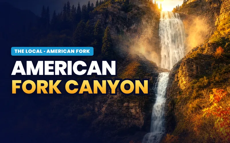 American Fork CanyonThe fee pass, the winter gates and the Timpooneke ticket.Read the guide
 Steel DaysEight days in July, named for the steel mill in 1945.Read the guide
 The Beach and Boat HarborA Utah Lake beach and boat launch, rebuilt and reopened in 2025.Read the guide
 Mary and Art Dye ParkBall fields, pickleball and disc golf on 1000 North, renamed in 2025.Read the guide
 Where the valley narrowsMain Street, the train station, and how the city plans to grow.Read the guide
Talk to Scott
Ready for your next step in American Fork?
My base is Southern Utah. So for an American Fork move, I connect you with a partner agent I trust for the work on the ground. I stay on your file for the homework and the loan side. You get a partner agent who knows the area, plus me in your corner.
How it works in American Fork
- A local agent on the ground.I connect you with a partner agent I trust near American Fork for the showings, the offer, and the closing.
- A second set of eyes.I stay on your file and do the homework on any home you are weighing, from the commute to the school boundaries.
- Real estate and lending, one person.I am licensed in both real estate and lending. On any one purchase I take one role. If I am your lender, I can tell you early if a home could be hard to get a loan on.
- A reply within one business day.Call or text, and I get back to you within one business day.
Or call me: (435) 357-4345I reply within one business day.

Referral disclosure. Outside Southern Utah, I connect home sellers and buyers with partner agents I trust in their area. If you choose to work with an agent I refer, that agent's brokerage pays my brokerage (Real Broker, LLC) a referral fee. The fee comes out of the agent's compensation; it is not an added cost to you. You are always free to choose any agent you wish, and using a referred agent is never required.