
Cache Valley Millville
A foothill town on Cache Valley's southeast edge
Millville, where the Face rises off the edge of town
About 2,200 people on the southeast bench of Cache Valley, tucked under the Millville Face on SR-165, with the mouth of Millville Canyon to the south and Logan ten minutes north. On calm evenings you can watch paragliders working the Face from the valley floor. Four pages on the town itself, with the wider valley written once and linked.
 By Scott Buehler, Moving Utah
Updated October 2026
By Scott Buehler, Moving Utah
Updated October 2026
The short answer
Millville is a small town on the southeast bench of Cache Valley, pressed up against the Bear River Range where SR-165 threads the south end of the valley. It began in 1860 as a mill settlement and kept the name long after the sawmill was gone. What stands out today is the mountain wall right behind it: the Millville Face, a steep west-facing ridge and a well known paragliding launch, with the mouth of Millville Canyon cut into the range just south. This hub is the map to four deeper pages on the town, and it hands the shared canyon, lake and ski country to the wider Cache Valley pages that every town in the valley draws on.
The shape of it
A compact grid on the valley floor, and the Face standing straight up behind it
Millville is small and easy to read. Its streets lay out as a tidy grid on the lower bench and floor at the southeast corner of the valley, hard against the base of the Bear River Range. SR-165 is the through road, the same corridor that ties the south-end towns together: a couple of minutes north to Providence and on to Logan, and south toward Hyrum. What ends the town on the east side is not another subdivision but the mountain itself. The last streets run out and the ground stands up almost at once into the Millville Face, so there is barely any transition between town and range.
The distinction that matters most here is which side of town you are on, floor or foot of the range, the same split that runs through the whole valley. The eastern streets sit right under the Face and lose the afternoon light early as the range throws its shadow, while the western edge opens out toward the farm ground and the long view across the basin to the Wellsville Mountains. The living in Millville page works through what daily life is actually like here, by housing stock and setting rather than by who lives where.
This hub stays at the level of the map and hands the detail to the pages below. The Face, the canyon and the trails behind town belong to the Millville Face and Canyon page. What there is to do around town, and the short drives to more, belong to things to do. The city parks, the ballfields and the rec programs belong to parks and recreation. And the practical side of a move, the prices, the neighborhoods for buyers and the school boundaries, lives on the Millville city guide.
The last streets run out and the ground stands up into the Face. That wall of the range behind town is the whole character of Millville.
The wider valley
The canyon, the lake and the ski hills are written once for every town in the valley
The big regional draws, up Logan Canyon, over to Bear Lake, the university that runs the local economy, and the mountain ranges on both sides, read the same from Millville as from anywhere else in the valley. So The Local gives each of them a single page at the valley level and links to it, rather than retelling it on every town hub. The six cards here are those pages. Millville's own four stay fixed on the Face, the canyon and the town.

Up US-89
Logan Canyon
The scenic byway up to Tony Grove and the summit, reached through Logan.
Read
Over the summit
Bear Lake
The bright blue lake and its roadside raspberry stands, up and over the canyon.
Read
The valley's engine
Utah State and Aggie country
The university that anchors the valley's economy, ten minutes up the road.
Read
The ski hills
Beaver Mountain and Cherry Peak
The valley's two family sized ski areas, both a short drive from the south end.
Read
The west wall
The Wellsville Mountains
The steep range across the valley, filling every west-facing view from town.
Read
Dairy and cheese
Cache Valley farm country
The working dairies, the cheese and the American West Heritage Center on the flats.
ReadYou reach all six from the Cache Valley region hub, the same page that lists every town in the valley.
The Millville companion
Four pages on the town itself, from the Face to the city parks
Everything The Local has written about Millville itself: what there is to do, the Face and the canyon standing behind town, the city parks and rec, and the lived texture of a small foothill town. Each is its own page, and this is the map to all four.

Things to do
Things to Do in Millville
What there is to do around the Face and the canyon, plus the short drives to more in the valley.
Read
Behind town
The Millville Face and Canyon
The steep west-facing ridge, the paragliding launch above it, and the trail up Millville Canyon.
Read
In town
Parks and Recreation
The city parks and ballfields, and the recreation programs that run through the year.
Read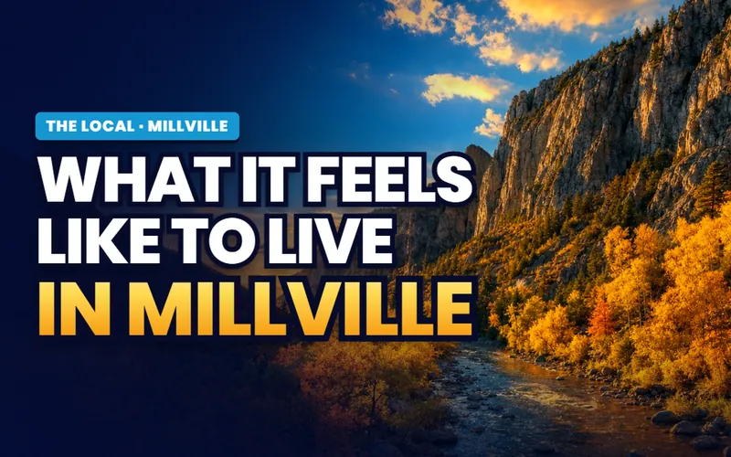
The lived texture
Living in Millville
Floor versus foot of the range, the winter inversion, schools, and the drive into Logan.
ReadThinking about a move, not a visit?
Prices, the neighborhoods buyers ask about, school boundaries and current listings all sit on the practical Millville city guide.
Scott Buehler
Moving Utah About Scott
Quick answers
Millville, answered
Millville is a small residential town on the southeast bench of Cache Valley, set right under the Bear River Range on SR-165. It takes its name from a sawmill built here in 1860, though no mill survives today. What people notice now is the skyline: the Millville Face, a steep west-facing ridge that rises straight off the edge of town, with the mouth of Millville Canyon cut into the range just south of it.
Millville sits on the southeast side of Cache Valley, at the foot of the Bear River Range, with Providence directly north and Nibley to the west. SR-165 runs through it and connects north to Logan, which is about ten minutes away. The town's elevation is roughly 4,643 feet.
From a sawmill. In the spring of 1860 settlers moved up from the Elkhorn Ranch to a mill built near the canyon mouth, and the ward that Apostle Ezra T. Benson organized that year took the name Millville. The town was incorporated in 1864. No mill stands today, and the name is the main thing that carries over from that first industry.
The 2020 census counted 2,222 people in Millville, which keeps it one of the smaller incorporated towns in Cache Valley. It has grown gradually as new subdivisions have filled in the bench between the older town center and the neighboring cities.
Millville falls within the Cache County School District. Children in town start at Millville Elementary, move up to the middle school the district's 2026-27 map assigns (Maple View Middle in Nibley opened that year), and finish at Ridgeline High School, which sits on Millville's south edge and draws from several towns at this end of the valley. Ratings, test scores and the current boundary lines are best read on an independent site like GreatSchools or Niche, then double checked with the district.
The Millville Face is the steep, west-facing wall of the Bear River Range that rises directly behind town. It is part of the Millville-Providence Wildlife Management Area and a well known paragliding launch, and on calm evenings you can watch gliders working the slope from the valley floor. The face and the canyon behind it get their own page on The Local.
Yes, in the open season. The Millville-Providence WMA on the range east of town is critical winter range for deer and elk, so the Division of Wildlife Resources closes it to all public entry through the winter and into spring most years to protect the animals. Check the current-year closure dates with Utah DWR before you plan a walk on the Face.
Yes. Logan is about ten minutes north on SR-165 and US-89, so Millville leans on Logan for its downtown, Utah State University, the regional hospital and most of its shopping. Providence, immediately north, has the nearest everyday stores. That short drive to a full-service city is a large part of what a small town like Millville offers.
Craig Jessop, the choral conductor who directed the Tabernacle Choir at Temple Square and later led the arts college at nearby Utah State University, grew up in Millville. The town stays proud of the connection.
A small town worth getting right
The questions Millville raises are mostly about the range at your back: how close to the Face you want to sit, whether the eastern streets in the mountain's shadow or the open western edge fits you better, how hard the winter inversion settles on the valley floor, and what living ten minutes out from Logan does to a daily routine. Tell me what matters most, and I will connect you with a Cache County partner agent who knows these streets, then stay with you through the research and the financing.
Or call Scott: (435) 357-4345or send Scott a message
Keep going
Continue your Millville research
Eight more doors into Millville, chosen for what this page covers.
Questions about Millville?
Call Scott, send a message, or find out what your Millville home is worth. No pressure, no obligation.
Referral Disclosure: For moves outside Southern Utah, I can connect you with trusted local agents. If you choose to work with one, their brokerage pays my brokerage (Real Broker, LLC) a referral fee from their commission. This costs you nothing extra, and you are never obligated to use my referral.