
City Moab, Grand County
Home of the Grand County offices, between Arches and Canyonlands on the Colorado
Moab, Utah, the red rock town between two parks
Moab is a red rock town of about 5,210 people at roughly 4,025 feet, wedged between Arches and Canyonlands on the Colorado River in the far southeast corner of Utah. The parks and the river drive a tourism and service economy that sets the rhythm of the year, and living here means working around the summer heat, a tight water supply, and a housing market priced by visitors rather than by local pay. Here is the honest read for anyone thinking about a move, plus every Moab page we have written.
 By Scott Buehler, Moving Utah
Updated October 2026
By Scott Buehler, Moving Utah
Updated October 2026
The short answer
For anyone weighing a move, Moab is a small red rock town that lives at the scale of the country around it. The 2020 census counted 5,366 people inside the city, yet within an hour of Main Street sit two national parks, a state park, a 9,000 acre slickrock reserve, a stretch of the Colorado River and a range that tops 12,700 feet. That mismatch is the whole story. The parks and the river pull in visitors by the millions, the visitors drive a tourism and service economy, and that economy sets home prices, wages, traffic and even how long the restaurants stay open. Living here rewards people who plan around the summer heat, respect a water supply with little slack in it, and confirm the rental and zoning rules on the exact parcel before they buy.
What follows is the shape of the place and the season that runs it, then a way into every deeper Moab page, from the parks and the river to the honest version of buying a home in a town this size.
The shape of it
Two parks, one river, and a mountain range for the hot months
Arches is the near one. The entrance station is roughly five miles north of town on US-191, close enough that the park is part of the week rather than an expedition, and it is the single reason a lot of people first come. It is also the piece of Moab whose rules change most often. In the busy season the park meters arrivals with a timed-entry reservation in some years and not in others, so the entry setup is worth checking fresh each year. The Arches page walks through how entry works, the two Fiery Furnace permits, and when the queue at the gate actually forms.
Canyonlands is the bigger and stranger one, and Moab meets it at Island in the Sky, a mesa standing on sheer cliffs more than a thousand feet above everything around it. The drive is US-191 north then UT-313 southwest, about 40 to 45 minutes on pavement. Off the rim edge falls the White Rim Road, a hundred miles of high-clearance four-wheel-drive track that people spend three days on. The Island in the Sky page takes the overlooks and the road below them.
Between the two runs the Colorado, and it is less scenery than the organizing fact of the valley. It carries the whitewater and the flatwater, two scenic byways, a potash operation and a rock art corridor, and for decades it carried something heavier: a pile of uranium mill tailings on its north bank, roughly sixteen million tons, now nearly all hauled thirty miles north to a disposal cell at Crescent Junction. The river page covers all of it.
The Needles is a different trip, and a different town
Canyonlands has three land districts and they do not connect to each other by road inside the park. Island in the Sky is Moab's. The Needles is reached from US-191 south and then UT-211 west, and the town that serves it is Monticello, about 54 miles down the highway. If the Needles, Newspaper Rock or the Indian Creek climbing is what you came for, plan the trip from there rather than from here, because doing it as a Moab day is three hours in the car before you have walked anywhere.
A town of five thousand people is the front door to two national parks, and the parks were here first.
The season
Spring and autumn are the peak, and July is a different town entirely
March through May and September through October are when Moab is at capacity. Lodging fills, Main Street backs up, the popular trailheads are full by nine in the morning, and the Arches entrance queue forms early even in a year with no reservation system. Those are also the best months to be here, which is exactly why everybody is.
Summer is hot in a way that changes the plan rather than merely the comfort. July averages a high near 99 degrees and many days pass 100, so the ordinary local pattern is to be out at first light, indoors or on the water through the afternoon, and out again at dusk. The other move is elevation: the La Sal Mountain Loop Road climbs out of the heat within half an hour. The La Sals page is the version of a Moab summer that works.
Winter is the quiet season and it is underrated. The parks stay open, the light is low and long, the crowds are gone, and the trails that are unbearable in July are pleasant. The trade is short daylight, cold nights, ice on north-facing slickrock, and a town where a share of the restaurants and outfitters have closed until spring. The ranked list flags which entries hold up out of season.
The monsoon is the hazard that catches visitors, not the heat. From roughly July into September, afternoon thunderstorms build fast over the plateau and drop water onto slickrock that absorbs none of it. A wash that is dry sand at noon can be running at knee height an hour later, and the storm producing it can be miles away and out of sight behind a cliff. Check the forecast before any canyon, slot or wash walk, and if water is rising, get to high ground rather than trying to outrun it downstream.
Good to know
Water, rentals, and the things Moab surprises people with
Start with the river, because a long cleanup is nearly finished on it. For decades a pile of Atlas uranium mill tailings, on the order of sixteen million tons, sat on the north bank of the Colorado just upstream of town. Almost all of it has now been hauled thirty miles north by rail to an engineered disposal cell at Crescent Junction, with a smaller volume of contaminated soil still to follow. That project is the reason for the freight trains, and the river page has the detail.
The harder story is water. Moab's drinking supply comes almost entirely from the Glen Canyon Group aquifer, and a 2020 estimate in the Journal of Hydrology put annual recharge to its deep portion at under 4,000 acre feet against roughly 3,600 acre feet already withdrawn each year across everyone drawing on it. Read those two numbers side by side and you have the whole growth argument in the valley, which is why conservation here is a rule rather than a suggestion.
The one a buyer meets first is nightly rentals. Both the City of Moab and Grand County have moved hard against new ones, and the rules turn on the exact zone and the exact parcel rather than on the neighborhood or the listing description. The mover page works through what that means in practice, alongside the gap between local wages and home prices, the utilities map, and the county line running through Spanish Valley.
| What people assume | What is actually true | |
|---|---|---|
| Arches entry | You always need a timed-entry reservation | Only in some busy seasons; check the park for the current year |
| Dead Horse Point | A national park pass covers it | It is a state park with its own separate gate fee |
| The White Rim | A capable crossover can do a bit of it | High-clearance four-wheel drive with low range, no exceptions |
| Sand Flats | A federal pass gets you in | It does not. Sand Flats charges its own day-use fee |
| Jeep Safari | It is one big Saturday | Nine days, with the crowd building all week |
| Nightly rental | Every Moab house can be one | Most cannot. It is decided parcel by parcel |
Six things worth confirming before you plan around them. Each one is covered on its own Moab page, with fees routed to the park or agency that sets them.
If you only have one day
One version of a good day out of Moab
First light
Be through the Arches gate by seven
Five miles north of Main Street, and the difference between arriving at seven and arriving at ten is the whole character of the visit.
The Arches page
Late morning
Walk out to Grand View Point
Forty minutes up UT-313 to a mesa standing a thousand feet above everything, with the White Rim laid out below and the river below that.
Island in the Sky
Afternoon
Climb the loop road out of the heat
Sixty miles from valley floor to aspen and back, and in July it is the only genuinely cool air within an hour of town.
The La Sals page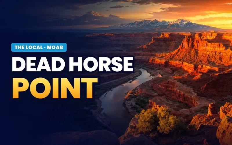
Sunset
Take the state park for the last light
Two thousand feet above a gooseneck of the Colorado, on its own gate fee that no federal pass covers, and the first Utah state park certified for its dark sky.
Dead Horse PointAll the Moab pages
Every Moab page, in one place
Everything The Local has written about Moab: the ranked list of what is worth a day, the park five miles north and how its entry works, the mesa forty minutes up the highway and the hundred mile road under it, the river and the two byways along it, the rock the bikes ride on and the fee system that pays for it, the nine days in spring that fill every room in town, the range that makes July survivable, the whole permit and fee picture in one place, the state park with its own gate, and the honest version of buying a home in a town this size with this much visitation.

Things to do
The top 11, ranked
ReadFive miles north
Arches National Park
ReadThe mesa
Canyonlands, Island in the Sky
Read
The river
The Colorado through Moab
Read
The rock itself
Slickrock and the Sand Flats
Read
Easter week
Easter Jeep Safari
ReadThe high country
The La Sal Mountains
Read
The paperwork
Permits, passes and entry
ReadThe state park
Dead Horse Point
Read
Moving here
Living with the season
Read
Scott Buehler
Moving Utah About Scott
Quick answers
Moab, answered
Two things: it is the closest town to Arches and Canyonlands national parks, and it is one of the best known outdoor towns in the country. The Arches entrance station is about five miles north of Main Street, and the Island in the Sky district of Canyonlands is about forty minutes up UT-313. Beyond the parks Moab is known for slickrock, both the 10.5 mile bike loop of that name and the wider rock the town rides and drives on, for the Colorado River running past it, and for the Easter Jeep Safari, a nine day off-road gathering ending on Easter weekend. Most local jobs come from the tourism and service economy those draws support.
This changes from one year to the next. Some busy seasons the park runs a timed-entry reservation booked on Recreation.gov, and some it does not, with the window and the hours shifting whenever it is in place. Look it up fresh before you plan a day around it. A valid entrance pass is always required either way, and a few things keep their own separate bookings no matter the timed-entry position: the Devils Garden Campground, the ranger-led Fiery Furnace hike and the self-guided Fiery Furnace permit. The permits page keeps the current fee and entry picture in one place.
Hot enough to change what you can do rather than just how comfortable you are. July is the hottest month with an average high near 99 degrees and many days above 100, with overnight lows in the 60s. Precipitation runs on the order of nine inches a year. The practical local pattern is to be out at first light and again at dusk, and to spend the middle of the day indoors, on the water, or up in the La Sal Mountains, where the loop road climbs into genuinely cooler air within about half an hour of town.
To Island in the Sky, yes. US-191 north and then UT-313 southwest is paved the whole way to the visitor center and along the mesa top scenic drive, so an ordinary car reaches Mesa Arch, Green River Overlook and Grand View Point with no trouble. What an ordinary car cannot do is leave the pavement. The Shafer Trail and the 100 mile White Rim Road below the rim require a high-clearance four-wheel-drive vehicle with low range, and the park states plainly that two-wheel drive and all-wheel drive vehicles lack both the ground clearance and the gearing.
No, and this is the most common fee mix-up in Moab. Dead Horse Point is a Utah state park, not a unit of the National Park Service, so an America the Beautiful pass or the local Arches and Canyonlands annual pass will not open the gate. It charges its own day-use fee, with a lower rate for Utah seniors and for motorcycles, and the state parks site carries the current amount. Camping and the yurts are reserved separately, and the park is usually full from March through November.
It runs for nine days and ends on Easter weekend, so the dates float from year to year with Easter. Registration and trail fees are handled by the Red Rock 4-Wheelers, and most trails take the better part of a day. If you are coming to Moab that week and not there for the event, it is the one stretch to avoid: lodging books out, Main Street slows to a crawl and the popular trails are spoken for.
Salt Lake City is roughly 234 miles and about four hours northwest. Canyonlands Field, the local airport with the code CNY, sits about 18 miles northwest of town with limited regional service that changes, so confirm current carriers before planning around it. Most people flying in use Grand Junction Regional Airport in Colorado, about 113 miles east and roughly an hour and three quarters away. There is no interstate through Moab; the nearest I-70 junction is at Crescent Junction about 32 miles north on US-191.
Assume not, until a planner tells you otherwise in writing. Inside the city limits the municipal code shuts nightly use out of most residential designations, leaving it to a small number of commercial and resort zones plus operations that were already legally established before the rules tightened. Outside the city, Grand County works through its zoning districts, an overnight-accommodations overlay and stretches when it has simply stopped accepting new overnight-accommodation applications at all. Every part of that turns on the individual parcel, so the answer worth having comes from Moab City Planning and Zoning, or Grand County Community Development for a county address, and it should arrive before an offer does.
Not really, and that is a matter of geography. Moab sits on the north side of this country: Arches, the Island in the Sky district of Canyonlands, the Colorado River corridor, the slickrock and the La Sals. The Needles district of Canyonlands, Newspaper Rock and Indian Creek are reached from Monticello, about fifty-four miles south, and Bears Ears National Monument and the Cedar Mesa country sit in San Juan County still farther south, reached from Blanding about seventy-five miles away. Both are long days from Moab and much shorter ones from the towns that serve them.
Thinking about a move to Moab?
Southern Utah is my patch and Grand County is not, so a Moab purchase runs as a partnership. A Moab area agent I trust does the walking, the neighbours and the local read. I stay on the file for the research, the paperwork and the lending. Two people examining the same house from two directions, and both of them work for you.
One role per purchase, never both. How I work has the detail.
Or call Scott: (435) 357-4345or send Scott a message
Keep going
Continue your Moab research
Eight more doors into Moab, chosen for what this page covers.
Questions about Moab?
Call Scott, send a message, or find out what your Moab home is worth. No pressure, no obligation.
Referral Disclosure: For moves outside Southern Utah, I can connect you with trusted local agents. If you choose to work with one, their brokerage pays my brokerage (Real Broker, LLC) a referral fee from their commission. This costs you nothing extra, and you are never obligated to use my referral.