
City Highland, Utah County
A bench that was claimed rather than laid out
Highland, and the shape a homestead left behind
19,348 people at the 2020 census on 8.64 square miles of bench at 4,876 feet, claimed under homestead patents from 1869, incorporated only in July 1977, and still carrying the spacing that a 131 acre average farmstead gave it. Seven pages on the city itself, including a pond with its own state monitoring page and a disc golf course the local club pays for, plus links to the region pages for the canyon, the mountain, the lake and the corridor.
 By Scott Buehler, Moving Utah
Updated October 2026
By Scott Buehler, Moving Utah
Updated October 2026
Start here
A bench town that got its shape from how it was claimed, not how it was planned
Highland occupies 8.64 square miles of dry bench between American Fork Canyon and the Lehi corridor, at 4,876 feet, and 19,348 people lived on it at the 2020 census. Almost every other town on this side of the valley was laid out as a village first, in blocks, around a center. Highland was not. Its own published history calls it a free-lance settlement rather than the result of a central mind, and the physical consequence of that is still legible from any street here.
The mechanism was the homestead. Patents were filed from 1869 onward and 28 of them were perfected by 1889, and because claimants picked their own ground rather than being assigned a lot, the farmsteads that resulted averaged 131 acres against ten acres or fewer in the settled towns below. That is why there is no Main Street to walk here, why the houses sit far apart, and why a modern subdivision on this bench still feels like it was spaced by somebody counting fence posts.
For a very long time almost nobody lived on it. The bench counted 88 residents in 1880, 195 by 1900 and 310 by 1940, and it did not incorporate until July 13, 1977, with 2,142 acres. Everything that makes the city recognizable now, the parks, the paved corridor across its middle, the celebration at the end of July and the code that keeps the lots large, arrived inside one working lifetime after that.
Highland at a glance
19,348
people at the 2020 census
8.64 sq mi
of bench, at 4,876 feet
1977
incorporated on July 13, with 2,142 acres
25
city parks, and 18.4 miles of trail
The public estate
Four addresses carry almost everything a visitor to Highland would drive for
Highland has no commercial center to wander and no ticketed attraction of any kind. What it has instead is a set of city owned addresses, each with its own hours, its own fee position and its own season. Sort which one you want before you set off, because they sit at four different corners of the same small city.
| Highland Glen Park | Beacon Hill Park | Mitchell Hollow Park | The Town Center splash pad | |
|---|---|---|---|---|
| What is actually there | A pond stocked as a state community fishery, a small sand beach, sand volleyball, a 100 person pavilion and a trailhead | An 18 hole disc golf course with two tees per basket, plus a nine hole putting course by the parking lot | A covered pavilion, a playground, restrooms, a ball diamond, a paved loop, open field and the city's second trailhead | A recirculating pad north of City Hall, with no pool and no lifeguard |
| Where | 4800 Knight Avenue, immediately south of the high school | 5959 West Beacon Hill Boulevard, on the west side | 6400 West 10250 North | 5400 West Civic Center Drive, about 10800 North 5400 West |
| When it works | Daily 8am to 9pm; the water question is seasonal | Year round, though the restrooms and drinking water shut from October to April | Daily 7am to 9pm; the diamond is Monday to Saturday | Memorial Day to Labor Day, Monday to Saturday 10am to 8pm |
| What it costs | No entrance fee is advertised; the pavilion is bookable at a published rate | Free to play, both courses | No entrance fee is advertised; the pavilion and the diamond are bookable | No admission fee |
| The page | Highland Glen Park | Beacon Hill Park | Mitchell Hollow | Inside the ranked list |
Municipal hours and seasons reset every year, and the splash pad in particular closes on the weather as well as the calendar, so check Highland City's own page for the date you are traveling rather than a listing site.
Three of these four switch off, and two of them switch off while the weather is still hot. The splash pad runs only from Memorial Day to Labor Day and shuts every day between 2:50 and 4pm for cleaning, and it closes outright below 75 degrees, in high wind and in a thunderstorm. Beacon Hill keeps its course open all year but locks the restrooms and the drinking water from October to April, which changes what a summer round taught you to expect. And the swimming question at Highland Glen is decided by state and county water quality sampling rather than by the gate, so it can change inside two weeks in midsummer. None of the three announces any of this on site.
The corridor across the middle
Two trailheads in one city, which no other town on the route has
The paved county corridor that runs the length of the north valley crosses Highland along its bench, and this city puts two of its own parks on it. Highland Glen Park opens onto it at the eastern end of town off the Alpine Highway, and Mitchell Hollow Park opens onto it at 6450 West 10400 North, roughly two and a half miles west. Every other city on the route manages one door. What that buys a Highland address is the ability to start a ride at one park, finish at the other and never see the same ground twice.
Everything else about that corridor belongs to seven cities rather than to this one. Its length, the enclosed aqueduct buried under the asphalt, the underpasses that carry it beneath the arterials, its junctions at either end and the rules that govern riding it are covered on the Murdock Canal Trail page. Highland is one of seven cities along it.
What is genuinely Highland's, and what almost nobody outside the city knows about, is the dirt hanging off it. In the Dry Creek gulch on the northwest side, downhill of a flood control dam beside the paved corridor, there are about four miles of singletrack ridden as tangled loops with names like Bonzai, Adrenaline, Machette, Shotgun and Greg's Trail. The Lone Peak High School mountain bike team built the network in the summer of 2016 with help from Eagle Scout projects, and the usual way in is to pedal about eight tenths of a mile from a paved trailhead and drop off the rim rather than to drive to it. The ranked list carries the approach and the season.
One thing these pages deliberately do not claim is a stretch of the Bonneville Shoreline Trail. The bench trail exists in Utah County in disconnected pieces and no source places a maintained segment inside Highland city limits, so the honest position is that Highland reaches the foothill network through its neighbors rather than owning a piece of it. Anyone who tells you otherwise is describing somebody else's city.
A city of about 21,600 people with two doors onto the same seventeen mile corridor, and about four miles of its own dirt hanging off the side of it.
What belongs to the valley
The canyon at the east door is not this city's to describe
Nineteen towns share this valley, and the biggest things any of them can see from a window belong to all of them. The canyon that opens at Highland's eastern edge, the mountain above it, the lake at the bottom of the bench and the corridor across the middle each have their own region page, linked below.
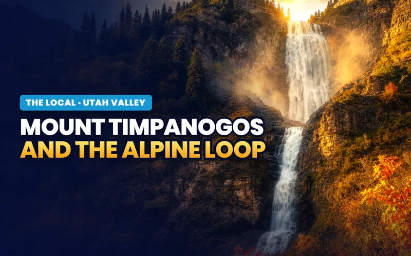
The mountain
Timpanogos and the Loop
SR-92 leaves Highland's east side and becomes the seasonal loop: the gate, the ticketed cave, the summit routes and the color drive.
Read the guide
The corridor
The Murdock Canal Trail
Seventeen paved miles laid over an enclosed aqueduct, through seven cities, of which Highland holds the highest ground.
Read the guide
The water
Utah Lake
The body of water at the bottom of the bench, its advisory system, its recovery and the five developed doors onto it.
Read the guide
Days out
Family weekends in Utah Valley
What a day out in this valley actually costs and when it runs, sorted so nobody drives to a closed gate.
Read the guideThe other three valley pages are further from this bench. Two of them are drives: a canyon road on the far side of the county with a waterfall and a ski resort along it, and a byway at the south end that spends most of the year behind a gate. The third is not a place at all but a pair of institutions, treated strictly as buildings and calendars, which matters here mainly for what it does to traffic on a game weekend. The full set of seven is indexed on the Utah Valley hub.
If you only have one day
One version of a good day on this bench

First thing
Play the west side while it is cool
Eighteen holes with two tees to a basket, on ground steep enough that the round is the exercise. It is free and it is empty at eight in the morning.
The course page
Late morning
Cross to the hollow
A pavilion, a paved loop and the ground where a dip in a country road gave this city the name of its celebration.
The hollow page
Afternoon
Take the rods to the pond
A state listed community water with trout and catfish in it, a small sand beach, and a paddle out if the water is reading clean that week.
The park page
Anything left
Work down the ranked nine
Nine entries in the order that keeps the car doing least, each with its operator, its fee position and its published season named.
The ranked listThe rhythm
Three days at the end of July, and a watering argument that runs the rest of it
The civic year here has one immovable point and it is the last weekend of July. The Highland Fling ran Thursday, July 30 to Saturday, August 1 in 2026 at Heritage Park on the Alpine Highway, with a car show and a firemen's dinner on the Thursday, a luau and a strongman competition on the Friday, and a Saturday that starts with a 5K at seven in the morning, runs a parade at nine and a full day of Scottish heavy athletics behind it, and finishes with fireworks at ten at night. The Fling page carries the three days and the naming.
The second thing that shapes a Highland year is water, and it is an argument rather than a date. This city runs treated water indoors and a separate pressurized system for everything outdoors, which is how acre lots stayed green here for decades. That outdoor system has been under drought pressure, and the clearest public sign of it in 2026 was the council keeping the Town Center splash pad running specifically because it draws on culinary water rather than the irrigation system, and recirculates what it uses.
Everything else is a shorter season stacked inside those two. The splash pad opens at Memorial Day and closes at Labor Day. Beacon Hill plays all year but loses its restrooms and its drinking water from October to April. The dirt in the Dry Creek gulch rides roughly March to December. The pond keeps the same hours in every month and changes character entirely, from a fishing water in April to a swimming argument in July to a quiet loop walk in November.
Two things run the Highland calendar: the last Saturday in July, and whatever the outdoor water is allowed to do that summer.
The Highland companion
Seven pages, and none of them borrows the canyon next door
Everything on Highland itself: the ranked nine, the pond that carries its own state monitoring page, the disc golf hill on the west side, the three days at the end of July, the hollow that gave the celebration its name, and the honest version of what a large lot code means when you are buying under it.


Scott Buehler
Moving Utah About Scott
Quick answers
Highland, answered
For large lots and for a celebration that leans into its name. Highland sits on 8.64 square miles of bench between American Fork Canyon and the Lehi corridor, it zones its residential ground for large parcels, and it has no traditional Main Street at all. Locally it is known for the Highland Fling at the end of July, which runs genuine Scottish heavy athletics including a state hammer championship, for a stocked pond at Highland Glen Park, for a free 27 basket disc golf course on the west side, and for holding two separate trailheads on the county's paved bench corridor.
19,348 people at the 2020 census, on 8.64 square miles at about 4,876 feet. The growth is recent and it is steep: the bench counted 88 residents in 1880, 195 by 1900 and 310 by 1940, and the city did not incorporate until July 13, 1977, when it took in 2,142 acres. Almost everything a visitor sees here, the parks, the paved corridor, the celebration and the subdivisions, was built inside one working lifetime after that incorporation date.
It is easier to list what is not. Four things in this city carry a price: a pavilion or a ball diamond booked through the city, a night at the municipal campground, a state fishing license if you intend to keep anything out of the pond, and the ticketed pieces of the July celebration. Everything else here, including twenty seven disc golf baskets, the splash pad by City Hall, the singletrack in the gulch and the paved corridor with both of its parking lots, costs nothing at all.
The end of July into the first day of August. In 2026 it ran Thursday, July 30 to Saturday, August 1 at Heritage Park, 10400 North Alpine Highway, with the Thursday billed as Kickoff Night, the Friday as Luau Night and the Saturday as Celebration Day. Saturday is the big one: a 5K at seven in the morning, a grand parade at nine, Scottish Highland Games from nine until five, vendors until ten at night, and a fireworks finale at ten. Highland City publishes the running order each year and the individual times move.
Yes, and under the state's own community fisheries program rather than as an informal city pond. Trout and catfish are put in by the Utah Division of Wildlife Resources, other species are present as well, and the rules that come with that status are tighter than reservoir rules: a small daily limit, a state license at the usual ages, bank fishing only, and no access outside park hours. Read the current state guidebook for the season you are fishing, because Utah resets its rules annually.
There is a small imported sand beach and there is no lifeguard, so swimming is at your own risk, and the more important answer is that the water quality question is decided elsewhere. Highland Glen Reservoir sits on the Utah Department of Environmental Quality's recreational monitoring program with its own results page, and it has carried both E. coli advisories and a harmful algal bloom warning advisory in warm months. Advisories come and go through the season, so check the state page for the week you are going.
Yes, and Highland is the only city on the route with two of its own trailheads on it. Highland Glen Park opens onto the corridor at the eastern end of the city off the Alpine Highway, and Mitchell Hollow Park opens onto it at 6450 West 10400 North about two and a half miles west. The corridor itself is shared by seven cities, so its full length, the enclosed aqueduct beneath the asphalt, its underpasses and its riding rules are covered on the Murdock Canal Trail page.
Yes, in a gulch inside the city rather than up a canyon outside it. A school team put in the network on the northwest side in 2016 with help from Eagle Scout projects, and what stands there now is roughly four miles of loops on ground that drops away below the paved bench corridor. It rides from beginner doubletrack to genuinely technical, the season is roughly March to December because the dirt holds water, and the sensible arrival is on a bicycle rather than in a car.
Half a day covers the city honestly. The four addresses worth a stranger's time, the disc golf hill on the west side, the hollow in the middle, the pond in the east and the splash pad by City Hall, sit inside 8.64 square miles and none of them is more than about ten minutes from any other. What half a day does not absorb is the last weekend of July, which is its own trip, or the canyon at the eastern edge, which is a national forest with its own fees, its own gate season and its own page.
Seven pages on the city, and seven more on the valley it sits in
A visit here asks which park to start at. A move asks harder questions: which of the three residential zones a parcel sits in and what the code actually requires of it, whether the pressurized irrigation service is connected and what the metering program does to it, how a lot meets the foothill edge and the drainages, and what the Town Center zoning near City Hall allows on the ground beside it. Tell me what you are weighing and I will put you with a Utah County partner agent who works this bench, and stay on the file for the financing side.
Or call Scott: (435) 357-4345or send Scott a message
Keep going
Continue your Highland research
Eight more doors into Highland, chosen for what this page covers.
Questions about Highland?
Call Scott, send a message, or find out what your Highland home is worth. No pressure, no obligation.
Referral Disclosure: For moves outside Southern Utah, I can connect you with trusted local agents. If you choose to work with one, their brokerage pays my brokerage (Real Broker, LLC) a referral fee from their commission. This costs you nothing extra, and you are never obligated to use my referral.