
City Santaquin, Utah County
A town that was called Summit City before it was called anything else
Santaquin, and the divide it was built on
13,725 people at the 2020 census, at 4,987 feet on the summit that separates Utah Valley from Juab Valley, with a city limit that laps south over the top into a second county. This is the working orchard that pulls traffic off the freeway, the canyon that spent seven winters closed and reopened in 2025, and the practical shape of the last town before the valley ends and the fruit corridor begins.
 By Scott Buehler, Moving Utah
Updated October 2026
By Scott Buehler, Moving Utah
Updated October 2026
Start here
The road stops climbing here and that is the whole explanation of the town
Drive south down I-15 out of Provo and the valley narrows for twenty miles until the ground quietly rises under the freeway and the mountains close in on both sides. The high point of that rise is Santaquin, and the settlers who arrived at the end of 1851 named the place for exactly that: Summit City, for the summit dividing Utah Valley from Juab Valley to the south. The name lasted five years. The geography has not moved since.
Everything else follows from being the last place before the ground tips the other way. The city limits lap over the top and take in a piece of Juab County, so the town is legally in two counties while feeling entirely like one. The benches that catch the late sun on either side of the divide grow tart cherries and peaches, which is why a farm is the busiest address in town. And the drainage behind the houses, Summit Creek out of Santaquin Canyon, is the reason there was ever water enough to plant them.
Two of those things are in the middle of changing. The canyon spent seven winters closed and came back in 2025, and the orchards sit in the path of some of the fastest percentage growth in the state. Both of them shape what a visit here, and a move here, look like right now, and each piece behaves differently month to month.
Santaquin at a glance
13,725
people at the 2020 census
4,987 ft
on the divide between two valleys
1851
settled from Payson, and called Summit City
2
counties the city limits sit in
The public estate
Four places worth the exit, and every one of them keeps a different calendar
Santaquin has no ticketed attraction open every day, no gallery district and no commercial street a visitor parks on for its own sake. What it has is four addresses where something genuinely happens, and the reason to sort them before you drive is that not one of them is available on the same days as the others.
| Rowley's Red Barn | Santaquin Canyon | Orchard Days | The Chieftain Museum | |
|---|---|---|---|---|
| What is actually there | A working orchard with a store, an ice cream counter, a cider mill and a large outdoor activity area behind it | A paved forest road up Summit Creek to a campground at about 7,000 feet, with limestone crags either side of it | The city's own celebration: two parades, two rodeo nights, tournaments, a quilt show and fireworks twice | Fifteen themed rooms in the 1903 school building, with pioneer cabins standing beside it |
| Where | 901 South 300 West, on the south side of town | Forest Road 14, reached from I-15 exit 244 by way of Highland Drive | Main Street, Centennial Park and the rodeo grounds | In the old blocks near the city offices, on Center Street |
| When it works | Year round for the store; the big season is the Fall Festival from 19 September to 30 October 2026 | Roughly Memorial Day until about the first of December, when the gate at the Trumbolt picnic area closes | Eight days at the start of August; 1 to 8 August in 2026 | By arrangement rather than by walk in, which is why the telephone number matters more than the hours |
| What it costs | Nothing to enter the store; Fall Festival admission ran $12 midweek and $15 Friday and Saturday in 2026 | Nothing to drive; Tinney Flat camping is booked and paid through Recreation.gov | Free to attend most of it; the rodeo nights are ticketed | Tours are free |
| The page | Rowley's Red Barn | Summit Creek Canyon | Orchard Days | Inside the ranked list |
Addresses hold, but seasons and prices move, and the 2026 dates and prices above are shown to give you the shape of a normal year. Festival dates change every year and the canyon gate follows the weather, so confirm the exact week on the operator's own page before you drive.
There is no apple picking in Santaquin in 2026, and the reason is the same one that emptied the cherry plant. A hard spring frost cost the town its u-pick season: Rowley's has cancelled its Harvest Festival for 2026 and the pick your own apple experience with it, Openshaw Acres has its u-pick orchard closed this year, and Cherry Hill Farms is not running peach or apple u-pick this season either. The Fall Festival, the corn maze, the pumpkin patch and the store are all still open. If your plan was a bag of apples off a Santaquin tree in October, make it a stand purchase instead and call the farm before you go, because a frost like this can happen in any spring.
The canyon
Seven winters shut, and open again since 2025
The single biggest change to what you can do in Santaquin happened in the spring of 2025, and it is recent enough that a lot of what you will still read says the canyon is closed. Santaquin Canyon, the drainage directly behind the houses, was closed by the Forest Service in the fall of 2018 after the Pole Creek and Bald Mountain fires burned the slopes above it. The following winter the burned ground let go: an avalanche came down dragging logs and debris, the creek was blocked, bridges were damaged and the road was washed out in places.
It stayed shut for roughly seven years. Reopening it took federal highway money rather than Forest Service money, and the road was partly open around Memorial Day 2025 and fully open by early that June. It has now had a full season of ordinary use, so if an older write-up tells you the canyon is closed, that is the news that has not caught up. The canyon page covers the closure, the repair, Tinney Flat, the climbing and the winter gate in full.
What the canyon is not is a way up the peak that shares the town's name. Santaquin Peak stands over the valley at 10,685 feet and is the pointed summit most of southern Utah County actually looks at, but the signed trail to it leaves the Mount Nebo Scenic Byway up Payson Canyon, one drainage north. The mountain is covered on Elk Ridge's mountain page and the road side of the approach on Salem's canyon page.
That byway is nobody's in particular either. Santaquin Canyon reaches it about four and a half miles above Tinney Flat, which makes this town a back entrance rather than a front door, and the road it joins runs shared from Payson through to Nephi. Its length, its stops and its gate season are covered on the Nebo Loop page.
A town can lose its own canyon for seven years, get it back, and still turn up in older write-ups as the place with the road that is closed.
What belongs to the valley
The byway, the lake and the wet Saturday belong to the whole valley
Santaquin holds the bottom corner of a valley with nineteen towns in it, and the largest things anybody here can point at are shared. The scenic road over the range, the water at the far end of it and the indoor options a February weekend needs each get their own page, so you get the full version rather than a thin summary here.

The drive
The Nebo Loop
The byway Santaquin Canyon joins from underneath, its overlooks, its red rock surprise and the gate that governs the whole calendar.
Read the guide
Days out
Family weekends in Utah Valley
Nine outings priced and dated against each other, which is what a rainy Saturday at this end of the county actually needs.
Read the guide
The water
Utah Lake
The lake west of here past Genola and Goshen, its advisory system, its restoration work and the developed ways onto it.
Read the guide
All of it
Utah Valley on The Local
Every town in this valley and every subject they share, listed together so you can see what sits next door.
Open the hubThree more valley subjects sit at the far end of the county from here. Two of them are canyons up at the top of the county, which from a house in Santaquin is a deliberate outing rather than an evening. The third covers two university campuses purely as buildings, venues and a term calendar, and its practical use down here is knowing which Saturdays fill the northbound lanes with people going to a stadium. All of them are listed on the Utah Valley hub.
If you only have one day
A day here runs uphill in the morning and downhill to the fruit
First thing
Drive up before the day heats
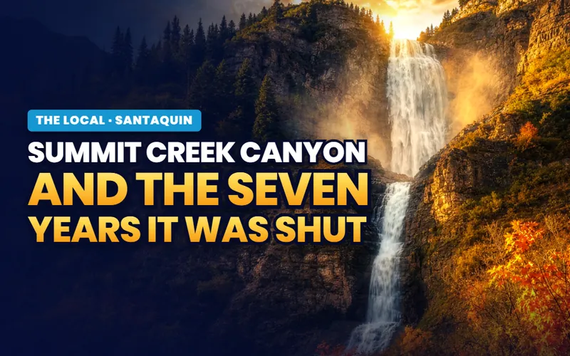
Six and a half paved miles of steep, narrow forest road to a campground in cottonwoods at about 7,000 feet, with the wilderness boundary a couple of hundred yards off the south side of it.
The canyon page
Late morning
Work the stands along the highway
A short corridor of family orchards on US-6 and SR-198 selling peaches, apples and tart cherries out of sheds, with the arithmetic of a bad crop year written all over it.
The fruit page
Afternoon
Give the farm two hours
A store with a cider mill and an ice cream counter at the front, and a ten acre corn maze, a six acre pumpkin patch and a large activity area behind it from the middle of September.
The farm page
Anything left
Work down the ranked seven
The whole town in seven entries, sorted so a half day covers most of it, with the operator, the month and the fee written next to each one.
The ranked listThe rhythm
Four moments carry the year, and a late frost can cancel two of them
The first is the middle of April, when the benches go white and pink and people drive the orchard roads for no reason other than to look at them. Rowley's runs a Blossom Festival in that window. It is the shortest of the four and the only one nobody organizes, since the trees do it whether or not anybody turns up.
The second is the first week of August. Orchard Days ran from 1 to 8 August in 2026 with a 5K and a children's rodeo to open it, a children's parade and a concert on the Monday, tournaments through the middle of the week, rodeo nights on the Friday and Saturday with fireworks at half past ten on both, and the grand parade up Main Street on the Saturday morning. The Orchard Days page carries the full slate, what is ticketed and the name the celebration used to have.
The third is the harvest, roughly from the middle of August into October, and 2026 is the year to state plainly rather than to skate over. A warm winter pushed bloom about a month early and mid April frosts killed the blossom, which took out Utah's tart cherry crop almost entirely and cancelled apple picking across the town's farms. The fruit stands page sets out what that means for a visit, and what a normal year looks like.
The fourth is winter, and it is the one that surprises people. The canyon road gates at the Trumbolt picnic area around the first of December and stays shut until spring, which means the drive, the campground and the summer climbing all go away together. What replaces them is a genuinely serious ice climbing season from about the middle of December through February, walked or skied in from the gate, on flows and seeps that form on the shaded south wall of the canyon.
Two of the four things this town does each year depend on what the weather did in April, and in 2026 the weather said no.
More on Santaquin
The rest of Santaquin, page by page
The rest of what there is to do and know in Santaquin itself: the ranked list of things to do, the farm that draws the traffic, the canyon that spent seven winters shut, eight days of celebration in August, the fruit corridor and the crop that failed on it, and the practical shape of living on a divide between two counties.


Scott Buehler
Moving Utah About Scott
Quick answers
Santaquin, answered
Fruit, and for sitting on a summit. Santaquin holds the south end of Utah Valley on the divide separating it from Juab Valley, which is why the settlers of 1851 called it Summit City before the name changed in 1856. The benches around it grow tart cherries, peaches and apples, the town's August celebration is called Orchard Days, and the busiest single address in it is a working orchard with a store and an activity field behind it. Behind the houses is Santaquin Canyon, which reopened in 2025 after seven years shut.
Mostly Utah County, and partly both. Santaquin is a Utah County city and its addresses, its county services and its school district all run through Utah County. The municipal boundary, however, extends south over the divide and takes in a piece of Juab County, so the city limits sit in two counties at once. The next settlements south on I-15, Mona and then Nephi, are entirely in Juab County, which is the practical sense in which Santaquin is the last town in Utah Valley.
For a Ute man named Santaquin, in the story the town has always told. In it, Chief Guffich came quietly to warn the settlers' leader, Benjamin F. Johnson, of a planned raid by young men that included Guffich's own son Santaquin; the settlers left the fort in time, and afterward offered to name the town for Guffich himself. He declined, and asked that it carry his son's name instead. It is a settler-told account of a Ute story, worth taking as that. The town's earlier name was Summit City.
Yes, since 2025, and seasonally rather than year round. The canyon was closed by the Forest Service in the fall of 2018 after the Pole Creek and Bald Mountain fires, and the following winter an avalanche off the burned slopes blocked the creek, damaged bridges and washed out the road. Repairs took federal highway money and about seven years. The road was partly open around Memorial Day 2025 and fully open by early that June. It gates for winter at the Trumbolt picnic area around the first of December.
No. A hard spring frost cost the town its u-pick season. Rowley's Red Barn has cancelled its Harvest Festival for 2026 and the pick your own apple experience with it, Openshaw Acres has its u-pick orchard closed this year, and Cherry Hill Farms is not running peach or apple u-pick this season either. What is still open is the Fall Festival at Rowley's from 19 September to 30 October, the corn maze and pumpkin patch behind it, and fruit bought over a counter at the stands rather than off the tree.
The first week of August, and it runs eight days rather than a weekend. The 2026 edition ran from 1 to 8 August, opening with a 5K and a children's rodeo on the Saturday, a children's parade and a concert at Centennial Park on the Monday evening, sports tournaments and a quilt show through the middle of the week, rodeo nights on the Friday and Saturday with fireworks at about half past ten on both, and the grand parade up Main Street at nine on the closing Saturday. Dates shift each year, so check the city's own schedule.
No. The celebration began as Cherry Days, was known for a time as Santaquin Days, and took the name Orchard Days in 2010 so that it represented all the fruit grown around the town rather than the cherries alone. The Cherry Pit Spit survived the rename and is still one of its signature events. The name change is a small thing that says something accurate about the place: the tart cherry is the commercial crop, but peaches, apples and pears are what most of the roadside trade is actually built on.
Not by any signed route, which catches out a lot of people. Santaquin Peak stands at 10,685 feet and is the summit most of southern Utah County looks at, but the signed trail to it leaves the Mount Nebo Scenic Byway up Payson Canyon, a drainage to the north, and it is confusingly signed as the Loafer Mountain Trail. Santaquin Canyon behind the town leads to Tinney Flat, the Mount Nebo Wilderness boundary and a junction with the byway, not to the peak. The mountain and its route are covered in full on the Elk Ridge and Salem pages.
For a couple of hours most of the year, and for a whole day in the first week of August or in October. The honest shape of it is a working orchard with a store and an activity field that is genuinely worth the exit, a paved canyon road behind the town that was unavailable for seven years and is now not, a small free museum in a 1903 school building that runs on volunteer arrangement rather than posted hours, and a short corridor of family fruit stands on the highway. What it does not have is a commercial street, a gallery district or an attraction open every day.
Weighing a move to Santaquin? Start with someone who knows the south end of the valley
A visit here is a canyon in the morning and fruit on the way home. A move here asks different questions: which side of the divide a parcel sits on and what that does to the county line, how close it is to the freeway interchange, whether the ground around it is still orchard or already platted, and what a growth rate in the state's top ten means for a street that is still being built out. Tell me what you are weighing and I will put you with a Utah County partner agent who works the south end of this valley, and stay on the file for the financing side.
Or call Scott: (435) 357-4345or send Scott a message
Keep going
Continue your Santaquin research
Eight more doors into Santaquin, chosen for what this page covers.
Questions about Santaquin?
Call Scott, send a message, or find out what your Santaquin home is worth. No pressure, no obligation.
Referral Disclosure: For moves outside Southern Utah, I can connect you with trusted local agents. If you choose to work with one, their brokerage pays my brokerage (Real Broker, LLC) a referral fee from their commission. This costs you nothing extra, and you are never obligated to use my referral.