
City West Bountiful, Davis County
The flat, valley-floor town on the old onion ground west of the Bountiful bench
West Bountiful, the flat town on the old lake floor west of the bench
About 5,900 people on 3.31 square miles of valley floor at roughly 4,232 feet, a good thirty to sixty feet below Bountiful on the bench. This is old lake bed and old farm ground: the sweet Spanish onion fields that gave 800 West the name Onion Street, a city golf course that is most of the open space in town, and a refinery and an industrial edge along the west side. Seven pages on the city itself, plus the county subjects an address here actually uses.
 By Scott Buehler, Moving Utah
Updated October 2026
By Scott Buehler, Moving Utah
Updated October 2026
The short answer
West Bountiful is the flat, valley-floor town of about 5,900 people on the west side of the Bountiful bench, seven miles north of Salt Lake City. It sits on old lake bed and century-old farm ground, not on the bench, and that flat ground explains almost everything about it: the onion fields that named Onion Street, the wetlands and the Legacy Parkway along the western edge, a city-owned golf course that is most of the open space, and a refinery and an industrial strip at the south and west. Three regional facilities sit inside the town under other towns' names. This hub is the map to seven deeper pages on the city, and it hands the canyons, the island and the county's big attractions to the wider Davis County pages that every city here shares.
Buying or selling in West Bountiful?
Start here
This is the flat town, and the flat ground explains almost all of it
Start with the ground, because it explains West Bountiful faster than any tour of the streets. This is the flat town: 3.31 square miles of old lake bed on the valley floor, a good thirty to sixty feet below Bountiful on the bench to the east. For a century it was farm ground, and more than a third of it still is, out on the west side between the last streets and the Legacy Parkway. The bench cities to the east open onto canyon mouths. West Bountiful opens onto wetlands and a parkway, and the difference in the ground is the difference in the town.
The flat ground is also why the big regional machinery ended up here. A 45,000 barrel a day oil refinery runs either side of 800 West at the south end of town, the one almost everyone calls the Woods Cross refinery. A landfill named for Bountiful and the South Davis sewer plant sit on the west side too. Three pieces of regional infrastructure inside a residential town of under six thousand people, and each one wears a neighbor's name. The refinery predates the town by seventeen years, which is the plain reason it carries the wrong city's name.
The other thing the flat ground gave the town is a golf course. Lakeside Golf Course covers about 114 acres, more than all four of the city's parks put together, and the city runs it as a department. So most of the open space in West Bountiful is one municipal course on the old fields, with a single community park beside the freeway doing the rest. And the town has nearly run out of room: other than the far west side, the vacant land is mostly gone, and the population has leveled off just under six thousand.
West Bountiful at a glance
5,917
counted at the 2020 census
3.31 sq mi
of flat valley floor at about 4,232 feet
114 acres
the city golf course, most of the town's open space
1848
the year the farms here were first settled
The land
A sixth of this town is industrial and more than a third of it is still farmed
Call West Bountiful a suburb and you miss it. The town has tracked how its ground is used for decades, and the shape is unusual for a place this close to Salt Lake City: farmland is still the largest single use, industry is next, and houses come only third.
| Share of the town's land | 1978 | 1990 | 2019 |
|---|---|---|---|
| Agriculture | 38.8% | 21.9% | 36.8% |
| Industrial | 8.4% | 9.3% | 16.4% |
| Residential | 21.7% | 23.4% | 15.3% |
| Commercial | 2.1% | 3.3% | 4.9% |
| Public and parks | 5.2% | 6.8% | 4.1% |
The town grew between the surveys, so read the rows across as the shape of the place rather than as a tidy trend. Prices and current listings live on the practical city guide.
Two other facts finish the picture. West Bountiful has only two through streets running north to south west of the freeway, 800 West and 1100 West, and one of them runs straight through the refinery. The town names that shortage of north-south routes as its main traffic problem, and it is nearly out of room to fix it: other than the far west side, the vacant land is mostly gone, and no development is allowed west of the Legacy Parkway at all.
Almost all of the town's shops sit east of Interstate 15 along 500 West, the old US Highway 91, on the far side of the freeway from the houses. West Bountiful is largely a bedroom community whose retail strip still serves a good part of southern Davis County, and the two sit deliberately apart, because the town decided long ago that commercial ground belongs on the outer edges.
Even the way across town on foot is borrowed. The regional trails here run on old rail grades and canal banks: the Legacy Parkway Trail along the western edge, the Prospector Trail on an abandoned railroad grade, and the Onion Parkway Trail on a canal bank. Nearly every path in town used to be something else, which is a very West Bountiful way to get around.
One last small thing, and it says as much about the scale of the place as any acreage figure. City Hall at 550 North 800 West keeps a four and a half day week, and the same 2006 building houses the town's own police department. A town of fewer than six thousand people running its own force out of the same building as the mayor's office, closing at three on a Friday, is a specific kind of place and worth knowing before you need either of them.
The long view
Settled in 1848 as farm ground, a city only a century later, and named twice along the way
West Bountiful was settled in 1848, when Bountiful expanded west onto the flat in search of farmland. The households here worked their own fields rather than commuting out from a village center, so the town never followed the standard Utah town grid. It grew instead as a line of farms strung along two roads, 800 West and 400 North, a pattern you can still read today in the long lots and the old houses.
The ground was fertile and well watered by artesian wells and mountain streams, and for decades it grew produce hauled by wagon into the Salt Lake City markets: corn, wheat, beets, carrots, cabbage, squash, watermelons and onions. The money shows up in the buildings, and in one kind in particular. West Bountiful is known for large two story brick carriage barns standing behind its Victorian farmhouses, a collection unlike anywhere else in the state.
Then the onions. West Bountiful became a major producer of sweet Spanish onions in the 1920s and 1930s, and 800 West became Onion Street. The name has outlived the crop by about ninety years. It survives in the old district's boundaries, in an adopted town plan to put the original names back on street signs, in the Onion Parkway Trail on its canal bank, and in a Christmas event the arts council helps run at City Hall. The Onion Street page carries the district, the houses and the dates.
The civic dates are late and precise. West Bountiful became a town on 28 January 1949, a hundred and one years after the first farms, and a third class city on 12 November 1962. Both came after the refinery was built in 1932, which is the plain reason the plant carries the neighbor's name: when it went up, there was no West Bountiful to name it for.
A town that was farm ground for a century before it was a town still shows it. More than a third of the land here is still farmed, and the last of it is the flat west side along the parkway.
The county
Three Davis subjects reach this doorstep, and four of them are somebody else's drive
Davis County carries seven subjects written once for all fifteen cities. West Bountiful has a real stake in three of them, and these are the ones an address here uses in an ordinary month.

Out the west end
The Legacy Parkway Trail
Several doors onto the paved corridor open off West Bountiful streets, and the county page runs the whole trail in order with the mileage and the water stops.
Read the guide
The northern seam
The lakeside parks
Bountiful Pond sits on the 1600 North line where this city meets Woods Cross, and the county page has the fishing rules and the advisory on it.
Read the guide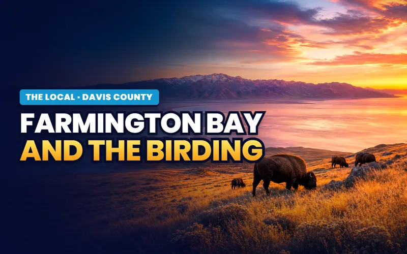
The flyway
Farmington Bay and the birding
The wetlands west of the trail are on the same flyway as the county's marquee birding ground, and the county page has the current access rules.
Read the guideFour of the seven county subjects have nothing to do with this address except a drive, and saying so is more useful than pretending otherwise. West Bountiful sits on the flat valley floor with no bench and no canyon mouth inside it, so the Davis canyons belong to the bench cities east of here, starting with Bountiful across the freeway. Antelope Island is reached from Syracuse, well to the north. Hill Air Force Base is at the far north end of the county. And the county's paid attractions are all a drive rather than a walk from here. All seven are indexed on the Davis County hub, and this hub links them rather than writing them twice.
If you only have one day
A mile of old farm street, a free practice green and a look at what is behind the fence

First thing
Walk the mile of 800 West
The town's oldest row, farm-era houses with two story brick carriage barns behind them, on the street the onions named. Free, and about forty minutes.
The Onion Street page
Mid morning
Use the free practice green
Two practice greens and a sand trap at the city's own course are open to anyone in the community at no charge, and almost nobody knows it.
The golf course page
Midday
Loop the one community park
Fourteen and a half flat acres beside the freeway with a path around it, six hoops, sand volleyball and a large bowery you can book for the day.
The city park page
Afternoon
Take the west door out
A quiet subdivision on the flat northwest edge whose streets end at the Legacy Parkway trail, with a pocket park behind and the wetlands beyond.
The Birnam Woods pageThe rhythm
One big day in July, a bike parade in August, and a Christmas named after an onion
The town's own big day is the Fourth of July, not a founders day, whatever the search results suggest. It runs as a carnival, food trucks and a concert at City Park the evening before, with fireworks, then a flag raising at City Hall and a parade the next morning. Take the exact times from the city calendar in the spring, because they move year to year. The arts council also runs a separate founder's day program, and it is not the fireworks night, so do not merge the two.
The rest of the calendar is small and real: a patriotic bike parade in late August, a monthly concert series, a featured-artist display and a farmers market, all at City Hall, because the town has no other arts venue. In December the arts council helps run Christmas on Onion Street at City Hall, which is the best named event in Davis County and worth checking is still running before you plan around it.
Two small mechanics catch newcomers every year. Booking the large bowery at City Park is a January job rather than a June one, because a resident address can claim a summer date months before anyone else, and the rental season is only mid April to mid October. And household recycling comes on published two-day windows rather than a weekly round, which is exactly the kind of thing nobody tells you in the first month. The city park page carries the booking calendar.
What governs an ordinary year here more than any event is the air. The flat valley floor sits below the bench, low enough to share the Wasatch Front's winter inversions, and that subject belongs to Salt Lake County's page rather than this one; the valley in winter page is where it is written. What this hub carries instead is the local version: what the refinery on 800 West actually is, and who to call about an odor, on the refinery page.
In a dry summer the town can restrict personal fireworks, sometimes for the whole season. Utah cities set and lift these limits on their own timing and by their own conditions, so a household planning a July here should read the current city notice in the week it matters rather than assume last year's answer. The town's own public display at City Park is a separate thing and is not affected by a limit on personal use.
The West Bountiful companion
Seven pages, and four of them are about something the city guide leaves out
Everything The Local has written about West Bountiful itself: the ranked short list, the plant that carries the next town's name, the golf course that is a city department and most of the open space, the mile of 800 West named for onions, the single community park, a flat-ground neighborhood on the west edge, and how this address compares with the larger bench town it is named after.


Quick answers
West Bountiful, answered
For being the flat, valley-floor town on the west side of the Bountiful bench, and for three regional facilities that sit inside it under other towns' names: the oil refinery almost everyone calls the Woods Cross refinery, a landfill named for Bountiful, and the South Davis sewer plant. Locally it is known for Lakeside Golf Course, which the city owns and runs itself, and for the mile of old farm road known as Onion Street.
On the valley floor of south Davis County, about seven miles north of Salt Lake City, with Centerville to the north, Bountiful to the east, Woods Cross to the south and the Great Salt Lake wetlands to the west. It covers about 3.31 square miles at roughly 4,232 feet, which is thirty to sixty feet below Bountiful on the bench. This is old lake bed, not bench, and that flat ground is the whole story of the town. It shares the 84087 postal code with Woods Cross.
Yes. The 45,000 barrel a day refinery that almost everyone calls the Woods Cross refinery sits inside West Bountiful, either side of 800 West at the south end of town. It carries the neighbor's name because it was built in 1932, seventeen years before West Bountiful incorporated, so there was no West Bountiful to name it for. A separate and much smaller plant sits inside Woods Cross itself.
It owns one. Lakeside Golf Course, at 1201 North 1100 West, is a West Bountiful City department with its own director of golf on the city staff. It is 18 holes at par 71 and opened in 1966. At about 114 acres it is larger than all four of the city's parks put together, so most of the open space in town is this one course. Two practice greens and a sand trap are open free to anyone in the community.
Because of the crop. West Bountiful became a major producer of sweet Spanish onions in the 1920s and 1930s, and 800 West, the town's main farm road, became known as Onion Street. The name has outlived the crop by about ninety years, and the city has an adopted plan to put the old names back on street signs along Onion Street and Howard Street.
The farms came first. The west side of Bountiful was settled in 1848 as the demand for farmland grew, and West Bountiful stayed farm ground for a full century before it became a town on 28 January 1949. It became a third class city on 12 November 1962. So 1848 for settlement and 1949 for incorporation is the correct pairing, and the two dates get collapsed all the time.
Barely. The 2020 census counted 5,917 residents, and recent estimates put the city close to flat, one of several small Davis County cities that have stopped rising. The reason is simple: the town is nearly built out. Other than the far west side, most of the vacant land is gone, and the only room left is a small amount of ground between the western edge and the Legacy Parkway.
No. The commuter line runs straight through the city without stopping, and the nearest platform is the Woods Cross station at 750 South 800 West, next door. Building the railway also closed 800 West between the two cities, which broke the old direct connection down that street.
The city runs its own police department out of City Hall at 550 North 800 West, with a non-emergency number of 801-292-4487. Culinary water comes from the city, which buys most of it from the Weber Basin Water Conservancy District. Sewer is the South Davis Sewer District. Power is Rocky Mountain Power rather than a city utility, which is a real difference from Bountiful next door.
Seven pages on a small, flat, nearly finished city with a very specific set of questions attached
West Bountiful comes down to a handful of things a household actually weighs: which side of 800 West a parcel sits on and how far it is from the plant, whether an address is in the old historic district or only near it, what the city's park arithmetic means if you use parks, which door onto the county trail is walkable from a street, and how the flat west side reads against the bench town next door. Tell me what you are weighing and I will introduce you to a Davis County partner agent who works these streets, and stay on the file for the financing side.
Or call Scott: (435) 357-4345or send Scott a message
Keep going
Continue your West Bountiful research
Eight more doors into West Bountiful, chosen for what this page covers.
Questions about West Bountiful?
Call Scott, send a message, or find out what your West Bountiful home is worth. No pressure, no obligation.
Referral Disclosure: For moves outside Southern Utah, I can connect you with trusted local agents. If you choose to work with one, their brokerage pays my brokerage (Real Broker, LLC) a referral fee from their commission. This costs you nothing extra, and you are never obligated to use my referral.